

This article lists the heads of government of the Kingdom of Sikkim from 1944 to 1975, when Sikkim became the 22nd state of India following a referendum. [1]
This article lists the heads of government of the Kingdom of Sikkim from 1944 to 1975, when Sikkim became the 22nd state of India following a referendum. [1]
(Dates in italics indicate de facto continuation of office)
| No. | Portrait | Name | Term | Notes |
|---|---|---|---|---|
| President of the State Council | ||||
| 1 | 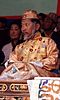 | Palden Thondup Namgyal | 1944–1949 | Later reigned as the twelfth and last Chogyal, in 1963–1975. |
| Chief Minister | ||||
| 2 | Tashi Tshering | 9 May 1949 – 6 June 1949 | ||
| 3 | Harishwar Dayal | 6 June 1949 – 11 August 1949 | Interim | |
| Dewan | ||||
| 4 | John S. Lall | 11 August 1949 – 1954 | ||
| 5 | Nari Kaikhosru Rustomji | 1954–1959 | ||
| 6 | Baleshwar Prasad | 22 August 1959 – 1963 | ||
| Principal Administrative Officer | ||||
| 7 | Ramdas Narayan Haldipur | 1963–1969 | ||
| Sidlon | ||||
| 8 | Inder Sen Chopra | 1969 – July 1972 | ||
| Chief Administrative Officer | ||||
| 9 | Brajbir Saran Das | 9 April 1973 – 23 July 1974 | ||
| Prime Minister | ||||
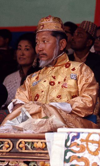
| 10 |  | Kazi Lhendup Dorjee | 23 July 1974 – 16 May 1975 | Afterwards served as the first Chief Minister of Sikkim, in 1975–1979. [2] |

Sikkim is a state in northeastern India. It borders the Tibet Autonomous Region of China in the north and northeast, Bhutan in the east, Koshi Province of Nepal in the west, and West Bengal in the south. Sikkim is also close to the Siliguri Corridor, which borders Bangladesh. Sikkim is the least populous and second-smallest among the Indian states. Situated in the Eastern Himalaya, Sikkim is notable for its biodiversity, including alpine and subtropical climates, as well as being a host to Kangchenjunga, the highest peak in India and third-highest on Earth. Sikkim's capital and largest city is Gangtok. Almost 35% of the state is covered by Khangchendzonga National Park – a UNESCO World Heritage Site.
Palden Thondup Namgyal was the 12th and last Chogyal (king) of the Kingdom of Sikkim.

India is a federal republic comprising 28 states and 8 union territories. The states and union territories are further subdivided into districts and smaller administrative divisions.

Gangtok is the capital and the most populous city of the Indian state of Sikkim. The seat of eponymous district, Gangtok is in the eastern Himalayan range, at an elevation of 1,650 m (5,410 ft). The city's population of 100,000 consists of the three Sikkimese ethnicities the Bhutias, Lepchas, Gorkhalis and also plainsmen from other states of India have settled here. Within the higher peaks of the Himalayas and with a year-round mild temperate climate, Gangtok is at the centre of Sikkim's tourism industry.
Jelep La elevation 14,390 feet (4,390 m), is a high mountain pass between Sikkim, India and Tibet Autonomous Region, China. It is on a route that connects Lhasa to India. The pass is about 4 km (2.5 mi) south of Nathu La and is slightly higher. It was frequently used for trade between Tibet and India during the British Raj, with Kalimpong serving as the contact point. The Menmecho Lake lies below the Jelep La.

Nathu La(Tibetan: རྣ་ཐོས་ལ་, Wylie: Rna thos la, THL: Na tö la, Sikkimese: རྣ་ཐོས་ལ་) is a mountain pass in the Dongkya Range of the Himalayas between China's Yadong County in Tibet, and the Indian states of Sikkim. But minor touch of Bengal in South Asia. The pass, at 4,310 m (14,140 ft), connects the towns of Kalimpong and Gangtok to the villages and towns of the lower Chumbi Valley.

The Siliguri Corridor, also known as the Chicken's Neck, is a stretch of land around the city of Siliguri in West Bengal, India. 20–22 kilometres (12–14 mi) at the narrowest section, this geo-political and geo-economical corridor connects the seven states of northeast India to the rest of the Indian Republic. The countries of Nepal and Bangladesh lie on each side of the corridor and the Kingdom of Bhutan lies at the northern end of the corridor. The Kingdom of Sikkim formerly lay on the northern side of the corridor, until its merging with India in 1975.
Gangtok District is an administrative district of the Indian state of Sikkim. It was renamed in 2021 as a result of administrative reorganisation of the state, which also saw three subdivisions of the East Sikkim district spawned off as a separate Pakyong district.

The Chogyal were the monarchs of the former Kingdom of Sikkim, which belonged to the Namgyal dynasty. The Chogyal was the absolute monarch of Sikkim from 1642 to 1973, and the constitutional monarch from 1973 to 1975, when the monarchy was abolished and the Sikkimese people voted in a referendum to make Sikkim the 22nd state of India.

The history of Sikkim begins with the indigenous Lepcha's contact with early Tibetan settlers. Historically, Sikkim was a sovereign Monarchical State in the eastern Himalayas. Later a protectorate of India followed by a merger with India and official recognition as a state of India. Lepchas were the main inhabitants as well as the Ruler of the land up to 1641. Lepchas are generally considered to be the first people, indigenous to Sikkim also includes Darjeeling.
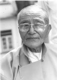
Kazi Lhendup Dorjee, also spelled Lhendup Dorji or Lhendup Dorji Khangsarpa was an Indian politician who was the first chief minister of Sikkim from 1975 to 1979 after its union with India. He was the first Prime Minister of Sikkim from 1974 to 1975. He also served as the Executive Council of Sikkim from 1967 to 1970. He was a member of INC after 1975 and Sikkim National Congress before 1975.
The Kingdom of Sikkim, officially Dremoshong until the 1800s, was a hereditary monarchy in the Eastern Himalayas which existed from 1642 to 16 May 1975, when it was annexed by India. It was ruled by Chogyals of the Namgyal dynasty.
At present there is no official flag of Sikkim, a state in India. The independent Kingdom of Sikkim did have a national flag until it became a state of India in 1975.

The Emblem of Sikkim is currently used as the official seal of the Government of Sikkim, India. It was earlier used as the coat of arms of the House of Namgyal and the Kingdom of Sikkim. The emblem is known as the Kham-sum-wangdu. It was designed in 1877 by Robert Taylor.
The Sikkim Legislative Assembly is the unicameral state legislature of Sikkim state in north-eastern India. The seat of the Legislative Assembly is at Gangtok, the capital of the Sikkim state.
A referendum on abolishing the monarchy was held in the Kingdom of Sikkim on 14 April 1975. Official results stated the proposal was approved by 97.55% of voters with a turnout of about 63%, and resulted in the country becoming an Indian state.
General elections were held in Sikkim on 13 April 1974. They were the first elections in Sikkim to be held on the basis of universal suffrage, and also the last prior to Indian annexation. The result was a victory for the Sikkim National Congress, which won 31 of the 32 seats in the State Council. Kazi Lhendup Dorjee subsequently became Chief Minister. In May 1975 Sikkim became a state of India, at which point the State Council became the Sikkim Legislative Assembly.
The State Council of Sikkim was the unicameral legislature of the former Kingdom of Sikkim, which was located in the Himalayas, between India and China.
| State symbols | |
|---|---|
| Topics | |
| Administration | |
| Districts | |
| Towns | |
| Rivers | |
| Lakes | |
| Glaciers | |
| See also | |