Springfield is a census-designated place (CDP) in northwestern Hampshire County in the U.S. state of West Virginia. As of the 2010 census, Springfield had a population of 477. Springfield is located north of Romney along West Virginia Route 28 at its junction with Green Spring Road and Springfield Pike. It is currently considering incorporation.
Forks of Cacapon, formerly Forks of Capon, is an unincorporated community in Hampshire County in the U.S. state of West Virginia. The community is named for its location at the confluence of the North River and Cacapon River. Forks of Cacapon is also located at another fork: the crossroads of West Virginia Route 29, West Virginia Route 127, and Frank Haines Road.

Three Churches is an unincorporated community in Hampshire County in the U.S. state of West Virginia. The town is located north of Romney along Jersey Mountain Road at a crossroads with Three Churches Hollow Road. Originally known as Jersey Mountain, Three Churches was renamed for the three historic white wooden churches located there: Mount Bethel Church, Mount Bethel Primitive Baptist Church, and Branch Mountain United Methodist Church. The Three Churches Post Office is no longer in service.

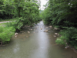
Kirby is an unincorporated community in Hampshire County in the U.S. state of West Virginia situated along Grassy Lick Run, a tributary of North River. Kirby is located south of Romney at the crossroads of Grassy Lick Road and Rock Oak Road.
Purgitsville is an unincorporated community in Hampshire County in the U.S. state of West Virginia. According to the 2000 census, the ZCTA for Purgitsville had a population of 813. Purgitsville is located on U.S. Highway 220/West Virginia Route 28 at its intersection with Huffman Road south of Junction. An elementary school, Mill Creek Elementary, was open here until 1993 when it was consolidated with Romney Elementary.

Rio is an unincorporated community in southern Hampshire County in the U.S. state of West Virginia. Rio is located just north of the Hardy County line at the crossroads of Augusta-Ford Hill Road and Delray Road in the North River Valley. According to the 2000 census, the Rio community has a population of 154.

Points is an unincorporated community in Hampshire County in the U.S. state of West Virginia. According to the 2000 census, the Points community has a population of 478.

Capon Lake is an unincorporated community in Hampshire County of West Virginia's Eastern Panhandle region. Capon Lake is situated between Yellow Spring and Intermont at the junction of West Virginia Route 259 and Capon Springs Road along the Cacapon River. Capon Springs Run empties into the Cacapon here across from the old Capon Lake Whipple Truss Bridge. Capon Lake takes its name from the Cacapon River's lake-like characteristics there. It was a popular picnic spot for tourists and travelers on the Winchester and Western Railroad.

Wappocomo is an unincorporated community in Hampshire County in the U.S. state of West Virginia. The community is located south of Springfield on West Virginia Route 28 at Hanging Rocks along the South Branch Potomac River. Wappocomo has also historically been referred to as The Rocks, Wapocoma, and Wapocomo.
The East River is a tributary of the New River, 24 miles (39 km) long, in southern West Virginia and southwestern Virginia in the United States. Via the New, Kanawha and Ohio rivers, it is part of the watershed of the Mississippi River, draining an area of 76.4 square miles (198 km2) in the Ridge-and-Valley Appalachians.
Hooks Mills is an unincorporated community in Hampshire County, West Virginia, United States. It is located on Hooks Mill Road which intersects Cacapon River Road 4.5 miles south of Capon Bridge. Hooks Mills is named for the saw and grist mill on the Cacapon River run by the Hook family from 1848 to the late 1930s.

Neals Run is an unincorporated community in Hampshire County in the U.S. state of West Virginia. Neals Run is located south of Little Cacapon near the confluence of the Little Cacapon River and Neals Run on Spring Gap-Neals Run Road. The community derives its name from the stream.
Rada is an unincorporated community in Hampshire County in the U.S. state of West Virginia. Rada is located on U.S. Highway 220/West Virginia Route 28 between Junction and Purgitsville in southwest Hampshire County along Mill Creek. It lies at an intersection of US 220/WV 28 with Rada Road.
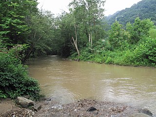
Cold Stream is an unincorporated community in Hampshire County in the U.S. state of West Virginia. Cold Stream is located north of Capon Bridge on Cold Stream Road. Referred to as Edwards Run in its past, the community of Cold Stream is in proximity to where Edwards Run empties into the Cacapon River. The community most likely took its name from a nearby stream of the same name noted for the cold water it contains. Their post office has been closed.

Shanghai is an unincorporated community in Berkeley County, West Virginia, United States. The town is nestled in Back Creek Valley between Leading Ridge and North Mountain. Shanghai lies at the junction of West Virginia Secondary Route 7 and Secondary Route 18.
Frametown is an unincorporated community in Braxton County, West Virginia, United States. While the heart of Frametown itself is rather small, there is a large sprawling area that considers itself to be part of the Frametown community. This is due to the large range of the United States Postal Service ZIP Code 26623 which covers the immediate area.

Pohick Creek is a 14.0-mile-long (22.5 km) tributary stream of the Potomac River in Fairfax County in the U.S. state of Virginia. It takes its name from the Pohick Native American tribe once prevalent in the area.
Sweet Chalybeate is an unincorporated community in Alleghany County, Virginia, United States. It is located directly across the state-line from Sweet Springs, West Virginia. It is serviced by Virginia State Route 311.

Dyke is an unincorporated community in Greene County, Virginia, United States. It is located along Virginia Secondary State Route 810. In 2020, the small store in Dyke was replaced with a new larger store and gas station.
Paint Creek is a 42.1-mile (67.8 km) tributary of the Kanawha River in southern West Virginia. Paint Creek is part of the Mississippi River watershed via the Kanawha and Ohio Rivers and drains an area of 123 square miles (320 km2).