Lake, Clare County, Michigan

Last updated

Lake, Michigan
Lake, Clare County, Michigan.jpg
Looking southeast along Mystic Lake Road
USA Michigan location map.svg
Red pog.svg
Lake
Location within the state of Michigan
Usa edcp location map.svg
Red pog.svg
Lake
Location within the United States
Coordinates: 43°51′07″N85°00′19″W / 43.85194°N 85.00528°W / 43.85194; -85.00528
CountryUnited States
State Michigan
County Clare
Township Garfield
Settled1873
Established1877
Elevation
1,063 ft (324 m)
Time zone UTC-5 (Eastern (EST))
  Summer (DST) UTC-4 (EDT)
ZIP code(s)
48632
Area code 989
GNIS feature ID629957 [1]

Lake is an unincorporated community in Clare County in the U.S. state of Michigan. [1] The community is located within Garfield Township. As an unincorporated community, Lake has no legal autonomy of its own but does have its own post office with the 48632 ZIP Code. [2] [3]

Contents

Geography

U.S. Post Office in Lake Lake, Michigan post office.jpg
U.S. Post Office in Lake
Perch Lake from the boating access site Perch Lake (Clare County, MI).jpg
Perch Lake from the boating access site

Lake is located in Garfield Township in southweastern Clare County about 5.0 miles (8.0 km) west of the village of Farwell along U.S. Route 10. The community is situated between two lakes: the larger Crooked Lake on the west and the smaller Perch Lake on the east. [4] [5] [6] The community is located near many other smaller lakes, including Big Cranberry Lake, Gray Lake, and Mystic Lake. [7] [8] [9] Eight Point Lake is a larger lake located to the west. [10]

Other nearby communities include Lake George to the north, Weidman to the south, the village of Barryton to the southwest, and Sears to the northwest. The city of Clare and U.S. Route 127 are about 12.0 miles (19.3 km) to the east via M-115. [11]

The Lake post office uses the 48632 ZIP Code. The current post office is located at 8959 Lake Station Avenue. [12] The post office serves a large Tabulation Area covering 126.84 square miles (328.51 km2) of land and a population of 5,125. [3] The post office serves the majority of Garfield Township, as well as most of Freeman Township to the north. The post office also serves the western portion of Lincoln Township, as well as a very small portion of Surrey Township and Redding Township. The ZIP Code also extends west into small areas of Orient Township in Osceola County and Fork Township in Mecosta County. In Isabella County to the south, the Lake post office serves portions of Coldwater, Gilmore, and Sherman townships. [2] [3]

The Pere Marquette State Trail is a 55-mile-long (89 km) multi-use trail that runs from Clare to Baldwin along the former railway lines. The community of Lake contains a trailhead called Lake Station Depot. [13] The Garfield Township Hall is located in Lake at 9348 Terry Street in the center of the community. [14] The community is served entirely by Farwell Area Schools to the east in the village of Farwell. [15]

History

Historic image of Lake in 1910 Lake, Clare County, historic image.jpg
Historic image of Lake in 1910
Lake General Store, established 1904 Lake General Store (Lake, MI).jpg
Lake General Store, established 1904

The Lake Station train depot predates the community itself, which was settled as a lumber camp as early as 1873 by Scott Garrish. [16] The Flint and Pere Marquette Railroad began expanding into the area in the early 1870s, and Lake Station can be seen on a historic 1873 map of Clare County, which itself was organized in 1871. Lake Station was originally part of Surrey Township until Garfield Township was created in 1897.

By 1877, a community named Lake Station formed around the train depot. A post office named Crooked Lake opened on February 28, 1877, with railroad agent Charles Howard Bates serving as the first postmaster. The name came from the nearby Crooked Lake. The original train depot was struck by lightning and burned down in 1892 during a severe storm that devastated the surrounding area. A new depot was soon built in its place. [17] In 1897, Garfield Township was set aside from the southwestern portion of Surrey Township, and Crooked Lake would become part of the new township. The name of the post office was shortened to Lake on March 11, 1909. [18] Among the oldest remaining structures in the community include the Lake General Store, which has been in operation since 1904. [16]

The Flint and Pere Marquette Railroad soon became the Pere Marquette Railway in 1900, and the railway lines served as an important route between Saginaw and Ludington, as well as connecting many communities in the Lower Peninsula. U.S. Route 10 was also rerouted to pass directly through the community just north of the railway lines by 1938. [19] The railway depot was expanded, and the railway lines eventually came under the ownership of the Chesapeake and Ohio Railway before closing in 1949. [20] The railway lines were removed, while the unused train depot was restored and serves as a museum. The only other trace of the former railway is the coaling tower, which still stands as one of the few remaining structures of its kind in the state. [17] This segment of the former railway lines was converted into the Pere Marquette State Trail. [13]

Because the community was once referred to as Lake Station, it may still be referred as such to distinguish it from its generic name of Lake. [16] While the post office itself remains in operation and is known as Lake, it can also receive mail under the Lake Station destination. [3]

Related Research Articles

<span class="mw-page-title-main">Munising Township, Michigan</span> Civil township in Michigan, United States

Munising Township is a civil township of Alger County in the U.S. state of Michigan. As of 2020, its population was 2,865.

<span class="mw-page-title-main">Garfield Township, Clare County, Michigan</span> Civil township in Michigan, United States

Garfield Township is a civil township of Clare County in the U.S. state of Michigan. The population was 1,807 at the 2020 census.

<span class="mw-page-title-main">Garfield Township, Mackinac County, Michigan</span> Civil township in Michigan, United States

Garfield Township is a civil township of Mackinac County in the U.S. state of Michigan. The population was 1,146 at the 2010 census, and 1,166 in 2020.

<span class="mw-page-title-main">Newton Township, Mackinac County, Michigan</span> Civil township in Michigan, United States

Newton Township is a civil township of Mackinac County in the U.S. state of Michigan. As of 2020, its population was 430.

<span class="mw-page-title-main">Clyde Township, St. Clair County, Michigan</span> Civil township in Michigan, United States

Clyde Township is a civil township of St. Clair County in the U.S. state of Michigan. The population was 5,579 at the 2010 Census.

<span class="mw-page-title-main">Newport, Michigan</span> Unincorporated community in Michigan, United States

Newport is an unincorporated community in Monroe County in the U.S. state of Michigan. The community is located within Berlin Charter Township. As an unincorporated community, Newport has no legally defined boundaries or population statistics of its own but does have its own post office with the 48166 ZIP Code.

<span class="mw-page-title-main">Topinabee, Michigan</span> Unincorporated community in Michigan, United States

Topinabee is an unincorporated community in Cheboygan County in the U.S. state of Michigan. The community is located within Mullet Township along the southwestern shores of Mullett Lake.

<span class="mw-page-title-main">Riverdale, Michigan</span> Census-designated place & unincorporated community in Michigan, United States

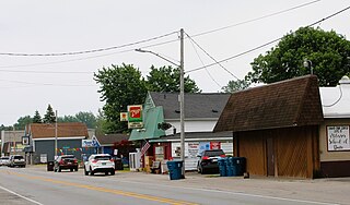
Riverdale is an unincorporated community and census-designated place (CDP) in Gratiot County in the U.S. state of Michigan. The population of the CDP was 281 at the 2020 census. The community is located within Seville Township.

<span class="mw-page-title-main">Linwood, Michigan</span> Unincorporated community in Michigan, United States

Linwood is a small unincorporated community in the northern portion of Bay County in the U.S. state of Michigan. The community is on the boundary between Fraser Township on the north and Kawkawlin Township on the south. It is situated with M-13 to the west and the Saginaw Bay of Lake Huron on the east, between Kaiser Tower Road and Elevator Road where Linwood Road becomes Center Street. Bay City is about 12 miles to the south and Linwood is included in the Bay City Metropolitan Statistical Area.

<span class="mw-page-title-main">Gould City, Michigan</span> Unincorporated community in Michigan, United States

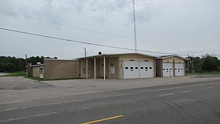
Gould City is an unincorporated community in Mackinac County in the U.S. state of Michigan. The community is located within Newton Township. As an unincorporated community, Gould City has no legal autonomy of its own but does have its own post office with the 49838 ZIP Code.

<span class="mw-page-title-main">Curtis, Michigan</span> Unincorporated community in Michigan, United States

Curtis is an unincorporated community in Mackinac County in the U.S. state of Michigan. The community is located within Portage Township. As an unincorporated community, Curtis has no legally defined boundaries or population statistics of its own but does have its own post office with the 49820 ZIP Code.

<span class="mw-page-title-main">Comins, Michigan</span> Unincorporated community in Michigan, United States

Comins is an unincorporated community in Oscoda County in the U.S. state of Michigan. The community is located within Clinton Township. As an unincorporated community, Comins has no legally defined boundaries or population statistics of its own but does have its own post office with the 48619 ZIP Code.

<span class="mw-page-title-main">McMillan, Michigan</span> Unincorporated community in Michigan, United States

McMillan is an unincorporated community in Luce County in the U.S. state of Michigan. The community is located along M-28 within Columbus Township. As an unincorporated community, McMillan has no legally defined boundaries or population statistics of its own but does have its own post office with the 49853 ZIP Code.

<span class="mw-page-title-main">Ottawa Lake, Michigan</span> Unincorporated community in Michigan, United States

Ottawa Lake is an unincorporated community in Monroe County in the U.S. state of Michigan. The community is located within Whiteford Township. As an unincorporated community, Ottawa Lake has no legally defined boundaries or population statistics of its own but does have its own post office with the 49267 ZIP Code.

<span class="mw-page-title-main">Merritt, Michigan</span> Unincorporated community in Michigan, United States

Merritt is an unincorporated community in Missaukee County in the U.S. state of Michigan. The community is centered between Butterfield Township to the south and Enterprise Township to the north. As an unincorporated community, Merritt has no legally defined boundaries or population statistics of its own but does have its own post office with the 49667 ZIP Code.

<span class="mw-page-title-main">Engadine, Michigan</span> Unincorporated community in Michigan, United States

Engadine is an unincorporated community in Mackinac County in the U.S. state of Michigan. The community is located within Garfield Township. As an unincorporated community, Engadine has no legally defined boundaries or population statistics of its own but does have its own post office with the 49827 ZIP Code.

<span class="mw-page-title-main">Naubinway, Michigan</span> Census-designated place & unincorporated community in Michigan, United States

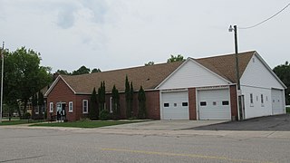
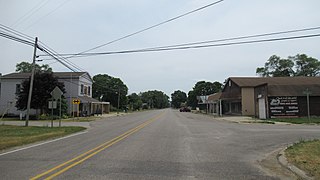
Naubinway is an unincorporated community and census-designated place (CDP) in Mackinac County in the U.S. state of Michigan. The population of the CDP was 147 at the 2020 census, which was the first year that it was recorded by the census. The community is located within Garfield Township.

<span class="mw-page-title-main">Garnet, Michigan</span> Unincorporated community in Michigan, United States

Garnet is an unincorporated community in Mackinac County in the U.S. state of Michigan. The community is located within Hudson Township. As an unincorporated community, Garnet has no legally defined boundaries or population statistics of its own.

<span class="mw-page-title-main">Loomis, Michigan</span> Census-designated place & unincorporated community in Michigan, United States

Loomis is an unincorporated community and census-designated place (CDP) in Isabella County in the U.S. state of Michigan. The population of the CDP was 194 at the 2020 census. The community is located within Wise Township.

<span class="mw-page-title-main">Willow, Michigan</span> Unincorporated community in Michigan, United States

Willow is an unincorporated community in Wayne County in the U.S. state of Michigan. The community is located within Huron Charter Township. As an unincorporated community, Willow has no legally defined boundaries or population statistics of its own.

References

  1. 1 2 U.S. Geological Survey Geographic Names Information System: Lake, Michigan
  2. 1 2 Google (September 14, 2022). "48632 ZIP Code map" (Map). Google Maps . Google. Retrieved September 14, 2022.
  3. 1 2 3 4 UnitedStatesZipCodes.org (2022). "ZIP Code 48632: Lake" . Retrieved September 14, 2022.
  4. Clare County (2021). "Welcome to Lake and Lake Station!" . Retrieved September 2, 2022.
  5. U.S. Geological Survey Geographic Names Information System: Crooked Lake
  6. U.S. Geological Survey Geographic Names Information System: Perch Lake
  7. U.S. Geological Survey Geographic Names Information System: Big Cranberry Lake
  8. U.S. Geological Survey Geographic Names Information System: Gray Lake
  9. U.S. Geological Survey Geographic Names Information System: Mystic Lake
  10. U.S. Geological Survey Geographic Names Information System: Eight Point Lake
  11. Google (June 24, 2022). "Lake to Clare, Michigan route" (Map). Google Maps . Google. Retrieved June 24, 2022.
  12. United States Postal Service (2022). "Lake – Post Office" . Retrieved September 12, 2022.
  13. 1 2 Michigan Trails Magazine (2022). "Pere Marquette State Trail map" (PDF). Retrieved September 11, 2022.
  14. Michigan Townships Association (2022). "Garfield Twp., Clare Co" . Retrieved September 3, 2022.
  15. Michigan Geographic Framework (November 15, 2013). "Clare County School Districts" (PDF). Retrieved August 28, 2022.
  16. 1 2 3 Lake General Store, Inc. (2022). "Lake General Store: History" . Retrieved September 11, 2022.
  17. 1 2 Michiganrailroads.com (2022). "Station: Lake, MI" . Retrieved September 19, 2022.
  18. Romig, Walter (October 1, 1986) [1973]. Michigan Place Names: The History of the Founding and the Naming of More Than Five Thousand Past and Present Michigan Communities (Paperback). Detroit, Michigan: Wayne State University Press. pp. 311, 316. ISBN   978-0-8143-1838-6.
  19. Michigan State Highway Department & Rand McNally (December 1, 1938). Official Michigan Highway Map (Map) (Winter ed.). [c. 1:850,000]. Lansing: Michigan State Highway Department. §§ I9–I10. OCLC   12701143 . Retrieved October 17, 2019 via Michigan History Center.
  20. "Chesapeake and Ohio Railway, Tables 50, 53". Official Guide of the Railways. National Railway Publication Company. 82 (3). August 1949.