
Sauk County is a county in Wisconsin. It is named after a large village of the Sauk people. As of the 2020 census, the population was 65,763. Its county seat and largest city is Baraboo. The county was created in 1840 from Wisconsin Territory and organized in 1844. Sauk County comprises the Baraboo, WI Micropolitan Statistical Area and is included in the Madison metropolitan area.

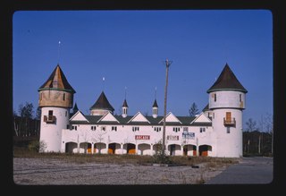
Wisconsin Dells is a city in Adams, Columbia, Juneau, and Sauk counties in the U.S. state of Wisconsin. A popular Midwestern tourist destination, Wisconsin Dells is home to several water parks and tourist attractions. The city had a population of 2,942 as of the 2020 census.

Delton, originally called New Buffalo, is a town in Sauk County, Wisconsin, United States. The population was 2,024 at the 2000 census.
Lake Delton is a village located on the Wisconsin River in Sauk County, Wisconsin, United States. The population was 3,501 at the 2020 census. Lake Delton, along with the nearby Wisconsin Dells, is a resort area and a center for tourism in the upper Midwest. Lake Delton is included in the Baraboo Micropolitan Area which comprises part of the larger Madison Combined Statistical Area.

Lake Delton is a man-made freshwater lake in Sauk County in central Wisconsin. For much of 2008, it was a mostly empty lake basin after a portion of a county highway that forms part of the dike wall eroded on June 9, 2008, under the pressure of floods in the area. The resulting wash out caused the lake to empty into the Wisconsin River, leaving behind only rainwater pools and the flow from Dell Creek. By March 2009, major repairs to correct the problem were completed, and the lake was allowed to refill. Minor repairs were expected to continue after that time, but the lake is now completely refilled and has been usable since Memorial Day weekend of 2009.

State Trunk Highway 23 is a state highway in the U.S. state of Wisconsin. The route is signed as a north–south route from Shullsburg to Wisconsin Dells and as an east–west route from Wisconsin Dells to Sheboygan. With the exception of freeway segments between Sheboygan Falls and Sheboygan, an expressway segment between Sheboygan Falls past Greenbush to Fond du Lac, a freeway concurrency with Interstate 39 (I-39), and an expressway segment concurrent with U.S. Highway 151 (US 151), the highway is generally either two-lane surface road or urban multilane arterial. WIS 23 provides access to several important Wisconsin destinations, such as the House on the Rock, the Wisconsin Dells area and various state parks.
Wisconsin's 2nd congressional district is a congressional district of the United States House of Representatives in southern Wisconsin, covering Dane County, Iowa County, Lafayette County, Sauk County and Green County, as well as portions of Richland County and Rock County. The district includes Madison, the state's capital, its suburbs and the surrounding areas. The district also includes the University of Wisconsin–Madison campus, and like many districts of this era anchored by a college town, the district is overwhelmingly Democratic.

U.S. Highway 12 in the U.S. state of Wisconsin runs east–west across the western to southeast portions of the state. It enters from Minnesota running concurrently with Interstate 94 (I-94) at Hudson, parallels the Interstate to Wisconsin Dells, and provides local access to cities such as Menomonie, Eau Claire, Black River Falls, Tomah, and Mauston. It then provides an alternative route for traffic between northwestern Wisconsin and Madison and is the anchor route for the Beltline Highway around Madison. Finally, it serves southeastern Wisconsin, connecting Madison with Fort Atkinson, Whitewater, Elkhorn, and Lake Geneva. The West Beltline Highway and the segment between Elkhorn and Genoa City are freeways, and the segment between Sauk City and Middleton is an expressway. The remainder of the road is a two-lane surface road or an urban multilane arterial. Between Hudson and west of Warrens, the road closely parallels the former main line of the Chicago, St. Paul, Minneapolis and Omaha Railway, now operated by Union Pacific Railroad.
Dell Creek is a warm freshwater stream that lies in northeastern Sauk County and southern Juneau County in central Wisconsin. Dell Creek was named from the dells which occur along its course. Dell Creek is a warm water sport fishery for the lower 1.5 miles and a Class II trout stream for the upper 10.5 miles of its length. The creek is classified as an exceptional resource water. Much of Dell Creek's length in Sauk County is publicly owned.
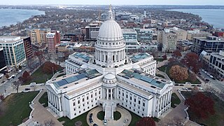
The Madison, Wisconsin, metropolitan area, also known as Greater Madison, is the metropolitan area surrounding the city of Madison, Wisconsin. Madison is the state capital of Wisconsin and is Wisconsin's second largest city, and the metropolitan area is also the state's second largest which the Madison MSA borders to its east.
Dellwood is an unincorporated community in Sauk County, Wisconsin, United States. Dellwood is located on Wisconsin Highway 23 southwest of Lake Delton, in the town of Dellona.
Stephen Steele Barlow was an American lawyer and Republican politician. He was the 10th Attorney General of Wisconsin and served four years in the Wisconsin Legislature. He also served several years as a district attorney and county judge.
The 14th Senate District of Wisconsin is one of 33 districts in the Wisconsin Senate. Located in central Wisconsin, the district comprises all of Richland and Sauk counties, along with most of Columbia County and parts of southern Adams County, southern Juneau County, and northern Dane County. It contains the cities of Baraboo, Columbus, Portage, Reedsburg, Richland Center, and Wisconsin Dells, and the villages of DeForest, Lake Delton, Poynette, Prairie du Sac, and Sauk City, and part of the city of Madison. The district also contains landmarks such as Devil's Lake State Park, Dane County Regional Airport, Mirror Lake State Park, Lake Wisconsin and the Kilbourn Dam.
George Gilbert Swain was an American businessman and politician.
School District of Wisconsin Dells is a school district headquartered in Wisconsin Dells, Wisconsin. Its territory includes sections of the counties of Adams, Columbia, Juneau, Marquette, and Sauk.

The 41st Assembly District of Wisconsin is one of 99 districts in the Wisconsin State Assembly. Located in west-central Wisconsin, the district comprises all of Richland County, much of the north half of Sauk County, and parts of southern Juneau County, southern Adams County, and northwest Columbia County. It includes the cities of Reedsburg, Richland Center, and Wisconsin Dells, and the villages of Boaz, Cazenovia, Ironton, La Valle, Lake Delton, Lime Ridge, Loganville, Lone Rock, Lyndon Station, North Freedom, Rock Springs, Union Center, Viola, Wonewoc, and Yuba. The district also contains the Dells of the Wisconsin River State Natural Area, Mirror Lake State Park, Dell Creek State Wildlife Area, the Mt. Olympus Water & Theme Park, and the Noah's Ark Water Park. The seat is represented by Republican Alex Dallman since January 2021. After the 2024 redistricting, Dallman no longer resides in the new district.
Henry W. Curtis was an American millwright, politician and Wisconsin pioneer. He was a member of the Wisconsin Senate, representing the 9th Senate district during the 1859 and 1860 sessions. In contemporaneous documents, his name was often abbreviated H. W. Curtis.