
The Province of Upper Canada was a part of British Canada established in 1791 by the Kingdom of Great Britain, to govern the central third of the lands in British North America, formerly part of the Province of Quebec since 1763. Upper Canada included all of modern-day Southern Ontario and all those areas of Northern Ontario in the Pays d'en Haut which had formed part of New France, essentially the watersheds of the Ottawa River or Lakes Huron and Superior, excluding any lands within the watershed of Hudson Bay. The "upper" prefix in the name reflects its geographic position along the Great Lakes, mostly above the headwaters of the Saint Lawrence River, contrasted with Lower Canada to the northeast.

Markham is a city in the Regional Municipality of York in Southern Ontario, Canada. It is approximately 30 km (19 mi) northeast of Downtown Toronto. In the 2016 Census, Markham had a population of 328,940, which ranked it the largest in York Region, fourth largest in the Greater Toronto Area (GTA), and 16th largest in Canada.

Richmond Hill is a city in south-central York Region, Ontario, Canada. Part of the Greater Toronto Area, it is the York Region's third most populous municipality and the 28th most populous municipality in Canada.

The Regional Municipality of York, also called York Region, is a regional municipality in Southern Ontario, Canada, between Lake Simcoe and Toronto. It replaced the former York County in 1971, and is part of the Greater Toronto Area and the inner ring of the Golden Horseshoe. The regional government is headquartered in Newmarket.

Yonge Street is a major arterial route in the Canadian province of Ontario connecting the shores of Lake Ontario in Toronto to Lake Simcoe, a gateway to the Upper Great Lakes. Until 1999, the Guinness Book of World Records repeated the popular misconception it was 1,896 km (1,178 mi) long, making it the longest street in the world; this was due to a conflation of Yonge Street with the rest of Ontario's Highway 11. Yonge Street is only 56 kilometres (35 mi) long.

The Don River is a watercourse in southern Ontario, that empties into Lake Ontario, at Toronto Harbour. Its mouth was just east of the street grid of the town of York, Upper Canada, the municipality that evolved into Toronto, Ontario. The Don is one of the major watercourses draining Toronto that have headwaters in the Oak Ridges Moraine.

Georgetown is a community in the town of Halton Hills, Ontario, Canada and is part of the Regional Municipality of Halton. The town includes several small villages or settlements such as Norval, Limehouse, Stewarttown and Glen Williams near Georgetown and another large population centre, Acton. In 2016, the population of Georgetown was 42,123. It sits on the banks of the Credit River, approximately 60 km west of Toronto, and is part of the Greater Toronto Area. Georgetown was named after entrepreneur George Kennedy who settled in the area in 1821 and built several mills and other businesses.

Whitchurch-Stouffville is a town in the Greater Toronto Area of Ontario, Canada, approximately 50 kilometres north of downtown Toronto, and 55 kilometres north-east of Toronto Pearson International Airport. It is 206.22 square kilometres in area, and located in the mid-eastern area of the Regional Municipality of York on the ecologically-sensitive Oak Ridges Moraine. Its motto since 1993 is "country close to the city".

The Oak Ridges Moraine is an ecologically important geological landform in the Mixedwood Plains of south-central Ontario, Canada. The moraine covers a geographic area of 1,900 square kilometres (730 sq mi) between Caledon and Rice Lake, near Peterborough. One of the most significant landforms in southern Ontario, the moraine gets its name from the rolling hills and river valleys extending 160 km (99 mi) from the Niagara Escarpment east to Rice Lake. It was formed 12,000 years ago by advancing and retreating glaciers. The moraine is a contested site in Ontario, since it stands in the path of major urban development.

The Rouge River is a river in Markham, Pickering, Richmond Hill and Toronto in the Greater Toronto Area of Ontario, Canada. The river flows from the Oak Ridges Moraine to Lake Ontario at the eastern border of Toronto, and is the location of Rouge Park, the only national park in Canada within a municipality. At its southern end, the Rouge River is the boundary between Toronto and southwestern Pickering in the Regional Municipality of Durham.
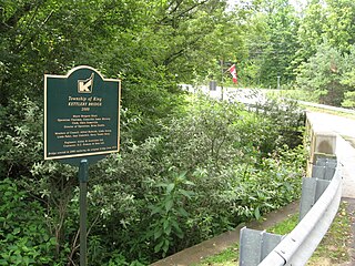
Kettleby is an unincorporated community located in northeastern King Township, in Ontario, Canada. It is located about 1.5 kilometres (0.93 mi) east of the Highway 400, 25 kilometres (16 mi) north of Toronto, about 40 kilometres (25 mi) south of Barrie, 6 kilometres (3.7 mi) west of Newmarket, and about 50 kilometres (31 mi) east of Orangeville.
The Toronto and Region Conservation Authority is one of 36 conservation authorities in Ontario, Canada. It owns more than 16,000 hectares of land in the Toronto region and employs more than 400 full-time employees and coordinates more than 3,000 volunteers each year. TRCA's area of jurisdiction is watershed-based, and includes 3,467 square kilometres: 2,506 on land and 961 water-based in Lake Ontario. This area comprises nine watersheds from west to east: Etobicoke Creek, Mimico Creek, Humber River, Don River, Highland Creek, Petticoat Creek, Rouge River, Duffins Creek, Carruthers Creek.

Conservation Ontario is the umbrella organization which represents all of the conservation authorities in Ontario. This nonprofit organization was founded in 1980/81. Conservation Ontario is the network of 36 Conservation Authorities.

Lake Wilcox is a kettle lake in the Oak Ridges neighbourhood of Richmond Hill, Ontario, Canada. The lake measures 1.5 kilometers across and covers 55.6 hectares or 0.55 square kilometres, making it the largest kettle lake on the Oak Ridges Moraine. Lake Wilcox, Lake St. George and their associated wetlands form a "provincially significant wetland".
The history of Richmond Hill began when the First Nations came and settled in the area. With the Toronto Purchase, the city gradually expanded with new greenhouse industries and improved transportation infrastructure.
The Huron Tract Purchase also known as the Huron Block, registered as Crown Treaty Number 29, is a large area of land in southwestern Ontario bordering on Lake Huron to the west and Lake Erie to the east. The area spans the counties of Huron, Perth, Middlesex and present day Lambton County, Ontario in the province of Ontario.

The Toronto waterway system comprises a series of natural and man-made watercourses in the Canadian city of Toronto. The city is dominated by a large river system spanning most of the city including the Don River, Etobicoke Creek, Highland Creek, Humber River, Mimico Creek and Rouge River.
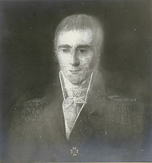
Quetton St. George was a French Royalist merchant and owned land in Upper Canada.
Bond Lake (Ontario) is a 55 acres glacier kettle lake in the Oak Ridges Moraine. It is located on the east side of Yonge Street in the north end of Richmond Hill, Ontario.

