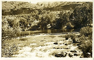
Kern County is located in the U.S. state of California. As of the 2020 census, the population was 909,235. Its county seat is Bakersfield.
Buena Vista, meaning "good view" in Spanish, may refer to:

Tulare Lake is a freshwater dry lake with residual wetlands and marshes in the southern San Joaquin Valley, California, United States. After Lake Cahuilla disappeared in the 17th century, Tulare Lake was the largest freshwater lake west of the Mississippi River and the second-largest freshwater lake entirely in the United States, based upon surface area. A remnant of Pleistocene-era Lake Corcoran, Tulare Lake dried up after its tributary rivers were diverted for agricultural irrigation and municipal water uses.

The Kern River, previously Rio de San Felipe, later La Porciuncula, is a Wild and Scenic river in the U.S. state of California, approximately 165 miles (270 km) long. It drains an area of the southern Sierra Nevada mountains northeast of Bakersfield. Fed by snowmelt near Mount Whitney, the river passes through scenic canyons in the mountains and is a popular destination for whitewater rafting and kayaking. It is the southernmost major river system in the Sierra Nevada, and is the only major river in the Sierra that drains in a southerly direction.

The ornate shrew is a species of mammal in the family Soricidae (shrews). It is endemic to western North America, ranging from Northern California in the United States to Baja California in Mexico. Eight subspecies are known, including the extinct tule shrew, known only from four specimens collected in 1905, and the Suisun ornate shrew, a species of conservation concern in California. Through skull morphology research and genetic testing on Ornate shrew populations, it has been shown that there are three main genetic subdivisions: The Southern, Central and Northern. These three genetic subdivisions of Ornate shrew arose from populations of Ornate shrews getting geographically isolated from other populations.

The Buena Vista Oil Field, formerly the Naval Petroleum Reserve No. 2 (NPR-2) is a large oil field in Kern County, San Joaquin Valley, California in the United States. Discovered in 1909, and having a cumulative production of approximately 667 million barrels (106,000,000 m3), it is the tenth-largest oil field in California. As of year end 2006 the field had a total reserve of only about one percent of its original oil, and having produced a mere 713,000 barrels (113,400 m3). Since, the field has gone through a revitalization. Crimson Resources initiated a waterflood in the Etchegoin Formation, saw good response and sold the asset to Occidental Petroleum. CRC continued the development of the waterflood, but also tested the viability of the Monterey Formation. The Monterey Formation at Buena Vista has proven to be a viable target and is currently being developed.
The Buena Vista Hills are a mountain range of the Transverse Ranges System, located in western Kern County, California.

Miracle Hot Springs is an unincorporated community in the Kern River Valley, in Kern County, California. It is located along the Kern River in the Sequoia National Forest 10 miles (16 km)West of Lake Isabella, California, at an elevation of 2,382 feet (726 m).

Lake Ming is a man-made recreational lake located in Bakersfield, California. It is primarily a motorboat and water-skiing lake, although sailboats are allowed the second full weekend each month, and every Tuesday and Thursday after 1:30 pm. Lake Ming also has fishing and the Department of Fish and Game stocks the lake with 10 to 12 inches rainbow trout during the winter months. The primary fishes are Large-mouth Bass, Catfish, Crappie, Bluegill, Carp and stocked Rainbow Trout. Lake Ming is a part of the Kern River County Park. The National Jet Boat Association holds races at the lake throughout the year.

Kern River County Park is a large recreation facility located just north of Bakersfield, California. The facility is 1,012 acres (4.10 km2), and includes a park, zoo, golf course, and other amenities. The complex is served by Alfred Harrell Highway. The segment to the west of the park was built as a 4-lane local freeway. The segment to the east of the park was built as a 2-lane expressway, with land reserved for a future 4-lane freeway.

The McKittrick Tar Pits are a series of natural asphalt lakes situated in the western part of Kern County in southern California. The pits are the most extensive asphalt lakes in the state.

Buena Vista was a Yokuts dialect of California.
Buena Vista Canal is an irrigation canal in Kern County, California. It originates from the Carrier Canal at Coffee Road. The canal terminates at Lake Webb and the Kern River.
Lake Evans is a manmade recreational lake in Kern County, California. It is the smaller of two lakes in the Buena Vista Aquatic Recreation Area southwest of Bakersfield. The lake is primarily a sailing and fishing lake, with a speed limit of 5 miles per hour (8.0 km/h). It has two boat ramps. The lake is located on the lakebed of the former Buena Vista Lake.

Buena Vista Lake was a fresh-water lake in Kern County, California, in the Tulare Lake Basin in the southern San Joaquin Valley, California.

Kern Lake, originally Laguna de los Tulares, was the smallest of the three large lakes in the Tulare Basin, in the southwestern San Joaquin Valley of California.
Lux v. Haggin, 69 Cal. 255; 10 P. 674; (1886), is a historic case in the conflict between riparian and appropriative water rights. Decided by a vote of four to three in the Supreme Court of California, the ruling held that appropriative rights were secondary to riparian rights.
Buena Vista County was a failed attempt to create a county from the territory of Tulare County, California, between 1855 and 1859.


