Tulare Lake or Tache Lake is a freshwater lake in the southern San Joaquin Valley, California, United States. Historically, Tulare Lake was once the largest freshwater lake west of the Mississippi River, and the second-largest freshwater lake entirely in the United States based upon surface area. For thousands of years, from the Paleolithic onward, Tulare Lake was a uniquely rich area, which supported perhaps the largest population of Native Americans north of Mexico.

The San Joaquin River is the longest river of Central California. The 366-mile (589 km) long river starts in the high Sierra Nevada, and flows through the rich agricultural region of the northern San Joaquin Valley before reaching Suisun Bay, San Francisco Bay, and the Pacific Ocean. An important source of irrigation water as well as a wildlife corridor, the San Joaquin is among the most heavily dammed and diverted of California's rivers.

The Kings River, historically called Wimmel-che by the Yokuts, is a 132.9-mile (213.9 km) river draining the Sierra Nevada mountain range in central California in the United States. Its headwaters originate along the Sierra Crest in and around Kings Canyon National Park and form the eponymous Kings Canyon, one of the deepest river gorges in North America. The river is impounded in Pine Flat Lake before flowing into the San Joaquin Valley southeast of Fresno. With its upper and middle course in Fresno County, the Kings River diverges into multiple branches in Kings County, with some water flowing south to the old Tulare Lake bed and the rest flowing north to the San Joaquin River. However, most of the water is consumed for irrigation well upstream of either point.
The St. John's River is a distributary of the Kaweah River in the San Joaquin Valley of California in the United States. The river begins at a diversion dam at McKay's Point, about a mile west of Lemon Cove. The distributary flows west along the north side of the city of Visalia, where it joins Elbow Creek, continuing west to Cross Creek.

The San Joaquin Valley is the area of the Central Valley of the U.S. state of California that lies south of the Sacramento–San Joaquin River Delta and is drained by the San Joaquin River. It comprises eight counties of Northern and one of Southern California, including, in the north, all of San Joaquin and Kings counties, most of Stanislaus, Merced, and Fresno counties, and parts of Madera and Tulare counties, along with a majority of Kern County, in Southern California. Although the valley is predominantly rural, it has densely populated urban centers: Fresno, Bakersfield, Stockton, Modesto, Porterville, Tulare, Visalia, and Merced.

The Governor Edmund G. Brown California Aqueduct is a system of canals, tunnels, and pipelines that conveys water collected from the Sierra Nevada Mountains and valleys of Northern and Central California to Southern California. Named after California Governor Edmund Gerald "Pat" Brown Sr., the over 400-mile (640 km) aqueduct is the principal feature of the California State Water Project.

The Kern River, previously Rio de San Felipe, later La Porciuncula, is an Endangered, Wild and Scenic river in the U.S. state of California, approximately 165 miles (270 km) long. It drains an area of the southern Sierra Nevada mountains northeast of Bakersfield. Fed by snowmelt near Mount Whitney, the river passes through scenic canyons in the mountains and is a popular destination for whitewater rafting and kayaking. It is the southernmost major river system in the Sierra Nevada, and is the only major river in the Sierra that drains in a southerly direction.

The Tule River, also called Rio de San Pedro or Rio San Pedro, is a 71.4-mile (114.9 km) river in Tulare County in the U.S. state of California. The river originates in the Sierra Nevada east of Porterville and consists of three forks, North, Middle and South. The North Fork and Middle Fork meet above Springville. The South Fork meets the others at Lake Success. Downstream of Success Dam, the river flows west through Porterville. The river used to empty into Tulare Lake, but its waters have been diverted for irrigation. However, the river does reach Tulare Lake during floods. Tulare Lake is the terminal sink of an endorheic basin that historically also received the Kaweah and Kern Rivers as well as southern distributaries of the Kings.

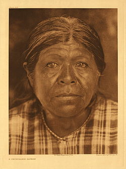
The Tübatulabal are an indigenous people of Kern River Valley in the Sierra Nevada range of California. They may have been the first people to make this area their permanent home. Today many of them are enrolled in the Tule River Indian Tribe. They are descendants of the people of the Uto-Aztecan language group, separating from Shoshone people about 3000 years ago.

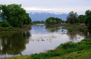
The Kaweah River is a river draining the southern Sierra Nevada in Tulare County, California in the United States. Fed primarily by high elevation snowmelt along the Great Western Divide, the Kaweah begins as four forks in Sequoia National Park, where the watershed is noted for its alpine scenery and its dense concentrations of giant sequoias, the largest trees on Earth. It then flows in a southwest direction to Lake Kaweah – the only major reservoir on the river – and into the San Joaquin Valley, where it diverges into multiple channels across an alluvial plain around Visalia. With its Middle Fork headwaters starting at almost 13,000 feet (4,000 m) above sea level, the river has a vertical drop of nearly two and a half miles (4.0 km) on its short run to the San Joaquin Valley, making it one of the steepest river drainages in the United States. Although the main stem of the Kaweah is only 33.6 miles (54.1 km) long, its total length including headwaters and lower branches is nearly 100 miles (160 km).
Kern River Slough is a former settlement in Kern County, California.
Kern River Slough was the distributary of the Kern River running south from the vicinity of Bakersfield to Kern Lake near Arvin, in Kern County, California.

Buena Vista was a Yokuts dialect of California.

Kern Lake, originally Laguna de los Tulares, was the smallest of the three large lakes in the Tulare Basin, in the southwestern San Joaquin Valley of California.
Connecting Slough, the former slough between Kern Lake and Buena Vista Lake in the southeastern San Joaquin Valley, in Kern County, California.
Buena Vista Slough was the joint outlet of an overflowing Buena Vista Lake and a distributary of the Kern River into Tulare Lake. It is now diverted into a system of canals by the Outlet Canal of the Central Valley Project.
Lux v. Haggin, 69 Cal. 255; 10 P. 674; (1886), is a historic case in the conflict between riparian and appropriative water rights. Decided by a vote of four to three in the Supreme Court of California, the ruling held that appropriative rights were secondary to riparian rights.
Hometwoli was a dialect of Buena Vista Yokuts spoken in the southern portion of the Tulare Basin of California near Kern Lake.
Sacramento–San Joaquin is a freshwater ecoregion in California. It includes the Sacramento and San Joaquin river systems of California's Central Valley, which converge in the inland Sacramento–San Joaquin Delta. It also includes the mostly-closed Tulare Lake basin in the southern Central Valley, the rivers and streams that empty into San Francisco Bay, and the Pajaro and Salinas river systems of Central California which empty into Monterey Bay.

Painted Rock, on the Tule River Reservation in Tulare County, is an archaeological and sacred site of the Yokuts people.