Related Research Articles
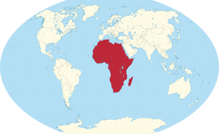
Africa is a continent comprising 63 political territories, representing the largest of the great southward projections from the main mass of Earth's surface. Within its regular outline, it comprises an area of 30,368,609 km2 (11,725,385 sq mi), excluding adjacent islands. Its highest mountain is Mount Kilimanjaro, its largest lake is Lake Victoria.
The Global 200 is the list of ecoregions identified by the World Wide Fund for Nature (WWF), the global conservation organization, as priorities for conservation. According to WWF, an ecoregion is defined as a "relatively large unit of land or water containing a characteristic set of natural communities that share a large majority of their species dynamics, and environmental conditions". For example, based on their levels of endemism, Madagascar gets multiple listings, ancient Lake Baikal gets one, and the North American Great Lakes get none.

The ecoregions of Madagascar, as defined by the World Wildlife Fund, include seven terrestrial, five freshwater, and two marine ecoregions. Madagascar's diverse natural habitats harbour a rich fauna and flora with high levels of endemism, but most ecoregions suffer from habitat loss.

A blackwater river is a type of river with a slow-moving channel flowing through forested swamps or wetlands. As vegetation decays, tannins leach into the water, making a transparent, acidic water that is darkly stained, resembling black tea. Most major blackwater rivers are in the Amazon Basin and the Southern United States. The term is used in fluvial studies, geology, geography, ecology, and biology. Not all dark rivers are blackwater in that technical sense. Some rivers in temperate regions, which drain or flow through areas of dark black loam, are simply black due to the color of the soil; these rivers are black mud rivers. There are also black mud estuaries.

The Gulf Coastal Plain extends around the Gulf of Mexico in the Southern United States and eastern Mexico.
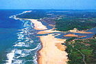
The Lower Guinean forests is region of coastal tropical moist broadleaf forest in West Africa, extending along the eastern coast of the Gulf of Guinea from eastern Benin through Nigeria and Cameroon.

Freshwater swamp forests, or flooded forests, are forests which are inundated with freshwater, either permanently or seasonally. They normally occur along the lower reaches of rivers and around freshwater lakes. Freshwater swamp forests are found in a range of climate zones, from boreal through temperate and subtropical to tropical.
References
- Olson, D., Dinerstein, E., Canevari, P., Davidson, I., Castro, G., Morisset, V., Abell, R., and Toledo, E.; eds. (1998). Freshwater Biodiversity of Latin America and the Caribbean: A Conservation Assessment. Biodiversity Support Program, Washington, D.C..
- Thieme, Michelle L. (2005). Freshwater Ecoregions of Africa and Madagascar: A Conservation Assessment. Island Press, Washington, D.C..
- "Freshwater Ecoregions of the World: Major Habitat Types" . Accessed May 12, 2008.