A marsh is - according to ecological definitions - a wetland that is dominated by herbaceous rather than woody plant species. More in general, the word can be used for any low-lying and seasonally waterlogged terrain. In Europe and in agricultural literature low-lying meadows that require draining and embanked polderlands are also referred to as marshes or marshland.

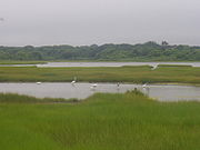
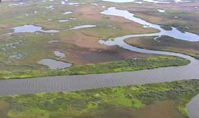
A salt marsh, saltmarsh or salting, also known as a coastal salt marsh or a tidal marsh, is a coastal ecosystem in the upper coastal intertidal zone between land and open saltwater or brackish water that is regularly flooded by the tides. It is dominated by dense stands of salt-tolerant plants such as herbs, grasses, or low shrubs. These plants are terrestrial in origin and are essential to the stability of the salt marsh in trapping and binding sediments. Salt marshes play a large role in the aquatic food web and the delivery of nutrients to coastal waters. They also support terrestrial animals and provide coastal protection.

Willapa Bay is a bay located on the southwest Pacific coast of Washington state in the United States. The Long Beach Peninsula separates Willapa Bay from the greater expanse of the Pacific Ocean. With over 120 square miles (310 km2) of surface area Willapa Bay is the second-largest riverine estuary on the Pacific coast of the continental United States. Early settlers called the bay Shoalwater Bay and this name is found on old maps and charts of the region.

A Ramsar site is a wetland site designated to be of international importance under the Ramsar Convention, also known as "The Convention on Wetlands", an international environmental treaty signed on 2 February 1971 in Ramsar, Iran, under the auspices of UNESCO. It came into force on 21 December 1975, when it was ratified by a sufficient number of nations. It provides for national action and international cooperation regarding the conservation of wetlands, and wise sustainable use of their resources. Ramsar identifies wetlands of international importance, especially those providing waterfowl habitat.

A tidal creek or tidal channel is a narrow inlet or estuary that is affected by the ebb and flow of ocean tides. Thus, it has variable salinity and electrical conductivity over the tidal cycle, and flushes salts from inland soils. Tidal creeks are characterized by slow water velocity, resulting in buildup of fine, organic sediment in wetlands. Creeks may often be a dry to muddy channel with little or no flow at low tide, but with significant depth of water at high tide. Due to the temporal variability of water quality parameters within the tidally influenced zone, there are unique biota associated with tidal creeks which are often specialised to such zones. Nutrients and organic matter are delivered downstream to habitats normally lacking these, while the creeks also provide access to inland habitat for salt-water organisms.
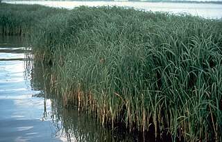
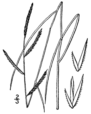
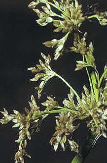
Sporobolus alterniflorus, or synonymously known as Spartina alterniflora, the smooth cordgrass, saltmarsh cordgrass, or salt-water cordgrass, is a perennial deciduous grass which is found in intertidal wetlands, especially estuarine salt marshes. It has been reclassified as Sporobolus alterniflorus after a taxonomic revision in 2014, but it is still common to see Spartina alterniflora and in 2019 an interdisciplinary team of experts coauthored a report published in the journal Ecology supporting Spartina as a genus. It grows 1–1.5 m tall and has smooth, hollow stems that bear leaves up to 20–60 cm long and 1.5 cm wide at their base, which are sharply tapered and bend down at their tips. Like its relative saltmeadow cordgrass S. patens, it produces flowers and seeds on only one side of the stalk. The flowers are a yellowish-green, turning brown by the winter. It has rhizoidal roots, which, when broken off, can result in vegetative asexual growth. The roots are an important food resource for snow geese. It can grow in low marsh as well as high marsh, but it is usually restricted to low marsh because it is outcompeted by salt meadow cordgrass in the high marsh. It grows in a wide range of salinities, from about 5 psu to marine, and has been described as the "single most important marsh plant species in the estuary" of Chesapeake Bay. It is described as intolerant of shade.
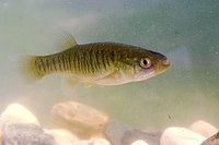
Euryhaline organisms are able to adapt to a wide range of salinities. An example of a euryhaline fish is the molly which can live in fresh water, brackish water, or salt water.
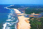
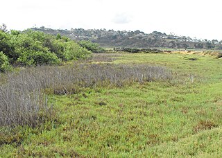
California's coastal salt marsh is a wetland plant community that occurs sporadically along the Pacific Coast from Humboldt Bay to San Diego. This salt marsh type is found in bays, harbors, inlets, and other protected areas subject to tidal flooding.
High salt marsh dieback, or salt marsh browning, is the primary force in salt marsh degradation in the high marsh. The general effect is that the plants in the marsh die off and brown, leaving dead organic matter, and ultimately open sediment. Without strong plant roots holding the sediment, these open areas of land erode, causing the salt marsh to retreat back to the mainland. Dieback zones lack their main producers, such as the salt marsh cord grass, or Spartina alterniflora, and ultimately become completely unproductive.
Brackish marshes develop from salt marshes where a significant freshwater influx dilutes the seawater to brackish levels of salinity. This commonly happens upstream from salt marshes by estuaries of coastal rivers or near the mouths of coastal rivers with heavy freshwater discharges in the conditions of low tidal ranges.
Classification of wetlands has been a problematical task, with the commonly accepted definition of what constitutes a wetland being among the major difficulties. A number of national wetland classifications exist. In the 1970s, the Ramsar Convention on Wetlands of International Importance introduced a first attempt to establish an internationally acceptable wetland classification scheme.

High marsh is a tidal marsh zone located above the Mean Highwater Mark (MHW) which, in contrast to the low marsh zone, is inundated infrequently during periods of extreme high tide and storm surge associated with coastal storms. This zone is impacted by spring tides, which is a bi-monthly lunar occurrence where the high marsh experiences higher inundation levels. The high marsh is the intermittent zone between the low marsh and the uplands, an entirely terrestrial area rarely flooded during events of extreme tidal action caused by severe coastal storms. The high marsh is distinguished from the low marsh by its sandy soil and higher elevation. The elevation of the high marsh allows this zone to be covered by the high tide for no more than an hour a day. With the soil exposed to air for long periods of time, evaporation occurs, leading to high salinity levels, up to four times that of sea water. Areas of extremely high salinity prohibit plant growth altogether. These barren sandy areas are known as "salt pans". Some cordgrass plants do survive here, but are stunted and do not reach their full size.
Low marsh is a tidal marsh zone located below the Mean Highwater Mark (MHM). Based on elevation, frequency of submersion, soil characteristics, vegetation, microbial community, and other metrics, salt marshes can be divided to into three distinct areas: low marsh, middle marsh/high marsh, and the upland zone. Low marsh is characterized as being flooded daily with each high tide, while remaining exposed during low tides.
The William T. Davis Wildlife Refuge (WTDWR) is an 814-acre (3.29 km2) wildlife refuge straddling the New Springville and Travis sections of Staten Island. The park was named in honor of Staten Island native William T. Davis, a renowned naturalist and entomologist who along with the Audubon Society started the refuge with an original acquisition of 52 acres (210,000 m2). Additional acreage was acquired in increments and the park is today 814 acres (3.29 km2). Beginning in 2010, the adjacent 223-acre (0.90 km2) North Park section of Freshkills Park has undergone preparation to serve as an expansion of the wildlife refuge.
Sporobolus pumilus, the saltmeadow cordgrass, also known as salt hay, is a species of cordgrass native to the Atlantic coast of the Americas, from Newfoundland south along the eastern United States to the Caribbean and north-eastern Mexico. It was reclassified after a taxonomic revision in 2014, but the older name, Spartina patens, may still be found in use. It can be found in marshlands in other areas of the world as an introduced species and often a harmful noxious weed or invasive species.
Juncus roemerianus is a species of flowering plant in the rush family known by the common names black rush, needlerush, and black needlerush. It is native to North America, where its main distribution lies along the coastline of the southeastern United States, including the Gulf Coast. It occurs from New Jersey to Texas, with outlying populations in Connecticut, New York, Mexico, and certain Caribbean islands.

Sporobolus cynosuroides is a species of grass known by the common names big cordgrass and salt reedgrass. It is native to the East Coast and Gulf Coast of the United States, where it grows in coastal habitat such as marshes, lagoons, and bays.

Salt marsh die-off is a term that has been used in the US and UK to describe the death of salt marsh cordgrass leading to subsequent degradation of habitat, specifically in the low marsh zones of salt marshes on the coasts of the Western Atlantic. Cordgrass normally anchors sediment in salt marshes; its loss leads to decreased substrate hardness, increased erosion, and collapse of creek banks into the water, ultimately resulting in decreased marsh health and productivity.

Charles E. Wheeler Wildlife Management Area is a 625-acre (253 ha) brackish tidal marsh, nature preserve and hunting area owned by the state of Connecticut located in Devon (village), Milford, New Haven County, Connecticut.
The marsh organ is a collection of plastic pipes attached to a wooden framework that is placed in marshes to measure the effects of inundation time and flood frequency on the productivity of marsh vegetation. The information is used for scientific research purposes.