Related Research Articles

A geographic information system (GIS) consists of integrated computer hardware and software that store, manage, analyze, edit, output, and visualize geographic data. Much of this often happens within a spatial database, however, this is not essential to meet the definition of a GIS. In a broader sense, one may consider such a system also to include human users and support staff, procedures and workflows, the body of knowledge of relevant concepts and methods, and institutional organizations.

In modern mapping, a topographic map or topographic sheet is a type of map characterized by large-scale detail and quantitative representation of relief features, usually using contour lines, but historically using a variety of methods. Traditional definitions require a topographic map to show both natural and artificial features. A topographic survey is typically based upon a systematic observation and published as a map series, made up of two or more map sheets that combine to form the whole map. A topographic map series uses a common specification that includes the range of cartographic symbols employed, as well as a standard geodetic framework that defines the map projection, coordinate system, ellipsoid and geodetic datum. Official topographic maps also adopt a national grid referencing system.

The United States Fish and Wildlife Service is a U.S. federal government agency within the U.S. Department of the Interior which oversees the management of fish, wildlife, and natural habitats in the United States. The mission of the agency is "working with others to conserve, protect, and enhance fish, wildlife, plants and their habitats for the continuing benefit of the American people."
National Wildlife RefugeSystem (NWRS) is a system of protected areas of the United States managed by the United States Fish and Wildlife Service (FWS), an agency within the Department of the Interior. The National Wildlife Refuge System is the system of public lands and waters set aside to conserve America's fish, wildlife, and plants. Since President Theodore Roosevelt designated Florida's Pelican Island National Wildlife Refuge as the first wildlife refuge in 1903, the system has grown to over 568 national wildlife refuges and 38 wetland management districts encompassing about 856,000,000 acres (3,464,109 km2).

The Endangered Species Act of 1973 is the primary law in the United States for protecting and conserving imperiled species. Designed to protect critically imperiled species from extinction as a "consequence of economic growth and development untempered by adequate concern and conservation", the ESA was signed into law by President Richard Nixon on December 28, 1973. The Supreme Court of the United States described it as "the most comprehensive legislation for the preservation of endangered species enacted by any nation". The purposes of the ESA are two-fold: to prevent extinction and to recover species to the point where the law's protections are not needed. It therefore "protect[s] species and the ecosystems upon which they depend" through different mechanisms. For example, section 4 requires the agencies overseeing the Act to designate imperiled species as threatened or endangered. Section 9 prohibits unlawful ‘take,’ of such species, which means to "harass, harm, hunt..." Section 7 directs federal agencies to use their authorities to help conserve listed species. The Act also serves as the enacting legislation to carry out the provisions outlined in The Convention on International Trade in Endangered Species of Wild Fauna and Flora (CITES). The Supreme Court found that "the plain intent of Congress in enacting" the ESA "was to halt and reverse the trend toward species extinction, whatever the cost." The Act is administered by two federal agencies, the United States Fish and Wildlife Service (FWS) and the National Marine Fisheries Service (NMFS). FWS and NMFS have been delegated by the Act with the authority to promulgate any rules and guidelines within the Code of Federal Regulations (CFR) to implement its provisions.
The Canada Geographic Information System (CGIS) was an early geographic information system (GIS) developed for the Government of Canada beginning in the early 1960s. CGIS was used to store geospatial data for the Canada Land Inventory and assisted in the development of regulatory procedures for land-use management and resource monitoring in Canada.

The United States National Grid (USNG) is a multi-purpose location system of grid references used in the United States. It provides a nationally consistent "language of location", optimized for local applications, in a compact, user friendly format. It is similar in design to the national grid reference systems used in other countries. The USNG was adopted as a national standard by the Federal Geographic Data Committee (FGDC) of the US Government in 2001.
The Emergency Wetlands Resources Act of 1986 became a United States federal law (P.L.) 99-645 on November 10, 1986. Prior to the Act the purchase of wetlands by the Federal Government had been prohibited. The Act allocated funds from the Land and Water Conservation Fund (LWCF) for the purchase of wetlands by the Secretary of Interior, who is head of the United States Department of the Interior. The Act also instituted a National Wetlands Priority Conservation Plan which was to be established and set up by the Secretary. Included in this plan was a requirement for all States to include wetlands as part of their Comprehensive Outdoors Recreation plan. The plan also transferred the Migratory Bird Conservation Fund amounts which were to be equal to the import duties on arms and ammunition. The main purpose of the Act was to ensure a follow through on international obligations and fulfillment of these obligations on the various past and future migratory bird treaties. It also promoted the conservation of wetlands so the benefits they provide could be maintained.
The Coastal Barrier Resources Act of the United States was enacted into law by the 40th President of the United States Ronald Reagan on October 18, 1982. The United States Congress passed this Act in order to address the many problems associated with coastal barrier development. CBRA designated various undeveloped coastal barriers, which were illustrated by a set of maps adopted by law, to be included in the John H. Chafee Coastal Barrier Resources System (CBRS). These designated areas were made ineligible for both direct and indirect federal expenditures and financial assistance, which are believed to encourage development of fragile, high-risk, and ecologically sensitive coastal barriers.

The National Atlas of the United States was an atlas published by the United States Department of the Interior from 1874 to 1997.
Geospatial metadata is a type of metadata applicable to geographic data and information. Such objects may be stored in a geographic information system (GIS) or may simply be documents, data-sets, images or other objects, services, or related items that exist in some other native environment but whose features may be appropriate to describe in a (geographic) metadata catalog.
The Federal Geographic Data Committee (FGDC) is a United States government committee which promotes the coordinated development, use, sharing, and dissemination of geospatial data on a national basis. Its 32 members are representatives from the Executive Office of the President, and Cabinet level and independent federal agencies. The secretary of the Department of the Interior chairs the FGDC, with the deputy director for management, Office of Management and Budget (OMB) as vice-chair.
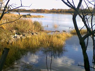
Wetlands of the United States are defined by the United States Army Corps of Engineers and the United States Environmental Protection Agency as "those areas that are inundated or saturated by surface or ground water at a frequency and duration sufficient to support, and that under normal circumstances do support, a prevalence of vegetations typically adapted for life in saturated soils. Wetlands generally include swamps, marshes, bogs, and similar areas." Wetlands can be valued in terms of their contributions to ecological, economic and social systems. Wetlands service these systems through multiple processes including water filtration, water storage and biological productivity. They also contribute the functions of flood control, providing a nutrient sink, groundwater recharge and habitat.
The Map Overlay and Statistical System (MOSS), is a GIS software technology. Development of MOSS began in late 1977 and was first deployed for use in 1979. MOSS represents a very early public domain, open source GIS development - predating the better known GRASS by 5 years. MOSS utilized an integrated vector based data structure in which point, line, and polygon features could all be stored in the same map file. The user interacted with MOSS via a command line interface.

Geographic Information Systems (GIS) has become an integral part of aquatic science and limnology. Water by its very nature is dynamic. Features associated with water are thus ever-changing. To be able to keep up with these changes, technological advancements have given scientists methods to enhance all aspects of scientific investigation, from satellite tracking of wildlife to computer mapping of habitats. Agencies like the US Geological Survey, US Fish and Wildlife Service as well as other federal and state agencies are utilizing GIS to aid in their conservation efforts.

A national mapping agency (NMA) is an organisation, usually publicly owned, that produces topographic maps and geographic information of a country. Some national mapping agencies also deal with cadastral matters.
Classification of wetlands has been a problematical task, with the commonly accepted definition of what constitutes a wetland being among the major difficulties. A number of national wetland classifications exist. In the 1970s, the Ramsar Convention on Wetlands of International Importance introduced a first attempt to establish an internationally acceptable wetland classification scheme.

The United States Geological Survey (USGS), founded as the Geological Survey, is an agency of the United States government whose work spans the disciplines of biology, geography, geology, and hydrology. The agency was founded on March 3, 1879, to study the landscape of the United States, its natural resources, and the natural hazards that threaten it. The agency also makes maps of extraterrestrial planets and moons based on data from U.S. space probes.

The Lower Rio Grande Valley National Wildlife Refuge is a 90,788-acre (367.41 km2) National Wildlife Refuge located in the Lower Rio Grande Valley region of southern Texas.
Kellys Slough National Wildlife Refuge was established to develop and manage a system of wetlands and grasslands that is unique to the Red River Valley. The Refuge supports a diversity of wetland and grassland wildlife, while providing for wildlife-dependent recreation, interpretation, and education. Kellys Slough National Wildlife Refuge is located in the heart of the Red River Valley. The Refuge contains an intermittent stream that flows into the Turtle River, a tributary of the Red River. The Refuge covers portions of Blooming, Lakeville and Rye Townships of Grand Forks County.
References
- ↑ "NWI Program Overview". US Fish & Wildlife Service. 2015. Retrieved December 29, 2015.
 This article incorporates text from this source, which is in the public domain .