Related Research Articles

Drainage is the natural or artificial removal of a surface's water and sub-surface water from an area with excess water. The internal drainage of most agricultural soils can prevent severe waterlogging, but many soils need artificial drainage to improve production or to manage water supplies.

A fen is a type of peat-accumulating wetland fed by mineral-rich ground or surface water. It is one of the main types of wetland along with marshes, swamps, and bogs. Bogs and fens, both peat-forming ecosystems, are also known as mires. The unique water chemistry of fens is a result of the ground or surface water input. Typically, this input results in higher mineral concentrations and a more basic pH than found in bogs. As peat accumulates in a fen, groundwater input can be reduced or cut off, making the fen ombrotrophic rather than minerotrophic. In this way, fens can become more acidic and transition to bogs over time.

Resource depletion is the consumption of a resource faster than it can be replenished. Natural resources are commonly divided between renewable resources and non-renewable resources. The use of either of these forms of resources beyond their rate of replacement is considered to be resource depletion. The value of a resource is a direct result of its availability in nature and the cost of extracting the resource. The more a resource is depleted the more the value of the resource increases. There are several types of resource depletion, including but not limited to: mining for fossil fuels and minerals, deforestation, pollution or contamination of resources, wetland and ecosystem degradation, soil erosion, overconsumption, aquifer depletion, and the excessive or unnecessary use of resources. Resource depletion is most commonly used in reference to farming, fishing, mining, water usage, and the consumption of fossil fuels. Depletion of wildlife populations is called defaunation.

Stormwater, also written storm water, is water that originates from precipitation (storm), including heavy rain and meltwater from hail and snow. Stormwater can soak into the soil (infiltrate) and become groundwater, be stored on depressed land surface in ponds and puddles, evaporate back into the atmosphere, or contribute to surface runoff. Most runoff is conveyed directly as surface water to nearby streams, rivers or other large water bodies without treatment.
Natural Resources Conservation Service (NRCS), formerly known as the Soil Conservation Service (SCS), is an agency of the United States Department of Agriculture (USDA) that provides technical assistance to farmers and other private landowners and managers.

Nonpoint source (NPS) pollution refers to diffuse contamination of water or air that does not originate from a single discrete source. This type of pollution is often the cumulative effect of small amounts of contaminants gathered from a large area. It is in contrast to point source pollution which results from a single source. Nonpoint source pollution generally results from land runoff, precipitation, atmospheric deposition, drainage, seepage, or hydrological modification where tracing pollution back to a single source is difficult. Nonpoint source water pollution affects a water body from sources such as polluted runoff from agricultural areas draining into a river, or wind-borne debris blowing out to sea. Nonpoint source air pollution affects air quality, from sources such as smokestacks or car tailpipes. Although these pollutants have originated from a point source, the long-range transport ability and multiple sources of the pollutant make it a nonpoint source of pollution; if the discharges were to occur to a body of water or into the atmosphere at a single location, the pollution would be single-point.

The Conservation Reserve Program (CRP) is a cost-share and rental payment program of the United States Department of Agriculture (USDA). Under the program, the government pays farmers to take certain agriculturally used croplands out of production and convert them to vegetative cover, such as cultivated or native bunchgrasses and grasslands, wildlife and pollinators food and shelter plantings, windbreak and shade trees, filter and buffer strips, grassed waterways, and riparian buffers. The purpose of the program is to reduce land erosion, improve water quality and effect wildlife benefits.
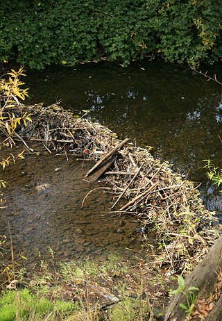
Hydric soil is soil which is permanently or seasonally saturated by water, resulting in anaerobic conditions, as found in wetlands.
Sonoma Creek is a 33.4-mile-long (53.8 km) stream in northern California. It is one of two principal drainages of southern Sonoma County, California, with headwaters rising in the rugged hills of Sugarloaf Ridge State Park and discharging to San Pablo Bay, the northern arm of San Francisco Bay. The watershed drained by Sonoma Creek is roughly equivalent to the wine region of Sonoma Valley, an area of about 170 square miles (440 km2). The State of California has designated the Sonoma Creek watershed as a “Critical Coastal Water Resource”. To the east of this generally rectangular watershed is the Napa River watershed, and to the west are the Petaluma River and Tolay Creek watersheds.

Groundwater recharge or deep drainage or deep percolation is a hydrologic process, where water moves downward from surface water to groundwater. Recharge is the primary method through which water enters an aquifer. This process usually occurs in the vadose zone below plant roots and is often expressed as a flux to the water table surface. Groundwater recharge also encompasses water moving away from the water table farther into the saturated zone. Recharge occurs both naturally and through anthropogenic processes, where rainwater and/or reclaimed water is routed to the subsurface.
The Conservation Security Program (CSP) was a voluntary conservation program in the United States that supported stewardship of private agricultural lands by providing payments and technical assistance for maintaining and enhancing natural resources. The program promoted the conservation and improvement of soil, water, air, energy, plant and animal life, and other conservation purposes. Congress established the CSP under the Farm Security and Rural Investment Act of 2002 (FSRIA), which amended the Food Security Act of 1985. The program was administered by the Natural Resources Conservation Service (NRCS), an agency of the United States Department of Agriculture (USDA).
Mexico, a classified arid and semi-arid country, has a total land area of 2 million square kilometres, 23% of which is equipped for irrigated agriculture. The agricultural sector plays an important role in the economic development of the country accounting for 8.4 of agricultural gross domestic product (GDP) and employing 23% of the economically active population. Irrigated agriculture contributes about 50% of the total value of agricultural production and accounts for about 70% of agriculture exports. Mexico's government initiated a number of structural reforms in the water sector aimed to introduce modern water management and irrigation.
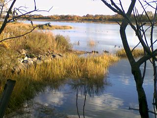
Wetlands of the United States are defined by the United States Army Corps of Engineers and the United States Environmental Protection Agency as "those areas that are inundated or saturated by surface or ground water at a frequency and duration sufficient to support, and that under normal circumstances do support, a prevalence of vegetations typically adapted for life in saturated soils. Wetlands generally include swamps, marshes, bogs, and similar areas." Wetlands can be valued in terms of their contributions to ecological, economic and social systems. Wetlands service these systems through multiple processes including water filtration, water storage and biological productivity. They also contribute the functions of flood control, providing a nutrient sink, groundwater recharge and habitat.

The environmental impact of irrigation relates to the changes in quantity and quality of soil and water as a result of irrigation and the subsequent effects on natural and social conditions in river basins and downstream of an irrigation scheme. The effects stem from the altered hydrological conditions caused by the installation and operation of the irrigation scheme.
Swampbuster is a provision officially titled the Wetland Conservation provisions of the Food Security Act of 1985 that discourages the conversion of wetlands to cropland use. The purpose was a balance between attempting to reduce crop subsidies, and conserving wetlands.

The Food Security Act of 1985, a five-year omnibus farm bill, allowed lower commodity price, income supports, and established a dairy herd buyout program. This 1985 farm bill made changes in a variety of other USDA programs. Several enduring conservation programs were created, including sodbuster, swampbuster, and the Conservation Reserve Program.
Farmed wetlands, under the swampbuster program, are wetlands that were partially drained or altered to improve crop production before swampbuster was enacted on December 23, 1985. Farmed wetlands have undergone less alteration than prior converted wetlands, and are therefore subject to more stringent rules about further change. Farmed wetlands may be farmed as they were before the 1985 date, and the drainage that was in place before that date can be maintained, but no additional drainage is allowed.
Water resources management in modern Egypt is a complex process that involves multiple stakeholders who use water for irrigation, municipal and industrial water supply, hydropower generation and navigation. In addition, the waters of the Nile support aquatic ecosystems that are threatened by abstraction and pollution. Egypt also has substantial fossil groundwater resources in the Western Desert.

Water-sensitive urban design (WSUD) is a land planning and engineering design approach which integrates the urban water cycle, including stormwater, groundwater, and wastewater management and water supply, into urban design to minimise environmental degradation and improve aesthetic and recreational appeal. WSUD is a term used in the Middle East and Australia and is similar to low-impact development (LID), a term used in the United States; and Sustainable Drainage System (SuDS), a term used in the United Kingdom.
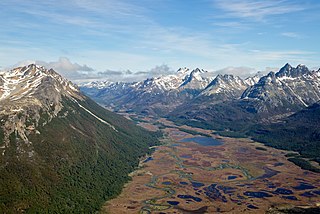
A peatland is a type of wetland whose soils consist of organic matter from decaying plants, forming layers of peat. Peatlands arise because of incomplete decomposition of organic matter, usually litter from vegetation, due to water-logging and subsequent anoxia. Peatlands are unusual landforms that derive mostly from biological rather than physical processes, and can take on characteristic shapes and surface patterning.
References
- ↑ "Converted Wetland Law and Legal Definition". USLEGAL.com. Archived from the original on 2012-03-06. Retrieved March 22, 2020.
- 1 2 3 "Highly Erodible Land Conservation Compliance Provisions". USDA Natural Resources Conservation Service. Archived from the original on 2013-05-10. Retrieved March 22, 2020.
 This article incorporates text from this source, which is in the public domain .