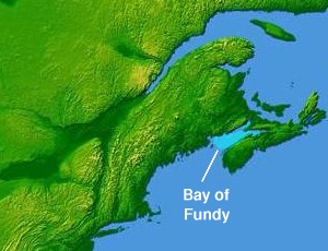
The Bay of Fundy is a bay between the Canadian provinces of New Brunswick and Nova Scotia, with a small portion touching the U.S. state of Maine. Its extremely high tidal range is the highest in the world. The name is likely a corruption of the French word fendu, meaning 'split'.

Acadia was a colony of New France in northeastern North America which included parts of what are now the Maritime provinces, the Gaspé Peninsula and Maine to the Kennebec River. During much of the 17th and early 18th centuries, Norridgewock on the Kennebec River and Castine at the end of the Penobscot River were the southernmost settlements of Acadia. The French government specified land bordering the Atlantic coast, roughly between the 40th and 46th parallels. It was eventually divided into British colonies. The population of Acadia included the various indigenous First Nations that comprised the Wabanaki Confederacy, the Acadian people and other French settlers.
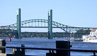
The Piscataqua River is a 12-mile-long (19 km) tidal river forming the boundary of the U.S. states of New Hampshire and Maine from its origin at the confluence of the Salmon Falls River and Cocheco River. The drainage basin of the river is approximately 1,495 square miles (3,870 km2), including the subwatersheds of the Great Works River and the five rivers flowing into Great Bay: the Bellamy, Oyster, Lamprey, Squamscott, and Winnicut.
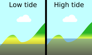
A tidal island is a piece of land that is connected to the mainland by a natural or man-made causeway that is exposed at low tide and submerged at high tide. Because of the mystique surrounding tidal islands, many of them have been sites of religious worship, such as Mont-Saint-Michel with its Benedictine Abbey. Tidal islands are also commonly the sites of fortresses because of their natural fortifications.
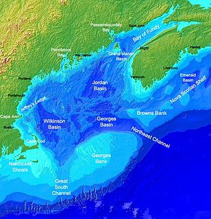
The Gulf of Maine is a large gulf of the Atlantic Ocean on the east coast of North America. It is bounded by Cape Cod at the eastern tip of Massachusetts in the southwest and by Cape Sable Island at the southern tip of Nova Scotia in the northeast. The gulf includes the entire coastlines of the U.S. states of New Hampshire and Maine, as well as Massachusetts north of Cape Cod, and the southern and western coastlines of the Canadian provinces of New Brunswick and Nova Scotia, respectively.

Passamaquoddy Bay is an inlet of the Bay of Fundy, between the U.S. state of Maine and the Canadian province of New Brunswick, at the mouth of the St. Croix River. Most of the bay lies within Canada, with its western shore bounded by Washington County, Maine. The southernmost point is formed by West Quoddy Head on the U.S. mainland in Lubec, Maine; and runs northeasterly through Campobello Island, New Brunswick, engulfing Deer Island, New Brunswick, to the New Brunswick mainland head at L'Etete, New Brunswick in Charlotte County, New Brunswick.

A tidal creek or tidal channel is a narrow inlet or estuary that is affected by ebb and flow of ocean tides. Thus it has variable salinity and electrical conductivity over the tidal cycle, and flushes salts from inland soils. Tidal creeks are characterized by slow water velocity resulting in buildup of fine, organic sediment in wetlands. Creeks may often be a dry to muddy channel with little or no flow at low tide, but with significant depth of water at high tide. Due to the temporal variability of water quality parameters within the tidally influenced zone, there are unique biota associated with tidal creeks which are often specialised to such zones. Nutrients and organic matter are delivered downstream to habitats normally lacking these, while the creeks also provide access to inland habitat for salt-water organisms.
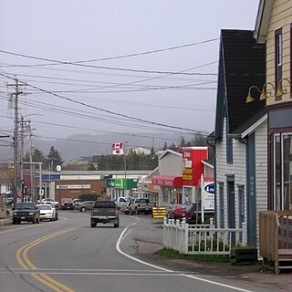
St. Peter's is a small incorporated village located on Cape Breton Island in Richmond County, Nova Scotia, Canada.
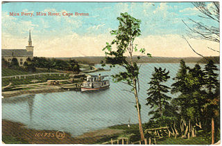
The Mira River is a Canadian river located in eastern Cape Breton Island, Nova Scotia.
The Marconi Trail is a scenic roadway in the Canadian province of Nova Scotia.

Sandy Point State Reservation is a coastal Massachusetts state park located in the town of Ipswich at the southern tip of Plum Island. The reservation is managed by the Department of Conservation and Recreation and is an important nesting area for the piping plover and the least tern. Access to the reservation is through the adjoining Parker River National Wildlife Refuge.
Digby Neck is a Canadian peninsula extending into the Bay of Fundy in Digby County, Nova Scotia.

The Nova Scotia peninsula is a peninsula on the Atlantic coast of North America.

Partridge Island is a significant historical, cultural and geological site located near the mouth of Parrsboro Harbour and the town of Parrsboro on the Minas Basin, in Cumberland County, Nova Scotia. It attracts many visitors including sightseers, swimmers, photographers, hikers and amateur geologists. Partridge Island is actually a peninsula that is connected to the mainland by a sandbar isthmus. According to local legend, the isthmus was created during the Saxby Gale of 1869. The hiking trail to the top of the island affords scenic views of key landforms on the Minas Basin including Cape Blomidon, Cape Split and Cape Sharp. The nearby Ottawa House By-the-Sea Museum contains artifacts and exhibits illustrating the history of the former village at Partridge Island, which dates from the 1770s. Partridge Island is a favourite hunting ground for rockhounds because its ancient sandstone and basalt cliffs are steadily eroded by the fast-moving currents of the world's highest tides. Rocks and debris worn away from its cliffs are dragged down the beach making it possible to find gemstones, exotic-looking zeolite minerals and fossils. Fossil hunters are warned, however, that although one or two loose specimens may be collected, Nova Scotia law requires that they be sent or taken to a museum for further study, and no fossils may be excavated from bedrock without a permit.

North Mountain is a narrow southwest-northeast trending volcanic ridge on the mainland portion of southwestern Nova Scotia, stretching from Brier Island to Cape Split. It forms the northern edge of the Annapolis Valley along the shore of the Bay of Fundy. Together with South Mountain, the two ranges form the Annapolis Highlands region.

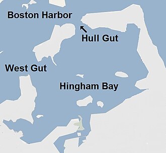
A gat is a strait that is constantly eroded by currents flowing back and forth, such as tidal currents. It is usually a relatively narrow but deep, up to 30 m (100 ft) passage between land masses or shallow bars in an area of mudflats. A gat is sometimes a shallower passage on lagoon coasts, including those without any tidal range.

Straumfjörð (Icelandic), or Straumfjǫrð sometimes anglicised to Straumsfjordr, Straumfjordr, Straumsfjord or Straumfjord, is according to the Sagas of Icelanders a fjord in Vinland where Thorfinn Karlsefni set up a temporary settlement. It is described in the Saga of Erik the Red, but not in the Greenland saga. Its name translates to "Current-fjord", "Stream-fjord" or "Tide-fjord".
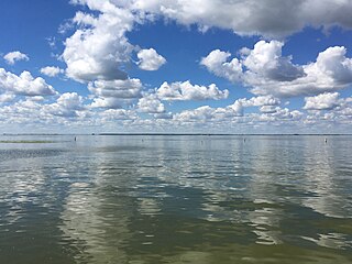
Oak Lake is a lake in the south-western part of the Canadian province of Manitoba in a region called Westman. Oak Lake is a kettle lake and is an aquifer supplier for numerous nearby residential areas and farms. The lake is in the RM of Sifton and sits at an elevation of 426 metres above sea level. Provincial Road 254 provides access to the lake.
