Lambley railway station

Last updated

Lambley
Lambley railway station and Metro Cammell dmu (British Rail Class 101).jpg
General information
Location Lambley, Northumberland
England
Coordinates 54°55′01″N2°30′33″W / 54.9170°N 2.5093°W / 54.9170; -2.5093 Coordinates: 54°55′01″N2°30′33″W / 54.9170°N 2.5093°W / 54.9170; -2.5093
Grid reference NY674581
Platforms1
Tracks1
Other information
StatusDisused
History
Original company Newcastle and Carlisle Railway
Pre-grouping North Eastern Railway
Post-grouping
Key dates
21 May 1852Opened
3 May 1976Closed
Location
Northumberland UK location map.svg
Red pog.svg
Lambley
Location in Northumberland, England

Lambley was a railway station on the Alston Branch Line, which ran between Haltwhistle and Alston. The station, situated 4+34 miles (8 km) south-west of Haltwhistle, served the village of Lambley in Northumberland.

Contents

The station was opened by the North Eastern Railway on 21 May 1852, following the completion of Lambley Viaduct. [1] The imposing stone viaduct is located the north-east of the former station, and was designed by Sir George Barclay Bruce. It spans a length of 850 feet (260 m) over the River South Tyne. The viaduct was designated a Grade II* listed structure on 23 August 1985. [2]

There were a number of unscheduled calling points on the section of the line between Lambley and Slaggyford, including those at Burnstones, Softley and Whitwham. [3] Trains regularly stopped to allow passengers to board and alight, despite no platform or facilities being available at these locations.

History

The Newcastle and Carlisle Railway was formed in 1829, opening to passengers in stages from March 1835. [4] A branch line from Haltwhistle to Alston and Nenthead was first considered in 1841, with the line authorised by an Act of Parliament in August 1846. [5] It was later decided that a line operating as far as Alston was sufficient, with the amended route approved by a further Act in July 1849.

In March 1851, the 412-mile section from Haltwhistle to Shaft Hill (which was later renamed Coanwood) was opened to goods traffic, with passenger services commencing in July 1851. The 814-mile section of the line between Alston and Lambley opened to goods traffic in January 1852, along with a short branch to Lambley Fell, with passenger services commencing in May 1852. At Lambley the Alston line connected with the Brampton Railway.

Construction of the branch line was completed in November 1852, following the opening of the, now Grade II* listed, [2] Lambley Viaduct over the River South Tyne. [6]

Demise and closure

Lambley became an unstaffed halt in 1966, with Alston following in 1969. Featherstone Park and Slaggyford were reduced to unstaffed halt status in 1954, along with Coanwood in 1955.

The line was originally marked for closure in the 1960s, under the Beeching plan, however the lack of an all-weather road kept it open. Following improvements to the road network, including a temporary level crossing over the branch at Lambley, the line was closed on 3 May 1976 by the British Railways Board, with the last train working two days earlier. [7] The line was replaced in part by a bus service, which was operated by Ribble Motor Services.

Since the line's closure, a 5-mile (8 km) section of the line has since reopened in stages between Slaggyford and Alston, with heritage services operated by the South Tynedale Railway.

Related Research Articles

<span class="mw-page-title-main">South Tynedale Railway</span>

The South Tynedale Railway is a preserved, 2 ft narrow gauge heritage railway in Northern England and at 875ft is England's second highest narrow gauge railway after the Lynton and Barnstaple Railway in north Devon. The South Tynedale line runs from Alston in Cumbria, down the South Tyne Valley, via Gilderdale, Kirkhaugh and Lintley, then across the South Tyne, Gilderdale and Whitley Viaducts to Slaggyford in Northumberland.

<span class="mw-page-title-main">Ashurst New Forest railway station</span> Railway station in the Hampshire, England

Ashurst railway station is in Ashurst, Hampshire, England, on the South West Main Line from London Waterloo to Weymouth. It is 85 miles 43 chains (137.7 km) down the line from Waterloo.

<span class="mw-page-title-main">Haltwhistle railway station</span> Railway station in Northumberland, England

Haltwhistle is a railway station on the Tyne Valley Line, which runs between Newcastle and Carlisle via Hexham. The station, situated 22 miles 66 chains east of Carlisle, serves the market town of Haltwhistle in Northumberland, England. It is owned by Network Rail and managed by Northern Trains.
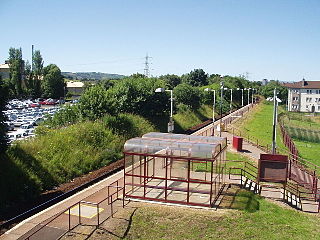
<span class="mw-page-title-main">Hawkhead railway station</span> Railway station in Renfrewshire, Scotland

Hawkhead railway station is a railway station in the Seedhill area of Paisley, Renfrewshire, Scotland. The station is managed by ScotRail and lies on the Paisley Canal Line, 6½ miles (10 km) west of Glasgow Central.

<span class="mw-page-title-main">Cwm-y-Glo railway station</span> Former railway station in Gwynedd, Wales

Cwm-y-Glo railway station served the village of Cwm-y-glo, Gwynedd, Wales, at the north-west end of Llyn Padarn. The station was closed for regular passenger services in 1930 but trains passed through until September 1964.
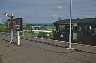
<span class="mw-page-title-main">Alston line</span> Partially operational railway line in Cumbria and Northumberland

The Alston Line was a 13-mile (21 km) single-track branch line, which linked Haltwhistle in Northumberland with Alston in Cumbria.

<span class="mw-page-title-main">Bellahouston railway station</span> Railway station serving the Bellahouston area of Glasgow, Scotland

Bellahouston railway station was a railway station serving the Bellahouston area of Glasgow, Scotland. The station was originally part of the G&SWR Paisley Canal Branch.

Airth was a railway station serving Airth in the Scottish county of Falkirk.

<span class="mw-page-title-main">Alston railway station</span> Station in Cumbria on the South Tynedale Railway

Alston is a heritage railway station on the South Tynedale Railway. The station, situated 13 miles (21 km) south of Haltwhistle, is in the market town of Alston, Eden in Cumbria, England.

<span class="mw-page-title-main">Kirkhaugh</span> Human settlement in England

Kirkhaugh is a very small village and former civil parish, now in the parish of Knaresdale with Kirkhaugh, adjacent to the River South Tyne in Northumberland, England. The village lies close to the A689 road north of Alston, Cumbria. In 1951 the parish had a population of 79.

<span class="mw-page-title-main">Lambley, Northumberland</span> Human settlement in England

Lambley, formerly known as Harper Town, is a village and former civil parish, now in the parish of Coanwood, in Northumberland, England about four miles (6 km) southwest of Haltwhistle. The village lies adjacent to the River South Tyne. In 1951 the parish had a population of 298. The place name Lambley refers to the "pasture of lambs". Lambley used to be the site of a small convent of Benedictine Nuns, founded by Adam de Tindale and Heloise, his wife, in the 12th century. The Scots led by William Wallace devastated it in 1296 [Rowland gives 1297]. However it was restored and one William Tynedale was ordained priest to the nunnery in about 1508 – most likely not William Tyndale, the reformer, as once believed but another man of the same name. At the time of the suppression of religious houses by Henry VIII, the nunnery contained six inmates. Nothing now remains but the bell from the nunnery, which hangs in the church, and a few carved stones. The village lies in the Midgeholme Coalfield and there are reserves of good-quality coal remaining.

<span class="mw-page-title-main">Tyne Valley line</span> Railway line in north of England

The Tyne Valley Line is a 58-mile (93 km) route, linking Newcastle upon Tyne with Hexham and Carlisle. The line follows the course of the River Tyne through Tyne and Wear and Northumberland. Five stations and two viaducts on the route are listed structures.

<span class="mw-page-title-main">Cummersdale railway station</span> Former railway station in Cumbria, England

Cummersdale was a railway station on the Maryport and Carlisle Railway (M&CR) serving Cummersdale in Cumbria. The station was opened by the M&CR in 1858 and lay in the Parish of Cummersdale near to the village of High Cummersdale.
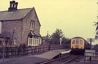
<span class="mw-page-title-main">Featherstone Park railway station</span> Disused railway station in Northumberland, England

Featherstone Park was a railway station on the Alston Branch Line, which ran between Haltwhistle and Alston. The station, situated 3 miles (5 km) south-west of Haltwhistle, served the villages of Featherstone and Rowfoot in Northumberland.

<span class="mw-page-title-main">Newcastle & Carlisle Railway</span>

The Newcastle & Carlisle Railway (N&CR) was an English railway company formed in 1825 that built a line from Newcastle upon Tyne on Britain's east coast, to Carlisle, on the west coast. The railway began operating mineral trains in 1834 between Blaydon and Hexham, and passengers were carried for the first time the following year. The rest of the line opened in stages, completing a through route between Carlisle and Gateshead, south of the River Tyne in 1837. The directors repeatedly changed their intentions for the route at the eastern end of the line, but finally a line was opened from Scotswood to a Newcastle terminal in 1839. That line was extended twice, reaching the new Newcastle Central Station in 1851.

Allhallows Colliery railway station was in the former county of Cumberland, now Cumbria, England. It was a stop on the Bolton Loop of the Maryport and Carlisle Railway.

Calderpark Halt railway station or Calderpark for Glasgow Zoo (NS679625) served Calderpark Zoo opened in 1947 on the old estate of Calderpark and the Baillieston area of Glasgow, Scotland on the Glasgow, Bothwell, Hamilton and Coatbridge Railway between Shettleston and Hamilton. Glasgow Zoo closed in 2003.

<span class="mw-page-title-main">Coanwood railway station</span> Disused railway station in Northumberland, England

Coanwood was a railway station on the Alston Branch Line, which ran between Haltwhistle and Alston. The station, situated 4 miles (6 km) south-west of Haltwhistle, served the village of Coanwood in Northumberland.
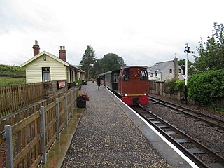
<span class="mw-page-title-main">Slaggyford railway station</span> Station in Northumberland on the South Tynedale Railway

Slaggyford was a railway station on the Alston Line, which ran between Haltwhistle and Alston. The station served the village of Slaggyford in Northumberland.

<span class="mw-page-title-main">Lintley Halt railway station</span> Station in Northumberland on the South Tynedale Railway

Lintley Halt is a railway station on the South Tynedale Railway, which runs between Slaggyford and Alston. The station is located about 1+14 miles (2 km) from the village of Slaggyford in Northumberland.

References

  1. Quick, Michael (2009). Railway Passenger Stations in Great Britain: A Chronology. Railway and Canal Historical Society. p. 243. ISBN   978-0901461575.
  2. 1 2 Historic England, "Railway Viaduct Across River South Tyne (Grade II*) (1042918)", National Heritage List for England , retrieved 7 November 2020
  3. Quick, Michael (2009). Railway Passenger Stations in Great Britain: A Chronology. Railway and Canal Historical Society. pp. 99, 370 and 428. ISBN   978-0901461575.
  4. James, Leslie (November 1983). A Chronology of the Construction of Britain's Railways 1778-1855. Shepperton: Ian Allan. p. 22. ISBN   0-7110-1277-6. BE/1183.
  5. Whittle, George (1979). The Newcastle and Carlisle Railway. Newton Abbot: David and Charles. p. 73. ISBN   0-7153-7855-4. OCLC   7197045.
  6. Fenton, Mike (January 2018). "Byway of the 'Barra'". BackTrack. Vol. 32, no. 321. Easingwold: Pendragon Publishing. pp. 26–30.
  7. Quick, Michael (2009). Railway Passenger Stations in Great Britain: A Chronology. Railway and Canal Historical Society. p. 10. ISBN   978-0901461575.

Sources

Preceding station National Rail logo.svg National Rail Following station
Disused railways
Coanwood   North Eastern Railway
Alston Branch Line
  Slaggyford