Langport Railway Cutting

Last updated

Langport Railway Cutting
Site of Special Scientific Interest
Langport railway cutting.JPG
Somerset UK location map.svg
Red pog.svg
Location within Somerset
Area of Search Somerset
Grid reference ST427272
Coordinates 51°02′29″N2°49′07″W / 51.04128°N 2.81868°W / 51.04128; -2.81868 Coordinates: 51°02′29″N2°49′07″W / 51.04128°N 2.81868°W / 51.04128; -2.81868
InterestGeological
Area0.5 hectares (0.0050 km2; 0.0019 sq mi)
Notification 1992 (1992)
Natural England website

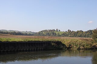
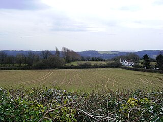
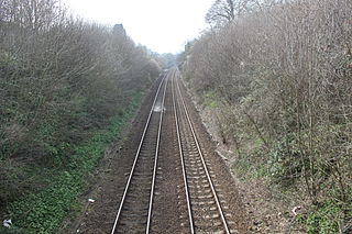
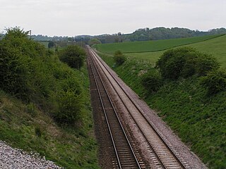
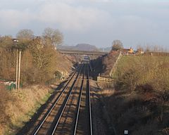
Langport Railway Cutting (grid reference ST427272 ) is a 0.5 hectare geological Site of Special Scientific Interest at Langport in Somerset, England, notified in 1992. It is a Geological Conservation Review site.

Ordnance Survey National Grid System of geographic grid references used in Great Britain

The Ordnance Survey National Grid reference system is a system of geographic grid references used in Great Britain, distinct from latitude and longitude. It is often called British National Grid (BNG).

Hectare metric unit of area

The hectare is an SI accepted metric system unit of area equal to a square with 100-metre sides, or 10,000 m2, and is primarily used in the measurement of land. There are 100 hectares in one square kilometre. An acre is about 0.405 hectare and one hectare contains about 2.47 acres.

Langport a town in South Somerset, United Kindom

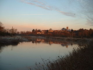
Langport is a small town and civil parish in Somerset, England, 5 miles (8.0 km) west of Somerton in the South Somerset district. The parish has a population of 1,081. Langport is contiguous with Huish Episcopi, a separate parish that includes much of the town's outskirts.

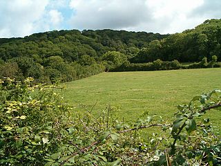
Gravels exposed at Langport Railway Cutting show scour-and-fill structures consistent with braided stream deposition. This site is of importance as one of the few permanently exposed localities for coldstage Pleistocene gravels in south Somerset and more particularly because it is the first site in Britain in which typical calcrete features have been recorded. As such it is of national significance and has considerable research potential.

Gravel mix of crumbled stone (grain size range = 2-63 mm according to ISO 14688)

Gravel is a loose aggregation of rock fragments. Gravel is classified by particle size range and includes size classes from granule- to boulder-sized fragments. In the Udden-Wentworth scale gravel is categorized into granular gravel and pebble gravel. ISO 14688 grades gravels as fine, medium, and coarse with ranges 2 mm to 6.3 mm to 20 mm to 63 mm. One cubic metre of gravel typically weighs about 1,800 kg.

The Pleistocene is the geological epoch which lasted from about 2,588,000 to 11,700 years ago, spanning the world's most recent period of repeated glaciations. The end of the Pleistocene corresponds with the end of the last glacial period and also with the end of the Paleolithic age used in archaeology.

Sources

Related Research Articles

River Parrett River in the United Kingdom

The River Parrett flows through the counties of Dorset and Somerset in South West England, from its source in the Thorney Mills springs in the hills around Chedington in Dorset. Flowing northwest through Somerset and the Somerset Levels to its mouth at Burnham-on-Sea, into the Bridgwater Bay nature reserve on the Bristol Channel, the Parrett and its tributaries drain an area of 660 square miles (1,700 km2) – about 50 per cent of Somerset's land area, with a population of 300,000.

Shepton Montague village in the United Kingdom

Shepton Montague is a village and civil parish in Somerset, England. It is situated on the River Pitt in the South Somerset district midway between Wincanton, Bruton and Castle Cary.

Newton St Loe SSSI

Newton St Loe SSSI is a geological Site of Special Scientific Interest (SSSI) close to the River Avon, near the village of Newton St Loe in Bath and North East Somerset. It was notified on September 1992.

Bleadon Hill

Bleadon Hill is a 13.52 hectare geological Site of Special Scientific Interest just north of the village of Bleadon, North Somerset, notified in 1999.

Hampton Rocks Cutting

Hampton Rocks Cutting is a 1.3 hectare geological Site of Special Scientific Interest near the village of Bathampton, Somerset, notified in 1990.

Emborough Quarries

Emborough Quarries is a 1 hectare geological Site of Special Scientific Interest at Emborough in the Mendip Hills, Somerset, notified in 1971.

Nightingale Valley

Nightingale Valley is a 5.4 hectare geological Site of Special Scientific Interest near the town of Portishead, North Somerset, notified in 1989.

Bruton railway cutting geological site in Bruton, Somerset, England

Bruton Railway Cutting is a 1.7 hectare geological Site of Special Scientific Interest at Bruton in Somerset, notified in 1971.

Doulting Railway Cutting

Doulting Railway Cutting is a 2.8 hectare geological Site of Special Scientific Interest in Somerset, notified in 1971.

Shepton Montague Railway Cutting

Shepton Montague Railway Cutting is a 1.61 hectare geological Site of Special Scientific Interest at Shepton Montague in Somerset, notified in 1992.

Godminster Lane Quarry and Railway Cutting

Godminster Lane Quarry and Railway Cutting is a 0.8 hectare geological Site of Special Scientific Interest at Pitcombe in Somerset, notified in 1971.

Laycock Railway Cutting

Laycock Railway Cutting is a 1.3 hectare geological Site of Special Scientific Interest near Milborne Port in Somerset, notified in 1993. It is a Geological Conservation Review site.

Maesbury Railway Cutting

Maesbury Railway Cutting is a 2 hectare geological Site of Special Scientific Interest between East Horrington and Gurney Slade in Somerset, notified in 1995.

Aller and Beer Woods

Aller and Beer Woods is a 56.9 hectares biological Site of Special Scientific Interest. off the A372 Othery to Langport road near Aller in Somerset. It was notified in 1952.

Uphill village in United Kingdom

Uphill is a village in the civil parish of Weston-super-Mare in North Somerset, England, at the southern edge of the town, on the Bristol Channel coast.

Wookey railway station

Wookey railway station was a station on the Bristol and Exeter Railway's Cheddar Valley line in Somerset, England. The site is a 0.04 hectare geological Site of Special Scientific Interest between Wells and Wookey Hole

Somerton railway station

Somerton railway station was a small railway station situated on the Great Western Railway's Langport and Castle Cary Railway. It served the town of Somerton in Somerset, England.