
The Mendip Hills is a range of limestone hills to the south of Bristol and Bath in Somerset, England. Running from Weston-super-Mare and the Bristol Channel in the west to the Frome valley in the east, the hills overlook the Somerset Levels to the south and the Chew Valley and other tributaries of the Avon to the north. The hills give their name to the local government district of Mendip, which administers most of the area. The higher, western part of the hills, covering 198 km2 (76 sq mi) has been designated an Area of Outstanding Natural Beauty (AONB), which gives it a level of protection comparable to a national park.

Polden Hills in Somerset, England are a long, low ridge, extending for 10 miles (16 km), and separated from the Mendip Hills, to which they are nearly parallel, by a marshy tract, known as the Somerset Levels. They are now bisected at their western end by the M5 motorway and a railway, the Bristol and Exeter Railway, part of the Great Western Main Line.
Nunney is a village and civil parish in the Mendip local government district within the English county of Somerset. It is located 3 miles (5 km) south-west of Frome and the parish includes the hamlet of Holwell.
The geology of Shropshire is very diverse with a large number of periods being represented at outcrop. The bedrock consists principally of sedimentary rocks of Palaeozoic and Mesozoic age, surrounding restricted areas of Precambrian metasedimentary and metavolcanic rocks. The county hosts in its Quaternary deposits and landforms, a significant record of recent glaciation. The exploitation of the Coal Measures and other Carboniferous age strata in the Ironbridge area made it one of the birthplaces of the Industrial Revolution. There is also a large amount of mineral wealth in the county, including lead and baryte. Quarrying is still active, with limestone for cement manufacture and concrete aggregate, sandstone, greywacke and dolerite for road aggregate, and sand and gravel for aggregate and drainage filters. Groundwater is an equally important economic resource.

Ebbor Gorge is a limestone gorge in Somerset, England, designated and notified in 1952 as a 63.5-hectare (157-acre) biological Site of Special Scientific Interest in the Mendip Hills. It was donated to the National Trust in 1967 and is now managed by Natural England as a national nature reserve.

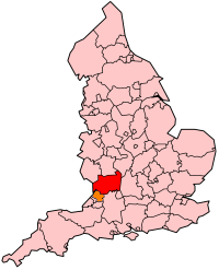
Somerset is a rural county in the southwest of England, covering 4,171 square kilometres (1,610 sq mi). It is bounded on the north-west by the Bristol Channel, on the north by Bristol and Gloucestershire, on the north-east by Wiltshire, on the south-east by Dorset, and on the south west and west by Devon. It has broad central plains with several ranges of low hills. The landscape divides into four main geological sections from the Silurian through the Devonian and Carboniferous to the Permian which influence the landscape, together with water-related features.
The Keuper is a lithostratigraphic unit in the subsurface of large parts of west and central Europe. The Keuper consists of dolomite, shales or claystones and evaporites that were deposited during the Middle and Late Triassic epochs. The Keuper lies on top of the Muschelkalk and under the predominantly Lower Jurassic Lias or other Early Jurassic strata.

Aust Cliff is a 5.3 hectare geological Site of Special Scientific Interest adjacent to the Severn Estuary, near the village of Aust, South Gloucestershire, notified in 1954. The Severn Bridge crosses the cliff.
Emborough Quarries is a 1 hectare geological Site of Special Scientific Interest at Emborough in the Mendip Hills, Somerset, notified in 1971.
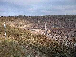
Cloford Quarry is a 39.92-hectare (98.6-acre) geological Site of Special Scientific Interest to the south of the A361 approximately 350 metres (1,150 ft) north of the hamlet of Cloford and 1 kilometre (0.6 mi) west of Nunney on the Mendip Hills in Somerset. It was notified in 1994.

Viaduct Quarry is a 0.3 hectare geological Site of Special Scientific Interest near Shepton Mallet on the Mendip Hills in Somerset, notified in 1984.
Wanstrow is a village and civil parish 6 miles (9.7 km) south west of Frome in the Mendip district of Somerset, England. The parish includes the village of Cloford.
Colemans Quarry, grid reference ST726452 is a limestone quarry at Holwell, near Nunney on the Mendip Hills, Somerset, England.

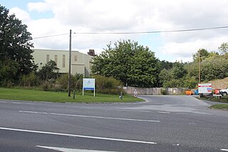
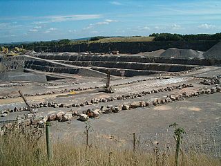
Gurney Slade quarry, grid reference ST626497 is a limestone quarry near Gurney Slade between Binegar and Holcombe, on the Mendip Hills, Somerset, England.
The Mendip Hills, (Mendips) in northern Somerset, are the most southerly Carboniferous Limestone uplands in Britain.
Gloucestershire is one of the most geologically and scenically diverse counties in England, with rocks from the Precambrian through to the Jurassic represented. These varying rock-types are responsible for the three major areas of the county, each with its own distinctive scenery and land-use - the Forest of Dean in the west, bordering Wales, the Cotswolds in the east, and in between, the Severn Vale.

Kuehneotherium is an early mammaliaform genus, previously considered a holothere, that lived during the Late Triassic-Early Jurassic Epochs and is characterized by reversed-triangle pattern of molar cusps. Although many fossils have been found, the fossils are limited to teeth, dental fragments, and mandible fragments. The genus includes Kuehneotherium praecursoris and all related species. It was first named and described by Doris M. Kermack, K. A. Kermack, and Frances Mussett in November 1967. The family Kuehneotheriidae and the genus Kuehneotherium were created to house the single species Kuehneotherium praecursoris. Modeling based upon a comparison of the Kuehneotherium jaw with other mammaliaforms indicates it was about the size of a modern-day shrew between 4 and 5.5 g at adulthood.
Tricuspisaurus is an extinct genus of reptile originally described as a trilophosaurid; it was later considered likely to be a procolophonid, but recent analyses have affirmed the original classification. Fossils are known from the Ruthin Quarry in Glamorgan, Wales, one of several Late Triassic to Early Jurassic British fissure deposits. Like some trilophosaurs, it has an edentulous, or toothless beak. Tricuspisaurus gets its name from its heterodont dentition, which includes tricuspid teeth, or teeth with three cusps. The type species, T. thomasi, was named in 1957 along with the possible trilophosaur Variodens inopinatus from Somerset, England.
The geology of Monmouthshire in southeast Wales largely consists of a thick series of sedimentary rocks of different types originating in the Silurian, Devonian, Carboniferous, Triassic and Jurassic periods.

Southerndown Coast is a Site of Special Scientific Interest (SSSI) in St Brides Major community, in the Vale of Glamorgan, South Wales. It forms part of the Glamorgan Heritage Coast, bordered by the Monknash Coast to the southeast. The nearby villages are Southerndown and Ogmore-by-Sea. The SSSI extends over 5 kilometres of south-west facing coastline, with rocky limestone cliffs, broad beaches and deeply fissured wave-cut platforms.

