
The Mendip Hills is a range of limestone hills to the south of Bristol and Bath in Somerset, England. Running from Weston-super-Mare and the Bristol Channel in the west to the Frome valley in the east, the hills overlook the Somerset Levels to the south and the Chew Valley and other tributaries of the Avon to the north. The hills give their name to the local government district of Mendip, which administers most of the area. The higher, western part of the hills, covering 198 km2 (76 sq mi) has been designated an Area of Outstanding Natural Beauty (AONB), which gives it a level of protection comparable to a national park.

Ebbor Gorge is a limestone gorge in Somerset, England, designated and notified in 1952 as a 63.5-hectare (157-acre) biological Site of Special Scientific Interest in the Mendip Hills. It was donated to the National Trust in 1967 and is now managed by Natural England as a national nature reserve.

Somerset is a rural county in the southwest of England, covering 4,171 square kilometres (1,610 sq mi). It is bounded on the north-west by the Bristol Channel, on the north by Bristol and Gloucestershire, on the north-east by Wiltshire, on the south-east by Dorset, and on the south west and west by Devon. It has broad central plains with several ranges of low hills. The landscape divides into four main geological sections from the Silurian through the Devonian and Carboniferous to the Permian which influence the landscape, together with water-related features.
Emborough Quarries is a 1 hectare geological Site of Special Scientific Interest at Emborough in the Mendip Hills, Somerset, notified in 1971.
Hobbs Quarry is a 0.5 hectare geological Site of Special Scientific Interest near Shepton Mallet on the Mendip Hills in Somerset, notified in 1984.
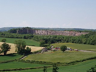
Cloford Quarry is a 39.92-hectare (98.6-acre) geological Site of Special Scientific Interest to the south of the A361 approximately 350 metres (1,150 ft) north of the hamlet of Cloford and 1 kilometre (0.6 mi) west of Nunney on the Mendip Hills in Somerset. It was notified in 1994.

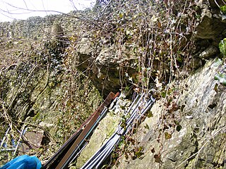
Shatter Cave is a cave in Fairy Cave Quarry, near Stoke St Michael in the limestone of the Mendip Hills, in Somerset, England. It falls within the St. Dunstan's Well Catchment Site of Special Scientific Interest.
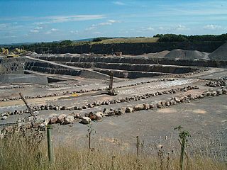
Whatley Quarry, grid reference ST731479 is a limestone quarry owned by Hanson plc, near the village of Whatley on the Mendip Hills, Somerset, England.
Halecombe, grid reference ST697474 is a limestone quarry near Leigh-on-Mendip on the Mendip Hills, Somerset, England.

Gurney Slade quarry, grid reference ST626497 is a limestone quarry near Gurney Slade between Binegar and Holcombe, on the Mendip Hills, Somerset, England.
Dulcote Quarry is a disused limestone quarry at Dulcote, near Wells on the Mendip Hills, Somerset, England. The quarry measures around 600 metres (2,000 ft) from West to East and around 350 metres (1,150 ft) from North to South, with an area of 18 acres (7.3 ha), which is surrounded by 80 acres (32 ha) of woodland.
The Mendip Hills, (Mendips) in northern Somerset, are the most southerly Carboniferous Limestone uplands in Britain.

Torr Works quarry, grid reference ST695446 is a limestone quarry at East Cranmore, near Shepton Mallet on the Mendip Hills, Somerset, England. The quarry was formerly known as Merehead, a name which has been retained for its rail depot on the opposite side of the A361 road.

Stoke Lane Slocker is a cave near Stoke St Michael, in the Carboniferous Limestone of the Mendip Hills, in the English county of Somerset.
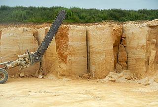
Doulting Stone Quarry is a limestone quarry at Doulting, on the Mendip Hills, Somerset, England.

The county of Somerset is in South West England, bordered by the Bristol Channel and the counties of Bristol and Gloucestershire to the north, and Wiltshire to the east, Dorset to the south, and Devon to the west. The climate, influenced by its proximity to the Atlantic Ocean and the prevailing westerly winds, tends to be mild, damp and windy.

Mendipite is a rare mineral that was named in 1939 for the locality where it is found, the Mendip Hills in Somerset, England. It is an oxyhalide of lead with formula Pb3Cl2O2.
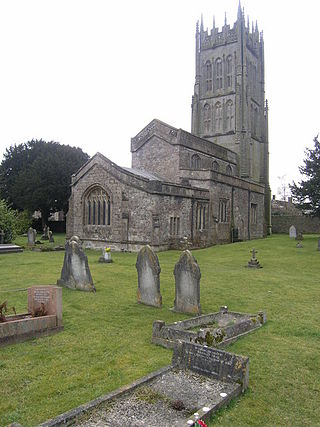
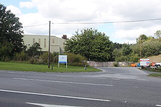
Leigh-on-Mendip or Leigh upon Mendip is a small village on the Mendip Hills in Somerset, England. It lies roughly equidistant from Frome, Radstock and Shepton Mallet at about 5 miles (8 km) from each town.

Fossiliferous limestone is any type of limestone, made mostly of calcium carbonate (CaCO3) in the form of the minerals calcite or aragonite, that contains an abundance of fossils or fossil traces. The fossils in these rocks may be of macroscopic or microscopic size. The sort of macroscopic fossils often include crinoid stems, brachiopods, gastropods, and other hard shelled mollusk remains.

Southerndown Coast is a Site of Special Scientific Interest (SSSI) in St Brides Major community, in the Vale of Glamorgan, South Wales. It forms part of the Glamorgan Heritage Coast, bordered by the Monknash Coast to the southeast. The nearby villages are Southerndown and Ogmore-by-Sea. The SSSI extends over 5 kilometres of south-west facing coastline, with rocky limestone cliffs, broad beaches and deeply fissured wave-cut platforms.
