
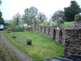
Wookey Hole Caves are a series of limestone caverns, a show cave and tourist attraction in the village of Wookey Hole on the southern edge of the Mendip Hills near Wells in Somerset, England. The River Axe flows through the cave. It is a Site of Special Scientific Interest (SSSI) for both biological and geological reasons. Wookey Hole cave is a "solutional cave", one that is formed by a process of weathering in which the natural acid in groundwater dissolves the rocks. Some water originates as rain that flows into streams on impervious rocks on the plateau before sinking at the limestone boundary into cave systems such as Swildon's Hole, Eastwater Cavern and St Cuthbert's Swallet; the rest is rain that percolates directly through the limestone. The temperature in the caves is a constant 11 °C (52 °F).
Krubera Cave is the second-deepest-known cave on Earth, after the Veryovkina Cave. It is located in the Arabika Massif of the Gagra Range of the Western Caucasus, in the Gagra District of Abkhazia, an occupied region of Georgia.

Swildon's Hole is an extensive cave in Priddy, Somerset. At 9,144 metres (30,000 ft) in length, it is the longest cave on the Mendip Hills. It has been found to be connected to Priddy Green Sink and forms part of the Priddy Caves Site of Special Scientific Interest (SSSI).

Pen Park Hole is a large cavern situated underground, at the edge of Filton Golf Course. The cavern was discovered accidentally in the 17th century and the first descent was made by Captain Sturmy in 1669. The entrance is adjacent to the Southmead and Brentry housing estates of north Bristol. Access is tightly controlled by Bristol City Council. It was scheduled as a Site of Special Scientific Interest in 2016 on account of its geological origins, and its cave invertebrate community including the cave shrimp Niphargus kochianus, which is normally known as a spring seepage or chalk aquifer species.
Banwell Caves are a 1.7-hectare geological and biological Site of Special Scientific Interest near the village of Banwell, North Somerset, England notified in 1963.
Lamb Leer is a 14.59 hectare geological Site of Special Scientific Interest between East Harptree and Priddy in the Mendip Hills, Somerset, notified in 1983. The cavern is a fragment of a very ancient major cave system which now contains one of the largest chambers in the Mendip Hills.

Gough's Cave is located in Cheddar Gorge on the Mendip Hills, in Cheddar, Somerset, England. The cave is 115 m (377 ft) deep and is 3.405 km (2.12 mi) long, and contains a variety of large chambers and rock formations. It contains the Cheddar Yeo, the largest underground river system in Britain.
The caves of the Mendip Hills are formed by the particular geology of the Mendip Hills: large areas of limestone worn away by water makes it a national centre for caving. The hills conceal the largest underground river system in Britain.

GB Cave is a cave between Charterhouse and Shipham in the limestone of the Mendip Hills, in Somerset, England.

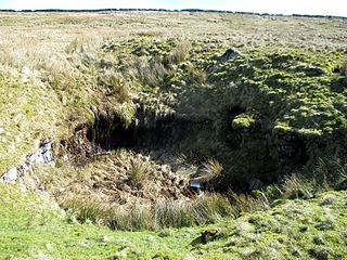
Goatchurch Cavern is a cave on the edge of Burrington Combe in the limestone of the Mendip Hills, in Somerset, England.

St Cuthbert's Swallet is the second longest, and most complex, cave on the Mendip Hills, in Somerset, England. It forms a major part of the Priddy Caves system and water entering this swallet re-emerges at Wookey Hole. St Cuthbert's Swallet is part of, and lies underneath, the Priddy Pools Site of Special Scientific Interest.

Stoke Lane Slocker is a cave near Stoke St Michael, in the Carboniferous Limestone of the Mendip Hills, in the English county of Somerset.
Balch Cave is a cave in Fairy Cave Quarry, near Stoke St Michael in the limestone of the Mendip Hills, in Somerset, England. The cave is part of the complex of passages feeding to St. Dunstan's Well Catchment Site of Special Scientific Interest and an abandoned Bristol Water abstraction point.

Upper Flood Swallet which was originally known as Blackmoor Flood Swallet, is an exceptionally well-decorated cave near Charterhouse, in the carboniferous limestone of the Mendip Hills, in Somerset, England. The cave is part of the Cheddar Complex SSSI.
Langcliffe Pot is a cave system on the slopes of Great Whernside in Upper Wharfedale, about 3 kilometres (1.9 mi) SSE of Kettlewell in North Yorkshire. It is part of the Black Keld Site of Special Scientific Interest where the "underground drainage system which feeds the stream resurgence at Black Keld is one of the largest and deepest in Britain, although only a small proportion of its cave passages are accessible at present." Mossdale Caverns is also part of the Black Keld SSSI. Although a considerable length of passage has been explored in Langcliffe Pot, the current end is over 170 metres (560 ft) above the resurgence, and over 4 kilometres (2.5 mi) in distance. A trip to the far end has been described as "one of the most serious undertakings in British caving".

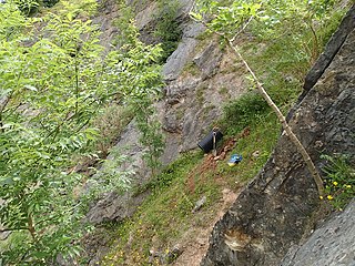
Pierre's Pot is a karst cave in Burrington Combe on the Mendip Hills in Somerset, England.

The Cheddar Yeo is a small river in Somerset, England. Beneath the limestone of the Mendip Hills it forms the largest underground river system in Britain. After emerging into Cheddar Gorge it flows through the village of Cheddar, where it has been used in the past to power mills. From the Middle Ages until the 19th century the river had ports for seagoing vessels but is no longer navigable. Some of the water, which is of good quality, is diverted into Cheddar Reservoir to provide drinking water for Bristol.
Tyning's Barrow Swallet is a cave between Charterhouse and Shipham in the limestone of the Mendip Hills, in Somerset, England. The cave is close to GB Cave and also to Charterhouse Cave, the deepest cave in the region.
Rhino Rift is a cave near Charterhouse, in the Carboniferous Limestone of the Mendip Hills, in Somerset, England. The cave is part of the Cheddar Complex SSSI.

Reservoir Hole is a cave in Cheddar Gorge in Somerset, southwest England. It contains what is believed to be the largest chamber yet found under the Mendip Hills.
