
The Cotswolds is an area in south-central England, along a range of rolling hills that rise from the meadows of the upper Thames to an escarpment above the Severn Valley and Evesham Vale.

Gloucestershire is a county in South West England. The county comprises part of the Cotswold Hills, part of the flat fertile valley of the River Severn, and the entire Forest of Dean.

Lechlade, or Lechlade-on-Thames, is a town at the southern edge of the Cotswolds in Gloucestershire, England, 55 miles (89 km) south of Birmingham and 68 miles (109 km) west of London. It is the highest point at which the River Thames is navigable, although there is a right of navigation that continues south-west into Cricklade, situated in the neighbouring county of Wiltshire. The town is named after the River Leach that joins the Thames near The Trout Inn and St. John's Bridge.

Wotton-under-Edge is a market town within the Stroud district of Gloucestershire, England. Located near the southern fringe of the Cotswolds, the Cotswold Way long-distance footpath passes through the town. Standing on the B4058, Wotton is about 5 miles (8.0 km) from the M5 motorway. The nearest railway station is Cam and Dursley, 7 miles (11 km) away by road, on the Bristol to Birmingham line.

Stroud is a constituency represented in the House of Commons of the UK Parliament. It is held by Siobhan Baillie of the Conservative Party. Formerly a safe Conservative seat, Stroud has been a marginal seat since 1992, changing hands four times in seven elections since then.

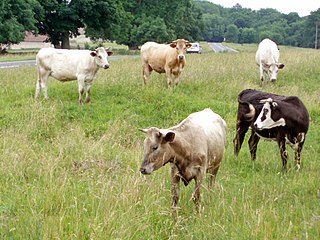
Old Sodbury is a small village in the valley of the River Frome just below and to the west of the Cotswold escarpment and to the east of Chipping Sodbury and Yate in South Gloucestershire, England. It is situated in the Hundred of Grumbald's Ash. The village extends from Chipping Sodbury in the West to the Cotswold Edge in the East and is on the Cotswold Way. The Badminton Road (A432) winds eastwards towards Badminton, Gloucestershire through the village, up to the Cross Hands junction with the A46, which runs along the top of the Cotswold escarpment from Bath to Stroud.
Boxwell with Leighterton is a civil parish in the Cotswold district of Gloucestershire, England. According to the 2001 census it had a population of 232, increasing to 306 at the 2011 census. The parish includes Boxwell and Leighterton.
Sir William Romney's School is an 11-16 secondary school with academy status located in Tetbury, Gloucestershire, England. It serves schools around the Tetbury, Leighterton, Stroud, Cirencester, Nailsworth and Avening areas. In 2016 the school achieved a 'Good' rating from Ofsted.

Long Newnton is a small village and civil parish in Gloucestershire, England, situated on the main road (B4014) between Malmesbury and Tetbury. It is near the SW end of the Cotswolds. In 2010 its population was estimated to be 199, increasing to 211 at the 2011 census, 109 males and 102 females.
Selsley is a village within the civil parish of King's Stanley and district of Stroud, in Gloucestershire, England. It is composed of around 175 houses, scattered around the western and eastern edge of a Cotswold spur, located approximately 2 miles (3.2 km) south of Stroud.

Nympsfield is a village and civil parish in the English county of Gloucestershire. It is located around four miles south-west of the town of Stroud. As well as Nympsfield village, the parish contains the hamlet of Cockadilly. The population taken at the 2011 census was 382.
Siddington is a village and civil parish in Gloucestershire, England. It is located immediately south of Cirencester. At the 2011 United Kingdom Census, the parish had a population of 1,249.

Didmarton is a village and civil parish in Gloucestershire, England. It lies in the Cotswold District, about 6 miles (10 km) southwest of Tetbury. The parish is on the county borders with South Gloucestershire and Wiltshire.

Oldbury-on-the-Hill is a small village and former civil parish in Gloucestershire, England, ninety-three miles west of London and less than one-mile (1.6 km) north of the village of Didmarton.

Boxwell Court is a country house near Leighterton in Gloucestershire, England, dating from the 15th and 16th century. It is a Grade II* listed building.

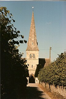
St Saviour's Church is a historic 19th-century Anglican church in the town of Tetbury, Gloucestershire, England under the care of The Churches Conservation Trust. It was designed by the architect Samuel Daukes. Augustus Welby Northmore Pugin and John Hardman undertook the design and execution of the chancel roof. St Saviour's is recorded in the National Heritage List for England as a designated Grade II* listed building.

Grumbald's Ash Hundred was a subdivision of the county of Gloucestershire, England. Hundreds originated in the late Saxon period and lasted as administrative divisions until the 19th century. It has been reported that the court was originally held under an Ash tree situated in Doddington parish, although this location would not be consistent with the previous split of hundred. Its name survives in the Grumbolds Ash with Avening electoral ward of Cotswold district council.
Driffield is a village in the Cotswold district of Gloucestershire, England. It is situated 3+1⁄2 miles (5.6 km) east-south-east of Cirencester.

