Lephalale Local Municipality

Last updated
Lephalale
Lephalale CoA.png
Map of Limpopo with Lephalale highlighted.svg
Location in Limpopo
Country South Africa
Province Limpopo
District Waterberg
Seat Lephalale
Wards 12
Government
[1]
  Type Municipal council
  MayorCllr Alpheus Thulare (African National Congress)
Area
  Total13,784 km2 (5,322 sq mi)
Population
 (2011) [2]
  Total115,767
  Density8.4/km2 (22/sq mi)
Racial makeup (2011)
[2]
   Black African 90.7%
   Coloured 0.9%
   Indian/Asian 0.3%
   White 7.9%
First languages (2011)
[2]
   Northern Sotho 51.7%
   Tswana 24.1%
   Afrikaans 8.1%
   English 3.1%
  Other13%
Time zone UTC+2 (SAST)
Municipal codeLIM362

Lephalale Municipality (Northern Sotho : Mmasepala wa Lephalale; Tswana : Mmasepala wa Lephalale) is a local municipality within the Waterberg District Municipality, in the Limpopo province of South Africa. The seat is Lephalale.

Contents

Politics

In the 2004 South African general election, the ANC won with an overwhelming majority of 88% (with 27,299 votes), while the Democratic Alliance (DA) and Freedom Front Plus (FF+, Afrikaans: VF+) only received 7% and 2% respectively.

In the 2009 South African general election, the ANC's support fell to 82.0% (24,451 votes), while the DA increased their vote percentage to 8.5% (2,521 votes) and COPE, a newly formed party, gained 5.7% (1,697 votes) of the vote. The Freedom Front Plus, the now 4th largest part, lost some support to 1.61% (480 votes), albeit only 17 fewer votes. [3]

In the most recent 2014 South African general election, the ANC once again won overwhelmingly but again lost support, this time earning 73.8%. Much of its losses went to the new Economic Freedom Fighters which gained 10.9% and a third place. DA remained in second position and increased their support to 11.3%. COPE lost almost all its support and gained only 0.7%.

Local elections

The municipal council consists of twenty-six members elected by mixed-member proportional representation. Thirteen councillors are elected by first-past-the-post voting in thirteen wards, while the remaining thirteen are chosen from party lists so that the total number of party representatives is proportional to the number of votes received. In the election of 3 August 2016 the African National Congress (ANC) won a majority of seventeen seats on the council. The following table shows the results of the election. [4] [5]

PartyVotesSeats
WardListTotal %WardListTotal
ANC 18,38918,26736,65664.610717
EFF 5,5225,65411,17619.7055
Democratic Alliance 3,8013,7817,58213.4314
Freedom Front Plus 4324188501.5000
COPE 1721973690.7000
PAC 61641250.2000
International Revelation Congress 323260.0000
Total28,38028,40456,784100.0131326
Spoilt votes523451974

Main places

The 2001 census divided the municipality into the following main places: [6]

PlaceCodeArea (km2)PopulationMost spoken language
Bakenberg 91501 260.8313,603 Northern Sotho
Ellisras (renamed Lephalale in 2002) 91502 3.221,572 Afrikaans
Kwarriehoek 91503 1.760-
Marapong 91505 3.215,636Northern Sotho
Onverwacht 91506 8.107,862Afrikaans
Potgietersrus 91507 23.8569Northern Sotho
Seleka 91508 335.6721,868 Tswana
Shongoane 91509 67.9213,172Northern Sotho
St Catherina 91510 1.79939Northern Sotho
Remainder of the municipality 91504 18,898.8431,392Northern Sotho

Related Research Articles

<span class="mw-page-title-main">2006 South African municipal elections</span>

Municipal elections were held in South Africa on 1 March 2006, to elect members to the local governing councils in the municipalities of South Africa. The municipalities form the local government of South Africa and are subdivisions of the provinces, thus making them responsible for local service delivery, such as electricity, water and fire services.

<span class="mw-page-title-main">2011 South African municipal elections</span> South African municipal elections held on 18 August 2011

Municipal elections were held in South Africa on 18 May 2011, electing new councils for all municipalities in the country. Municipal elections are held every five years, and the previous municipal elections were held in 2006. The first municipal elections following the reorganisation of municipalities took place in December 2000.

<span class="mw-page-title-main">Moretele Local Municipality</span> Local municipality in North West, South Africa

Moretele Municipality is a local municipality within the Bojanala Platinum District Municipality, in the North West province of South Africa. As of 2011, its population was approximately 180,000, a majority of whom speak Setswana as a first language.

<span class="mw-page-title-main">Mogale City Local Municipality</span> Local municipality in Gauteng, South Africa

Mogale City Local Municipality is a local municipality within the West Rand District Municipality, in the Gauteng province of South Africa.

<span class="mw-page-title-main">Mogalakwena Local Municipality</span> Local municipality in Limpopo, South Africa

Mogalakwena Municipality is a local municipality within the Waterberg District Municipality, in the Limpopo province of South Africa. The seat is Mokopane.

<span class="mw-page-title-main">Thabazimbi Local Municipality</span> Local municipality in Limpopo, South Africa

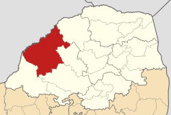
Thabazimbi Municipality is a local municipality within the Waterberg District Municipality, in the Limpopo province of South Africa. The seat is Thabazimbi.

<span class="mw-page-title-main">Kgetlengrivier Local Municipality</span> Local municipality in North West, South Africa

Kgetlengrivier Municipality is a local municipality within the Bojanala Platinum District Municipality, in the North West province of South Africa.

<span class="mw-page-title-main">Maquassi Hills Local Municipality</span> Local municipality in North West, South Africa

Maquassi Hills Municipality is a local municipality within the Dr Kenneth Kaunda District Municipality, in the North West province of South Africa.

<span class="mw-page-title-main">Lekwa-Teemane Local Municipality</span> Local municipality in North West, South Africa

Lekwa-Teemane Municipality is a local municipality within the Dr Ruth Segomotsi Mompati District Municipality, located in the North West province of South Africa. The seat of the municipality is Christiana.

<span class="mw-page-title-main">Ratlou Local Municipality</span> Local municipality in North West, South Africa

Ratlou Municipality, formerly Setla-Kgobi Municipality, is a local municipality within the Ngaka Modiri Molema District Municipality, in the North West province of South Africa.

<span class="mw-page-title-main">Mangaung Metropolitan Municipality</span> Metropolitan municipality in Free State, South Africa

The Mangaung Metropolitan Municipality is a metropolitan municipality which governs Bloemfontein and surrounding towns in the Free State province of South Africa. Mangaung is a Sesotho word meaning "place of cheetahs", as it was not uncommon for the Basotho to name warrior regiments after ferocious animals.

<span class="mw-page-title-main">Tsantsabane Local Municipality</span> Local municipality in Northern Cape, South Africa

Tsantsabane Municipality is a local municipality within the ZF Mgcawu District Municipality, in the Northern Cape province of South Africa.

<span class="mw-page-title-main">Tokologo Local Municipality</span> Local municipality in Free State, South Africa

Tokologo Municipality is a local municipality within the Lejweleputswa District Municipality, in the Free State province of South Africa. Tokologo is a Setswana word meaning "freedom".

<span class="mw-page-title-main">Phokwane Local Municipality</span> Local municipality in Northern Cape, South Africa

Phokwane Municipality is a local municipality within the Frances Baard District Municipality, in the Northern Cape province of South Africa. The name means "small Billy goat" in Setswana.

<span class="mw-page-title-main">Magareng Local Municipality</span> Local municipality in Northern Cape, South Africa

Magareng Municipality is a local municipality within the Frances Baard District Municipality, in the Northern Cape province of South Africa.

<span class="mw-page-title-main">Joe Morolong Local Municipality</span> Local municipality in Northern Cape, South Africa

Joe Morolong Municipality, formerly Moshaweng Municipality, is a local municipality within the John Taolo Gaetsewe District Municipality, in the Northern Cape province of South Africa.

<span class="mw-page-title-main">Ga-Segonyana Local Municipality</span> Local municipality in Northern Cape, South Africa

Ga-Segonyana Municipality is a local municipality within the John Taolo Gaetsewe District Municipality, in the Northern Cape province of South Africa.

<span class="mw-page-title-main">Kai ǃGarib Local Municipality</span> Local municipality in Northern Cape, South Africa

Kai ǃGarib Municipality is a local municipality within the ZF Mgcawu District Municipality, in the Northern Cape province of South Africa. The name Kai ǃGarib originates from the Khoekhoe language and means "big great river", referring to the Orange River that flows through the area.

<span class="mw-page-title-main">Dikgatlong Local Municipality</span> Local municipality in Northern Cape, South Africa

Dikgatlong Municipality is a local municipality within the Frances Baard District Municipality, in the Northern Cape province in South Africa. Dikgatlong is a Setswana name meaning "confluence", and refers to the place where the Harts and Vaal rivers flow into each other in Delportshoop. The name was used as early as 1700.

The 2016 South African municipal elections were held on 3 August 2016, to elect councils for all district, metropolitan and local municipalities in each of the country's nine provinces. It was the fifth municipal election held in South Africa since the end of apartheid in 1994; municipal elections are held every five years.

References

  1. "Contact list: Executive Mayors". Government Communication & Information System. Archived from the original on 14 July 2010. Retrieved 22 February 2012.
  2. 1 2 3 "Statistics by place". Statistics South Africa. Retrieved 27 September 2015.
  3. elections.org.za
  4. "Results Summary – All Ballots: Lephalale" (PDF). Independent Electoral Commission. Retrieved 23 January 2017.
  5. "Seat Calculation Detail: Lephalale" (PDF). Independent Electoral Commission. Retrieved 23 January 2017.
  6. Lookup Tables - Statistics South Africa

23°30′S27°55′E / 23.500°S 27.917°E / -23.500; 27.917