Lesterville, South Dakota

Last updated

Lesterville, South Dakota
Nickname: 
Lesty
Yankton County South Dakota Incorporated and Unincorporated areas Lesterville Highlighted.svg
Location in Yankton County and the state of South Dakota
Coordinates: 43°02′19″N97°35′26″W / 43.03861°N 97.59056°W / 43.03861; -97.59056
Country United States
State South Dakota
County Yankton
Incorporated1883 [1]
Government
  MayorPhoebe Van Driel
Area
[2]
  Total0.20 sq mi (0.52 km2)
  Land0.20 sq mi (0.52 km2)
  Water0.00 sq mi (0.00 km2)
Elevation
[3]
1,388 ft (423 m)
Population
 (2020) [4]
  Total115
  Density569.31/sq mi (220.09/km2)
Time zone UTC-6 (Central (CST))
  Summer (DST) UTC-5 (CDT)
ZIP code
57040
Area code 605
FIPS code 46-36540 [5]
GNIS feature ID1267461 [3]

Lesterville is a town in Yankton County, South Dakota, United States. The population was 115 at the 2020 census. [6]

Contents

History

The town is named for Lester Dix, the grandson of an early postmaster. [7]

Geography

According to the United States Census Bureau, the town has a total area of 0.20 square miles (0.52 km2), all land. [8]

Demographics

Historical population
CensusPop.Note
1900 244
1910 27914.3%
1920 2810.7%
1930 228−18.9%
1940 2290.4%
1950 192−16.2%
1960 173−9.9%
1970 1814.6%
1980 156−13.8%
1990 1687.7%
2000 158−6.0%
2010 127−19.6%
2020 115−9.4%
U.S. Decennial Census [9] [4]

2010 census

As of the census [10] of 2010, there were 127 people, 56 households, and 36 families residing in the town. The population density was 635.0 inhabitants per square mile (245.2/km2). There were 68 housing units at an average density of 340.0 per square mile (131.3/km2). The racial makeup of the town was 100.0% White.

There were 56 households, of which 26.8% had children under the age of 18 living with them, 57.1% were married couples living together, 5.4% had a female householder with no husband present, 1.8% had a male householder with no wife present, and 35.7% were non-families. 32.1% of all households were made up of individuals, and 14.3% had someone living alone who was 65 years of age or older. The average household size was 2.27 and the average family size was 2.89.

The median age in the town was 44.5 years. 22.8% of residents were under the age of 18; 6.2% were between the ages of 18 and 24; 22% were from 25 to 44; 29.1% were from 45 to 64; and 19.7% were 65 years of age or older. The gender makeup of the town was 52.0% male and 48.0% female.

2000 census

As of the census [5] of 2000, there were 158 people, 63 households, and 45 families residing in the town. The population density was 787.0 inhabitants per square mile (303.9/km2). There were 73 housing units at an average density of 363.6 per square mile (140.4/km2). The racial makeup of the town was 96.20% White, 1.90% Native American, 1.27% from other races, and 0.63% from two or more races. Hispanic or Latino of any race were 1.27% of the population.

There were 63 households, out of which 36.5% had children under the age of 18 living with them, 58.7% were married couples living together, 7.9% had a female householder with no husband present, and 27.0% were non-families. 23.8% of all households were made up of individuals, and 14.3% had someone living alone who was 65 years of age or older. The average household size was 2.51 and the average family size was 2.98.

In the town, the population was spread out, with 29.1% under the age of 18, 2.5% from 18 to 24, 28.5% from 25 to 44, 20.9% from 45 to 64, and 19.0% who were 65 years of age or older. The median age was 36 years. For every 100 females, there were 107.9 males. For every 100 females age 18 and over, there were 100.0 males.

The median income for a household in the town was $41,667, and the median income for a family was $45,833. Males had a median income of $24,464 versus $17,813 for females. The per capita income for the town was $15,487. None of the families and 3.4% of the population were living below the poverty line, including no under eighteens and 18.2% of those over 64.

Related Research Articles

<span class="mw-page-title-main">Dakota, Minnesota</span> City in Minnesota, United States

Dakota is a city in Winona County, Minnesota, United States. The population was 295 at the 2020 census.

<span class="mw-page-title-main">Hoople, North Dakota</span> City in North Dakota, United States

Hoople is a city in Walsh County, North Dakota, United States. The population was 247 at the 2020 census. Hoople, named for early settler Alan Hoople, was founded in 1889. Hoople's nickname is "Tater Town."

<span class="mw-page-title-main">Yale, South Dakota</span> Town in South Dakota, United States

Yale is an incorporated town in Beadle County, South Dakota, United States. The population was 112 at the 2020 census.

<span class="mw-page-title-main">Tabor, South Dakota</span> Town in South Dakota, United States

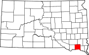
Tabor is a town in Bon Homme County, South Dakota, United States. The population was 407 at the 2020 census.

<span class="mw-page-title-main">Claremont, South Dakota</span> Town in South Dakota, United States

Claremont is a town in Brown County, South Dakota, United States. The population was 108 at the 2020 census.

<span class="mw-page-title-main">Warner, South Dakota</span> Town in South Dakota, United States

Warner is a town in Brown County, South Dakota, United States. The population was 485 at the 2020 census.

<span class="mw-page-title-main">South Shore, South Dakota</span> Town in South Dakota, United States

South Shore is a town in Codington County, South Dakota, United States. The population was 189 at the 2020 census. It is part of the Watertown, South Dakota Micropolitan Statistical Area.

<span class="mw-page-title-main">Astoria, South Dakota</span> Town in South Dakota, United States

Astoria is a town in Deuel County, South Dakota, United States. The population was 132 at the 2020 census.

<span class="mw-page-title-main">Isabel, South Dakota</span> Town in South Dakota, United States

Isabel is a town in Dewey County, South Dakota, United States. The population was 145 at the 2020 census.

<span class="mw-page-title-main">Corsica, South Dakota</span> City in South Dakota, United States

Corsica is a city in Douglas County, South Dakota, United States. The population was 561 at the 2020 census.

<span class="mw-page-title-main">La Bolt, South Dakota</span> Town in South Dakota, United States

La Bolt is a town in Grant County, South Dakota, United States. The population was 66 at the 2020 census.

<span class="mw-page-title-main">Stockholm, South Dakota</span> Town in South Dakota, United States

Stockholm is a town in Grant County, South Dakota, United States. The population was 102 at the 2020 census.

<span class="mw-page-title-main">St. Lawrence, South Dakota</span> Town in South Dakota, United States

St. Lawrence or Saint Lawrence is a town in central Hand County, South Dakota, United States. The population was 164 at the 2020 census.

<span class="mw-page-title-main">Harrold, South Dakota</span> Town in South Dakota, United States

Harrold is a town in Hughes County, South Dakota, United States. It is part of the Pierre, South Dakota Micropolitan Statistical Area. The population was 101 at the 2020 census.

<span class="mw-page-title-main">Ramona, South Dakota</span> Town in South Dakota, United States

Ramona is a town in Lake County, South Dakota, United States. The population was 159 at the 2020 census.

<span class="mw-page-title-main">Trent, South Dakota</span> Town in South Dakota, United States

Trent is a town in Moody County, South Dakota, United States. The population was 206 at the 2020 census.

<span class="mw-page-title-main">Ortley, South Dakota</span> Town in South Dakota, United States

Ortley is a town in Roberts County, South Dakota, United States. The population was 50 according to the 2020 census.

<span class="mw-page-title-main">Peever, South Dakota</span> Town in South Dakota, United States

Peever is a town in Roberts County, South Dakota, United States. The population was 180 at the 2020 census.

<span class="mw-page-title-main">Tulare, South Dakota</span> Town in South Dakota, United States

Tulare is a town in Spink County, South Dakota, United States. The population was 211 at the 2020 census.

<span class="mw-page-title-main">Davis, South Dakota</span> Town in South Dakota, United States

Davis is a town in Turner County, South Dakota, United States. The population was 54 at the 2020 census.

References

  1. "SD Towns" (PDF). South Dakota State Historical Society. Archived from the original (PDF) on February 10, 2010. Retrieved February 14, 2010.
  2. "ArcGIS REST Services Directory". United States Census Bureau. Retrieved October 15, 2022.
  3. 1 2 U.S. Geological Survey Geographic Names Information System: Lesterville, South Dakota
  4. 1 2 "Census Population API". United States Census Bureau. Retrieved October 15, 2022.
  5. 1 2 "U.S. Census website". United States Census Bureau . Retrieved January 31, 2008.
  6. "U.S. Census Bureau: Lesterville town, South Dakota". www.census.gov. United States Census Bureau. Retrieved July 21, 2022.
  7. Federal Writers' Project (1940). South Dakota place-names, v.1-3. University of South Dakota. p. 48.
  8. "US Gazetteer files 2010". United States Census Bureau. Archived from the original on January 12, 2012. Retrieved June 21, 2012.
  9. "Census of Population and Housing". Census.gov. Retrieved June 4, 2015.
  10. "U.S. Census website". United States Census Bureau . Retrieved June 21, 2012.