Simmesport is a town in Avoyelles Parish, Louisiana, United States. The population was 2,161 at the 2010 census. It is the northernmost town on the Atchafalaya River, located near the Old River which connects the Red and Atchafalaya rivers with the Mississippi River.

Morganza is an incorporated village near the Mississippi River in Pointe Coupee Parish, Louisiana, United States. The population was 610 at the 2010 census, down from 659 in 2000. As of 2020 the population was 525. It is part of the Baton Rouge metropolitan statistical area. The village's zip code is 70759. The Morganza Spillway, a flood control structure between the Mississippi River and the Atchafalaya Basin, is located nearby.

Denton is a town in Caroline County, Maryland, United States. The population of Denton was 4,418 as of the 2010 United States Census, and it is the county seat of Caroline County.

Irvington is a town on the Rappahannock River in Lancaster County, Virginia, United States. The population was 432 at the 2010 census. Located on a peninsula known as the Northern Neck, it has been designated a historic district.

The Red River, or sometimes the Red River of the South, is a major river in the Southern United States. It was named for its reddish water color from passing through red-bed country in its watershed. It is known as the Red River of the South to distinguish it from the Red River of the North, which flows between Minnesota and North Dakota into the Canadian province of Manitoba. Although once a tributary of the Mississippi River, the Red River is now a tributary of the Atchafalaya River, a distributary of the Mississippi that flows separately into the Gulf of Mexico. This confluence is connected to the Mississippi River by the Old River Control Structure.

The Cuyahoga River is a river located in Northeast Ohio that bisects the City of Cleveland and feeds into Lake Erie.

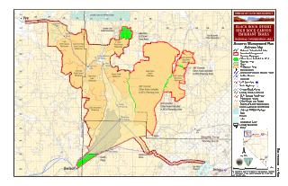
The Black Rock Desert is a semi-arid region of lava beds and playa, or alkali flats, situated in the Black Rock Desert–High Rock Canyon Emigrant Trails National Conservation Area, a silt playa 100 miles (160 km) north of Reno, Nevada that encompasses more than 300,000 acres (120,000 ha) of land and contains more than 120 miles (200 km) of historic trails. It is in the northern Nevada section of the Great Basin with a lakebed that is a dry remnant of Pleistocene Lake Lahontan.

The Red Cedar River is a tributary of the Grand River in central Michigan in the United States. The river is approximately 51.1 miles (82.2 km) long and drains a watershed of approximately 461 square miles (1,190 km2) in the Lansing–East Lansing metropolitan area and suburban and rural areas to the east. The river flows through the campus of Michigan State University, and is considered a cultural symbol of the school, including being mentioned in the school's fight song.

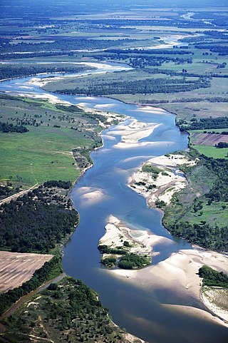
The Atchafalaya River is a 137-mile-long (220 km) distributary of the Mississippi River and Red River in south central Louisiana in the United States. It flows south, just west of the Mississippi River, and is the fifth largest river in North America, by discharge. The name Atchafalaya comes from Choctaw for 'long river', from hachcha, 'river', and falaya, 'long'.

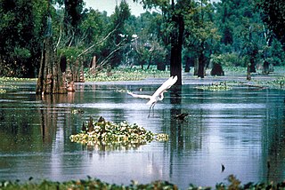
The Atchafalaya Basin, or Atchafalaya Swamp, is the largest wetland and swamp in the United States. Located in south central Louisiana, it is a combination of wetlands and river delta area where the Atchafalaya River and the Gulf of Mexico converge. The river stretches from near Simmesport in the north through parts of eight parishes to the Morgan City southern area.
Bayou Pigeon is a small unincorporated community Cajun village located near the southern extremities of Iberville Parish, Louisiana, United States. The hamlet is primarily composed of fishermen and plant workers. A great majority of the village's population are of Cajun descent.

Redbank Creek is a tributary of the Allegheny River in Clarion, Armstrong, and Jefferson counties, Pennsylvania in the United States.
East Krotz Springs is a ghost town that was located in Pointe Coupee Parish's 1st Ward, approximately 12 miles west of Livonia, Louisiana, United States. The site of the town itself is located at coordinates 30°32'12.87"N, 91°44'24.59"W, and is abandoned. United States Geological Survey maps from 1948 show the town to be located on the east bank of the Atchafalaya River at the mouth of Bayou Sherman, directly across from Krotz Springs, south of the railroad bridge.
McCrea is an unincorporated community on the east bank of the Atchafalaya River in the northwestern portion of Pointe Coupee Parish, Louisiana, United States. It is located along Louisiana Highway 417, some distance north of East Krotz Springs. A post office opened here in 1902 but was discontinued in 1954.
Torras is the name of a former town in the extreme northeastern corner of Pointe Coupee Parish, Louisiana, United States. The town was located along either side of the Texas & Pacific Railroad at its juncture with Lower Old River. The Mississippi River is located just to the east and the juncture of the Red and Atchafalaya Rivers just to the west.

White Hall Plantation House is an 1840s Italianate and Greek Revival plantation house attributed to the architect Henry Howard and built in 1848-49 by Elias Norwood. It is located in Legonier, a hamlet on the east bank of the Atchafalaya River, today part of the unincorporated town of Lettsworth, Louisiana. White Hall's most notable owner and slaveholder was Bennet Barton Simmes, founder of Simmesport, state senator, and contributor to the Louisiana Articles of Secession prior to the Civil War. He is also said to have been a steamboat captain and Confederate general. The home is listed on the National Register of Historic Places.
Batchelor is an unincorporated community in Pointe Coupee Parish, Louisiana, United States. The community is located at the intersection of Louisiana highways 1 and 419 near the south bank of the Mississippi River, and runs north-northwest up from the village of Morganza. Batchelor has a post office with ZIP code 70715, which opened on July 26, 1902. Down in the rural area of Batchelor is Raccourci Old River and Oxbow Lake in the Mississippi River System.
Enterprise is an unincorporated community in Catahoula Parish, Louisiana, United States. The community is located along the south bank of the Ouachita River and Louisiana Highway 124, 9.7 miles (15.6 km) north-northwest of Harrisonburg. Enterprise had a post office until it closed on October 15, 2011. It still has its own ZIP code, 71425


