Related Research Articles

Bellingham is an area of South East London, England, within the London Borough of Lewisham. It lies south of Catford and north-west of Beckenham, and is part of the Catford postal district (SE6).

Blackheath is an area of South East London, England, straddling the border of the Royal Borough of Greenwich and the London Borough of Lewisham. It is located 1-mile (1.6 km) north east of Lewisham, 1.5 miles (2.4 km) south of Greenwich and 6.4 miles (10.3 km) south east of Charing Cross, the traditional centre of London.

Lewisham is a London borough in south-east London; it forms part of Inner London. The principal settlement of the borough is Lewisham. The local authority is Lewisham London Borough Council, based in Catford. The Prime Meridian passes through Lewisham. Blackheath, Goldsmiths, University of London and Millwall F.C. are located within the borough.

Hither Green is a district in south-east London, England, in the London Borough of Lewisham. It forms the southern part of Lewisham, 6.6 miles (10.6 km) south-east of Charing Cross, and on the Prime Meridian.

Lewisham is an area of south-east London, England, 5.9 miles (9.5 km) south of Charing Cross. It is the principal area of the London Borough of Lewisham, and is also within the historic county of Kent. It is identified in the London Plan as one of 35 major centres in Greater London, with a large shopping centre and street market.

Lewisham is a National Rail and Docklands Light Railway station in Lewisham, south-east London which first opened in 1849. On the National Rail network it is 7 miles 61 chains (12.5 km) measured from London Victoria and is operated by Southeastern.

The Metropolitan Borough of Lewisham was a Metropolitan borough in the County of London between 1900 and 1965, when it became part of the London Borough of Lewisham along with the Metropolitan Borough of Deptford.

Grove Park is a district of South East London, England within the London Borough of Lewisham. It is located north east of Bromley and south east of Lewisham.

Grove Park is a railway station in southeast London, England. It is located on Baring Road within Travelcard Zone 4, and serves the areas of Grove Park and Downham in the London Borough of Lewisham. It is 8 miles 78 chains (14.4 km) down the line from London Charing Cross.

The Dartford Loop Line is one of three lines linking London with Dartford in Kent, England. It lies to the south of the other two: the North Kent Line and the Bexleyheath Line.

Hither Green is a railway station located in Hither Green in the London Borough of Lewisham, south-east London. It is 7 miles 16 chains (11.6 km) down the line from London Charing Cross and is situated between Lewisham and either Grove Park or Lee depending on the route.

Lewisham East is a parliamentary constituency represented in the House of Commons of the UK Parliament since the by-election on 14 June 2018 by Janet Daby of the Labour Party.

Lewisham West and Penge is a constituency in Greater London created in 2010 and represented in the House of Commons of the UK Parliament since 2017 by Ellie Reeves of the Labour Party.

Hither Green Cemetery, opened as Lee Cemetery in 1873, is a large cemetery located on Verdant Lane, London, England. The cemetery is situated between Catford, Hither Green, Grove Park and Lee. Next to Hither Green Cemetery is Lewisham Crematorium that was opened in 1956.

The A2212 road is a 4-digit, non-primary A road in southeast London, England; it is 5.7 km (3.5 mi) long and runs in a north to south direction from Lee Green, to Bromley passing through Grove Park, Downham, Plaistow and Sundridge. Bromley is the only one of these places which is a primary destination.
Lewisham South was a parliamentary constituency in Lewisham, London which returned one Member of Parliament (MP) to the House of Commons of the Parliament of the United Kingdom from 1950 until it was abolished for the February 1974 general election.
Whitefoot is an electoral ward in the London Borough of Lewisham. It is located 13 km (8.1 mi) south-east of Charing Cross, and is north of Downham, south of Catford, west of Grove Park, and east of Bellingham. It is long east to west following Whitefoot Lane, the local main road, making it about 3 km (1.9 mi) at its longest point. Whitefoot is also on the Prime Meridian.

Mountsfield Park is a public park in Catford, near to Hither Green within the London Borough of Lewisham. The nearest railway stations are Hither Green, Catford and Catford Bridge.
The 2022 Lewisham London Borough Council election is due to take place on 5 May 2022. All 54 members of Lewisham London Borough Council will be elected. The elections will take place alongside local elections in the other London boroughs and elections to local authorities across the United Kingdom.

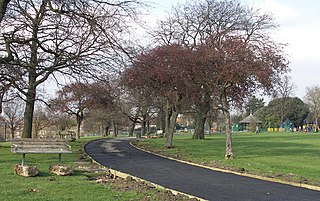
Northbrook Park is a public park located on Baring Road south of Lee Green and north of Grove Park in the London Borough of Lewisham, southeast London, England. It is roughly 9 acres (3.6 ha) in size, and contains a large central field bounded by trees, a children's playground, with a sandpit and splash pool, a multipurpose game court, two football pitches, outdoor gym equipent and a legal graffiti wall. The park was previously a field named Ten-Acre Field, despite actually being 7 acres (2.8 ha), and part of the Baring Estate of Lee. In 1898, Thomas Baring, 1st Earl of Northbrook gifted part of his family's estate to public use in commemoration of the Diamond Jubilee of Queen Victoria. The Park was designed by Lt Col J J Sexby, Chief Officer of the London County Council's Parks Department, then was officially opened on 14 March 1903. In the past the park contained a larger playground, a paddling pool, a pond, a bowling green and a tennis court.
References
- ↑ Local Government Boundary Commission for England https://consultation.lgbce.org.uk/node/17020