Lewisham station

Last updated

Lewisham DLR no-text roundel.svg National Rail logo.svg
Lewisham station MMB 08.jpg
Greater London UK location map 2.svg
Red pog.svg
Lewisham
Location of Lewisham in Greater London
Location Lewisham
Local authority London Borough of Lewisham
Managed by Southeastern
Docklands Light Railway
Station codeLEW
DfT category C2
Number of platforms4 NR, 2 DLR
AccessibleYes(DLR and 4 NR platforms) [1] [2]
Fare zone 2 and 3
DLR annual boardings and alightings
2018Decrease2.svg 9.860 million [3]
2019Decrease2.svg 9.662 million [4]
2020Decrease2.svg 4.236 million [5]
2021Increase2.svg 4.701 million [6]
2022Increase2.svg 7.030 million [7]
National Rail annual entry and exit
2018–19Decrease2.svg 10.326 million [8]
– interchange Increase2.svg 2.634 million [8]
2019–20Decrease2.svg 10.005 million [8]
– interchange Decrease2.svg 2.564 million [8]
2020–21Decrease2.svg 2.555 million [8]
– interchange Decrease2.svg 0.564 million [8]
2021–22Increase2.svg 5.249 million [8]
– interchange Increase2.svg 1.320 million [8]
2022–23Increase2.svg 5.918 million [8]
– interchange Increase2.svg 2.154 million [8]
Key dates
30 July 1849First station opened
1 January 1857Present station opened as Lewisham Junction
7 July 1929Renamed (Lewisham)
20 November 1999DLR extension
Other information
External links
WGS84 51°27′55″N0°00′48″W / 51.4653°N 0.0133°W / 51.4653; -0.0133
Underground sign at Westminster.jpg  London transportportal

Lewisham is an interchange station in Lewisham, south-east London for Docklands Light Railway (DLR) and National Rail services.

Contents

On the National Rail network it is 7  miles 61  chains (12.5 km) measured from London Victoria and is operated by Southeastern. [9]

Station layout

There are four platforms for main-line trains: 3 and 4 on the North Kent Line, and 1 and 2 on the Mid-Kent line which is also used as a loop off the South Eastern Main Line.

Elaborate cast iron brackets Lewisham station Platform 3.jpg
Elaborate cast iron brackets

The current station which dates from 1857 is constructed of yellow stock brick with stone dressing and has an unusual survival of a wooden clapboard building at the back. The facade has a pleasing symmetry of three windows, three entrance doors, and three windows.

Original doors sash windows skirting tiling and banisters are present inside. The original corniced ceiling of the main hall is currently concealed by a lowered fake ceiling. Platform 3 has kept its original canopy with its elaborate cast iron brackets which depict cherries. some of the original chamfered wood and cast iron supports of the original canopy survive on platform 2.

The station has similarities with other listed stations built at around the same time such as the listed Ladywell railway station, Blackheath station and Gravesend railway station which has the same elaborate cast iron supporting brackets as can be found at Lewisham. [10]

Platforms 5 and 6 are served by Docklands Light Railway trains to Bank and Stratford. The Docklands Light Railway station opened in 1999 following a southward extension from Island Gardens. The original canopy over platform 4 was demolished at some point post 1990.

The original canopy over the main entrance was demolished in 2009 at a cost of £790k [11] and replaced with a steel version.

Lewisham station entrance Lewisham Station (2) - geograph.org.uk - 436678.jpg
Lewisham station entrance

From December 2009, Lewisham was fitted with electric ticket gates, in line with the Government's new strategy to give all Greater London National Rail stations Oyster card accessibility and closing access to those who attempt to travel without tickets. This was controversial as it involved the closure of the gate on Platform 4 and led to a petition signed by over 1,000. [12]

British Transport Police also maintains a neighbourhood policing presence at Lewisham. [13]

History

Opening and early years (1849–1922)

The North Kent line opened on 30 July 1849 by the South Eastern Railway linking Strood with the London and Greenwich Railway route to London Bridge. The original station was located east of the Lewisham Road overbridge with access off Lewisham Road.

With the opening of the Mid-Kent line on 1 January 1857 a new station was built to the west so both lines could be served. [14] [15] For a period Old Lewisham Station was also kept open [16]

Platform 1, Lewisham station Platform 1, Lewisham station - geograph.org.uk - 229248.jpg
Platform 1, Lewisham station

Eleven passengers were killed in the 1857 Lewisham rail crash when a train ran into the back of a stationary train.

In 1898 the South Eastern Railway and the London Chatham and Dover Railway agreed to work as one railway company under the name of the South Eastern and Chatham Railway.

Southern Railway (1923–1947)

Following the Railways Act 1921 (also known as the Grouping Act), Lewisham became a Southern Railway station on 1 January 1923.

The Mid-Kent line was electrified with services commencing on 28 February 1926.

The North Kent Line was electrified with the (750 V DC third rail) system. Electrification was initially to Dartford (6 June 1926) and was extended to Gillingham by World War Two.

In 1929 large-scale remodelling of the junction was undertaken to enable cross-London freight traffic to be routed via Nunhead and Loughborough Junction. The new route utilised part of the former Greenwich Park branch (which had closed in 1917) and included a flyover.

The loop between Lewisham and the main line towards Hither Green, which had opened in 1929, was electrified on 16 July 1933 allowing Sidcup and Orpington local electric services to call. [17]

The Nunhead line was electrified in summer 1935 and opened to electric traffic on 30 September 1935 with services from the Bexleyheath and Sidcup to St Paul's (today Blackfriars). This service was cancelled during World War 2 as an economy measure recommencing on 12 August 1946. [17]

British Railways (1948–1994)

After World War II and following nationalisation on 1 January 1948, it fell under the auspices of British Railways Southern Region.

On 4 December 1957 the Lewisham rail crash occurred to the west of the station with 90 fatalities.

As part of the London Bridge re-signalling a new loop line was opened with a reversible track down to the west (Fast Line) side of St Johns which opened up on 1 April 1976.

Upon sectorisation in 1982, three passenger sectors were created: Provincial (later renamed Regional Railways) for local services outside of the London area; InterCity, operating principal express services; and London & South East (renamed Network SouthEast in 1986) who operated commuter services in the London area. [18]

Franchise (1994–present day)

piano in Lewisham station Piano in Lewisham station.jpg
piano in Lewisham station

Following de-nationalisation of British Rail on 1 April 1994 the infrastructure to St Johns station became the responsibility of Railtrack whilst a business unit operated the train services. On 13 October 1996 operation of the passenger services passed to Connex South Eastern who were originally due to run the franchise until 2011.

On 22 November 1999 Deputy Prime Minister John Prescott opened the 4·2 km Lewisham extension of London's Docklands Light Railway with trains running through to Bank. [19]

Following a number of accidents and financial issues Railtrack plc was sold to Network Rail on 3 October 2002 who became responsible for the infrastructure. [20] [21]

On 27 June 2003 the Strategic Rail Authority decided to strip Connex of the franchise citing poor financial management and run the franchise itself. [22] [23] Connex South Eastern continued to operate the franchise until 8 November 2003 with the services transferring to the Strategic Rail Authority's South Eastern Trains subsidiary the following day.

On 30 November 2005 the Department for Transport awarded Govia the Integrated Kent franchise. The services operated by South Eastern Trains transferred to Southeastern on 1 April 2006.

The loop line to St Johns was doubled in 2013.

There was formerly a bus terminus within the station, but this was relocated to Thurston Road as part of the Lewisham Gateway project.

Incidents

Planned London Underground services

Fleet line service

In 1971 and 1972, parliamentary approval was given for construction of Phases 2 and 3 of the planned Fleet line. [27] Phase 3 on the proposal would have extended the line from Fenchurch Street to Lewisham, with new platforms constructed underground. [27] Further plans for Phase 4 of the extension considered the line taking over the mainline tracks on the Addiscombe and Hayes branch lines. Preliminary construction works were carried out elsewhere on the extension before the plan was postponed by lack of funds. Following a change of name to Jubilee line, the first part of the line opened in 1979, but the remaining plans were not carried out. When the Jubilee line was extended in 1999, a different route to Stratford was followed.

Bakerloo line service

TfL is currently considering extending the Bakerloo line to Lewisham. Both line options stop at Lewisham. If progressed the station is currently expected to open in 2030. [28]

In its draft Kent Route Utilisation Strategy, [29] Network Rail mentions the possibility of extending the Bakerloo line from Elephant & Castle to Lewisham, and then taking over the Hayes branch line. Network Rail states that this would free up six paths per hour into central London and so increasing capacity on the Tonbridge main line, which would also relieve the junctions around Lewisham.

Services

Lewisham is the southern terminus of the DLR, the previous station being Elverson Road. It is on the boundary of Travelcard Zone 2 and Zone 3 and is a major transport hub, with many buses passing through or terminating here.

During infrastructure works on the Greenwich Line, Thameslink services are normally diverted through Lewisham, giving it a temporary link to Luton in the north and Rainham in the east.

National Rail

National Rail services at Lewisham are operated by Southeastern using Class 376, 465, 466 and 707 EMUs.

The typical off-peak service in trains per hour is: [30]

Additional trains serve the station during the peak hours.

Docklands Light Railway

The typical off-peak DLR service from Lewisham is 12 trains per hour to and from Bank. Additional services run to and from the station during the peak hours, increasing the service to up to 22 trains per hour, with up to 8 trains per hour running to and from Stratford instead of Bank. [31]

Preceding station National Rail logo.svg National Rail Following station
Southeastern
Southeastern
Southeastern
Southeastern
Southeastern
Southeastern
DLR no-text roundel.svg DLR
Elverson Road
towards Bank or Stratford
  Docklands Light Railway  Terminus
 Future Development 
Preceding station  Underground no-text.svg London Underground  Following station
New Cross Gate
  Bakerloo line
Bakerloo line extension
 Terminus
 Abandoned Plans 
Preceding station  Underground no-text.svg London Underground  Following station
New Cross
towards Stanmore
  Jubilee line
Phase 3 (never constructed)
 Terminus

Connections

Former bus station Lewisham.jpg
Former bus station

London Buses routes 21, 47, 75, 89, 129, 136, 178, 181, 185, 199, 208, 225, 261, 273, 284, 321, 380, 436, 484, P4, school route 621 and night routes N21, N89, N136 and N199 serve the station. [32] [33]

Lewisham previously had an adjoining bus station for terminating routes. The station closed on 28 February 2014 for the major Lewisham Gateway redevelopment project. [34]

Related Research Articles

<span class="mw-page-title-main">Woolwich Arsenal station</span> Docklands Light Railway and National Rail station

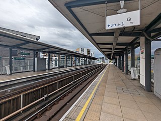
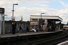
Woolwich Arsenal station is an interchange station in the heart of Woolwich in the Royal Borough of Greenwich for Docklands Light Railway (DLR) and National Rail services.

<span class="mw-page-title-main">Limehouse station</span> Docklands Light Railway and National Rail station

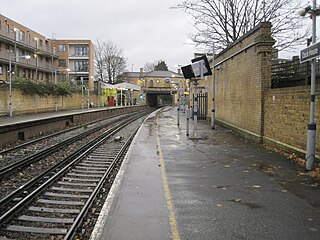
Limehouse is a National Rail and connected Docklands Light Railway (DLR) station in Limehouse, London, England. It is served by regional services operated by c2c to and from Fenchurch Street, and by light metro services provided by the DLR to and from Tower Gateway or Bank. On the main line, Limehouse is located 1 mile 58 chains (2.8 km) from Fenchurch Street and the following station is West Ham; on the DLR it is between Shadwell and Westferry in Travelcard Zone 2.

<span class="mw-page-title-main">Greenwich station</span> Docklands Light Railway and National Rail station

Greenwich station is about 400 m south-west of the district centre, in London, England. It is an interchange between National Rail between central London and Dartford, and the Docklands Light Railway (DLR) between Lewisham to the south and Docklands and the City of London. It is in Travelcard Zones 2 and 3.

<span class="mw-page-title-main">Deptford Bridge DLR station</span> Docklands Light Railway station

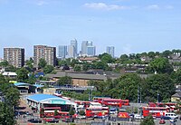
Deptford Bridge is a Docklands Light Railway (DLR) station in Deptford, London in England. The station is elevated above both local roads and Deptford Creek, and is adjacent to Lewisham College and Deptford market.

<span class="mw-page-title-main">Cutty Sark for Maritime Greenwich DLR station</span> Docklands Light Railway station

Cutty Sarkfor Maritime Greenwich is a light metro station on the Docklands Light Railway (DLR) Bank-Lewisham Line in Greenwich, south-east London, so named for its proximity to the Cutty Sark in the Maritime Greenwich district. It is the most central of the Greenwich DLR stations, being situated in Greenwich town centre.

<span class="mw-page-title-main">Shadwell DLR station</span> Docklands Light Railway station

Shadwell is a Docklands Light Railway (DLR) station in Shadwell in east London, England and is between the terminals of Bank and Tower Gateway to the west and Limehouse to the east. The 1991 Bank extension joins the main DLR line just to the west of Shadwell. It is located near Shadwell railway station for London Overground services, in Travelcard Zone 2.

<span class="mw-page-title-main">Heron Quays DLR station</span> Docklands Light Railway station

Heron Quays is a light metro station on the Docklands Light Railway (DLR) Bank to Lewisham Line in the Heron Quays area of Canary Wharf in East London. The station is situated on the Isle of Dogs and serves the southern part of the Canary Wharf office complex and is directly connected to the Jubilee Place underground shopping centre. The station is elevated and contained within one of the complex's office towers. It has an out of station interchange (OSI) for Canary Wharf Underground station on London Underground's Jubilee line. Through ticketing is allowed between both stations.

<span class="mw-page-title-main">Canary Wharf DLR station</span> Docklands Light Railway station

Canary Wharf is a Docklands Light Railway (DLR) station in Canary Wharf in East London. Located next to One Canada Square and between two parts of a shopping centre, it serves the Canary Wharf office complex. Each of its three tracks feature platforms on both sides, allowing for easy interchanges and access to surrounding buildings. The station is sheltered by a distinctive elliptical glass roof.

<span class="mw-page-title-main">Crossharbour DLR station</span> Docklands Light Railway station

Crossharbour is a light metro station on the Docklands Light Railway (DLR) Bank-Lewisham Line in Cubitt Town, East London. The station is situated on the Isle of Dogs and is between Mudchute and South Quay stations and is in Travelcard Zone 2.

<span class="mw-page-title-main">Island Gardens DLR station</span> Docklands Light Railway station

Island Gardens is a Docklands Light Railway (DLR) station next to Island Gardens on the Isle of Dogs, East London. It is just north of the River Thames and is close to the southern tip of the Isle of Dogs and the River Thames.

<span class="mw-page-title-main">Mudchute DLR station</span> Docklands Light Railway station

Mudchute is a Docklands Light Railway (DLR) station on the Isle of Dogs, next to Mudchute in London, England. The station is situated in the Millwall area and is in Travelcard Zone 2. The name of the area refers to the engineering overspill when Millwall Dock was being created in the 1840s. Spoil from the excavation of the Dock and silt from its channels and waterways were dumped on nearby land, creating "The Mudchute", which quickly established itself as a wildlife habitat and adventuring location for local children.

<span class="mw-page-title-main">Abbey Wood railway station</span> National Rail station in London, England

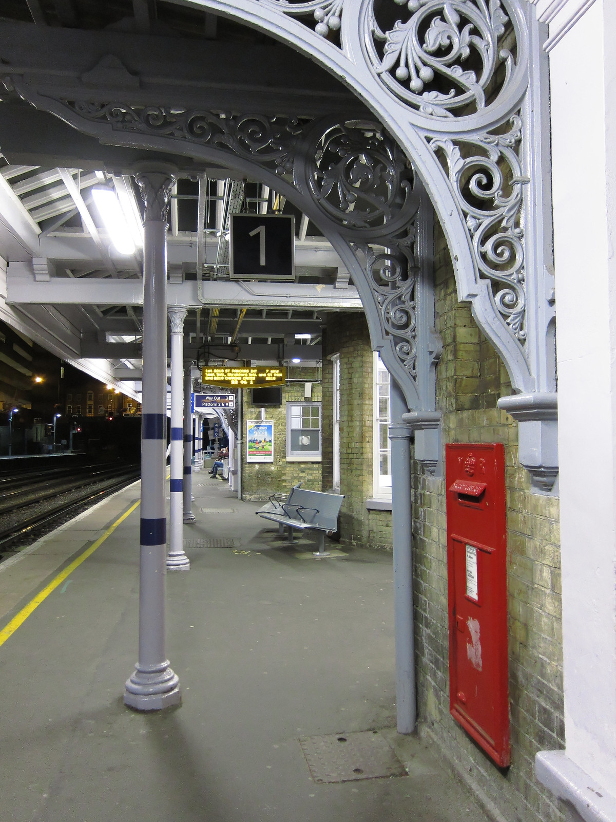
Abbey Wood is a National Rail station in Abbey Wood in southeast London, England. It is between Plumstead and Belvedere stations on the North Kent Line. It is 11 miles 43 chains (18.6 km) measured from London Charing Cross, with services to central London routed via Greenwich or Lewisham, and Elizabeth line services to Paddington and Reading via Canary Wharf and Liverpool Street. The station is managed by Transport for London with passenger services provided by Southeastern, Thameslink and the Elizabeth line. It is the closest railway station to the suburb of Thamesmead, which is connected to the station by local buses. The station platforms are located in the Royal Borough of Greenwich with the station entrance in the London Borough of Bexley.

<span class="mw-page-title-main">Poplar DLR station</span> Docklands Light Railway station

Poplar is a Docklands Light Railway (DLR) station in Poplar in London, England. Poplar is a cross-platform interchange station for three of the six lines on the DLR making it one of the busiest stations on the network in terms of services. It is also nearby the Canary Wharf Station on Crossrail's Elizabeth Line.

<span class="mw-page-title-main">West India Quay DLR station</span> Docklands Light Railway station

West India Quay is a Docklands Light Railway (DLR) station in Canary Wharf’s West India Quay. It is located at the point where the line from Lewisham splits into branches to Tower Gateway/Bank and Stratford. The next stations on each line are Canary Wharf DLR station, Westferry and Poplar DLR station. The station is in Travelcard Zone 2.

<span class="mw-page-title-main">All Saints DLR station</span> Docklands Light Railway station

All Saints is a Docklands Light Railway (DLR) station in Poplar in East London. The station is named after nearby All Saints, a Church of England parish church dating from 1821 to 1823. The station entrance is on the East India Dock Road, the high street of Poplar and is opposite Chrisp Street Market while adjacent to the Poplar Baths, it also has two rail sidings directly west of the station forming part of Poplar DLR depot.

<span class="mw-page-title-main">Stratford International station</span> Docklands Light Railway and National Rail station

Stratford International is a National Rail station in Stratford and a separate Docklands Light Railway (DLR) station nearby, located in East Village in London. Despite its name, no international services stop at the station; plans for it to be served by Eurostar trains never came to fruition. The National Rail platforms are served by Southeastern trains on the High Speed 1 route originating at London St Pancras International. On the DLR, it is a terminus – one of seven end-of-the-line termini – for local services via Canning Town and London City Airport.

<span class="mw-page-title-main">Elmers End station</span> British railway station

Elmers End is a railway station and tram terminus in Elmers End, south London, England. It is in the London Borough of Bromley and on the railway it is 11 miles 7 chains (17.8 km) down the line from London Charing Cross.

<span class="mw-page-title-main">Clock House railway station</span> National Rail station in London, England

Clock House railway station is in the London Borough of Bromley in south east London, in Travelcard Zone 4 between Beckenham and Penge. It is 10 miles 23 chains (16.6 km) down the line from London Charing Cross. The station and all trains serving it are operated by Southeastern on the Hayes line.

<span class="mw-page-title-main">Eden Park railway station</span> National Rail station in London, England

Eden Park railway station serves Eden Park in the London Borough of Bromley in south east London, in Travelcard Zone 5. It is therefore possible to use an Oyster card at the station. It is 12 miles 34 chains (20.0 km) down the line from London Charing Cross. The station and all trains serving it is operated by Southeastern on the Hayes line. The trains are electric, powered by a third rail.

<span class="mw-page-title-main">Langdon Park DLR station</span> Docklands Light Railway station

Langdon Park is a Docklands Light Railway (DLR) station in Poplar in Greater London, England. The station is between All Saints and Devons Road stations on the Stratford-Lewisham Line. Construction of the infill station began on 17 November 2006, and the first day of operation was 9 December 2007.

References

  1. Tube Map
  2. "Southeastern: Lewisham". Archived from the original on 29 May 2009.
  3. "Station Usage Data" (XLSX). Usage Statistics for London Stations, 2018. Transport for London. 23 September 2020. Retrieved 9 January 2022.
  4. "Station Usage Data" (XLSX). Usage Statistics for London Stations, 2019. Transport for London. 23 September 2020. Retrieved 9 January 2022.
  5. "Station Usage Data" (XLSX). Usage Statistics for London Stations, 2020. Transport for London. 16 April 2021. Retrieved 9 January 2022.
  6. "Station Usage Data" (XLSX). Usage Statistics for London Stations, 2021. Transport for London. 12 July 2022. Retrieved 7 September 2022.
  7. "Station Usage Data" (XLSX). Usage Statistics for London Stations, 2022. Transport for London. 4 October 2023. Retrieved 20 October 2023.
  8. 1 2 3 4 5 6 7 8 9 10 "Estimates of station usage". Rail statistics. Office of Rail Regulation. Please note: Some methodology may vary year on year.
  9. Southeastern -Station facilities: Lewisham Archived 9 July 2007 at archive.today
  10. "Picture". c1.staticflickr.com. Retrieved 8 February 2020.
  11. "Archived copy" (PDF). Archived from the original (PDF) on 14 June 2015. Retrieved 8 June 2015.{{cite web}}: CS1 maint: archived copy as title (link)
  12. "Petition to re-open Lewisham station gate signed by 1,152". News Shopper.
  13. "Error". btp.police.uk. Archived from the original on 21 December 2008.
  14. Jackson, Alan A (1999). London's Local Railways (2nd ed.). Harrow Weald: Capital Transport Publishing. p. 47.
  15. "Search". beckenhamhistory.co.uk.
  16. "BoT Lewisham" (PDF). railwaysarchive.co.uk. Retrieved 8 February 2020.
  17. 1 2 Jackson, Alan A (1999). London's Local Railways (2nd ed.). Harrow Weald: Capital Transport Publishing. p. 17.
  18. Thomas, David St John; Whitehouse, Patrick (1990). BR in the Eighties. Newton Abbot: David & Charles. ISBN   978-0-7153-9854-8. OL   11253354M. Wikidata   Q112224535.
  19. "On 22 November Britain's Deputy Prime Minister John Prescott opened the 4·2 km Lewisham extension of London's Docklands Light Railway". Railway Gazette. Retrieved 27 March 2016.
  20. Network Rail closer to Railtrack takeover BBC News, 1 April 2016
  21. "Accounting for Producer Needs: The case of Britain's rail infrastructure" (PDF). Centre for Management and Organisational History. p. 18. Archived from the original (PDF) on 4 March 2016. Retrieved 1 April 2016.
  22. "BBC NEWS - UK - England - Train firm loses franchise". BBC News. 27 June 2003. Retrieved 1 April 2016.
  23. Basher Bowker pulls the plug on Connex The Telegraph 29 June 2003
  24. The Telegraph (24 January 2017). "Southeastern passengers face major delays after freight train derailment near Lewisham station". The Telegraph. London.
  25. Network Rail. "Lewisham Derailment - 24 January, 2017". YouTube.[ dead YouTube link ]
  26. BBC News https://www.bbc.co.uk/news/uk-england-london-43266245
  27. 1 2 Horne, Mike (2000). The Jubilee Line. Capital Transport. p. 36. ISBN   1-85414-220-8.
  28. "Bakerloo line extension - Transport for London - Citizen Space". consultations.tfl.gov.uk.
  29. , Network Rail - Kent Route Utilisation Strategy: Draft for Consultation (April 2009) at paragraph 10.8.2 p. 172
  30. Table 195, 199, 200, 203, 204 National Rail timetable, December 2022
  31. "DLR train timetables". Transport for London . Retrieved 17 August 2023.
  32. "Buses from Lewisham" (PDF). TfL. 4 February 2023. Retrieved 5 February 2023.
  33. "Night buses from Lewisham" (PDF). TfL. June 2022. Retrieved 5 February 2023.
  34. "Lewisham Gateway changes start today". SE13URE. 1 March 2014. Retrieved 16 February 2020.