Fenchurch Street railway station

Last updated

Fenchurch Street National Rail logo.svg
London Fenchurch Street
Fenchurch Street station (6553644825).jpg
Main entrance on Fenchurch Place
Open street map central london.svg
Red pog.svg
Fenchurch Street
Location of Fenchurch Street in Central London
Location City of London
Local authority City of London
Managed by c2c
Station codeFST
DfT category A
Number of platforms4
Fare zone 1
OSI Aldgate Underground no-text.svg
Bank-Monument Underground no-text.svg DLR no-text roundel.svg
Liverpool Street National Rail logo.svg Overground roundel (no text).svg Elizabeth line roundel (no text).svg Underground no-text.svg
Tower Gateway DLR no-text roundel.svg
Tower Hill Underground no-text.svg [1]
National Rail annual entry and exit
2018–19Increase2.svg 18.508 million [2]
2019–20Decrease2.svg 17.717 million [2]
2020–21Decrease2.svg 3.200 million [2]
2021–22Increase2.svg 7.795 million [2]
2022–23Increase2.svg 10.208 million [2]
Railway companies
Original company London and Blackwall Railway
Pre-grouping Great Eastern Railway
Post-grouping London and North Eastern Railway
Key dates
20 July 1841Opened
13 April 1854Rebuilt
1935Remodelled
Listed status
Listed featureFront block
Listing gradeII
Entry number1079149 [3]
Added to list14 April 1972
Other information
External links
Coordinates 51°30′42″N0°04′44″W / 51.51167°N 0.07881°W / 51.51167; -0.07881
Underground sign at Westminster.jpg  London transportportal

Fenchurch Street railway station, also known as London Fenchurch Street, [4] is a central London railway terminus in the southeastern corner of the City of London. It takes its name from its proximity to Fenchurch Street, a key thoroughfare in the City. The station and all trains are operated by c2c. Services run on lines built by the London and Blackwall Railway (L&BR) and the London, Tilbury and Southend Railway (LTSR) are to destinations in east London and south Essex, including Upminster, Grays, Basildon, Southend and Shoeburyness.

Contents

The station opened in 1841 to serve the L&BR and was rebuilt in 1854 when the LTSR, a joint venture between the L&BR and the Eastern Counties Railway (ECR), began operating. The ECR also operated trains out of Fenchurch Street to relieve congestion at its other London terminus at Bishopsgate. In 1862 the Great Eastern Railway was created by amalgamating various East Anglian railway companies (including the ECR) and it shared the station with the LTSR until 1912, when the latter was bought by the Midland Railway. The station came under ownership of the London & North Eastern Railway (LNER) following the Railways Act 1921, and was shared by LNER and London Midland & Scottish Railway (LMS) services until nationalisation in 1948. The line from the station was electrified in 1961, and closed for seven weeks in 1994.

Fenchurch Street is one of the smallest railway terminals in London in terms of platforms, but one of the most intensively operated. It is the only London terminal with no direct interchange with the London Underground. Plans to connect it stalled in the early 1980s because of the lack of progress on the Jubilee line, but it is within 350 yards (320 m) of both the Tower Hill station on the London Underground and the Tower Gateway station on the Docklands Light Railway.

Location

The station has an entrance on Cooper's Row, close to Tower Hill on the London Underground network. Fenchurch St station from Coopers Row 02.jpg
The station has an entrance on Cooper's Row, close to Tower Hill on the London Underground network.

The station frontage is on Fenchurch Place, adjacent to Fenchurch Street in the City of London. The station has two entrances: one on Fenchurch Place and another on Cooper's Row, near Tower Hill. It has four platforms arranged on two islands elevated on a viaduct. [5] The station has been Grade II listed since 1972 [3] [6] and the conference venue One America Square is built adjacent to it. [7] Following rail privatisation in 1994, the station was run by Network Rail. [8] Since 1996, the station has been served by c2c (which was sold by National Express to Trenitalia in 2017) [9] who have a franchise to run services until 2029. [10] [11]

Fenchurch Street is in the central London Travelcard zone 1 like other terminal stations in the city, [12] but it does not have a direct link to the London Underground. The nearest stations on the London Underground network are Tower Hill about 0.2 miles (0.32 km) to the southeast [13] [lower-alpha 1] and Aldgate around 0.3 miles (0.48 km) to the northeast. [15]

History

London and Blackwall Railway

The area around Fenchurch Street is one of the oldest inhabited parts of London; the name "Fenchurch" derives from the Latin faenum (hay) and refers to hay markets in the area. [16] The station was the first to be granted permission by the Corporation of London to be constructed inside the City of London, following several refusals against other railway companies. [17]

The original building, designed by William Tite opened on 20 July 1841, serving the London and Blackwall Railway (L&BR), replacing a nearby terminus at Minories that had opened in July 1840. [18] [19] It had two platforms connected via a stairway to the booking hall. [20] Steam locomotives did not use the station until 1849 because before this time trains were dragged uphill from Blackwall to Minories, and ran to Fenchurch Street via their own momentum. The reverse journey eastwards required a manual push from railway staff. [21] William Marshall's railway bookstall established at the station in 1841 was the first to be opened in the City of London. [22]

Eastern Counties Railway and London, Tilbury and Southend Railway

The station in the early 1980s; this building was constructed in 1854 by George Berkley. The zig-zag canopy is an addition from the 1870s. Fenchurch Street station geograph-3515089-by-Ben-Brooksbank.jpg
The station in the early 1980s; this building was constructed in 1854 by George Berkley. The zig-zag canopy is an addition from the 1870s.

Following the opening of the London and Blackwall Extension Railway on 2 April 1849, services operated from Fenchurch Street to Bow & Bromley. Some were extended to Victoria Park & Bow where an interchange existed with the Eastern Counties Railway (ECR) from Bishopsgate. [23]

On 26 September 1850, the East and West India Docks and Birmingham Junction Railway (renamed the North London Railway (NLR) on 1 January 1853) [24] started operating a service from Bow into Fenchurch Street and the L&BR withdrew its service, closing the line between Gas Factory Junction and Bow & Bromley. [25] The station had two heavily used platforms and a double track line from Stepney onwards. [26] Following a reduced income at Blackwall (the South Eastern Railway had opened a direct line from Gravesend to London), LBR shareholders voted to align with the ECR and jointly construct the London, Tilbury and Southend Railway (LTSR) from Tilbury to Forest Gate Junction. Services would split at Stratford, one service to Bishopsgate and the other to Fenchurch Street along the reopened line via Bow & Bromley (although the station did not reopen). To accommodate this service a third line was built between Stepney and Fenchurch Street which was enlarged at this time. The new service commenced on 13 April 1854 using ECR locomotives and stock. [27]

To accommodate the changes, the station was enlarged to designs by George Berkley incorporating a 32 metres (105 ft) by 91 metres (299 ft) trussed-arch vaulted roof. [21] [lower-alpha 2] Two platforms were added at the same time [29] as was a circulating area for L&BR and LTSR traffic. [21] The NLR, wanting its own London terminus instead of co-sharing Fenchurch Street, extended its railway towards the new Broad Street station in 1865. [30]

The railway through Stratford was unable to cope with the extra services, so the LTSR planned to build a more direct line from Barking to Gas Factory Junction. The third track from Stepney to Fenchurch Street opened in 1856, followed by the direct line from Barking in 1858. [31] LTSR services were diverted from Stratford and a spur was opened at Abbey Mills Junction (east of Bromley) which allowed services to and from North Woolwich to operate directly from Fenchurch Street instead of via Stratford. [32]

Great Eastern Railway

Railway Clearing House diagram of the Fenchurch Street area, 1906. Aldgate, Bishopsgate, Haydon Square, Liverpool Street, Mansion House, Spitalfields & Whitechapel RJD 45.JPG
Railway Clearing House diagram of the Fenchurch Street area, 1906.

By the 1860s, railways in East Anglia were in financial difficulties, and most lines were leased to the ECR. Although the companies wished to amalgamate they could not obtain government consent until 1862, when the Great Eastern Railway (GER) was formed. [33] In common with most railways, signalling was fairly basic and trains were separated by time interval. As traffic levels increased there was a need to improve signalling and, in 1869, the GER introduced absolute block working between Fenchurch Street, Gas Factory Junction and Bow Junction, opening signal boxes at all locations. [34] In the 1870s the flat awning over the station main's entrance was replaced with the current zig-zag canopy. [35]

The station's track layout was rearranged in 1883 with platform extensions, a fifth platform for use by the Blackwall services and a new gantry signal box (which lasted until the 1935 re-modelling). [34] The GER used the station as an alternative to Liverpool Street station during the late-19th and early-20th centuries for former ECR routes. [31] The GER took over operation of the NLR shuttle from Bow in 1869, which it operated until April 1892 when the second Bow Road railway station opened along with a passenger foot connection to the NLR station. Subsequent services into Fenchurch Street were operated by the GER and the LTSR, and three years later the viaduct from Stepney to Fenchurch Street was widened to accommodate a fourth track. [36]

Despite this, overcrowding of LTSR services was still occurring and this persisted until 1902 when the opening of the Whitechapel and Bow Railway offered an alternative route. [37]

In 1903, the GER built the Fairlop Loop, a short connecting line between Ilford and Woodford from where services ran to Liverpool Street and around 36 trains a day ran to Fenchurch Street. [31] In 1912, the Midland Railway (MR) bought and took over operation of the LTSR services. [38]

London, Midland and Scottish Railway

After the Railways Act 1921 the country's railways were grouped into four companies, with effect from 1 January 1923. At Fenchurch Street, the London, Midland and Scottish Railway (LMSR) took over operations of the MR, whilst GER services were taken over by the London and North Eastern Railway (LNER). Direct trains to Gallions were usually routed via Bromley at off-peak hours and a peak shuttle service operated from Custom House to Gallions. Passengers for the North Greenwich branch changed at Millwall Junction. The Blackwall and North Greenwich passenger services were scheduled for closure on 30 June 1926 but the general strike brought that forward to 3 May. [39]

The station was rebuilt in 1935 to address overcrowding and provide better accommodation for Southend line services. [40] When the former ECR lines transferred to the Underground's Central line in 1948, the station was served solely by the former LTSR services. [41] [42]

Nationalisation and beyond

Fenchurch Street station in 1961, immediately before electrification Fenchurch Street Station 2035795 5ec533e7.jpg
Fenchurch Street station in 1961, immediately before electrification

Following nationalisation of Britain's railways in 1948, the station transferred under British Railways to the Eastern Region although the old LTSR network west of Gasworks Junction was controlled by the London Midland Region. On 20 February 1949, the whole LTS line was transferred to the Eastern Region, yet despite the organisational changes, the old LTSR still was a distinctive system operated by former LTS and LMS locomotives until electrification. [43]

British Railways electrified the former LTSR line in 1959. [44] Electric services began on 6 November 1961 and a full electric timetable was introduced on 18 June the following year. [45] In the 1980s, the station roof was dismantled and high-rise office blocks were built above the station leaving the 1854 facade intact. [20]

C2C Class 357 at Fenchurch Street C2c 357037 at Fenchurch Street 02.jpg
C2C Class 357 at Fenchurch Street

Fenchurch Street station suffered a negative reputation under public ownership. By the end of the 1980s, the former LTSR line was carrying over 50,000 passengers a day on a 50-year old infrastructure. The persistent overcrowding and uncleanliness on trains led to it being dubbed "the misery line". In 1989 Sir Robert Reid called the service from Fenchurch Street "wholly unacceptable", [46] while Teresa Gorman, Member of Parliament for Billericay, subsequently called it "one of the disgraces of our public railway service for many years". [47] Between 1982 and 1992, the station was operated by Network SouthEast, one of British Rail's three passenger business sectors, before being handed over to a business unit in preparation for privatisation. [48]

In July 1994, shortly before rail privatisation, the station closed for seven weeks for an £83 million project to replace signals, track and electrification works. It was the first significant closure of a London terminal station, [47] albeit planned and temporary.

The development of Lakeside Shopping Centre, near Chafford Hundred and Thurrock, increased demand for services from the station. [49] In 2013, Network Rail announced a £3.4m upgrade creating a third exit on Cooper's Row to make connections with Tower Hill easier. [50]

In 2019, a planning application [51] was submitted to the City of London (planning authority) for permission to revamp the station building. [52]

Underground

Fenchurch Street at night Fenchurch Street Station - geograph.org.uk - 5417482.jpg
Fenchurch Street at night

In the 1970s, Fenchurch Street was considered to be an integral part of the proposed Fleet line (now called the Jubilee line), which would have given the station an Underground connection. An extension from the end of the track terminus at Charing Cross to Fenchurch Street via Aldwych and Ludgate Circus would have seen the line cross the River Thames and continue southeastwards towards Surrey Docks and Lewisham. [53] A revised route, approved in 1980, would have seen the line follow a more northerly route to Woolwich Arsenal and Beckton. [54]

Mott, Hay and Anderson and Sir William Halcrow and Partners began constructing the line to Charing Cross, but did not finish the project until 1979. Rising costs and high inflation led to London Transport abandoning the eastwards extension via Fenchurch Street in 1981. [55] The line was completed in 1999, using a different route via the Greenwich Peninsula to Stratford, crossing the LTSR line from Fenchurch Street at West Ham. [56] This has altered demand for Fenchurch Street, with passengers from Essex changing there instead. [49]

Services

View of the platforms Fenchurch St. railway station (6282827916).jpg
View of the platforms

Services from Fenchurch Street run towards East London and south Essex, including Barking, Upminster, Chafford Hundred Lakeside (for Lakeside Shopping Centre), Tilbury Town (for the Gravesend–Tilbury Ferry and cruise services) Basildon, Southend Central and Shoeburyness. As of the December 2023 timetable the typical Monday to Friday off-peak service is: [57]

tphDestinationRouteStopping pattern
2Shoeburynessvia Laindon and Basildonall stations
2 Southend Central via Ockendon all stations
2 Grays via Rainham (London) all stations

During peak periods services are increased up to 20 trains per hour. Most peak services have 12 cars. [58]

Although the station's capacity is small compared to other London terminals, it has a high footfall, averaging around 16 million passengers annually. [59] A report in 2001 showed approximately 3,000 people commuted daily from Castle Point to the city via Fenchurch Street, [60] while a 2013 report said it was the busiest station on the LTSR route, with 46,000 daily peak-time passengers. [50]

Preceding station National Rail logo.svg National Rail Following station
Terminus  c2c
London, Tilbury and Southend line
  Limehouse
Abandoned plans
Preceding station Underground no-text.svg London Underground Following station
Cannon Street
towards Stanmore
Jubilee line
Phase 3 (1971/2) (never constructed)
Surrey Docks
Jubilee line
Phase 3 (1980) (never constructed)
St Katharine Docks

Future

There have been proposals to move the station 380 yards to the east to allow the station to expand to 6 platforms, (up from the current 4) and would be built partly on the site of Tower Gateway DLR station, which would likely be permanently closed. [61]

The new station could be built with direct interchange with Tower Hill tube station, [61] which could also have a replacement DLR station for Tower Gateway as Transport for London have looked into closing Tower Gateway and constructing a replacement on the Bank branch to increase capacity. [62]

Incidents

Goods depots

An abandoned hydraulic accumulator tower to the east of Fenchurch Street station, now demolished City Goods Station - geograph.org.uk - 253578.jpg
An abandoned hydraulic accumulator tower to the east of Fenchurch Street station, now demolished

A number of goods depots were established near Fenchurch Street owing to the station's proximity to the City of London. This table lists the depots connected to the line between the station and Christian Street Junction just east of Leman Street: [72] [73] [74]

NameCompanyOpeningClosedNotes
Cable Street Great Eastern Railway 1870s [75]  ??Coal depot – leased by Charringtons
City Goods Midland Railway 1 October 18621 July 1949Closed after nationalisation (duplication of facilities). An hydraulic accumulator tower lasted until 2015 when it was demolished
Commercial RoadLTSR17 April 18863 July 1967
East Smithfield Great Eastern Railway 17 June 18641 September 1966Short quarter-mile branch that led to the Thames riverside. Marked as London Docks on Railway Clearing House diagram above.
Goodmans YardL&BR1 February 18611 April 1951Built later for ECR and LTSR traffic. Badly damaged during London Blitz.
Haydon Square London North Western Railway 12 March 18532 July 1962A short fragment of the viaduct serving the depot can be seen today (2015).
Mint StreetL&BR then leased to the Great Northern Railway from 18611 August 18581 April 1951Contained part of the original Minories station building. Known as Royal Mint Street c1870. Badly damaged by bombs on 29 December 1940. – closed after nationalisation (duplication of facilities)

Cultural references

The poet John Betjeman passed through the station on day-trips to Southend, and described it as a "delightful hidden old terminus". [76]

The first documented murder on the British rail network occurred on 9 July 1864, when Franz Muller murdered Thomas Briggs shortly after a train left the station en route to Chalk Farm. [77]

Fenchurch Street is one of four railway stations on the standard UK Monopoly board, alongside Liverpool Street, Marylebone and King's Cross. All are former LNER terminal stations. [78]

The 2005 football hooliganism film Green Street used the station to represent Manchester Piccadilly. [79]

In the Douglas Adams novel So Long, and Thanks for All the Fish , Fenchurch was so-named because she was conceived at the station. [80]

Related Research Articles

<span class="mw-page-title-main">Limehouse station</span> Docklands Light Railway and National Rail station

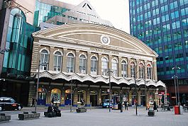
Limehouse is a National Rail and connected Docklands Light Railway (DLR) station in Limehouse, London, England. It is served by regional services operated by c2c to and from Fenchurch Street, and by light metro services provided by the DLR to and from Tower Gateway or Bank. On the main line, Limehouse is located 1 mile 58 chains (2.8 km) from Fenchurch Street and the following station is West Ham; on the DLR it is between Shadwell and Westferry in Travelcard Zone 2.

<span class="mw-page-title-main">Stratford station</span> London Underground, Docklands Light Railway and National rail station

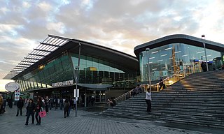
Stratford is a major multi-level interchange station serving the district of Stratford and the mixed-use development known as Stratford City, in the London Borough of Newham, East London for London Underground, London Overground, Docklands Light Railway (DLR) and Elizabeth line services. National Rail services also operate on the West Anglia Main Line and the Great Eastern Main Line, 4 miles 3 chains (6.5 km) from Liverpool Street.

<span class="mw-page-title-main">Bromley-by-Bow tube station</span> London Underground station

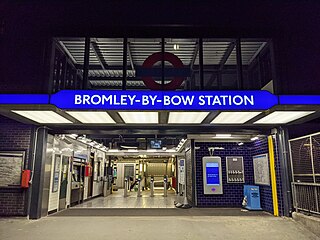
Bromley-by-Bow is a London Underground station located on the Blackwall Tunnel Northern Approach Road in the Bromley-by-Bow area of London, United Kingdom. The station is below the Blackwall Tunnel Northern Approach Road and lies between Bow Road and West Ham stations on the District and Hammersmith & City lines, and is in both Travelcard Zones 2 and 3.

<span class="mw-page-title-main">Barking station</span> Interchange railway station in London

Barking is an interchange station serving the town of Barking, east London. It is served by London Underground, London Overground and National Rail main line services. It is located on Station Parade, in the town centre.

<span class="mw-page-title-main">Great Eastern Main Line</span> Principal railway route in eastern England

The Great Eastern Main Line is a 114.5-mile (184.3 km) major railway line on the British railway system which connects Liverpool Street station in central London with destinations in east London and the East of England, including Shenfield, Chelmsford, Colchester, Ipswich and Norwich. Its numerous branches also connect the main line to Southminster, Braintree, Sudbury, Harwich and a number of coastal towns including Southend-on-Sea, Clacton-on-Sea, Walton-on-the-Naze and Lowestoft.

<span class="mw-page-title-main">Upminster station</span> London Underground and railway station

Upminster is an interchange station serving the town of Upminster in the London Borough of Havering, Greater London. It is on the London, Tilbury and Southend line (LTSR), 15 miles 20 chains (24.5 km) down the line from London Fenchurch Street; it is the eastern terminus of the District line on the London Underground; and it is the eastern terminus of the Romford to Upminster Line on the London Overground network. Upminster is the easternmost station on the London Underground network as well as the easternmost National Rail station in London.

Originally called the Commercial Railway, the London and Blackwall Railway (L&BR) in east London, England, ran from Minories to Blackwall via Stepney, with a branch line to the Isle of Dogs, connecting central London to many of London's docks. It was operational from 1840 until 1926 and 1968, closing after the decline of inner London's docks. Much of its infrastructure was reused as part of the Docklands Light Railway. The L&BR was leased by the Great Eastern Railway in 1866, but remained independent until absorbed into the London and North Eastern Railway at the 1923 Grouping. Another branch was opened in 1871, the Millwall Extension Railway.

<span class="mw-page-title-main">London, Tilbury and Southend line</span> Commuter railway line in Essex, England

The London, Tilbury and Southend line, also known as Essex Thameside, is a commuter railway line on the British railway system. It connects Fenchurch Street station, in central London, with destinations in east London and Essex, including Barking, Upminster, Basildon, Grays, Tilbury, Southend and Shoeburyness.

<span class="mw-page-title-main">Plaistow tube station</span> London Underground station

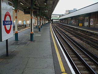
Plaistow is a London Underground station on Plaistow Road in the London Borough of Newham in Greater London. It is between West Ham and Upton Park stations on the District and Hammersmith & City lines, and in Travelcard Zone 3.

<span class="mw-page-title-main">Chafford Hundred railway station</span> Network Rail station in Essex, England

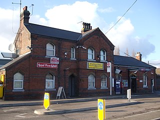
Chafford Hundred railway station, also known as Chafford Hundred Lakeside station, is located on a single-track branch line of the London, Tilbury and Southend line, serving the area of Chafford Hundred as well as Lakeside Shopping Centre in Essex. It is 20 miles 77 chains (33.7 km) down the line from London Fenchurch Street via Upminster; it is situated between Ockendon and Grays. Its three-letter station code is CFH.

<span class="mw-page-title-main">Ockendon railway station</span> Network Rail station in Essex, England

Ockendon railway station is located on a passing loop on a single-track branch of the London, Tilbury and Southend line, serving the town of South Ockendon, Essex. It is 18 miles 44 chains (29.9 km) down the line from London Fenchurch Street via Upminster; the following station on the branch is Chafford Hundred. Its three-letter station code is OCK.

The North London Railway (NLR) company had lines connecting the northern suburbs of London with the East and West India Docks further east. The main east to west route is now part of London Overground's North London Line. Other NLR lines fell into disuse but were later revived as part of the Docklands Light Railway, and London Overground's East London Line. The company was originally called the East & West India Docks & Birmingham Junction Railway (E&WID&BJR) from its start in 1850, until 1853. In 1909, it entered into an agreement with the London and North Western Railway which introduced common management, and the NLR was taken over completely by the LNWR in 1922. The LNWR itself became part of the LMS from the start of 1923. The railways were nationalised in 1948 and most LMS lines, including the North London route, then came under the control of the London Midland Region of British Railways.

<span class="mw-page-title-main">Woodgrange Park railway station</span> Railway station in Greater London, England

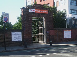
Woodgrange Park is a railway station on Romford Road in Manor Park in the London Borough of Newham, east London. It is served by London Overground and is on the Gospel Oak to Barking line. It is located 12 miles 1 chain (19.3 km) down the line from Gospel Oak; it lies in Travelcard Zones 3 and 4. It has only limited station buildings and facilities.

<span class="mw-page-title-main">Bow Road railway station</span> Disused railway station in England

Bow Road is a closed railway station in Bow, East London, that was opened in 1876 on the Bow Curve branch line by the Great Eastern Railway (GER).

<span class="mw-page-title-main">Bow railway station</span> Disused railway station in England

Bow was a railway station in Bow, east London, that was opened in 1850 by the East & West India Docks and Birmingham Junction Railway, which was later renamed the North London Railway (NLR). The station was situated between Old Ford and South Bromley, and was located on the north side of Bow Road, close to the second Bow Road station which was open from 1892 to 1949. A covered footway connected the two stations between 1892 and 1917.

<span class="mw-page-title-main">Burdett Road railway station</span> Disused railway station in England

Burdett Road is a disused railway station located in Bow Common, east London. It was opened in 1871 by the Great Eastern Railway and closed in 1941.

<span class="mw-page-title-main">East Ham Depot</span>

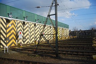
East Ham Depot is a depot on the London, Tilbury and Southend line between East Ham and Barking stations with the depot code EM. The depot is approximately 6+12 mi (10.5 km) from London Fenchurch Street station, and just west of the River Roding.

The London, Tilbury and Southend Railway (LT&SR), was a British railway company, whose network connected Fenchurch Street station, in central London, with destinations in east London and Essex, including Barking, Upminster, Grays, Tilbury, Southend and Shoeburyness. The company and its assets were sold to the Midland Railway in 1912. The network over which they operated is largely intact and is currently operated as part of the Essex Thameside franchise.

Victoria Park & Bow was a short-lived railway station in Bow, east London. It was located close to the present-day Bow Junction on what is now the Great Eastern Main Line between Stratford and Bethnal Green. Built by the Eastern Counties Railway (ECR), it opened on 2 April 1849, seemingly for the main purpose of providing an interchange between the London and Blackwall Extension Railway's (LBER) Fenchurch Street branch and the ECR's main line between Bishopsgate and Stratford.

<span class="mw-page-title-main">Bow Curve</span> Railway line in Bow, East London

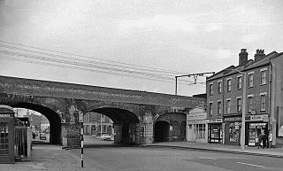
The Bow Curve is a railway branch line in Bow, east London, that connects the Great Eastern Main Line and the London, Tilbury and Southend line. The line, 47 chains (0.95 km) in length, connects Stratford on the GEML with Limehouse on the LTSR.

References

Notes

  1. Fenchurch Street is marked as a mainline station next to Tower Hill on a standard Tube Map. [14]
  2. Peter Kay suggests that the façade was designed by Tite. [28]

Citations

  1. "Out-of-Station Interchanges" (Microsoft Excel). Transport for London. 2 January 2016. Retrieved 28 August 2016.
  2. 1 2 3 4 5 "Estimates of station usage". Rail statistics. Office of Rail Regulation. Please note: Some methodology may vary year on year.
  3. 1 2 Historic England. "Front block of Fenchurch Street Station (1079149)". National Heritage List for England . Retrieved 12 November 2012.
  4. "Station facilities for London Fenchurch Street". National Rail Enquiries. Retrieved 29 May 2013.
  5. "Fenchurch Street Station". Google Maps. Retrieved 14 July 2016.
  6. City 2013, p. 34.
  7. "City of London Conference Centres". Cavendish Venues. 4 September 2015. Retrieved 14 July 2016.
  8. "History – Fenchurch Street station". Network Rail. Archived from the original on 29 August 2016. Retrieved 14 July 2016.
  9. "Trenitalia Completes c2c Acquisition". Railway Gazette International . 13 February 2017. Retrieved 16 April 2017.
  10. "London Fenchurch Street". c2c. Retrieved 14 July 2016.
  11. Annual Customer Report (PDF) (Report). p. 2. Archived from the original (PDF) on 2 February 2017. Retrieved 14 July 2016.
  12. "Standard Tube Map" (PDF). Transport for London. Retrieved 3 August 2016.
  13. "Fenchurch Street Station to Tower Hill Underground Station". Google Maps. Retrieved 14 July 2016.
  14. "Standard Tube Map" (PDF). Transport for London. Retrieved 14 July 2016.
  15. "Fenchurch Street Station to Aldgate Station". Google Maps. Retrieved 14 July 2016.
  16. Weinreb et al. 2008, p. 288.
  17. Martin 2012, p. 13.
  18. Christopher 2013, p. 27.
  19. McCormack 2016, p. 6.
  20. 1 2 Christopher 2015, p. 119.
  21. 1 2 3 Weinreb et al. 2008, p. 289.
  22. "Hooked on books" . The Daily Telegraph. 20 August 2006. Archived from the original on 12 January 2022. Retrieved 14 July 2016.
  23. Connor 1987, p. 38.
  24. Freeman 1991, p. 145.
  25. Jackson 1978, p. 167.
  26. Connor 1987, pp. 38, 39.
  27. Connor 1987, pp. 43–53.
  28. Kay, Peter (October 1994). "Who designed the 1854 Fenchurch Street station?(Letter)". Great Eastern Journal. Vol. 80. Great Eastern Railway Society. p. 26.
  29. Christopher 2013, p. 30.
  30. McCormack 2016, p. 104.
  31. 1 2 3 W R Powell, ed. (1966). Economic influences on growth: Local transport. A History of the County of Essex. Vol. 5. London: British History Online. pp. 21–29. Retrieved 14 July 2016.
  32. Connor 1987, p. 47.
  33. Vaughan 1997, pp. 134, 135.
  34. 1 2 Kay 1996, p. 71.
  35. City 2013, p. 5.
  36. Connor 1987, p. 116.
  37. Kay 1996, p. 72.
  38. Hennessey 2013, p. 128.
  39. Brennand 2013, p. 23.
  40. Dow 2005, p. 41.
  41. Davies & Grant 1983, p. 131.
  42. Croome & Jackson 1993, p. 294.
  43. Connor & Phillips 1998, p. 8.
  44. Hay, John (27 January 1960). "Fenchurch Street-Tilbury-Southend Line (Electrification)". Parliamentary Debates (Hansard) . Retrieved 15 July 2016.
  45. McCarthy & McCarthy 2009, p. 72.
  46. Horsnell, Michael (3 February 1993). "Sell-off news brings little joy to the misery line" . The Times. p. 5. Retrieved 16 August 2016.
  47. 1 2 "Fenchurch Street Line". Parliamentary Debates (Hansard) . 28 June 1994. Retrieved 15 July 2016.
  48. Thomas, David St John; Whitehouse, Patrick (1990). BR in the Eighties. Newton Abbot: David & Charles. ISBN   978-0-7153-9854-8. OL   11253354M. Wikidata   Q112224535.
  49. 1 2 "Route F : Thameside" (PDF). Network Rail. p. 6. Archived from the original (PDF) on 26 September 2012. Retrieved 22 July 2016.
  50. 1 2 "£3.4 million upgrade of Fenchurch Street station begins". Network Rail Media Centre. 19 September 2013. Retrieved 22 July 2013.
  51. "19/00873/LBC | Alterations to the principal elevation of Fenchurch Street Station comprising: (i) demolition of internal partitions and other accretions (ii) repair and redecoration of the internal surfaces (iii) restoration of the missing internal architectural details (iv) installation of a lighting scheme comprising 71 luminaire fittings on the external face of the elevation. | Fenchurch Street Railway Station Fenchurch Place London EC3M 4AJ". Planning2.cityoflondon.gov.uk.
  52. "Fenchurch Street station destined for a makeover". Ianvisits.co.uk. 10 September 2019.
  53. Mitchell 2003, pp. 1, 2.
  54. Horne 2000, pp. 50–52.
  55. Mitchell 2003, p. 3.
  56. Mitchell 2003, p. 184.
  57. "c2c Train Times from 10 December 2023" (PDF). c2c. 10 December 2023. Retrieved 24 February 2024.
  58. London and South East Route Utilisation Strategy (PDF) (Report). Network Rail. July 2011. p. 15. Archived from the original (PDF) on 15 April 2016. Retrieved 21 July 2016.
  59. "Footfall breakdown for each station" (PDF). Network Rail. Archived from the original (PDF) on 11 June 2012. Retrieved 15 July 2016.
  60. "Rail Commuters (Castle Point)". Parliamentary Debates (Hansard) . 27 February 2001. Retrieved 15 July 2016.
  61. 1 2 Horgan, Rob (19 August 2020). "DLR station may be decommissioned to make space for Fenchurch Street expansion". New Civil Engineer. Retrieved 25 June 2022.
  62. "Transport Supporting Paper" (PDF). London.gov.uk. Retrieved 25 June 2022.
  63. "Accident at Fenchurch Street on 1st August 1859". Railways Archive. Retrieved 16 August 2016.
  64. "Accident Returns: Extract for the Accident at Fenchurch Street on 28th November 1860". Railways Archive. Retrieved 16 August 2016.
  65. "Accident Returns: Extract for the Accident at Fenchurch Street on 24th June 1872". Railways Archive. Retrieved 16 August 2016.
  66. "Accident Returns: Extract for the Accident at Fenchurch Street on 17th August 1872". Railways Archive. Retrieved 16 August 2016.
  67. O'Donnell, Martin (2 December 2019). "George Joseph Stuttaford (1855 – 1893)". Railway Work, Life & Death. University of Portsmouth . Retrieved 4 May 2022.
  68. "Accident at Fenchurch Street on 2nd September 1903". Railways Archive. Retrieved 16 August 2016.
  69. Wardle, George (23 July 1908). "Fenchurch Street Station Accident". Parliamentary Debates (Hansard) . Retrieved 15 July 2016.
  70. "Accident Returns: Extract for Accident at Fenchurch Street on 3rd February 1912". Railways Archive. Retrieved 16 August 2016.
  71. "Accident at Fenchurch Street on 26th January 1927". Railways Archive. Retrieved 16 August 2016.
  72. Connor 1987, p. 123.
  73. Connor, J E (August 1998). Fenchurch Street – Barking. Midhurst UK: Middleton Press. pp. 28–44. ISBN   1-901706-20-6.
  74. Hawkins, Chris (1990). Great Eastern in Town and Country. Pinner UK: Irwell Press. pp. 36–42. ISBN   1-871608-16-3.
  75. Watling, John; Taylor, Dave; Goldsmit, Paul (April 1996). "Lineside features 2:coal drops". Great Eastern Journal. 86: 16.
  76. Christopher 2013, p. 26.
  77. Arthur & Mary Sellwood (2013). Death Ride From Fenchurch Street & Other Victorian Railway Murders. Amberley Publishing Limited. pp. 9–10. ISBN   978-1-445-62337-5.
  78. Moore, Tim (2003). Do Not Pass Go. Random House. pp. 158–159. ISBN   978-1-409-02216-9.
  79. "Green Street film locations". The Worldwide Guide To Movie Locations. Archived from the original on 7 May 2018. Retrieved 15 July 2016.
  80. Adams, Douglas (2009) [1984]. So Long, and Thanks for All the Fish. Pan Macmillan. p. 66. ISBN   978-0-330-51317-3.

Sources