Waterloo East railway station

Last updated

Waterloo East National Rail logo.svg
London Waterloo East
Waterlooeast.jpg
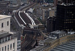
Waterloo East viewed from the London Eye
Open street map central london.svg
Red pog.svg
Waterloo East
Location of Waterloo East in Central London
Location Waterloo
Local authority London Borough of Lambeth
Grid reference TQ313800
Managed by Southeastern
Owner Network Rail
Station codeWAE
DfT category B
Number of platforms4 (lettered A–D)
Fare zone 1
OSI Waterloo National Rail logo.svg
Waterloo Underground no-text.svg
Embankment Underground no-text.svg
Southwark Underground no-text.svg [1]
National Rail annual entry and exit
2018–19Increase2.svg 10.507 million [2]
– interchange Increase2.svg 0.869 million [2]
2019–20Decrease2.svg 10.075 million [2]
– interchange Decrease2.svg 0.863 million [2]
2020–21Decrease2.svg 2.194 million [2]
– interchange Decrease2.svg 0.255 million [2]
2021–22Increase2.svg 5.109 million [2]
– interchange Increase2.svg 0.557 million [2]
2022–23Increase2.svg 5.430 million [2]
– interchange Increase2.svg 0.641 million [2]
Railway companies
Original company South Eastern Railway
Pre-grouping South Eastern and Chatham Railway
Post-grouping Southern Railway
Key dates
1 January 1869 (1869-01-01)Opened as Waterloo Junction
7 July 1935Renamed Waterloo
2 May 1977Renamed Waterloo East
Other information
External links
WGS84 51°30′13″N0°06′40″W / 51.5037°N 0.111°W / 51.5037; -0.111
Underground sign at Westminster.jpg  London transportportal

Waterloo East railway station, also known as London Waterloo East, [3] is a railway station in central London on the line from Charing Cross through to London Bridge towards Kent, in the south-east of England. It is to the east of London Waterloo railway station and close to Southwark tube station.

Contents

The station opened in 1869 as Waterloo Junction, to provide a connection between the London and South Western Railway at Waterloo, and the South Eastern Railway at Charing Cross. A dedicated line was built between Waterloo and Waterloo East, which was later converted to a footpath. Trains originally ran to Cannon Street, but after competition from the London Underground, these were withdrawn as a wartime measure in 1916. The station continued to be connected to Waterloo mainline via a footbridge. Waterloo East was given its current name in 1977, and remains an important interchange in London. It is part of the London station group. The station is located in London fare zone 1.

Location

Entrance to Waterloo East from Waterloo station prior to the completion of the retail balcony in 2012. Waterloo station MMB 20.jpg
Entrance to Waterloo East from Waterloo station prior to the completion of the retail balcony in 2012.

The station is on the South Eastern Main Line 61 chains (1.2 km) down the line from Charing Cross, [4] on the other side of the River Thames across from Hungerford Bridge. Although Waterloo East is a through-station, it is classed for ticketing purposes as a central London terminus. [5]

Services through the station are operated by Southeastern and it is situated within fare zone 1. The main access is via an elevated walkway across Waterloo Road, which connects it to the larger Waterloo station. [6] The eastern ends of the platforms provide pedestrian connection to Southwark station which is served by London Underground's Jubilee line; [7] at street level there is an entrance in Sandell Street. Connections with the Underground's Bakerloo, Northern and Waterloo & City lines are available at Waterloo Underground station. [8]

The four platforms at Waterloo East are lettered rather than numbered to ensure that staff and passengers do not confuse the platforms at the two stations. [n 1]

London Buses routes 1, 26, 59, 68, 76, 77, 139, 168, 172, 176, 188, 211, 243, 341, 381, peak hours express route SL6 and night routes N1, N68, N171, N343 and N381 serve the station. [10] [11]

History

South Eastern Railway

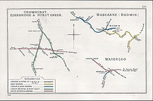
A 1910 Railway Clearing House map of lines around Waterloo - note the connecting line between Waterloo and Waterloo East. Crowhurst, Edenbridge & Hurst Green Boscare(Bodmin) Waterloo RJD 126.jpg
A 1910 Railway Clearing House map of lines around Waterloo – note the connecting line between Waterloo and Waterloo East.

The station was built by the South Eastern Railway (SER) after the line to Charing Cross opened in 1864. [12] The company were under pressure to connect with London and South Western Railway (LSWR) services, as it would allow the latter to connect to the City of London via Cannon Street. The LSWR were not interested in making Charing Cross a joint station, but were amenable to providing a connection with the SER next to Waterloo. [13]

In 1867, the two companies agreed to build a joint connection so that passengers could change from LSWR to SER services in order to reach the City of London via Cannon Street. [14] Another station, Blackfriars was built to the east, but it was closed in favour of a connecting station with the LSWR. [15] Construction of a single-line, 5-chain (100 m) connection begun in May 1868, and the new connection station opened on 1 January 1869 at a total cost of £14,290 (£1,404,000 as of 2021). Blackfriars station closed on the same date. [16] [17] Trains began running from Waterloo Junction to Charing Cross and Cannon Street around every five minutes. [18] Queen Victoria used the connection for royal trains travelling from Windsor Castle to Dover and Continental Europe. [19]

The original station was built with two platforms, which were 530 feet (160 m) and 440 feet (130 m) long, and both 18 feet (5.5 m) wide. The waiting room and ticket offices were housed in arches underneath the line. [20] The bridge connection from the main Waterloo station included a movable platform, which allowed passengers to cross directly into Waterloo East when trains were not running. It was mounted on a four-wheel truck which could easily be moved out of the way if a train needed to come through. [21] The connection ran until January 1893, when it was discontinued because of overcrowding. [12]

When the SER line opened between Charing Cross and Cannon Street in 1864, it was frequented by prostitutes, who discovered the journey between the two stations was sufficiently long to service clients while paying minimum rent. After Waterloo East opened, the frequent stopping of trains there made this impractical. [22]

The connection from Waterloo Junction through to Cannon Street did not prove a success because of competition from the Metropolitan District Railway (now the District line) and the spread of the Underground. [23] Passengers were generally unaware of the existence of the station, as it was not obvious to find it from the main concourse in Waterloo. [24] Following the opening of the Waterloo and City line on 8 August 1898, connections to Cannon Street were reduced. [25] Cross train services from Waterloo Junction to Cannon Street ended on 31 December 1916, as a wartime economy measure. [26]

The dedicated line from Waterloo through to Waterloo Junction was demolished in 1911 when the main-line station underwent an extensive reconstruction. [27] The bridge which carried the line over Waterloo Road subsequently accommodated the pedestrian walkway between the two stations. [28]

Southern Railway and later

Escalators leading to Waterloo East station from Southwark tube station. Southwark station access to Waterloo East.JPG
Escalators leading to Waterloo East station from Southwark tube station.

The Southern Railway renamed the station Waterloo (also known as Waterloo Eastern) on 7 July 1935 and it took its present name on 2 May 1977. [29] The platforms were designated A – D at the same time. [30]

The pedestrian access from Waterloo mainline was replaced by the current high level covered walkway in 1992. [31] [28] [19] The site of the original rail link, which had been out of use since 1916 was then demolished. [32]

Waterloo East was closed for maintenance on 24 July 1993 so a link with Southwark tube station, then under construction, could be built. It re-opened on 16 August. [29] [33] Southwark tube station opened on 20 November 1999 with the extension of the Jubilee line to Stratford, and included a direct connection to Waterloo East. [7] [34]

In 2012, ticket barriers were installed at the Sandell Street and Southwark station entrances, and also at the main entrance from Waterloo station following the completion of the retail balcony. [35] In 2018, Transport for London announced a new entrance would be built on Greet Street, providing access to both Waterloo East and Southwark. [36]

Services

Mainline railways around the South Bank
BSicon numN090.svg
BSicon vCONT2.svg
BSicon vSTRc3.svg
BSicon dWASSER.svg
BSicon POINTER3.svg
BSicon FERRY.svg Underground no-text.svg Waterloo
BSicon vSTRc1.svg
BSicon vSTRl+4.svg
BSicon vKBHFeq.svg
BSicon HUB2.svg
BSicon ex-STR2+r.svg
BSicon exSTRc3.svg
BSicon HUBc3.svg
BSicon vSTR+l.svg
BSicon vSTRq.svg
BSicon vSTRq.svg
BSicon lMKRZvu.svg
BSicon vUSTq.svg
BSicon WASSER.svg
BSicon vKBHFeq.svg
Charing Cross Underground no-text.svg
Waterloo East
BSicon HUBc1.svg
BSicon exSTRc1.svg
BSicon vBHF.svg
BSicon HUB4.svg
BSicon exvSTR+4-.svg
BSicon WASSER.svg
(
1864–
1868
)
Blackfriars
BSicon evHST.svg
BSicon WASSER.svg
Underground no-text.svg Elephant & Castle
BSicon POINTER2.svg
BSicon vSTR.svg
BSicon ldKRZu+F.svg
BSicon dWASSER.svg
BSicon POINTER3.svg
Blackfriars Underground no-text.svg BSicon FERRY.svg
BSicon vCONTgq.svg
BSicon vBHFq.svg
BSicon vSTRq.svg
BSicon vSTRq.svg
BSicon STRc2.svg
BSicon mvKRZvu.svg
BSicon vSTRq.svg
BSicon -STR3+l.svg
BSicon exlvHSTq.svg
BSicon cvSTRq.svg
BSicon vUSTq.svg
BSicon vKBHFeq.svg
BSicon -STRq.svg
BSicon lv-BHF@F.svg
BSicon t-STRa@gq.svg
BSicon td-CONTfq.svg
(
1864–
1885
)
Blackfriars Bridge
BSicon dSTR.svg
BSicon dABZg+1.svg
BSicon POINTER1.svg
BSicon STRc4.svg
BSicon lKRZu+G.svg
BSicon WASSER.svg
BSicon POINTER4.svg
City Thameslink
BSicon vCONTgq.svg
BSicon vSTRq.svg
BSicon lvBHF-Rq.svg
BSicon vKBHFeq.svg
BSicon dSTR.svg
BSicon dABZg2.svg
BSicon STRc3.svg
BSicon lKRZu+F.svg
BSicon WASSER.svg
BSicon FERRY.svg Underground no-text.svg London Bridge
BSicon STRc2.svg
BSicon CONTgq-.svg
BSicon -STR3+l.svg
BSicon SHI2grq-.svg
BSicon lBHF-Mq.svg
BSicon vSTRq.svg
BSicon d-STRr.svg
BSicon STRc12.svg
BSicon vSTRr.svg
BSicon -STR3+l.svg
BSicon STRl+4-.svg
BSicon vUSTq.svg
BSicon vKBHFeq.svg
Cannon Street Underground no-text.svg
Pfeil links unten.svg
South Eastern Main Line
to SE London and Kent
BSicon CONT1.svg
BSicon lCONTf3.svg
BSicon STRc4.svg
BSicon STR3+l-.svg
BSicon lBHF-Lq-.svg
BSicon STRq-.svg
BSicon STRr+1-.svg
BSicon STRc4.svg
BSicon lKRZu+G.svg
BSicon WASSER.svg
BSicon MASKe.svg

All "up" trains run to Charing Cross only, and depart from platforms B and D. All "down" trains run from platforms A and C. [37]

All services at Waterloo East are operated by Southeastern using Class 375, 376, 465, 466 and 707 EMUs.

The typical off-peak service in trains per hour is: [38]

Platform A view towards the Shard Waterloo East Station.jpg
Platform A view towards the Shard
Platform C and Platform D Platforms C & D at London Waterloo East.jpg
Platform C and Platform D
Preceding station National Rail logo.svg National Rail Following station
Southeastern
  Historical railways  
Terminus  South Eastern Railway
  Blackfriars

Incidents

On 25 October 1913, a passenger train coming into Waterloo Junction from Blackheath collided with a stationary train in heavy fog. Three people were killed and 24 injured. [39] An inquest was held, where it was determined that the accident was caused by negligence of a signalman, though not to the level of criminal negligence. [40]

Notes

  1. The Thameslink platforms at St Pancras International and the platforms at New Cross use this numbering convention, as did the platforms at the predecessor Thameslink station to St Pancras, King's Cross Thameslink. [9]

Related Research Articles

<span class="mw-page-title-main">London Waterloo station</span> Central London terminus on the National Rail network in the United Kingdom

Waterloo station, also known as London Waterloo, is a central London terminus on the National Rail network in the United Kingdom, in the Waterloo area of the London Borough of Lambeth. It is connected to a London Underground station of the same name and is adjacent to Waterloo East station on the South Eastern Main Line. The station is the terminus of the South West Main Line to Weymouth via Southampton, the West of England main line to Exeter via Salisbury, the Portsmouth Direct line to Portsmouth Harbour which connects with ferry services to the Isle of Wight, and several commuter services around west and south-west London, Surrey, Hampshire and Berkshire.

<span class="mw-page-title-main">London Bridge station</span> London Underground and mainline railway station

London Bridge is a central London railway terminus and connected London Underground station in Southwark, south-east London. It occupies a large area on three levels immediately south-east of London Bridge, from which it takes its name. The main line station is the oldest railway station in London fare zone 1 and one of the oldest in the world having opened in 1836. It is one of two main line termini in London to the south of the River Thames and is the fourth-busiest station in London, handling over 50 million passengers a year.

<span class="mw-page-title-main">Cannon Street station</span> London railway and Underground station

Cannon Street station, also known as London Cannon Street, is a central London railway terminus and connected London Underground station in Travelcard zone 1 located on Cannon Street in the City of London and managed by Network Rail. It is one of two London termini of the South Eastern Main Line, the other being Charing Cross, while the Underground station is on the Circle and District lines, between Monument and Mansion House. The station runs services by Southeastern, mostly catering for commuters in southeast London and Kent, with occasional services further into the latter.
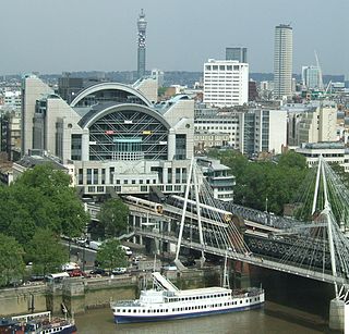
<span class="mw-page-title-main">Charing Cross railway station</span> Central London railway terminus

Charing Cross railway station is a central London railway terminus between the Strand and Hungerford Bridge in the City of Westminster. It is the terminus of the Southeastern Main Lines to Dover via Ashford and Hastings via Tunbridge Wells. All trains are operated by Southeastern, which provides the majority of commuter and regional services to south-east London and Kent. It is connected to Charing Cross Underground station and is near to Embankment Underground station and Embankment Pier.
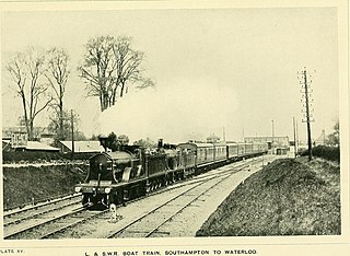
<span class="mw-page-title-main">London and South Western Railway</span> British pre-grouping railway company

The London and South Western Railway was a railway company in England from 1838 to 1922. Originating as the London and Southampton Railway, its network extended to Dorchester and Weymouth, to Salisbury, Exeter and Plymouth, and to Padstow, Ilfracombe and Bude. It developed a network of routes in Hampshire, Surrey and Berkshire, including Portsmouth and Reading.

<span class="mw-page-title-main">Vauxhall station</span> London Underground and railway station

Vauxhall is a National Rail, London Underground and London Buses interchange station in central London. It is at the Vauxhall Cross road junction opposite the southern approach to Vauxhall Bridge over the River Thames in the district of Vauxhall. The mainline station is run by the South Western Railway and is the first stop on the South West Main Line from London Waterloo towards Clapham Junction and the south-west. The Underground station is on the Victoria line and the station is close to St George Wharf Pier for river services.
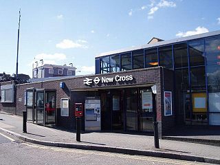
<span class="mw-page-title-main">New Cross railway station</span> National Rail station in London, England

New Cross railway station serves New Cross in south-east London, England. It is 4 miles 68 chains (7.8 km) down the line from London Charing Cross and is in London fare zone 2. The platforms are lettered rather than numbered to avoid confusion with those at New Cross Gate by staff who worked at both stations before privatisation of the stations in 1997. Platform D is used exclusively by London Overground services. Ticket barriers control access to all platforms.

<span class="mw-page-title-main">Epsom railway station</span> Railway station in Surrey, England

Epsom railway station serves the town of Epsom in Surrey, England. It is located off Waterloo Road and is less than two minutes' walk from the town's high street. It is 14 miles 18 chains (22.9 km) down the line from London Waterloo.

<span class="mw-page-title-main">Catford Bridge railway station</span> National Rail station in London, England

Catford Bridge railway station is on the Mid-Kent Line, serving Hayes line trains from London to Hayes. It lies between Ladywell and Lower Sydenham stations, 7 miles 42 chains (12.1 km) from London Charing Cross and in Travelcard Zone 3. It is adjacent to Catford railway station on the Catford Loop line. The station entrance is on Catford Road, a part of the South Circular Road (A205), and has brick buildings on both platforms, though the up side building is no longer in use by the railway. The station is managed by Southeastern, who operate all trains serving it.

<span class="mw-page-title-main">St Johns railway station</span> National Rail station in London, England

St Johns railway station is in the London Borough of Lewisham. It lies 5 miles 47 chains (9.0 km) down the South Eastern Main Line from London Charing Cross, and is situated between New Cross and Lewisham.

<span class="mw-page-title-main">Ladywell railway station</span> National Rail station in London, England

Ladywell railway station is in Ladywell, in the London Borough of Lewisham in south east London, in Travelcard Zone 3. It is 6 miles 62 chains (10.9 km) measured from London Charing Cross.

<span class="mw-page-title-main">Lower Sydenham railway station</span> National Rail station in London, England

Lower Sydenham railway station is located on the boundary of the London Borough of Bromley and the London Borough of Lewisham in south-east London. It is 9 miles 2 chains (14.5 km) measured from London Charing Cross.

<span class="mw-page-title-main">New Beckenham railway station</span> National Rail station in London, England

New Beckenham railway station serves Beckenham in the London Borough of Bromley in south-east London, in Travelcard Zone 4. It is 9 miles 44 chains (15.4 km) measured from London Charing Cross.

<span class="mw-page-title-main">Hither Green railway station</span> National Rail station in London, England

Hither Green is a railway station located in Hither Green in the London Borough of Lewisham, south-east London. It is 7 miles 16 chains (11.6 km) down the line from London Charing Cross and is situated between Lewisham and either Grove Park or Lee depending on the route.

<span class="mw-page-title-main">Guildford railway station</span> Railway station in Guildford, Surrey, England

Guildford railway station is at one of three main railway junctions on the Portsmouth Direct Line and serves the town of Guildford in Surrey, England. It is 30 miles 27 chains down the line from London Waterloo via Woking.

<span class="mw-page-title-main">Rainham railway station (Kent)</span> Railway station in Kent, England

Rainham railway station is on the Chatham Main Line in South East England, serving the town of Rainham, Kent. It is 38 miles 74 chains (62.6 km) down the line from London Victoria and is situated between Gillingham and Newington.

<span class="mw-page-title-main">Sevenoaks railway station</span> Railway station in Kent, England

Sevenoaks railway station is a railway station on the South Eastern Main Line in England, serving the town of Sevenoaks, Kent. It is 22 miles 9 chains (35.6 km) down the line from London Charing Cross and is situated between Dunton Green and Hildenborough stations. Trains calling at the station are operated by Southeastern and Thameslink.

<span class="mw-page-title-main">Folkestone West railway station</span> Railway station in Kent, England

Folkestone West railway station is on the South Eastern Main Line in England, serving the western area of Folkestone, Kent. It is 69 miles 22 chains (111.5 km) down the line from London Charing Cross. All trains that call are operated by Southeastern.

<span class="mw-page-title-main">Robertsbridge railway station</span> Railway station in East Sussex, England

Robertsbridge railway station is on the Hastings line in the south of England and serves the village of Robertsbridge, East Sussex. It is 49 miles 47 chains (79.8 km) down the line from London Charing Cross. The station and all trains serving it are operated by Southeastern.

<span class="mw-page-title-main">Staines railway station</span> Railway station in Surrey, England

Staines railway station is on the Waterloo to Reading line and is the junction station for the diverging Windsor line, in southern England to the west of London. It is 19 miles 2 chains (30.6 km) down the line from London Waterloo.
References

Citations

  1. "Out of Station Interchanges" (XLSX). Transport for London. 16 June 2020. Retrieved 5 November 2020.
  2. 1 2 3 4 5 6 7 8 9 10 "Estimates of station usage". Rail statistics. Office of Rail Regulation. Please note: Some methodology may vary year on year.
  3. "Station facilities for London Waterloo East". National Rail Enquiries. Retrieved 29 May 2013.
  4. Yonge 2008, map 3A.
  5. "Travelling to, from and via London". National Rail Enquiries. Retrieved 13 December 2018.
  6. "Where Do London's Mysterious Overhead Footbridges Go?". Londonist. 3 February 2017. Retrieved 11 April 2018.
  7. 1 2 Binney, Marcus (2 March 1999). "Sights at the end of the tunnel" . The Times. London. p. 18. Retrieved 23 September 2018.
  8. "Standard Tube Map". Transport for London. Retrieved 24 September 2018.
  9. Jefferson, Ed (3 August 2016). "From Platform 0 to Platform 9¾: The strange world of British Rail mathematics". CityMetric. Retrieved 21 September 2018.
  10. "Buses from Waterloo" (PDF). TfL. 15 June 2019. Retrieved 1 June 2020.
  11. "Night buses from Waterloo" (PDF). TfL. 15 June 2019. Retrieved 1 June 2020.
  12. 1 2 Jackson 1984, pp. 216–217.
  13. Gray 1990, p. 111.
  14. Gray 1990, p. 119.
  15. Jackson 1984, p. 244.
  16. Gray 1990, pp. 119–120.
  17. Jackson 1984, pp. 216–217, 244.
  18. "Sleeping Cars from Calais to Brindisi" . The Times. London. 3 June 1879. p. 13. Retrieved 21 September 2018.
  19. 1 2 "The Waterloo Link". London Reconnections. 4 January 2011. Retrieved 25 September 2018.
  20. "New Station At Waterloo Junction" . The Times. London. 1 January 1869. p. 9. Retrieved 21 September 2018.
  21. Maggs 2016, p. 104.
  22. Jackson 1984, p. 176.
  23. Gray 1990, p. 120.
  24. "Some Little-Known Railway Stations". The Railway Magazine. 8: 122–123. 1901.
  25. Gray 1990, p. 124.
  26. Maggs 2017, p. 131.
  27. Jackson 1984, p. 224.
  28. 1 2 Christopher 2015, p. 153.
  29. 1 2 Butt 1995, p. 242.
  30. Jackson 1984, p. 362.
  31. "Waterloo East Pedestrian Link" (Document). Channel Connection. 1992. p. 4.
  32. Slade 2016, p. 126.
  33. Hughes, Simon (18 May 1992). "Jubilee Line Extension". Hansard. Retrieved 19 April 2018.
  34. Day & Reed 2010, p. 207.
  35. "Waterloo Station's New 220m Balcony Opens to Reduce Congestion in Time for Olympic Games". Network Rail. 17 July 2012.
  36. "Southwark Tube station could get second entrance to "help ease overcrowding"". London Evening Standard. 12 September 2018. Retrieved 24 September 2018.
  37. "London Waterloo East". South Eastern Railway. Retrieved 24 September 2018.
  38. Table 199, 200, 201, 203, 204, 206, 207, 212 National Rail timetable, May 2023
  39. "Another Railway Accident" . The Times. London. 27 October 1913. p. 9+. Retrieved 21 September 2018.
  40. "The London Railway Accident" . The Times. London. 4 November 1913. p. 4. Retrieved 21 September 2018.

Sources