New Cross railway station

Last updated

New Cross National Rail logo.svg Overground roundel (no text).svg
New Cross Station, SE14 - geograph.org.uk - 874214.jpg
Entrance to New Cross station
Greater London UK location map 2.svg
Red pog.svg
New Cross
Location of New Cross in Greater London
Location New Cross
Local authority London Borough of Lewisham
Managed by Southeastern
Owner Network Rail
Station codeNWX
DfT category C2
Number of platforms4
AccessibleYes [1]
Fare zone 2
OSI New Cross Gate National Rail logo.svg Overground roundel (no text).svg [2]
National Rail annual entry and exit
2018–19Increase2.svg 4.784 million [3]
– interchange Increase2.svg 0.840 million [3]
2019–20Increase2.svg 4.877 million [3]
– interchange Decrease2.svg 0.827 million [3]
2020–21Decrease2.svg 0.903 million [3]
– interchange Decrease2.svg 0.174 million [3]
2021–22Increase2.svg 2.492 million [3]
– interchange Increase2.svg 0.451 million [3]
2022–23Increase2.svg 3.071 million [3]
– interchange Increase2.svg 4.609 million [3]
Key dates
October 1850Opened
October 1850East London Line opened
22 December 2007 London Underground services discontinued
27 April 2010 East London Line reopened
Other information
External links
WGS84 51°28′36″N0°01′58″W / 51.4766°N 0.0327°W / 51.4766; -0.0327
Underground sign at Westminster.jpg  London transportportal

New Cross railway station serves New Cross in south-east London, England. It is 4  miles 68  chains (7.8 km) down the line from London Charing Cross and is in London fare zone 2. The platforms are lettered rather than numbered to avoid confusion with those at New Cross Gate by staff who worked at both stations before privatisation of the stations in 1997. Platform D is used exclusively by London Overground services. Ticket barriers control access to all platforms.

Contents

History

A 1908 Railway Clearing House map showing lines around New Cross (lower right, indicated "S.E.& C.") Bricklayers Arms & New Cross, Midhurst RJD 91.jpg
A 1908 Railway Clearing House map showing lines around New Cross (lower right, indicated "S.E.& C.")

In the early Victorian railway boom two companies constructed lines through the area. The London and Croydon Railway (L&CR) built a station on the New Cross Road close to Hatcham in 1839.

On 14 October 1844 a large fire that broke out in a paint shop destroyed carriage and engine sheds and workshops adjacent to the station. The fire was witnessed by Louis Philippe I, King of France who was travelling from the station to Dover. [4]

On 30 July 1849 the South Eastern Railway (SER) opened a station at North Kent Junction when the North Kent line opened linking Strood with the London and Greenwich Railway route to London Bridge. [5] [6] This station proved inconvenient so a new station called New Cross & Naval School [5] was opened by the SER in October 1850 located adjacent to the New Cross Road in the heart of New Cross. In 1854 the station was renamed New Cross. Accordingly, both the South Eastern Railway (SER) and the London Brighton & South Coast Railway had stations named New Cross which caused confusion until the two companies were absorbed under the 1923 grouping into the Southern Railway and the name of the older station was changed to New Cross Gate; the ex-South Eastern station remained New Cross.

On 7 December 1869 the East London Line opened serving the LBSCR New Cross station but it was not until 1 April 1880 that services (which started at Addiscombe and worked through to Liverpool Street) started operation via New Cross SER. Freight trains also operated via the East London Line and were hauled by Great Eastern Railway locomotives through to Hither Green Goods Yards. From 30 June 1911 East London Line passenger services south of New Cross ceased.

On 31 March 1913 electric passenger services operated by the Metropolitan Railway started operation from New Cross and worked through to Kensington Addison Road via Kings Cross. [7]

After World War II and following nationalisation on 1 January 1948, the station was part of British Railways Southern Region.

The East London Line was closed to goods traffic in 1962.

In the 1950s and 1960s, London Underground planned a new line connecting north-west and south-east London. Approval for the first stage of the Fleet line (renamed the Jubilee line in 1975) to Charing Cross was granted in 1969, [8] with second and third stages approved in 1971 and 1972. [9] New Cross station was to be the penultimate station of phase 3 running to Lewisham. Southbound trains were to serve one of the existing platforms and northbound trains would have served a new platform in tunnel beneath the station. [9] Although phases 2 and 3 were not carried out due to a lack of funds, a 200-yard (180 m) section of the northbound tunnel was constructed near New Cross in 1972 to test new tunnelling techniques. [10]

The station was rebuilt in the 1970s and the original station buildings on the road bridge were replaced in 1975 by a wooden building which opened in Amersham Vale. Platforms on the down and up fast lines were closed and demolished and a new track layout was introduced at this time in connection with the wider London Bridge re-signaling scheme. [11]

In 1985, the present buildings in Amersham Vale opened. [12]

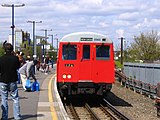
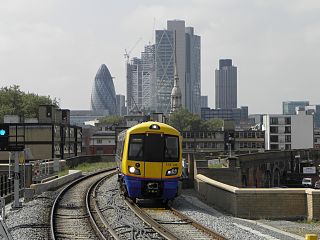
Until 22 December 2007 London Underground used to serve this station as the southern terminus to their East London Line. This closed for major engineering work to convert the East London Line to standard 750 V third rail electrification. The line reopened on 27 April 2010 with services now operated by London Overground using Class 378 Capitalstar units.

Carriage Shed

A 6 siding carriage shed was located just north of the station. Built by the East London Railway the shed was leased by the Metropolitan Railway and continued in service until the line closed in 2007. When the line re-opened the new Capitalstar units were maintained at a new depot at New Cross Gate. [13]

Services

Services at New Cross are operated by Southeastern and London Overground using Class 376, 378, 465, 466 and 707 EMUs.

The typical off-peak service in trains per hour is: [14]

During the peak hours, the station is served by an additional half-hourly circular service to and from London Cannon Street via Sidcup in the clockwise direction and Woolwich Arsenal and Greenwich in the anticlockwise direction.

The station is also served by a single early morning train per day that extends beyond Dalston Junction to Highbury & Islington.

Platform layout

Preceding station National Rail logo.svg National Rail Following station
Southeastern
Southeastern
Southeastern
Southeastern
Peak Hours Only
Preceding station Overground notextroundel.svg National Rail logo.svg London Overground Following station
Surrey Quays Windrush line
New Cross branch
Terminus
Former services
Preceding station Underground no-text.svg London Underground Following station
Surrey Docks
towards Hammersmith
Metropolitan line
(1884–1906)
(1913–39)
Terminus
Surrey Quays
towards Shoreditch
East London line
(1940–2007)
Abandoned plans
Preceding station Underground no-text.svg London Underground Following station
Surrey Docks
towards Stanmore
Jubilee line
Phase 3 (never constructed)
Lewisham
Terminus

Connections

London Buses routes 53, 177, 225, 453 and night routes N53 and N89 serve the station. [15] [16]

Accidents

Related Research Articles

<span class="mw-page-title-main">East London line</span> London Overground line

The East London line is part of the London Overground, running north to south through the East, Docklands and South areas of London. It was previously a line of the London Underground.

<span class="mw-page-title-main">Greenwich station</span> Docklands Light Railway and National Rail station

Greenwich station is about 400 m south-west of the district centre, in London, England. It is an interchange between National Rail between central London and Dartford, and the Docklands Light Railway (DLR) between Lewisham to the south and Docklands and the City of London. It is in Travelcard Zones 2 and 3.

<span class="mw-page-title-main">Surrey Quays railway station</span> London Overground station

Surrey Quays is a station on the East London Line of the London Overground. It is located in Rotherhithe, part of London Borough of Southwark; it is in Zone 2. The next station to the north is Canada Water; to the south, it splits into branches to Clapham Junction, New Cross and Crystal Palace/West Croydon. Closed in late 2007 as an underground station, it was refurbished and reopened as part of the London Overground network on 27 April 2010.

<span class="mw-page-title-main">Waterloo East railway station</span> Railway station in central London

Waterloo East railway station, also known as London Waterloo East, is a railway station in central London on the line from Charing Cross through to London Bridge towards Kent, in the south-east of England. It is to the east of London Waterloo railway station and close to Southwark tube station.

<span class="mw-page-title-main">Denmark Hill railway station</span> National rail station in London, England

Denmark Hill railway station is in the area of Denmark Hill in south London, England, on the South London and Catford Loop lines. It is 4 miles 22 chains (6.9 km) down the line from London Victoria. It is managed by Thameslink. The station is located in London fare zone 2. The station runs services by Thameslink, Southeastern and London Overground.

<span class="mw-page-title-main">Peckham Rye railway station</span> National rail station in London, England

Peckham Rye is a railway station in Peckham town centre, South London. It opened on 1 December 1865 for LC&DR trains and on 13 August 1866 for LB&SCR trains. It was designed by Charles Henry Driver (1832–1900), the architect of Abbey Mills and Crossness pumping stations, who also designed the grade II listed Denmark Hill and Battersea Park stations between here and London Victoria. The station is served by Southern, London Overground, Southeastern and Thameslink.

<span class="mw-page-title-main">Queens Road Peckham railway station</span> British railway station

Queens Road Peckham railway station is in the London Borough of Southwark and also serves the area to the east of Peckham, in the London Borough of Lewisham. It is on the South London Line, 2 miles 58 chains (4.4 km) from London Bridge, and trains also go to Croydon via various routes and beyond. It is on the road of that name and is in Travelcard Zone 2.

<span class="mw-page-title-main">Catford Bridge railway station</span> National Rail station in London, England

Catford Bridge railway station is on the Mid-Kent Line, serving Hayes line trains from London to Hayes. It lies between Ladywell and Lower Sydenham stations, 7 miles 42 chains (12.1 km) from London Charing Cross and in Travelcard Zone 3. It is adjacent to Catford railway station on the Catford Loop line. The station entrance is on Catford Road, a part of the South Circular Road (A205), and has brick buildings on both platforms, though the up side building is no longer in use by the railway. The station is managed by Southeastern, who operate all trains serving it.

<span class="mw-page-title-main">Petts Wood railway station</span> Railway station in southern England

Petts Wood railway station is on the South Eastern Main Line, serving Petts Wood in the London Borough of Bromley, south-eastern Greater London. It is 12 miles 53 chains (20.4 km) down the line from London Charing Cross and is situated between Chislehurst and Orpington stations. It is in Travelcard zone 5.

<span class="mw-page-title-main">Sanderstead railway station</span> National Rail station in London, England

Sanderstead railway station is on the Oxted Line in the London Borough of Croydon, 1 mile (1.6 km) from Sanderstead village. It is in Travelcard Zone 6, 12 miles 23 chains from London Bridge. The station is managed by Southern.

<span class="mw-page-title-main">Ladywell railway station</span> National Rail station in London, England

Ladywell railway station is in Ladywell, in the London Borough of Lewisham in south east London, in Travelcard Zone 3. It is 6 miles 62 chains (10.9 km) measured from London Charing Cross.

<span class="mw-page-title-main">Lower Sydenham railway station</span> National Rail station in London, England

Lower Sydenham railway station is located on the boundary of the London Borough of Bromley and the London Borough of Lewisham in south-east London. It is 9 miles 2 chains (14.5 km) measured from London Charing Cross.

<span class="mw-page-title-main">New Beckenham railway station</span> National Rail station in London, England

New Beckenham railway station serves Beckenham in the London Borough of Bromley in south-east London, in Travelcard Zone 4. It is 9 miles 44 chains (15.4 km) measured from London Charing Cross.
<span class="mw-page-title-main">Clock House railway station</span> National Rail station in London, England

Clock House railway station is in the London Borough of Bromley in south east London, in Travelcard Zone 4 between Beckenham and Penge. It is 10 miles 23 chains (16.6 km) down the line from London Charing Cross. The station and all trains serving it are operated by Southeastern on the Hayes line.

<span class="mw-page-title-main">West Wickham railway station</span> National Rail station in London, England

West Wickham railway station serves West Wickham in the London Borough of Bromley. It is located in Southeast London and is in Travelcard Zone 5. It is 13 miles 19 chains (21.3 km) down the line from London Charing Cross.

<span class="mw-page-title-main">Otford railway station</span> Railway station in Kent, England

Otford railway station serves Otford in Kent. It is 24 miles 6 chains (38.7 km) down the line from London Victoria. Train services are provided by Southeastern and Thameslink.

<span class="mw-page-title-main">Headcorn railway station</span> Railway station in Kent, England

Headcorn railway station is on the South Eastern Main Line in England, serving the village of Headcorn, Kent. It is 45 miles 20 chains (72.8 km) down the line from London Charing Cross. The station and all trains that serve the station are operated by Southeastern.

<span class="mw-page-title-main">Cheshunt railway station</span> National Rail station in Hertfordshire, England

Cheshunt is a National Rail and London Overground station in Cheshunt, Hertfordshire, England. On the National Rail network it is on the West Anglia Main Line, 14 miles 1 chain (22.6 km) from London Liverpool Street and situated between Waltham Cross and Broxbourne. On the London Overground network it is one of three northern termini of the Lea Valley lines.

<span class="mw-page-title-main">Dalston Junction railway station</span> Railway station in London, England

Dalston Junction is an inter-modal rail and bus transport interchange in Dalston, London. It is located at the crossroads of Dalston Lane, Kingsland Road and Balls Pond Road. The station served by London Overground East London line and is in Zone 2. The station is located in a short section of cut and cover tunnel north of the Kingsland Viaduct.

<span class="mw-page-title-main">Haggerston railway station</span> London Overground station

Haggerston is a London Overground station in Haggerston, London, England, served by the East London line. It lies between Hoxton and Dalston Junction stations, is in Travelcard Zone 2, and is open 24 hours on a Friday and Saturday as part of the London Overground Night Service service. The station was rebuilt as part of the East London line extension.

References

  1. "Step free Tube Guide" (PDF). Transport for London . April 2021. Archived (PDF) from the original on 15 May 2021.
  2. "Out of Station Interchanges" (XLSX). Transport for London. 16 June 2020. Retrieved 5 November 2020.
  3. 1 2 3 4 5 6 7 8 9 10 "Estimates of station usage". Rail statistics. Office of Rail Regulation. Please note: Some methodology may vary year on year.
  4. "Destructive Fire at New Cross Railway Station". Illustrated London News . 19 October 1844. p. 253. Retrieved 20 March 2019.
  5. 1 2 Chronology of London Railways by H.V.Borley
  6. Londons Disused Stations Volume 4 by J.E.Connor
  7. Mitchell, Vic; Smith, Keith (1996). East London Line. Midhurst, UK: Middleton Press. p. 5. ISBN   1-873793-80-4.
  8. Horne, Mike (2000). The Jubilee Line. Capital Transport. pp. 28–34. ISBN   1-85414-220-8.
  9. 1 2 Horne, Mike (2000). The Jubilee Line. Capital Transport. p. 36. ISBN   1-85414-220-8.
  10. Horne, Mike (2000). The Jubilee Line. Capital Transport. p. 37. ISBN   1-85414-220-8.
  11. Mitchell, Vic; Smith, Keith (1996). East London Line. Midhurst, UK: Middleton Press. p. 60. ISBN   1-873793-80-4.
  12. Mitchell, Vic; Smith, Keith (1996). East London Line. Midhurst, UK: Middleton Press. p. 64. ISBN   1-873793-80-4.
  13. Mitchell, Vic; Smith, Keith (1996). East London Line. Midhurst, UK: Middleton Press. p. 65. ISBN   1-873793-80-4.
  14. Table 199, 200, 203, 204 National Rail timetable, December 2022
  15. "Buses from New Cross" (PDF). TfL. 4 February 2023. Retrieved 5 February 2023.
  16. "Night buses from New Cross" (PDF). TfL. June 2022. Retrieved 5 February 2023.
  17. "Buffer stop collision at Enfield Town station 12 October 2021" (PDF). Para 105: Rail Accidents Investigation Branch. Retrieved 6 July 2022.{{cite web}}: CS1 maint: location (link)