The Metropolitan line, colloquially known as the Met, is a London Underground line between Aldgate in the City of London and Amersham and Chesham in Buckinghamshire, with branches to Watford in Hertfordshire and Uxbridge in Hillingdon. Printed in magenta on the tube map, the line is 41.4 miles (66.7 km) in length and serves 34 stations. Between Aldgate and Finchley Road, the track is mostly in shallow "cut and cover" tunnels, apart from short sections at Barbican and Farringdon stations. The rest of the line is above ground, with a loading gauge of a similar size to those on main lines. Just under 67 million passenger journeys were made on the line in 2011/12.

Baker Street is a London Underground station at the junction of Baker Street and the Marylebone Road in the City of Westminster. It is one of the original stations of the Metropolitan Railway (MR), the world's first underground railway, opened on 10 January 1863.

Amersham is a London Underground and National Rail station in Amersham in the Chiltern district of Buckinghamshire, England.

Moorgate is a central London railway terminus and connected London Underground station on Moorgate in the City of London. Main line railway services for Hertford, Welwyn Garden City and Stevenage are operated by Great Northern, while the Underground station is served by the Circle, Hammersmith & City, Metropolitan and Northern lines.
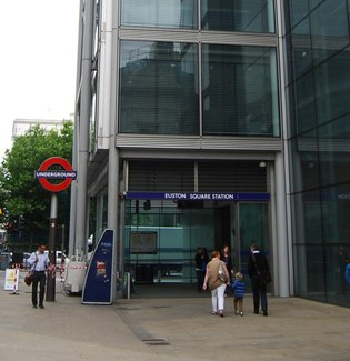
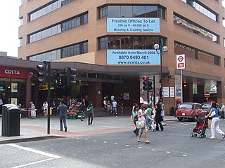
Euston Square is a London Underground station at the corner of Euston Road and Gower Street, just north of University College London – its main entrance faces the tower of University College Hospital. The multi-interchange Euston station is beyond Euston Square Gardens, which is one street east. The station is between Great Portland Street and King's Cross St Pancras on the Circle, Hammersmith & City and Metropolitan lines in Travelcard Zone 1.
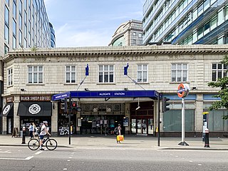
Aldgate is a London Underground station near Aldgate in the City of London. The station is on the Circle line between Tower Hill and Liverpool Street, and is the eastern terminus of the Metropolitan line. It is in Travelcard Zone 1.

Great Portland Street is a London Underground station near Regent's Park. It is between Baker Street and Euston Square on the Hammersmith & City, Circle and Metropolitan lines. Great Portland Street station is listed as a building of National Significance and lies in Travelcard Zone 1.

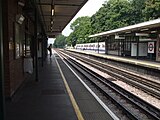
Chalfont & Latimer is a London Underground and National Rail station in Travelcard Zone 8 on the Metropolitan line, in Buckinghamshire. It also serves the Chiltern Railways line to Aylesbury. Chalfont & Latimer station is located just before the junction for trains to Chesham. The station serves Chalfont St Giles, Chalfont St Peter, Little Chalfont and Latimer. It is located in Little Chalfont. It opened as "Chalfont Road" on 8 July 1889 but changed to the present name from 1 November 1915. The station is a good location to alight from to explore the Chess Valley.

Northwood Hills is a London Underground station on the Metropolitan line in the area of Northwood, between Northwood and Pinner stations and is in Travelcard Zone 6.
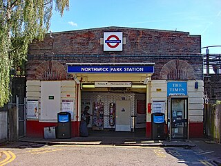
Northwick Park is a London Underground station in Kenton in the London Borough of Brent on the Metropolitan line. It lies between Harrow-on-the-Hill and Preston Road stations and is in Travelcard zone 4.
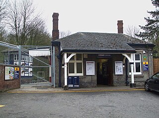
Chesham tube station is a London Underground station in Chesham, Buckinghamshire, United Kingdom. It was opened on 8 July 1889 by the Metropolitan Railway (MR). It is the terminus station of the Chesham branch of the Metropolitan line, which runs from Chalfont & Latimer. The station, a Grade II listed building, is in London fare Zone 9.

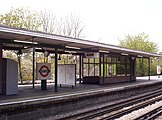
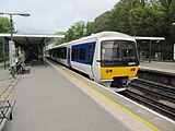
Chorleywood is a London Underground and National Rail station in Travelcard Zone 7 on the Metropolitan line. The village of Chorleywood is in the Three Rivers district of Hertfordshire about 20 miles (32 km) from London. Chorleywood station is also served by Chiltern Railways, which runs trains from London Marylebone station through to Aylesbury.
Pinner is a London Underground station on the Metropolitan line in zone 5. The station was opened in 1885 as part of the Victorian expansion of dormitory suburbs, and was one of the stations included in the Metro-land project in the early 20th century. The site is served by several bus routes including links to the Hatch End railway station which was known as Pinner & Hatch End prior to 1920. Step free facilities were opened in 2008. Its adjacent stations are Northwood Hills (northbound) and North Harrow (southbound).
Harrow-on-the-Hill is an interchange railway station in Harrow, served by suburban London Underground Metropolitan line services and commuter National Rail services on the London–Aylesbury line. It is 9 miles 18 chains down the line from London Marylebone. Harrow-on-the-Hill is the final Metropolitan line stop from Central London before the line splits with the main branch towards Moor Park and the diverged Uxbridge branch towards Uxbridge. It is in Travelcard Zone 5.

North Harrow is a London Underground station situated in North Harrow in North West London. The station is on the Metropolitan line between Harrow-on-the-Hill (southbound) and Pinner (northbound). Fast Metropolitan line and Chiltern Railways services pass by using two of the four tracks. It has won Transport for London awards for best customer service in 2009 and 2010.

West Harrow is a London Underground station in Harrow in north west London.
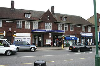
Preston Road is a London Underground station on the Metropolitan line in the London Borough of Brent. It lies between Northwick Park and Wembley Park stations and is in Travelcard Zone 4. It serves the local area of Preston in Wembley and parts of Kenton.

Croxley is a London Underground station located on Watford Road (A412) in Croxley Green, Rickmansworth, Hertfordshire, on the Watford branch of the Metropolitan line. It is the only intermediate station on the branch between Moor Park, on the main line from Baker Street to Amersham, and the terminus at Watford.

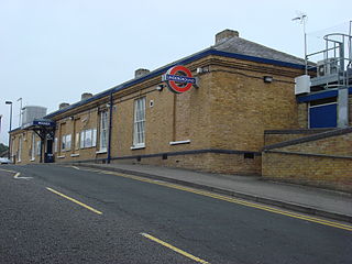
Rickmansworth is an interchange railway station in Rickmansworth, Hertfordshire, northwest of central London, served by the London Underground Metropolitan line and by Chiltern Railways. It is one of the few London Underground stations beyond Greater London and as a consequence is in Travelcard Zone 7. The station is a good location to alight from to explore the Chess Valley.

Northwood is a station on the Watford branch of the Metropolitan line, in Travelcard Zone 6. The station is located just off the main road through the town, Green Lane. The line serves as the sole continuous link between the town of Northwood and London, key for a region known as Metro-Land.