
Hertford is the county town of Hertfordshire, England, and is also a civil parish in the East Hertfordshire district of the county. The parish had a population of 26,783 at the 2011 census.

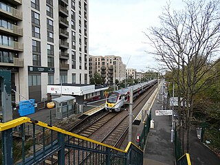
Stratford is a major multi-level interchange station serving the district of Stratford and the mixed-use development known as Stratford City, in the London Borough of Newham, East London for London Underground, London Overground, Docklands Light Railway (DLR) and Elizabeth line services. National Rail services also operate on the West Anglia Main Line and the Great Eastern Main Line, 4 miles 3 chains (6.5 km) from Liverpool Street.
The Northern & Eastern Railway (N&ER) was an early British railway company, that planned to build a line from London to York. Its ambition was cut successively back, and it was only constructed from Stratford, east of London, to the towns of Bishop's Stortford and Hertford. It was always short of money, and it got access to London over the Eastern Counties Railway (ECR). It was built at the track gauge of 5 ft, but it converted to standard gauge in 1844.

Tottenham Hale is an interchange station located in Tottenham Hale, North London for London Underground and National Rail services.
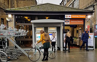
Hackney Downs is a London Overground and National Rail station in Hackney Central and serves the old common land of Hackney Downs in Lower Clapton in the London Borough of Hackney, it is on the Lea Valley lines and West Anglia Main Line. It is 2 miles 78 chains (4.8 km) down the line from London Liverpool Street and has a direct passenger link to Hackney Central station, providing interchange with the North London line of the Overground network.
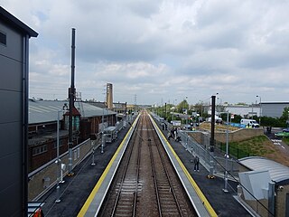
Ponders End railway station is on the West Anglia Main Line, serving the district of Ponders End in the London Borough of Enfield, north London. It is 9 miles 71 chains (15.9 km) down the line from London Liverpool Street and is located between Meridian Water and Brimsdown. Its three-letter station code is PON and it is in Travelcard zone 5.

Brimsdown railway station is on the Lea Valley line that forms part of the West Anglia Main Line, serving the neighbourhood of Brimsdown in the London Borough of Enfield, north London. It is 10 miles 61 chains (17.3 km) down the line from London Liverpool Street and is situated between Ponders End and Enfield Lock. Its three-letter station code is BMD and it is in Travelcard zone 5.

Enfield Lock railway station is on the West Anglia Main Line, it is in Enfield Lock in the London Borough of Enfield, London. It is 11 miles 65 chains (19.0 km) down the line from London Liverpool Street and is situated between Brimsdown and Waltham Cross. Its three-letter station code is ENL and it is in Travelcard zone 6.

The Lea Valley lines are two commuter lines and two branches in north-east London, so named because they run along the Lower Lea Valley of the River Lea. They were part of the Great Eastern Railway, now part of the Anglia Route of Network Rail.

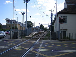
St Margarets railway station is on the Hertford East branch line off the West Anglia Main Line in the east of England, serving the villages of Stanstead St Margarets and Stanstead Abbotts, Hertfordshire. It is 20 miles 25 chains (32.7 km) down the line from London Liverpool Street and is situated between Rye House and Ware. Its three-letter station code is SMT. It is in the civil parish of Great Amwell.

Rye House railway station is on the Hertford East branch line off the West Anglia Main Line in the east of England, serving the Rye House area of Hoddesdon, Hertfordshire. It is 18 miles 71 chains (30.4 km) down the line from London Liverpool Street and is situated between Broxbourne and St Margarets. Its three-letter station code is RYH.

Broxbourne railway station is on the West Anglia Main Line serving the towns of Broxbourne and Hoddesdon in Hertfordshire, England. It is 17 miles 17 chains (27.7 km) down the line from London Liverpool Street and is situated between Cheshunt and Roydon. Its three-letter station code is BXB and it is in fare zone B.

Cheshunt is a National Rail and London Overground station in Cheshunt, Hertfordshire, England. On the National Rail network it is on the West Anglia Main Line, 14 miles 1 chain (22.6 km) from London Liverpool Street and situated between Waltham Cross and Broxbourne. On the London Overground network it is one of three northern termini of the Lea Valley lines.

Waltham Cross railway station is on the West Anglia Main Line, serving the suburban town of Waltham Cross in Hertfordshire, and the neighbouring Waltham Abbey in Essex, England. It is 12 miles 63 chains (20.6 km) down the line from London Liverpool Street and is situated between Enfield Lock and Cheshunt. Its three-letter station code is WLC and it is in Travelcard zone 7.
Ware railway station is on the Hertford East branch line off the West Anglia Main Line in the east of England, serving the town of Ware, Hertfordshire. It is 22 miles 16 chains (35.7 km) down the line from London Liverpool Street and is situated between St Margarets and Hertford East. Its three-letter station code is WAR.

Hertford East railway station is the northern terminus of the Hertford East branch line off the West Anglia Main Line in the east of England, and is located in the town of Hertford in Hertfordshire. It is 24 miles 19 chains (39.0 km) down the line from London Liverpool Street and is one of two stations in the town, the other being Hertford North on the Hertford Loop Line. Its three-letter station code is HFE.

The West Anglia Main Line is one of the two main lines that operate out of Liverpool Street. It runs generally north through Cheshunt, Broxbourne, Harlow, Bishop's Stortford and Audley End to Cambridge, with branches between serving Stratford, Hertford and Stansted Airport. The line runs along the boundary between Hertfordshire and Essex for much of its length.
Lea Bridge is a railway station on the line between Stratford and Tottenham Hale on the Lea Valley Lines, which reopened on 15 May 2016 with the full service beginning on 16 May 2016, operated by Greater Anglia.
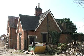
The Buntingford branch line in Hertfordshire, England, connected Buntingford to the railway network at St Margarets. It was promoted locally and opened in 1863 after overspending its available capital. The line was completed with the assistance of the neighbouring Great Eastern Railway. Residential travel and goods services became significant at the end of the 19th century. The area served by the line was predominantly agricultural, and after 1948 usage did not keep pace with rising costs. When the Hertford East branch was electrified, Buntingford branch trains were reduced in frequency with through trains to London withdrawn. The line was recommended for closure in the Beeching Report, and the passenger service was withdrawn in 1964; goods services closed in 1965.

The Southbury Loop is a line linking Edmonton Green, in north-east London, to Cheshunt. It was opened by the Great Eastern Railway in 1891. Initially it was not very successful and was closed to passenger traffic in 1909. Goods trains continued to use the line and during World War I passenger services were reinstated for munitions workers. Once the war finished the line returned to its goods-only status although it was occasionally used for diversionary purposes when the West Anglia Main Line was closed south of Cheshunt. Electrification of the line and the reintroduction of passenger services in 1960 saw the line become busy with regular suburban services as part of the Lea Valley Lines network. Since May 2015 passenger services on the line are part of London Overground.


