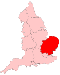
Breckland line

Last updated

Breckland line
Train approaching Shippea Hill station - geograph.org.uk - 1519343.jpg
Shippea Hill in the typically flat Fens
Overview
StatusOperational
Owner Network Rail
Locale East of England
Termini
Stations12
Service
Type Heavy rail
System National Rail
Operator(s) Greater Anglia
CrossCountry
East Midlands Railway
Great Northern
Rolling stock Class 158
Class 170
Class 387
Class 720
Class 755
History
Opened1845
Technical
Track length51 miles 8 chains (82.2 km)
Number of tracks2
CharacterSecondary [1]
Track gauge 4 ft 8+12 in (1,435 mm) standard gauge
Loading gauge W10
Electrification 25 kV AC (between Cambridge and Ely and around Norwich)
Operating speed75–90 mph
Route map
Breckland line.png
(Click to expand)
Preserved British Railways Standard 7MT 70013 Oliver Cromwell near Hethersett in 2010, hauling a special train bound for the North Norfolk Railway. Locomotive70013OliverCromwellHethersett11March2010.jpg
Preserved British Railways Standard 7MT 70013 Oliver Cromwell near Hethersett in 2010, hauling a special train bound for the North Norfolk Railway.

The Breckland line is a secondary railway line in the east of England that links Cambridge in the west to Norwich in the east. The line runs through three counties: Cambridgeshire, Suffolk and Norfolk. It takes its name from the Breckland region of Norfolk and passes through Thetford Forest.

Contents

The line is 51 miles 8 chains (82.2 km) in length, from where it branches off the Fen line north of Ely to where it joins the Great Eastern Main Line south of Norwich. There are 12 stations on the line, including the termini.

The line is part of the Network Rail Strategic Route 5, SRS 05.09 and part of SRS 05.05. It is classified as a secondary line, except between Cambridge and Ely which is a London and South East commuter line. [1] Passenger services on the Breckland line are operated by Greater Anglia (which manages all of the stations), CrossCountry, East Midlands Railway and Great Northern.

History

Following the successful opening of the Yarmouth and Norwich Railway, the Norwich & Brandon Railway was incorporated in 1844 to build a line between those two places. The Eastern Counties Railway was at the same time building a route from Newport in Essex through Cambridge via Ely to Brandon. This route would be the first route between Norwich and London.

A month before opening, the Yarmouth and Norwich Railway and the Norwich & Brandon Railway merged to become the Norfolk Railway. [2]

The two lines opened on the same day, 30 July 1845, although the line only opened to a temporary station at Wensum, pending the completion of the Trowse swing bridge which was achieved in December 1845. Through services from Shoreditch (later known as Bishopsgate) to Norwich Thorpe station started on 15 December 1845. [3] [4]

Although it was expected that locomotive changes would take place between the two companies at Brandon, where an engine house had been built, the Norfolk Railway in fact operated trains to Ely. The ECR and its rival, the Eastern Union Railway (EUR), were both sizing up the NR to acquire and expand their railway empires. The ECR trumped the EUR by taking over the NR and became responsible for operating the services from 8 May 1848. [5]

By the 1860s, the railways in East Anglia were in financial trouble and most were leased to the Eastern Counties Railway, which wished to amalgamate formally but could not obtain government agreement for this until an Act of Parliament on 7 August 1862, when the Great Eastern Railway (GER) was formed by the amalgamation. [6]

The system settled down for the next six decades, apart from the disruption of the First World War. The difficult economic circumstances after the war led the Government to pass the Railways Act 1921 which led to the creation of the Big Four railway companies. The GER amalgamated with other railways to create the London and North Eastern Railway (LNER) on 1 January 1923.

In 1948, the line came under the British Railways Eastern Region.

Accidents and incidents

Accidents at Norwich Thorpe and Trowse, and those at Ely, Waterbeach, Cambridge North and Cambridge are not covered in this section.
The private level crossing on the Roudham Hall estate, which was the scene of an accident on 10 April 2016. Rural level crossing in Roudham - geograph.org.uk - 1710417.jpg
The private level crossing on the Roudham Hall estate, which was the scene of an accident on 10 April 2016.

Infrastructure

The line is double-track throughout but is only electrified between Cambridge and Ely, and also between Norwich and Trowse Junction, at 25 kV AC. It has a loading gauge of W8, except for the section connecting the Ipswich–Ely line to the Ely–Peterborough line, which is W10. The line speed ranges between 40 and 90 mph (64–145 km/h). [1]

Until 2012 the line retained its historic characteristics, with well preserved stations, semaphore signalling and, until spring 2009, lineside telegraph poles, along with sections of jointed rail on wooden sleepers. However, the two-stage Ely–Norwich re-signalling programme in August and December 2012 involved the closure of the nine local mechanical signal boxes and removal of the seven sets of manually-operated wooden gates at level crossings. The Cambridge signal box now controls the modern electronic interlockings which operate the lightweight LED signals, while the level crossings have been fully automated with barriers and warning lights.

Route

The Wymondham station sign Wymondham Train Station Name Sign.jpg
The Wymondham station sign

The places served by the route are listed below, with Ordnance Survey grid references provided for the stations:

PlaceStation and grid reference
Norwich Norwich: TG239083
Wymondham Wymondham: TG114009
Spooner Row Spooner Row: TM094974
Attleborough Attleborough: TM051950
Eccles and Quidenham Eccles Road: TM018900
East Harling Harling Road: TL977879
Thetford Thetford: TL867836
Brandon Brandon: TL784872
Lakenheath Lakenheath: TL723863
Burnt Fen area Shippea Hill: TL641841
Ely Ely: TL543793
Cambridge North Cambridge North: TL475606
Cambridge Cambridge: TL461572

Trains pass through Waterbeach station between Ely and Cambridge North without stopping.

Prickwillow station, between Ely and Shippea Hill stations, closed in 1850.

Services

Some of the stations on the Breckland line see just one stopping train in each direction per day, mostly in the Norwich direction in the morning and in the Cambridge direction in the afternoon or evening. Three stations on the line are request stops only: Spooner Row, Lakenheath and Shippea Hill. Harling Road and Eccles Road have peak-hour only services: two in each direction each day, Monday to Saturday (two in the morning to Norwich and two westbound in the evening, one of which is operated by East Midlands Railway on weekdays only).

Passenger services are operated by several companies:

Related Research Articles

<span class="mw-page-title-main">Thetford</span> Human settlement in England

Thetford is a market town and civil parish in the Breckland District of Norfolk, England. It is on the A11 road between Norwich and London, just east of Thetford Forest. The civil parish, covering an area of 29.55 km2 (11.41 sq mi), in 2011 had a population of 24,340.

<span class="mw-page-title-main">Mid-Norfolk Railway</span> Heritage railway in Norfolk, England

The Mid-Norfolk Railway (MNR) is a 17+12 miles (28.2 km) preserved standard gauge heritage railway, one of the longest in Great Britain. Preservation efforts began in 1974, but the line re-opened to passengers only in the mid-1990s as part of the "new generation" of heritage railways. The MNR owns and operates most of the former Wymondham-Fakenham branch line of the Norfolk Railway. The branch opened in 1847, was closed to passengers in stages from 1964 to 1969 as part of the Beeching cuts, and was finally fully closed to goods traffic in 1989.

<span class="mw-page-title-main">Bittern Line</span>

The Bittern Line is a railway branch line in Norfolk, England, that links Norwich to Sheringham. It passes through the Broads on its route to an Area of Outstanding Natural Beauty on the north Norfolk coast. It is named after the bittern, a rare bird found in the reedy wetlands of Norfolk.

<span class="mw-page-title-main">Norwich railway station</span> Railway station in Norwich, England

Norwich railway station is the northern terminus of the Great Eastern Main Line in the East of England, serving the city of Norwich, Norfolk. It is 114 miles 77 chains (185.0 km) down the main line from London Liverpool Street, the western terminus.

<span class="mw-page-title-main">Ely railway station</span> Railway station in Cambridgeshire, England

Ely railway station is on the Fen line in the east of England, serving the city of Ely, Cambridgeshire. It is 70 miles 30 chains (113.3 km) from London Liverpool Street and is situated between Waterbeach and Littleport stations on the Fen line to King's Lynn. It is an important junction for three other lines: the Ely to Peterborough Line, the Ipswich to Ely Line and the Norwich to Ely line.

<span class="mw-page-title-main">Harling Road railway station</span> Railway station in Norfolk, England

Harling Road railway station is on the Breckland line in the east of England, serving the villages of Larling, Roudham and East Harling, Norfolk. The line runs between Cambridge in the west and Norwich in the east.

<span class="mw-page-title-main">County School railway station</span> Railway station in Norfolk, England

County School railway station is on the Mid-Norfolk Railway in Norfolk, England; it will serve the villages of North Elmham and Guist once services resume. It is 17 miles 40 chains (28 km) down the line from Wymondham and is the northernmost station owned by the Mid-Norfolk Railway Preservation Trust.

<span class="mw-page-title-main">Wymondham railway station</span> Railway station in Norfolk, England, United Kingdom

Wymondham railway station is on the Breckland Line in the East of England, serving the town of Wymondham, Norfolk. The line runs between Cambridge in the west and Norwich in the east. It is situated between Spooner Row and Norwich, 113 miles 72 chains (183.3 km) from London Liverpool Street via Ely.

<span class="mw-page-title-main">Wymondham Abbey railway station</span> Railway station in Norfolk, England

Wymondham Abbey railway station is a railway station in the town of Wymondham in the English county of Norfolk. The station is served by heritage services operated by the Mid-Norfolk Railway (MNR) between Wymondham and East Dereham.

<span class="mw-page-title-main">Eccles Road railway station</span> Railway station in Norfolk, England

Eccles Road railway station is on the Breckland line in the east of England, serving the villages of Eccles, Quidenham and Wilby in Norfolk. The line runs between Cambridge in the west and Norwich in the east.

<span class="mw-page-title-main">Thetford railway station</span> Railway station in Norfolk, England

Thetford railway station is on the Breckland line in the east of England, serving the town of Thetford, Norfolk. The line runs between Cambridge in the west and Norwich in the east.

<span class="mw-page-title-main">Attleborough railway station</span> Railway station in Norfolk, England

Attleborough railway station is on the Breckland line in the east of England, serving the town of Attleborough, Norfolk. The line runs between Cambridge in the west and Norwich in the east. Attleborough is situated between Eccles Road and Spooner Row, 108 miles 19 chains (174.2 km) from London Liverpool Street via Ely.

<span class="mw-page-title-main">Spooner Row railway station</span> Railway Station in Norfolk, England

Spooner Row railway station is on the Breckland line in the East of England, serving the village of Spooner Row, Norfolk. The line runs between Cambridge in the west and Norwich in the east.

<span class="mw-page-title-main">Shippea Hill railway station</span> Railway station in Cambridgeshire, England

Shippea Hill railway station is on the Breckland Line in the east of England, serving the Burnt Fen area of Cambridgeshire and Suffolk. The line runs between Cambridge in the west and Norwich in the east.

<span class="mw-page-title-main">Brandon railway station</span> Railway station in Norfolk, England, United Kingdom

Brandon railway station is on the Breckland Line in the East of England, serving the town of Brandon, Suffolk, although the station is actually situated across the county boundary in Norfolk. The line runs between Cambridge in the west and Norwich in the east.

<span class="mw-page-title-main">Forncett railway station</span> Former railway station in South Norfolk, England

Forncett railway station was a railway station in Forncett, South Norfolk located 104 miles from London Liverpool Street. It was opened in 1849 when Norwich and Ipswich were connected by the Eastern Union Railway in 1849. Between 1881 and 1951 it was a junction for a short route to Wymondham and was closed as a result of the Beeching Axe with other smaller stations between Norwich and Ipswich.

<span class="mw-page-title-main">Hethersett railway station</span> Former railway station in Norfolk, England

Hethersett was a railway station near Hethersett, Norfolk.

<span class="mw-page-title-main">Railways in Norfolk</span>

Railways have played an important part in the history and development of the English county of Norfolk. It currently has thirty open National Rail stations, though there were once well over a hundred.

The Wymondham to Wells Branch was a railway built in stages by the Norfolk Railway, Eastern Counties Railway and Wells and Fakenham Company between 1847 and 1857. The railway ran from Wymondham in the south, through Dereham and Fakenham to the coastal town of Wells-next-the-Sea; more specifically, the line ran from Wymondham South Junction, where it met the present-day Breckland Line. Passenger services along the line lasted until 1969; the railway continued to be used for freight until 1989. The southern section of the railway now forms the Mid-Norfolk Railway, with part of the northern section serving as the narrow gauge Wells and Walsingham Light Railway.

<span class="mw-page-title-main">Norfolk Railway</span> Railway company in Norfolk, England operating from 1845 to 1862

The Norfolk Railway was an early railway company that controlled a network of 94 miles around Norwich, England. It was formed in 1845 by the amalgamation of the Yarmouth and Norwich Railway opened in 1844, and the Norwich and Brandon Railway, not yet opened. These lines were built out of frustration that the Eastern Counties Railway line that was expected to connect Norwich to London failed to be completed. The Norfolk Railway also leased the Lowestoft Railway and Harbour company, and built a branch to Dereham and Fakenham, opened in 1846 and 1849 respectively.

References

  1. 1 2 3 "Route 5 – West Anglia" (PDF). Network Rail. Archived from the original (PDF) on 7 June 2011. Retrieved 22 May 2009.
  2. Allen, Cecil J. (1975). Great Eastern Railway (3rd ed.). Shepparton, UK: Ian Allan Limited. p. 24. ISBN   0-7110-0659-8.
  3. "Station history". Wymondham Station. Archived from the original on 11 May 2006. Retrieved 4 May 2009.
  4. Allen, Cecil J. (1975). Great Eastern Railway (3rd ed.). Shepparton, UK: Ian Allan Limited. p. 234. ISBN   0-7110-0659-8.
  5. Allen, Cecil J. (1975). Great Eastern Railway (3rd ed.). Shepparton, UK: Ian Allan Limited. p. 30. ISBN   0-7110-0659-8.
  6. Vaughan, Adrian (1997). Railwaymen, Politics and Money. London: John Murray. pp.  134, 135. ISBN   0 7195 5150 1.
  7. "Fatal Accidents on the Eastern Counties Railway". The Morning Chronicle. No. 24093. 12 January 1847. p. 3.
  8. Capt. Douglas Galton / Board of Trade (2 March 1854). "Eastern Counties Railway" (PDF). Railways Archive. Retrieved 10 April 2016.
  9. Colonel W Yolland / Board of Trade (31 July 1865). "Great Eastern Railway" (PDF). Railways Archive. Retrieved 10 April 2016.
  10. "News of the Day". Birmingham Daily Post. No. 3819. 14 October 1870. p. 4.
  11. "Railway Accidents". The Glasgow Herald. No. 10933. p. 5.
  12. "Railway Accidents". The Bradford Observer. No. 3877. 2 June 1875. p. 3.
  13. "Wymondham". The Ipswich Journal. No. 7702. 18 January 1879. p. 5.
  14. "General News". Jackson's Oxford Journal. No. 6619. 24 January 1880. p. 7.
  15. "Accident on the Great Eastern Railway". Liverpool Mercury. No. 10449. 7 July 1881. p. 5.
  16. Lt. Col. P G von Donop / Board of Trade (7 May 1906). "Great Eastern Railway" (PDF). Railways Archive. Retrieved 10 April 2016.
  17. "Fall of an Omnibus onto a Railway". The Times. No. 44291. London. 7 June 1926. col C, p. 16.
  18. Lt. Col A H Mount / Board of Trade (7 January 1927). "London and North Eastern Railway" (PDF). Retrieved 10 April 2016.
  19. "Report on the Accident that occurred on 3rd December 1976 at Chivers Occupation Level Crossing (No. 1) between Lakenheath and Shippea Hill in the Eastern Region British Railways". The Railways Archive. 4 February 2014. Retrieved 9 December 2016.
  20. "Derailment of a train at Croxton Level Crossing 2 September 2006" (PDF). Rail Accidents Investigation Board. May 2008. Retrieved 10 April 2016.
  21. Bishop, Donna-Louise (10 April 2016). "Tractor driver suffers serious injuries following collision between train and tractor at Roudham, near Thetford". Eastern Daily Press. Archant Media Ltd.[ permanent dead link ]
  22. "Train carrying 135 passengers crashes at level crossing". ITV News Anglia. Retrieved 10 April 2016.
  23. "Collision near Thetford". Rail Accidents Investigation Branch. Retrieved 22 April 2016.