
Oakland is the academic and healthcare center of Pittsburgh and one of the city's major cultural centers. Home to three universities, museums, hospitals, shopping venues, restaurants, and recreational activities, this section of the city also includes two city-designated historic districts: the mostly residential Schenley Farms Historic District and the predominantly institutional Oakland Civic Center Historic District, as well as the locally-designated Oakland Square Historic District.

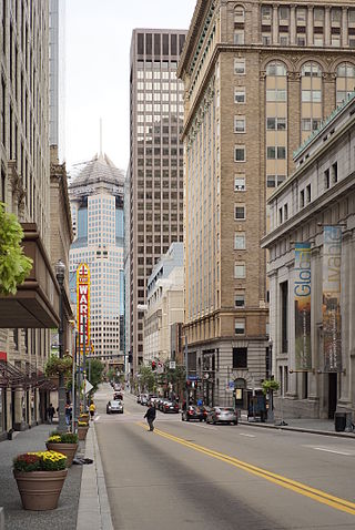
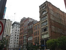
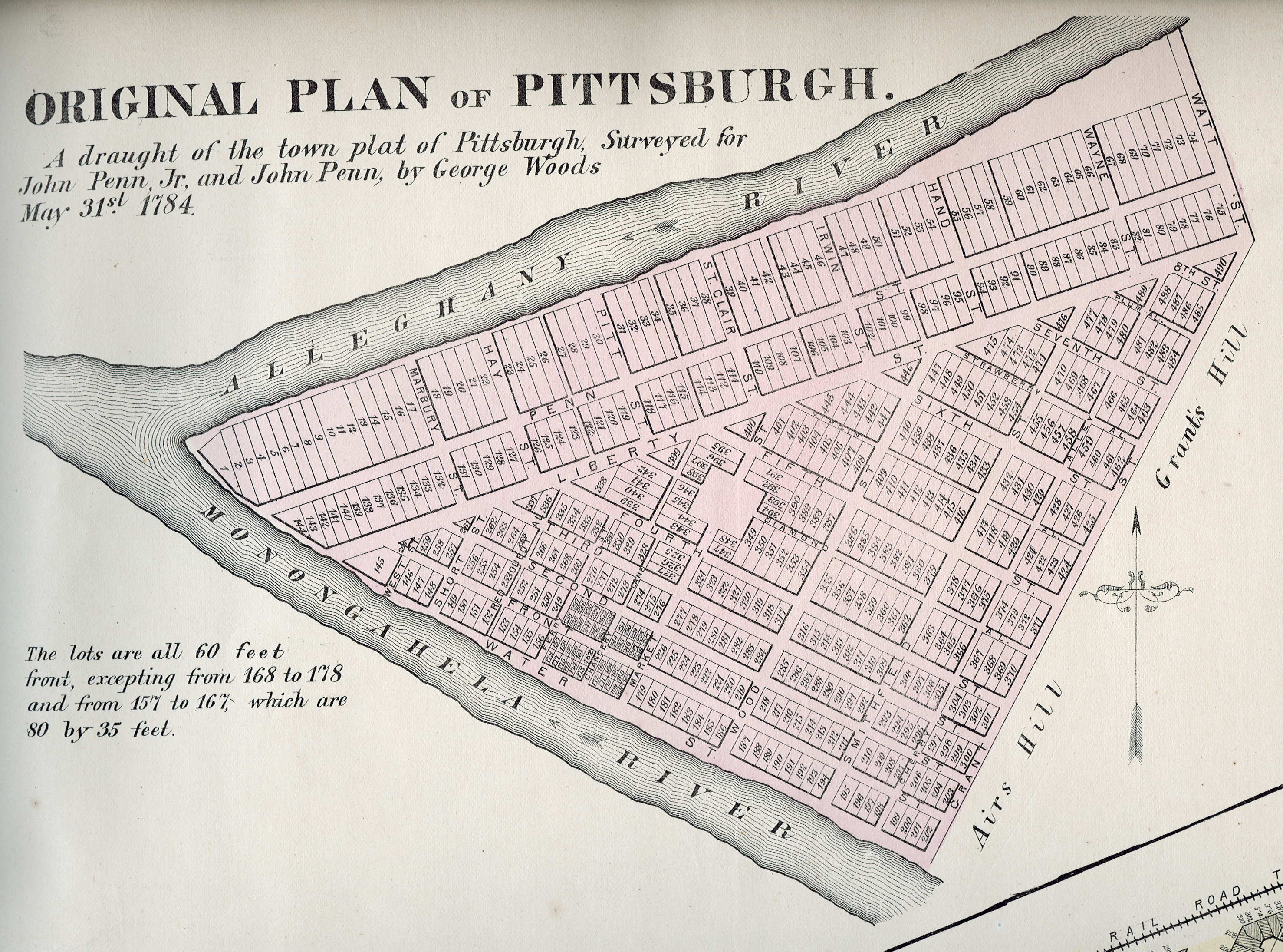
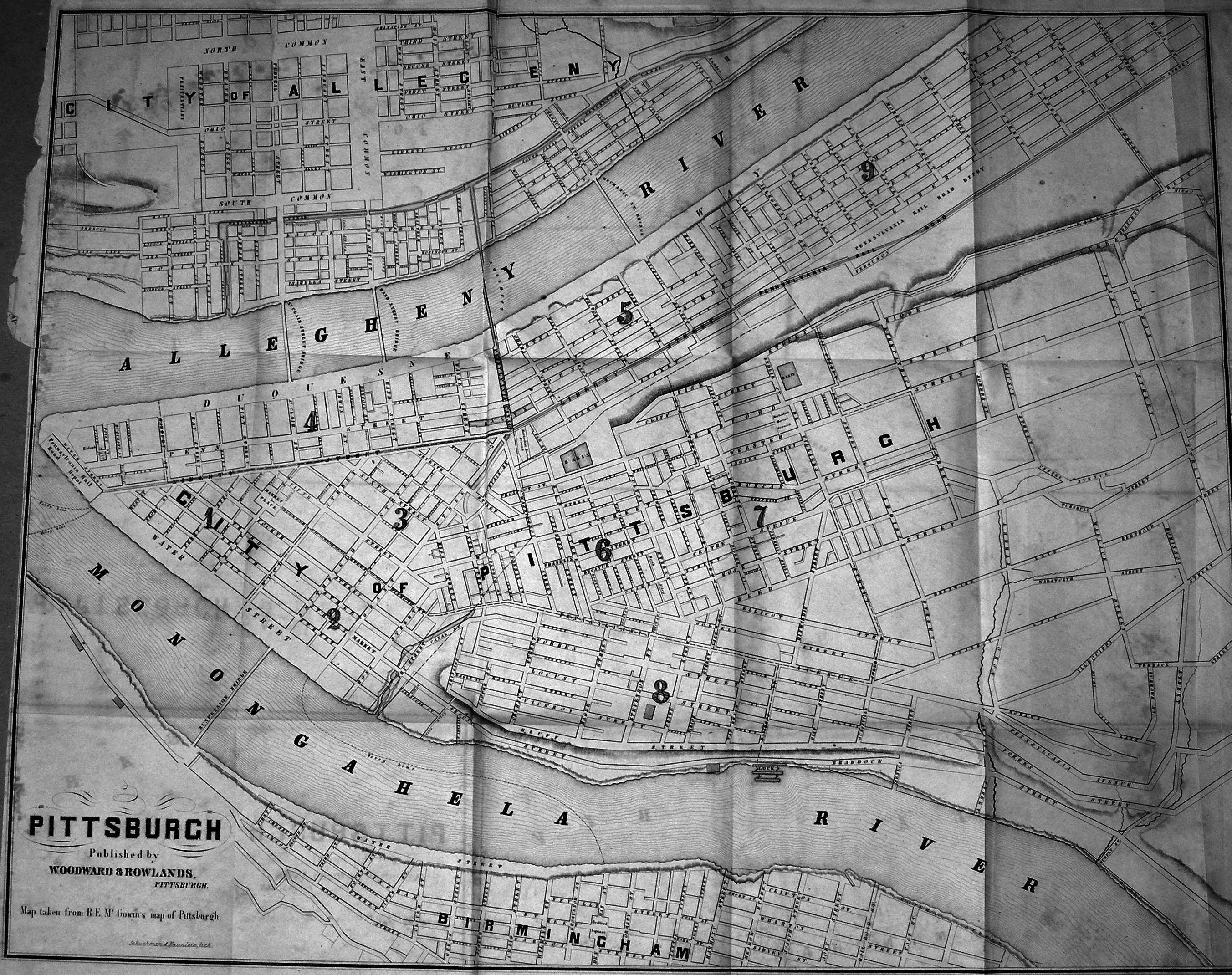
Downtown Pittsburgh, colloquially referred to as the Golden Triangle, and officially the Central Business District, is the urban downtown center of Pittsburgh, Pennsylvania, United States. It is located at the confluence of the Allegheny River and the Monongahela River whose joining forms the Ohio River. The triangle is bounded by the two rivers.
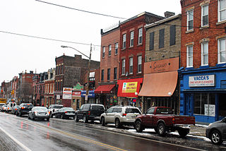
Bloomfield is a neighborhood in Pittsburgh, Pennsylvania. It is located three miles from the downtown area. Bloomfield is sometimes referred to as Pittsburgh's Little Italy because it was settled by Italians from the Abruzzi region and has been a center of Italian–American population. Pittsburgh architectural historian Franklin Toker has said that Bloomfield "is a feast, as rich to the eyes as the homemade tortellini and cannoli in its shop windows are to the stomach." Recently, the neighborhood has attracted young adults and college students as a "hip" neighborhood.

Friendship is a neighborhood of large Victorian houses in the East End of the City of Pittsburgh, Pennsylvania, United States, about four miles (6 km) east of Pittsburgh's Golden Triangle. Friendship is bordered on the north by Garfield, on the east by East Liberty, on the south by Shadyside, and on the west by Bloomfield. It is divided into three Pittsburgh City Council districts.
Highland Park is a neighborhood in the northeastern part of Pittsburgh, Pennsylvania. Highland Park, the neighborhood, fully encompasses the park with the same name.

East Liberty is a neighborhood in Pittsburgh, Pennsylvania's East End. It is bordered by Highland Park, Morningside, Stanton Heights, Garfield, Friendship, Shadyside and Larimer, and is represented on Pittsburgh City Council by Councilwoman Deborah Gross and Rev. Ricky Burgess. One of the most notable features in the East Liberty skyline is the East Liberty Presbyterian Church, which is an area landmark.

Garfield is a neighborhood in the East End of the City of Pittsburgh, Pennsylvania, United States. Garfield is bordered on the South by Bloomfield and Friendship, on the West by the Allegheny Cemetery, on the North by Stanton Heights, and on the East by East Liberty. Like many parts of Pittsburgh, Garfield is a fairly steep neighborhood, with north-south residential streets running at about a 20% incline from Penn Avenue at the bottom to Mossfield Street at the top. Garfield is divided into “the valley” and “the hilltop.”

The Strip District is a neighborhood in Pittsburgh, Pennsylvania, United States. It is a one-half square mile area of land northeast of the central business district bordered to the north by the Allegheny River and to the south by portions of the Hill District. The Strip District runs between 11th and 33rd Streets and includes four main thoroughfares—Railroad Street/Waterfront Place, Smallman Street, Penn Avenue, and Liberty Avenue—as well as various side streets.

Lawrenceville is one of the largest neighborhood areas in Pittsburgh in the U.S. state of Pennsylvania. It is located northeast of downtown, and like many of the city's riverfront neighborhoods, it has an industrial past. The city officially divides Lawrenceville into three neighborhoods, Upper Lawrenceville, Central Lawrenceville, and Lower Lawrenceville, but these distinctions have little practical effect. Accordingly, Lawrenceville is almost universally treated as a single large neighborhood.
The culture of Pittsburgh stems from the city's long history as a center for cultural philanthropy, as well as its rich ethnic traditions. In the 19th and 20th centuries, wealthy businessmen such as Andrew Carnegie, Henry J. Heinz, Henry Clay Frick, and nonprofit organizations such as the Carnegie Foundation donated millions of dollars to create educational and cultural institutions.

A large metropolitan area that is surrounded by rivers and hills, Pittsburgh has an infrastructure system that has been built out over the years to include roads, tunnels, bridges, railroads, inclines, bike paths, and stairways; however, the hills and rivers still form many barriers to transportation within the city.

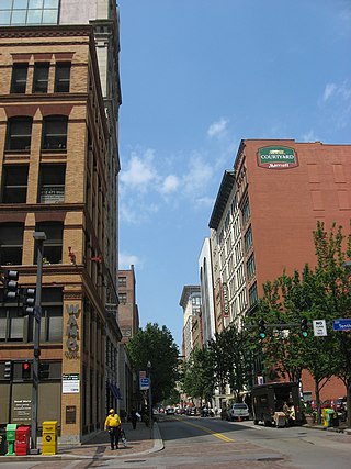
The Pittsburgh Cultural Trust (PCT) is an American, nonprofit, arts organization that was formed in 1984 to promote economic and cultural development in Downtown Pittsburgh, Pennsylvania. The "Trust" has focused its work on a fourteen-square block section known as the Cultural District, which encompasses numerous entertainment and cultural venues, restaurants, and residential buildings.
The Cultural District is a fourteen-square-block area in Downtown Pittsburgh bordered by the Allegheny River on the north, Tenth Street on the east, Stanwix Street on the west, and Liberty Avenue on the south.

The Harris Theater is a landmark building which is located at 809 Liberty Avenue in Downtown Pittsburgh, Pennsylvania's Cultural District. The 200-seat theater is owned and operated by the Pittsburgh Cultural Trust.
The City of Oklahoma City uses Special Zoning Districts as a tool to maintain the character of many neighborhood communities.
Fifth Avenue is one of the longest streets in Pittsburgh, Pennsylvania, United States. It begins downtown and moves eastward for over five miles (9 km). Fifth Avenue passes by the Carlow University, the Cathedral of Learning and other buildings of the University of Pittsburgh, then forms the borders between Shadyside on the north and Squirrel Hill and Point Breeze to the south. Finally, after passing Chatham University, The Ellis School, and Mellon Park, it turns north and forms the border between Larimer on the west and North Point Breeze and Homewood (Pittsburgh) on the east. At the intersection with Frankstown Avenue its name becomes Washington Boulevard and descends a branch of Negley Run to meet Allegheny River Boulevard near the Highland Park Bridge.
Penn Avenue is a major arterial street in Pittsburgh and Wilkinsburg, in Pennsylvania. Its western terminus lies at Gateway Center in downtown Pittsburgh. For its westernmost ten blocks it serves as the core of the Cultural District with such attractions as Heinz Hall, the Benedum Center and the Byham Theater as well as the David L. Lawrence Convention Center and the Heinz History Center bordering it. Exiting downtown it is the major route through the city's Strip District, Lawrenceville, Bloomfield, Garfield and East Liberty neighborhoods. Its eastern portion exits the city at Wilkinsburg where it continues to exist as Penn Avenue with a numbering system that begins anew using small numbers as it approaches Interstate 376 the "Parkway East". Penn Avenue is about 8.7 miles (14.0 km) long.

The ToonSeum: Pittsburgh Museum of Cartoon Art was a museum devoted exclusively to the cartoon arts that was located in Pittsburgh, Pennsylvania. At the time of its operation it was one of three museums dedicated to cartoon art in the United States.

Ellsworth Avenue is located in the Shadyside neighborhood of Pittsburgh, Pennsylvania. It is mostly a commercial street that has locally owned businesses, galleries, restaurants, and bars. It runs southwest-northeast, parallel to Walnut Street, another commercial street, and is bounded by Shady Avenue to the east and South Neville Street to the west. Ellsworth Avenue is one of Shadyside's three business districts, along with South Highland Avenue and Walnut Street.

