Shadyside (Pittsburgh)

Last updated
Shadyside
Street in Shadyside Pittsburgh PA.jpg
Street in Shadyside, 2001
Pgh locator shadyside.svg
Coordinates: 40°27′00″N79°56′06″W / 40.450°N 79.935°W / 40.450; -79.935
Country United States
State Pennsylvania
County Allegheny County
City Pittsburgh
Area
[1]
  Total0.921 sq mi (2.39 km2)
Population
 (2010) [1]
  Total13,915
  Density15,000/sq mi (5,800/km2)

Shadyside is a neighborhood in the East End of Pittsburgh, Pennsylvania, United States. It has three zip codes (15206, 15213, and 15232) and representation on Pittsburgh City Council by the council member for District 8 (East Central Neighborhoods). Shadyside is drawn from the name of a 19th-century Pennsylvania Railroad station in the area, which was named for its shady lanes.

Contents

Notable neighborhood institutions include UPMC Shadyside hospital, a member of the University of Pittsburgh Medical Center; Chatham University, which is located just across the southern edge of the neighborhood in Squirrel Hill, along with Pittsburgh Center for the Arts, which sits inside Mellon Park.

Business districts

Shadyside is home to many upscale stores and boutiques. In Shadyside, businesses are located along three corridors: Walnut Street, Ellsworth Avenue, and S. Highland Avenue. Given the compact nature of this historic residential neighborhood, the three business corridors are all within walking distance of one another.

Walnut Street

Walnut Street's business district is home to several national chains and locally owned businesses. Among them, Pamela's Diner gained publicity in 2009 when it served then President Barack Obama, his wife Michelle Obama and 80 veterans during a Memorial Day breakfast. [2]

The Jam on Walnut is a summer concert series that features local and regional music concerts. The concerts are held on the last Saturday of each summer month on the corner of Bellefonte and Walnut Street. Proceeds from beer sales go to Cystic Fibrosis. Walnut Street also hosts the Shadyside Arts Festival, a juried art show. This late summer/early fall street fair has been held on Walnut Street for so long that the event has been renamed "The Art Festival on Walnut Street."

Ellsworth Avenue

Retail options on Ellsworth Avenue are typically smaller locally owned businesses, including vintage clothing, an art gallery and beauty salons. Ellsworth has a number of restaurants also features one of Pittsburgh's gay friendly bars.

South Highland Avenue

Storefronts along South Highland Avenue. South Highland Avenue Pittsburgh.JPG
Storefronts along South Highland Avenue.

S. Highland Avenue features several upscale design and furniture stores, local restaurants and cafes. Also on S. Highland is the entrance to East Liberty's Eastside retail complex, which features many food options.

Residential Shadyside

Since the 1920s, residential Shadyside has been home to a mix of affluent families, young professionals, artists, musicians, students, and apartment dwellers. The residential areas of the neighborhood include Victorian mansions along with modern apartments and condominiums. The neighborhood has a compact layout, which prevents most houses from having garages. Public transportation is available via Pittsburgh Regional Transit bus system; express busway stops are located in the neighborhood on Negley Avenue (between Ellsworth and Centre avenues) and on Ellsworth Avenue at Shady Avenue.

Schools

The Shadyside school district consists mainly of The Liberty School, a public school; and private schools, Winchester Thurston School, The Ellis School, and Shadyside Academy.

The Liberty School is located in the Shadyside area of Pittsburgh, and consists of grades pre-kindergarten to fifth. The school's colors are navy and white and its mascot is the soaring eagle. It was built in 1872, and in 1911, the industrial arts portion of the school was built. From the years 1911 to 1934, the first and older building instilled primary instruction- such as the core subjects of learning- while the newer building offered woodworking, home economics, and other courses. In 1934, the eldest building was completely torn down to further renovate the school. Therefore, the newest building was attached to the 1911 building, consisting of both classrooms and an auditorium. Later on in the 1990s, playgrounds were constructed on both sides of the buildings providing more recreation for the students. [3]

Liberty is a "magnet school," which merely means it is a public school with specialized courses and therefore draws in a diverse group of students. [4]

Shadyside in winter Pittsburghwinter.jpg
Shadyside in winter

Liberty's approximate student enrollment is 375 students per school year, with a student to teacher ratio of about 16:1. The percentage of males and females is fairly equal, with 45% male and 55% female. [5]

The Winchester Thurston School is a private co-ed institution located in Shadyside. It has two campuses-the North Hills campus in Allison Park and the city campus in Shadyside. [6] [ third-party source needed ]

The Ellis School is an independent school for girls ages three through grade twelve in Shadyside, Pittsburgh, Pennsylvania. It was established in 1916 by Sara Frazer Ellis. [7] [ third-party source needed ]

The Ellis School and the Winchester Thurston School are both part of the Pittsburgh Consortium of Independent Schools (PCIS) which is a non-profit organization consisting of these and eleven other independent schools in the area. [8]

Shady Side Academy, though founded in the neighborhood in 1883, is no longer located in the Shadyside neighborhood. The school originally occupied the present-day site of the Winchester Thurston School as an all-male day school, but relocated its Senior and Middle School campuses to suburban Fox Chapel in the 1920s. Its Junior School campus, however, remains in the city in nearby Point Breeze.

Shadyside Action Coalition

The Shadyside Action Coalition, known colloquially as SAC, is a community organization. This not-for-profit organization was formed in 1973. [9] According to their website, their goals are to, "preserve values and laws of this community"; the issues they have chosen to focus on are "neighborhood safety, planning and zoning, parking, quality of life, preserving the character of the community, and being actively involved with the future development of our community". [10]

History

Shadyside was originally named after a local farm, and was annexed to Pittsburgh in 1868. [11]

See also

Related Research Articles

<span class="mw-page-title-main">Squirrel Hill</span> Neighborhood of Pittsburgh in Allegheny County, Pennsylvania, United States

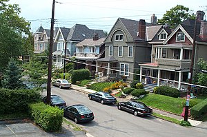
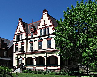
Squirrel Hill is a residential neighborhood in the East End of Pittsburgh, Pennsylvania, United States. The city officially divides it into two neighborhoods, Squirrel Hill North and Squirrel Hill South, but it is almost universally treated as a single neighborhood.

<span class="mw-page-title-main">Oakland (Pittsburgh)</span> Place in Pennsylvania, United States

Oakland is the academic and healthcare center of Pittsburgh and one of the city's major cultural centers. Home to three universities, museums, hospitals, shopping venues, restaurants, and recreational activities, this section of the city also includes two city-designated historic districts: the mostly residential Schenley Farms Historic District and the predominantly institutional Oakland Civic Center Historic District, as well as the locally-designated Oakland Square Historic District.

<span class="mw-page-title-main">Friendship (Pittsburgh)</span> Neighborhood of Pittsburgh in Allegheny County, Pennsylvania, United States

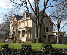
Friendship is a neighborhood of large Victorian houses in the East End of the City of Pittsburgh, Pennsylvania, United States, about four miles (6 km) east of Pittsburgh's Golden Triangle. Friendship is bordered on the north by Garfield, on the east by East Liberty, on the south by Shadyside, and on the west by Bloomfield. It is divided into three Pittsburgh City Council districts.

<span class="mw-page-title-main">Highland Park (Pittsburgh neighborhood)</span> Neighborhood of Pittsburgh in Allegheny County, Pennsylvania, United States

Highland Park is a neighborhood in the northeastern part of Pittsburgh, Pennsylvania. Highland Park, the neighborhood, fully encompasses the park with the same name.

<span class="mw-page-title-main">East Liberty (Pittsburgh)</span> Neighborhood of Pittsburgh in Allegheny County, Pennsylvania, United States

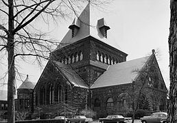
East Liberty is a neighborhood in Pittsburgh, Pennsylvania's East End. It is bordered by Highland Park, Morningside, Stanton Heights, Garfield, Friendship, Shadyside and Larimer, and is represented on Pittsburgh City Council by Councilwoman Deborah Gross and Rev. Ricky Burgess. One of the most notable features in the East Liberty skyline is the East Liberty Presbyterian Church, which is an area landmark.

<span class="mw-page-title-main">Garfield (Pittsburgh)</span> Place in Pennsylvania, United States

Garfield is a neighborhood in the East End of the City of Pittsburgh, Pennsylvania, United States. Garfield is bordered on the South by Bloomfield and Friendship, on the West by the Allegheny Cemetery, on the North by Stanton Heights, and on the East by East Liberty. Like many parts of Pittsburgh, Garfield is a fairly steep neighborhood, with north-south residential streets running at about a 20% incline from Penn Avenue at the bottom to Mossfield Street at the top. Garfield is divided into “the valley” and “the hilltop.”

<span class="mw-page-title-main">Larimer (Pittsburgh)</span> Neighborhood of Pittsburgh in Allegheny County, Pennsylvania, United States

Larimer is a neighborhood in the East End of the City of Pittsburgh, Pennsylvania in the United States. The neighborhood takes its name from William Larimer, who grew up in nearby Westmoreland County and, after making a fortune in the railroad industry, built a manor house overlooking East Liberty along a path that came to be called "Larimer Lane" and later Larimer Avenue.

<span class="mw-page-title-main">Uptown Pittsburgh</span> Neighborhood of Pittsburgh in Allegheny County, Pennsylvania, United States

Uptown or The Bluff is a neighborhood in the city of Pittsburgh, Pennsylvania to the southeast of the city's Central Business District. It is bordered in the north by the Hill District and located across the Monongahela River from South Side. The predominant area zip code is 15219.

<span class="mw-page-title-main">The Ellis School</span> Independent college-preparatory school in Pittsburgh, Pennsylvania, United States

The Ellis School is an independent, all-girls, college-preparatory school located in the Shadyside neighborhood in the East End of Pittsburgh, Pennsylvania, United States. The school serves girls aged 3 to grade 12.

<span class="mw-page-title-main">Point Breeze, Pittsburgh</span> Neighborhood of Pittsburgh in Allegheny County, Pennsylvania, United States

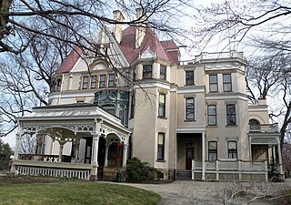
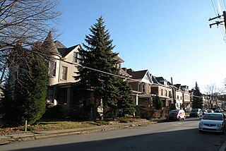
Point Breeze, or South Point Breeze, is a largely residential neighborhood in Pittsburgh, Pennsylvania, USA. The community was named after a tavern once located there.

<span class="mw-page-title-main">Morningside (Pittsburgh)</span> Neighborhood of Pittsburgh in Allegheny County, Pennsylvania, United States

Morningside is a neighborhood in Pittsburgh, Pennsylvania's East End. It has two Zip Codes, 15201 and 15206.

<span class="mw-page-title-main">North Point Breeze</span> Neighborhood of Pittsburgh in Allegheny County, Pennsylvania, United States

North Point Breeze is a mostly residential neighborhood that is located in the East End of Pittsburgh, Pennsylvania. It has a zip code of 15208, and representation on Pittsburgh City Council by the council member for District 9.

<span class="mw-page-title-main">Stanton Heights</span> Neighborhood of Pittsburgh in Allegheny County, Pennsylvania, United States

Stanton Heights is a neighborhood in Pittsburgh, Pennsylvania's East End. It has zip codes of both 15201 and 15206, and has representation on Pittsburgh City Council by the council member for District 7. Stanton Heights is the home of PBF 7 Engine and the city's Arson Investigation Units, and is covered by PBP Zone 5 and the Bureau of EMS Medic 6.

<span class="mw-page-title-main">Winchester Thurston School</span> Independent, preparatory school in Pittsburgh, PA, USA

Winchester Thurston School is an independent, coeducational preparatory school located in the Shadyside neighborhood of Pittsburgh, Pennsylvania. Established in 1887, Winchester Thurston offers PK–12 education in Lower, Middle, and Upper School. The school is a member of the Pittsburgh Consortium of Independent Schools.

<span class="mw-page-title-main">Shady Side Academy</span> School in Pittsburgh, Pennsylvania, United States

Shady Side Academy is an independent preparatory school located in the Borough of Fox Chapel, and in the Point Breeze neighborhood of Pittsburgh, Pennsylvania. Founded in 1883 as an all-male night school in the Shadyside neighborhood of Pittsburgh, the academy now offers a secular coeducational PK–12 program on four campuses in the city and its suburbs, including a boarding program in the Croft and Morewood Houses of its Senior School Campus.

<span class="mw-page-title-main">Frederick G. Scheibler Jr.</span> American architect

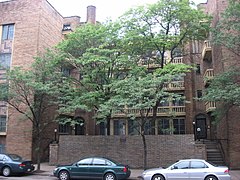
Frederick Gustavus Scheibler Jr. was an American architect.

<span class="mw-page-title-main">Fifth Avenue (Pittsburgh)</span>

Fifth Avenue is one of the longest streets in Pittsburgh, Pennsylvania, United States. It begins downtown and moves eastward for over five miles (9 km). Fifth Avenue passes by the Carlow University, the Cathedral of Learning and other buildings of the University of Pittsburgh, then forms the borders between Shadyside on the north and Squirrel Hill and Point Breeze to the south. Finally, after passing Chatham University, The Ellis School, and Mellon Park, it turns north and forms the border between Larimer on the west and North Point Breeze and Homewood (Pittsburgh) on the east. At the intersection with Frankstown Avenue its name becomes Washington Boulevard and descends a branch of Negley Run to meet Allegheny River Boulevard near the Highland Park Bridge.

<span class="mw-page-title-main">Walnut Street (Pittsburgh)</span>

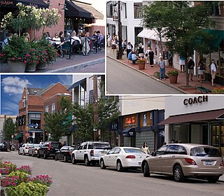
Walnut Street is located in the Shadyside neighborhood of Pittsburgh, Pennsylvania. It runs southwest-northeast, bounded on the west by South Aiken Avenue and on the east by Denniston Street. Walnut Street is best known for its upscale shopping, fine dining, and private boutiques. Some stores include Apple, Apricot Lane Boutiqe, Athleta, Banana Republic, Blick Art Materials, Gap, J.Jill, lululemon, Moda, Patagonia, and Williams Sonoma.

Ellsworth Avenue is located in the Shadyside neighborhood of Pittsburgh, Pennsylvania. It is mostly a commercial street that has locally owned businesses, galleries, restaurants, and bars. It runs southwest-northeast, parallel to Walnut Street, another commercial street, and is bounded by Shady Avenue to the east and South Neville Street to the west. Ellsworth Avenue is one of Shadyside's three business districts, along with South Highland Avenue and Walnut Street.

Negley may refer to:

References

Commons-logo.svg Media related to Shadyside, Pittsburgh at Wikimedia Commons

  1. 1 2 "PGHSNAP 2010 Raw Census Data by Neighborhood". Pittsburgh Department of City Planning PGHSNAP Utility. 2012. Retrieved 28 June 2013.
  2. Balingit, Moriah (May 26, 2009). "President flips over Pamela's flapjacks". Pittsburgh Post-Gazette.
  3. "Our History". 2009. Retrieved December 1, 2010.
  4. "General Information". 2009. Retrieved December 1, 2010.
  5. "Ul Liberty Elementary School". Public School Review LLC. Retrieved December 1, 2010.
  6. "About Us". 2008. Retrieved December 1, 2010.
  7. "Ellis at a Glance". 2008. Retrieved December 1, 2010.
  8. Pittsburgh Metroguide. Pittsburgh Metroguide (2007-09-19). Retrieved on 2013-07-17.
  9. Roy Lubove (1996). Twentieth Century Pittsburgh. University of Pittsburgh Press. ISBN   978-0-8229-5566-5 . Retrieved 2010-11-17.
  10. "About Us". 2009. Retrieved November 14, 2010.
  11. Bloom, Albert W. (Jan 14, 1953). "Pittsburgh today made up of many villages". Pittsburgh Post-Gazette. p. 23. Retrieved 2 December 2015.