Larimer (Pittsburgh)

Last updated

Larimer
Pgh locator larimer.svg
Coordinates: 40°27′50″N79°54′47″W / 40.464°N 79.913°W / 40.464; -79.913
Country United States
State Pennsylvania
County Allegheny County
City Pittsburgh
Area
[1]
  Total0.445 sq mi (1.15 km2)
Population
 (2010) [1]
  Total1,728
  Density3,900/sq mi (1,500/km2)

Larimer is a neighborhood in the East End of the city of Pittsburgh, Pennsylvania in the United States. The neighborhood takes its name from William Larimer, who grew up in nearby Westmoreland County and, after making a fortune in the railroad industry, built a manor house overlooking East Liberty along a path that came to be called "Larimer Lane" and later Larimer Avenue.

Contents

History

Larimer's daughter, Rachel, married James Mellon, son of Thomas Mellon, which brought what is now Larimer into the Mellon clan's control. As with East Liberty, the Mellons sold or rented this land and used the proceeds to finance Pittsburgh's coal, steel, and gas industries. A number of James Mellon's heirs used Larimer as a middle name, including Gulf Oil founder William Larimer Mellon, and they ensured that the present-day neighborhood took the name as well.

Larimer was originally settled by Germans in the later half of the 19th century. By the early 1900s Italians from Abruzzi, Calabria, Campania, Sicily and Northern Italians became the dominant ethnic group. These settlers were slightly better-off than their kinsmen who moved to Bloomfield around the same time: the residents of Bloomfield built modest frame row-houses, while those in Larimer built somewhat nicer detached brick homes with small yards. Before long, Larimer residents had built and were running concrete foundries and commercial bakeries along Lincoln Avenue towards Two-Mile Run (some of which still exist today), and a successful commercial district at the intersection of Larimer Avenue and Meadow Street, near the community's spiritual home of Our Lady Help of Christians Catholic Church (1898). In 1928, the Italian Sons and Daughters of America was founded in the neighborhood. Larimer was Pittsburgh's Little Italy until the 1960s.

As with other neighborhoods in Pittsburgh's East End, the 1960s were a turning point for Larimer. Some residents began to move to the suburbs in the early part of the decade, and this process was hastened by the urban renewal of East Liberty and the construction of a 320-unit housing project on Larimer Avenue near the entrance to Larimer from East Liberty. Today, aside from a few remaining businesses along Lincoln Avenue, no vestige of the neighborhood's Italian community remains (Our Lady Help of Christians was closed in 1992). The residents, largely African-American, [2] are among the poorest in Pittsburgh. [2]

Geography

Larimer is surrounded on nearly all sides by small valleys, or "runs" in the vernacular: branches of Negley Run form a border between Larimer and Highland Park on the North-West, and between Larimer and Lincoln-Lemington on the North-East, while the last bit of Two-Mile Run, the present site of the East Busway, forms a border between Larimer and Homewood on the South-East. On the South-West, there is a natural passage from East Liberty to Larimer along Larimer Avenue. More than 60 years earlier, the city buried the stream that once carried floodwater to the river. Renowned entrepreneur and judge Thomas Mellon argued against it, saying that there was too much water to fit into an underground sewer line. “This run in cases of heavy rains is turned into a raging torrent which an eight-and-a-half foot sewer cannot carry off,” Mellon said in an 1887 article in the Pittsburgh Commercial Gazette. [3]

Housing and Urban Development Grant

In June 2014, Larimer successfully applied for and received a coveted $30 million grant to re-build the neighborhood, which was provided through the US Department of Housing and Development. The grant will provide over 350 units of mixed-income housing. The Mayor of Pittsburgh, William "Bill" Peduto, called the grant, "huge."

See also

Related Research Articles

<span class="mw-page-title-main">Oakland (Pittsburgh)</span> Place in Pennsylvania, United States

Oakland is the academic and healthcare center of Pittsburgh and one of the city's major cultural centers. Home to three universities, museums, hospitals, shopping venues, restaurants, and recreational activities, this section of the city also includes two city-designated historic districts: the mostly residential Schenley Farms Historic District and the predominantly institutional Oakland Civic Center Historic District, as well as the locally-designated Oakland Square Historic District.

<span class="mw-page-title-main">Hazelwood (Pittsburgh)</span> Neighborhood of Pittsburgh in Allegheny County, Pennsylvania, United States

Hazelwood is a neighborhood of Pittsburgh, Pennsylvania in the United States. It is represented on Pittsburgh City Council by Barb Warwick. It is bordered by Greenfield and Oakland on the north, Squirrel Hill and Glen Hazel on the east, and the Monongahela River on the south and west. The Pittsburgh Bureau of Fire houses 13 Engine and 13 Truck in Hazelwood.

<span class="mw-page-title-main">Downtown Pittsburgh</span> Neighborhood in Allegheny County, Pennsylvania, United States

Downtown Pittsburgh, colloquially referred to as the Golden Triangle, and officially the Central Business District, is the urban downtown center of Pittsburgh, Pennsylvania, United States. It is located at the confluence of the Allegheny River and the Monongahela River whose joining forms the Ohio River. The triangle is bounded by the two rivers.
<span class="mw-page-title-main">Hill District</span> Neighborhoods of Pittsburgh in Allegheny County, Pennsylvania, United States

The Hill District is a grouping of historically African American neighborhoods in the City of Pittsburgh, Pennsylvania. Beginning in the years leading up to World War I, "the Hill" was the cultural center of black life in the city and a major center of jazz. Despite its cultural and economic vibrancy, in the mid-1950s a substantial area was slated for redevelopment, displacing about 8,000 individuals.
<span class="mw-page-title-main">Bloomfield (Pittsburgh)</span> Neighborhood of Pittsburgh in Allegheny County, Pennsylvania, United States

Bloomfield is a neighborhood in Pittsburgh, Pennsylvania. It is located three miles from the downtown area. Bloomfield is sometimes referred to as Pittsburgh's Little Italy because it was settled by Italians from the Abruzzi region and has been a center of Italian–American population. Pittsburgh architectural historian Franklin Toker has said that Bloomfield "is a feast, as rich to the eyes as the homemade tortellini and cannoli in its shop windows are to the stomach." Recently, the neighborhood has attracted young adults and college students as a "hip" neighborhood.

<span class="mw-page-title-main">Friendship (Pittsburgh)</span> Neighborhood of Pittsburgh in Allegheny County, Pennsylvania, United States

Friendship is a neighborhood of large Victorian houses in the East End of the City of Pittsburgh, Pennsylvania, United States, about four miles (6 km) east of Pittsburgh's Golden Triangle. Friendship is bordered on the north by Garfield, on the east by East Liberty, on the south by Shadyside, and on the west by Bloomfield. It is divided into three Pittsburgh City Council districts.
<span class="mw-page-title-main">Highland Park (Pittsburgh neighborhood)</span> Neighborhood of Pittsburgh in Allegheny County, Pennsylvania, United States

Highland Park is a neighborhood in the northeastern part of Pittsburgh, Pennsylvania. Highland Park, the neighborhood, fully encompasses the park with the same name.
<span class="mw-page-title-main">Lincoln–Lemington–Belmar</span> Neighborhood of Pittsburgh in Allegheny County, Pennsylvania, United States

Lincoln–Lemington–Belmar is a neighborhood in Pittsburgh, Pennsylvania. It is located in the northeastern section of the city and spans the Allegheny River. Lincoln–Lemington–Belmar houses PBF 15 Engine, and is covered by PBP Zone 5 and the Bureau of EMS Medic 1.

<span class="mw-page-title-main">Brookline (Pittsburgh)</span> Neighborhood of Pittsburgh in Allegheny County, Pennsylvania, United States

Brookline is a neighborhood in the South Hills of Pittsburgh, Pennsylvania, United States. It takes its name from the town in Massachusetts, which early settlers felt bore a resemblance to the area.

<span class="mw-page-title-main">East Liberty (Pittsburgh)</span> Neighborhood of Pittsburgh in Allegheny County, Pennsylvania, United States

East Liberty is a neighborhood in Pittsburgh, Pennsylvania's East End. It is bordered by Highland Park, Morningside, Stanton Heights, Garfield, Friendship, Shadyside and Larimer, and is represented on Pittsburgh City Council by Councilwoman Deborah Gross and Rev. Ricky Burgess. One of the most notable features in the East Liberty skyline is the East Liberty Presbyterian Church, which is an area landmark.

<span class="mw-page-title-main">Garfield (Pittsburgh)</span> Place in Pennsylvania, United States

Garfield is a neighborhood in the East End of the City of Pittsburgh, Pennsylvania, United States. Garfield is bordered on the South by Bloomfield and Friendship, on the West by the Allegheny Cemetery, on the North by Stanton Heights, and on the East by East Liberty. Like many parts of Pittsburgh, Garfield is a fairly steep neighborhood, with north-south residential streets running at about a 20% incline from Penn Avenue at the bottom to Mossfield Street at the top. Garfield is divided into “the valley” and “the hilltop.”
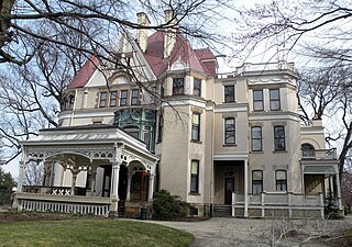
<span class="mw-page-title-main">Point Breeze, Pittsburgh</span> Neighborhood of Pittsburgh in Allegheny County, Pennsylvania, United States

Point Breeze, or South Point Breeze, is a largely residential neighborhood in Pittsburgh, Pennsylvania, USA. The community was named after a tavern once located there.

<span class="mw-page-title-main">California-Kirkbride</span> Neighborhood of Pittsburgh in Allegheny County, Pennsylvania, United States

California-Kirkbride is a neighborhood on Pittsburgh, Pennsylvania's North Side.
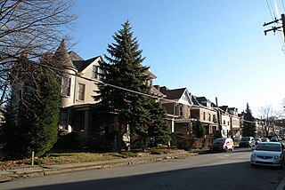
<span class="mw-page-title-main">Morningside (Pittsburgh)</span> Neighborhood of Pittsburgh in Allegheny County, Pennsylvania, United States

Morningside is a neighborhood in Pittsburgh, Pennsylvania's East End. It has two Zip Codes, 15201 and 15206.
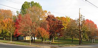
<span class="mw-page-title-main">North Point Breeze</span> Neighborhood of Pittsburgh in Allegheny County, Pennsylvania, United States

North Point Breeze is a mostly residential neighborhood that is located in the East End of Pittsburgh, Pennsylvania. It has a zip code of 15208, and representation on Pittsburgh City Council by the council member for District 9.

<span class="mw-page-title-main">Shadyside (Pittsburgh)</span> Neighborhood of Pittsburgh in Allegheny County, Pennsylvania, United States

Shadyside is a neighborhood in the East End of Pittsburgh, Pennsylvania, United States. It has three zip codes and representation on Pittsburgh City Council by the council member for District 8. Shadyside is drawn from the name of a 19th-century Pennsylvania Railroad station in the area, which was named for its shady lanes.

<span class="mw-page-title-main">Stanton Heights</span> Neighborhood of Pittsburgh in Allegheny County, Pennsylvania, United States

Stanton Heights is a neighborhood in Pittsburgh, Pennsylvania's East End. It has zip codes of both 15201 and 15206, and has representation on Pittsburgh City Council by the council member for District 7. Stanton Heights is the home of PBF 7 Engine and the city's Arson Investigation Units, and is covered by PBP Zone 5 and the Bureau of EMS Medic 6.

<span class="mw-page-title-main">West End (Pittsburgh)</span> Neighborhood of Pittsburgh in Allegheny County, Pennsylvania, United States

West End Village is a neighborhood in Pittsburgh, Pennsylvania's west city area. It has a zip code of 15220, and has representation on Pittsburgh City Council by the council member for District 2.
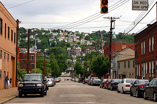
<span class="mw-page-title-main">South Side Slopes</span> Neighborhood of Pittsburgh in Allegheny County, Pennsylvania, United States

South Side Slopes is a neighborhood in Pittsburgh, Pennsylvania's South Side area. The neighborhood comprises the hills from the South Side Flats neighborhood along the Monongahela River from the Liberty Bridge (west) to beyond Josephine Street (east).

<span class="mw-page-title-main">Bakery Square</span> Shopping mall in Pennsylvania, United States

Bakery Square is an open-air shopping and office development in the Pittsburgh neighborhood of Larimer, adjacent to the neighborhoods of Shadyside and East Liberty in the city's East End. Bakery Square is located on 5.1 acres along Penn Avenue.

References

  1. 1 2 "PGHSNAP 2010 Raw Census Data by Neighborhood". Pittsburgh Department of City Planning PGHSNAP Utility. 2012. Retrieved June 24, 2013.{{cite news}}: External link in |publisher= (help)
  2. 1 2 "Census: Pittsburgh" (PDF). Pittsburgh Department of City Planning. January 2006. Archived from the original (PDF) on August 10, 2007. Retrieved July 19, 2007.{{cite journal}}: Cite journal requires |journal= (help)
  3. "Can reviving a 120-year-old stream stop dangerous flooding on Pittsburgh's Washington Boulevard?".

See also