Manchester (Pittsburgh)

Last updated

Manchester
Manchesterstreet.jpg
Liverpool Street in Manchester
Pgh locator manchester.svg
Location of Manchester in Pittsburgh
Coordinates: 40°27′18″N80°1′30″W / 40.45500°N 80.02500°W / 40.45500; -80.02500
Country Flag of the United States.svg  United States
State Flag of Pennsylvania.svg  Pennsylvania
City Flag of Pittsburgh, Pennsylvania.svg Pittsburgh
Area
[1]
  Total0.72 km2 (0.279 sq mi)
Population
 (2010) [1]
  Total2,130
  Density2,900/km2 (7,600/sq mi)
Manchester Historic District
Pittsburgh locator map 2018.png
Red pog.svg
USA Pennsylvania location map.svg
Red pog.svg
Usa edcp location map.svg
Red pog.svg
Area51.6 acres (20.9 ha). Irregular pattern contained with Faulsey, Chateau, Franklin, and Bidwell Streets.
Architectural style Late Victorian
NRHP reference No. 75001611 [2]
Significant dates
Added to NRHPSeptember 18, 1975
Designated CPHDJuly 30, 1979 [3]
Designated PHLF1976 [4]

Manchester is a North Side neighborhood in Pittsburgh, Pennsylvania. The neighborhood is represented on Pittsburgh City Council by the District 6 (Northshore/Downtown Neighborhoods). Manchester houses PBF Battalion 1 & 37 Engine, and is covered by PBP Zone 1 and the Bureau of EMS Medic 4. The neighborhood includes the Manchester Historic District, which protects, to some degree, 609 buildings over a 51.6-acre (20.9 ha) area. The district was listed on the National Register of Historic Places in 1975. [2] It uses ZIP code of 15233.

Contents

History

Manchester began as a village along the shore of the river, providing supplies and services to the surrounding farms. On November 2, 1843, by act of the Pennsylvania Assembly, the borough of Manchester was created out of the surrounding Ross Township. [5] By 1868 there was a well-used wharf in the borough that needed repair. [6] On 12 March 1867, the State Legislature enacted a statute to allow Allegheny City to annex the Borough of Manchester, adding a 9 April 1867 supplement to also annex the southern portions of M'Clure and Reserve townships. [7] [8] Until 1907, Manchester was a ward of Allegheny, Pennsylvania. Thereafter it is a neighborhood of Pittsburgh with boundaries that are still clearly known.
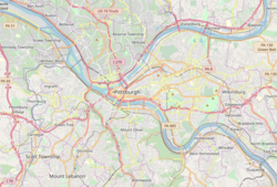
Geography

The Manchester Historic District is Pittsburgh's largest historic district under the National Register of Historic Places, preserved for its early 19th century-built Late Victorian-style houses.

Manchester was rated as one of the top 10 neighborhoods for "being close to everything" because it's walkable and has easy access to public transportation and major roadways. The Three Rivers Heritage Trail System runs along Manchester.

Demographics

Manchester is almost exclusively residential. As of the 2010 census, there were 2,130 people residing in Manchester. According to a report created by the University Center for Social and Urban Research, 46.3% of houses were families while 55.7% were nonfamily households. The median sales price for homes in Manchester for Nov 12 to Jan 13 was $172,350. This represents an increase of 36.8%, or $46,350, compared to the prior quarter and an increase of 48.6% compared to the prior year. Sales prices have appreciated 94.7% over the last 5 years in Manchester, Pittsburgh. The median sales price of $172,350 for Manchester is 29.68% higher than the median sales price for Pittsburgh PA. Average price per square foot for homes in Manchester was $54 in the most recent quarter, which is 43.75% lower than the average price per square foot for homes in Pittsburgh.

Education

Manchester's public schools are managed by Pittsburgh Public Schools. [9]

Surrounding Pittsburgh neighborhoods

Notable Residents

See also

Related Research Articles

<span class="mw-page-title-main">Homestead, Pennsylvania</span> Borough in Pennsylvania, United States

Homestead is a borough in Allegheny County, Pennsylvania, United States, along the Monongahela River 7 miles (11 km) southeast of downtown Pittsburgh. The borough is known for the Homestead strike of 1892, an important event in the history of labor relations in the United States. The population was 2,884 at the 2020 census. It is part of the Pittsburgh metropolitan area.

<span class="mw-page-title-main">West Homestead, Pennsylvania</span> Borough in Pennsylvania, United States

West Homestead is a borough in Allegheny County, Pennsylvania, United States, 8 miles (13 km) southeast of Pittsburgh, on the Monongahela River. Heavy industries associated with nearby steel mills existed here, such as axle works, brickworks, and manufactories of machinery, car wheels, etc. The largest concern was Mesta Machinery, which was one of the world's leading industrial manufacturers from 1898 until 1983. The population was 1,872 at the 2020 census.

<span class="mw-page-title-main">Wilkinsburg, Pennsylvania</span> Borough in Pennsylvania, United States

Wilkinsburg is a borough in Allegheny County, Pennsylvania, United States. The borough has a population of 14,349 as of the 2020 census. Wilkinsburg is located as part of the Pittsburgh metropolitan area. The borough was named for John Wilkins Jr., a United States Army officer who served as Quartermaster General of the United States Army from 1796 to 1802.

<span class="mw-page-title-main">North Side (Pittsburgh)</span> Region of Pittsburgh, Pennsylvania

North Side refers to the region of Pittsburgh, Pennsylvania, located to the north of the Allegheny River and the Ohio River. The term "North Side" does not refer to a specific neighborhood, but rather to a disparate collection of contiguous neighborhoods.

<span class="mw-page-title-main">Downtown Pittsburgh</span> Neighborhood in Allegheny County, Pennsylvania, United States

Downtown Pittsburgh, colloquially referred to as the Golden Triangle, and officially the Central Business District, is the urban downtown center of Pittsburgh, Pennsylvania, United States. It is located at the confluence of the Allegheny River and the Monongahela River whose joining forms the Ohio River. The triangle is bounded by the two rivers.

<span class="mw-page-title-main">Allegheny, Pennsylvania</span> Former city in Pennsylvania, United States

Allegheny City was a municipality that existed in the U.S. state of Pennsylvania from 1788 until it was annexed by Pittsburgh in 1907. It was located north across the Allegheny River from downtown Pittsburgh, with its southwest border formed by the Ohio River, and is known today as the North Side. The city's waterfront district, along the Allegheny and Ohio rivers, became Pittsburgh's North Shore neighborhood.

<span class="mw-page-title-main">Strip District, Pittsburgh</span> Neighborhood in Allegheny County, Pennsylvania, United States

The Strip District is a neighborhood in Pittsburgh, Pennsylvania, United States. It is a one-half square mile area of land northeast of the central business district bordered to the north by the Allegheny River and to the south by portions of the Hill District. The Strip District runs between 11th and 33rd Streets and includes four main thoroughfares—Railroad Street/Waterfront Place, Smallman Street, Penn Avenue, and Liberty Avenue—as well as various side streets.

<span class="mw-page-title-main">Allegheny Center</span> Neighborhood of Pittsburgh in Allegheny County, Pennsylvania, United States

Allegheny Center is a neighborhood on Pittsburgh's North Side. Its zip code is 15212, and it has representation on Pittsburgh City Council by both council members for District 6 and District 1 (Northside).

<span class="mw-page-title-main">Allegheny West (Pittsburgh)</span> Neighborhood of Pittsburgh in Pennsylvania, United States

Allegheny West is a historic neighborhood in Pittsburgh, Pennsylvania's North Side. The Pittsburgh Historic Review Commission voted in favor of designating the neighborhood as a city historic district in September 1989.

<span class="mw-page-title-main">South Side Flats</span> Neighborhood in Pittsburgh, Pennsylvania, United States

The South Side Flats is a neighborhood in Pittsburgh, Pennsylvania's South Side area. It is located just south of the Monongahela River. The neighborhood has one of the City of Pittsburgh's largest concentrations of 19th-century homes, which has prompted outsiders to call the neighborhood the City's Georgetown. It includes many bars and restaurants as well as residences. The main throughway in the South Side Flats is East Carson Street. The street is home to a significant portion of Pittsburgh's nightlife.

<span class="mw-page-title-main">California-Kirkbride</span> Neighborhood of Pittsburgh in Allegheny County, Pennsylvania, United States

California-Kirkbride is a neighborhood on Pittsburgh, Pennsylvania's North Side.

<span class="mw-page-title-main">Banksville (Pittsburgh)</span> Neighborhood of Pittsburgh in Allegheny County, Pennsylvania, United States

Banksville is a neighborhood in Pittsburgh, Pennsylvania. The neighborhood of Banksville is located in the West End of the city and borders the South Hills region. Real estate agencies frequently refer to the Banksville area as Greentree City due to Banksville's shared border with the borough of Green Tree. It has two zip codes of both 15220 and 15216, and has representation in Pittsburgh City Council by the council member for District 2. Theresa Kail-Smith is the current Councilperson for district two. Banksville's primary corridor, Banksville Road, is frequently used as a gateway between the South Hills of Pittsburgh and downtown Pittsburgh via the Fort Pitt Tunnels. Banksville, formerly Union Township, joined the City of Pittsburgh around 1928.

<span class="mw-page-title-main">Central Northside</span> Neighborhood of Pittsburgh in Allegheny County, Pennsylvania, United States

Central Northside is a neighborhood in the North Side of the city of Pittsburgh, Pennsylvania, USA. It has a zip code of 15212, and has representation on Pittsburgh City Council by the council member for District 6. Originally known as "The Buena Vista Tract", it is densely filled with restored row houses, community gardens and tree lined streets and alleyways.

<span class="mw-page-title-main">East Allegheny</span> Neighborhood of Pittsburgh in Allegheny County, Pennsylvania, United States

East Allegheny, also known as Deutschtown, is a neighborhood on Pittsburgh's North Side. It has a ZIP code of 15212, and has representation on Pittsburgh City Council by the council member for District 1. The Pittsburgh Bureau of Fire houses 32 engines and 32 trucks in Deutschtown.

<span class="mw-page-title-main">Lawrenceville (Pittsburgh)</span> Place in Pennsylvania, United States

Lawrenceville is one of the largest neighborhood areas in Pittsburgh in the U.S. state of Pennsylvania. It is located northeast of downtown, and like many of the city's riverfront neighborhoods, it has an industrial past. The city officially divides Lawrenceville into three neighborhoods, Upper Lawrenceville, Central Lawrenceville, and Lower Lawrenceville, but these distinctions have little practical effect. Accordingly, Lawrenceville is almost universally treated as a single large neighborhood.

<span class="mw-page-title-main">Troy Hill (Pittsburgh)</span> Neighborhood of Pittsburgh in Allegheny County, Pennsylvania, United States

Troy Hill is a neighborhood on Pittsburgh, Pennsylvania's North Side. It has a zip code of 15212, and has representation on Pittsburgh City Council by the council member for District 1.

<span class="mw-page-title-main">West End (Pittsburgh)</span> Neighborhood of Pittsburgh in Allegheny County, Pennsylvania, United States

West End Village is a neighborhood in Pittsburgh, Pennsylvania's west city area. It has a zip code of 15220, and has representation on Pittsburgh City Council by the council member for District 2.

<span class="mw-page-title-main">Mexican War Streets</span> Historic district in Pennsylvania, United States

The Mexican War Streets, originally known as the "Buena Vista Tract," is a historic district that is located in the Central Northside neighborhood of Pittsburgh, Pennsylvania, in the United States. The district is densely filled with restored row houses, community gardens, and tree-lined streets and alleyways. The area dates to around the time of the Mexican–American War.

<span class="mw-page-title-main">South Side Slopes</span> Neighborhood of Pittsburgh in Allegheny County, Pennsylvania, United States

South Side Slopes is a neighborhood in Pittsburgh, Pennsylvania's South Side area. The neighborhood comprises the hills from the South Side Flats neighborhood along the Monongahela River from the Liberty Bridge (west) to beyond Josephine Street (east).

<span class="mw-page-title-main">Frederick C. Sauer</span> American architect

Frederick C. Sauer was a German-American architect, particularly in the Pittsburgh, Pennsylvania, region of the late 19th and early 20th centuries.

References

  1. 1 2 "PGHSNAP 2010 Raw Census Data by Neighborhood". Pittsburgh Department of City Planning [PGHSNAP Utility]. 2012. Retrieved June 24, 2013.
  2. 1 2 "NPS Focus". National Register of Historic Places. National Park Service . Retrieved April 27, 2010.
  3. "Local Historic Designations". Pittsburgh: Pittsburgh History & Landmarks Foundation. Retrieved August 9, 2011.
  4. Historic Landmark Plaques 1968-2009 (PDF). Pittsburgh, PA: Pittsburgh History & Landmarks Foundation. 2010. Retrieved August 5, 2011.
  5. Atlas of the county of Allegheny, Pennsylvania. Philadelphia: G. M. Hopkins. 1876. p. 4.
  6. The Legislative Record: Containing the Debates and Proceedings of the Pennsylvania Legislature, Pennsylvania General Assembly, pub. 1868. Page 117. Accessed 6 October 2019.
  7. Laws of the General Assembly of the Commonwealth of Pennsylvania, Pennsylvania, 1867. Page 409. Accessed 6 October 2019.
  8. Allegheny City: A History of Pittsburgh’s North Side, by Dan Rooney and Carol Peterson. University of Pittsburgh Press, 2013. Page 130. Accessed 6 October 2019.
  9. "Pittsburgh Public Schools". Archived from the original on January 14, 2013. Retrieved February 8, 2013.
  10. Gratzinger, Ollie (May 19, 2022). "Pittsburgh Writer Wins GLAAD Media Award for the Second Time". Pittsburgh Magazine . Retrieved August 10, 2022.