National Register of Historic Places listings in South Philadelphia

Last updated

Location of South Philadelphia in Philadelphia SPhilaDistrict.PNG
Location of South Philadelphia in Philadelphia

This is a list of the National Register of Historic Places listings in South Philadelphia.

Contents

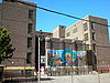
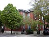
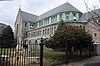
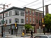
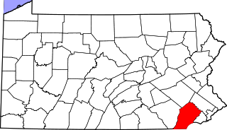
This is intended to be a complete list of the properties and districts on the National Register of Historic Places in South Philadelphia, Pennsylvania, United States. The locations of National Register properties and districts for which the latitude and longitude coordinates are included below may be seen in an online map. [1]

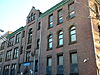
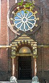
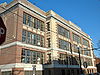
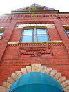
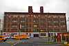
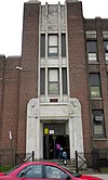
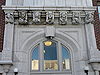
There are 582 properties and districts listed on the National Register in Philadelphia, including 67 National Historic Landmarks. South Philadelphia includes 61 of these properties and districts, including 2 National Historic Landmarks; the city's remaining properties and districts are listed elsewhere. One site is split between South Philadelphia and other parts of the city, and is thus included on multiple lists.

Map all coordinates using: OpenStreetMap

Current listings

[2] Name on the RegisterImageDate listed [3] Location NeighborhoodDescription
1 James Alcorn School
James Alcorn School Alcorn School Philly.JPG
James Alcorn School
November 18, 1988
(#88002225)
1500 South 32nd Street
39°56′07″N75°11′51″W / 39.9353°N 75.1975°W / 39.9353; -75.1975 (James Alcorn School)
Grays Ferry
2 Marian Anderson House
Marian Anderson House M Anderson House Philly.jpg
Marian Anderson House
April 14, 2011
(#11000198)
762 South Martin Street
39°56′32″N75°10′29″W / 39.942361°N 75.174861°W / 39.942361; -75.174861 (Marian Anderson House)
Southwest Center City
3 Charles Y. Audenried Junior High School
Charles Y. Audenried Junior High School CY Audenreid HS Philly.JPG
Charles Y. Audenried Junior High School
November 18, 1988
(#88002239)
1601 South 33rd Street
39°56′01″N75°11′58″W / 39.9336°N 75.1994°W / 39.9336; -75.1994 (Charles Y. Audenried Junior High School)
Grays Ferry The photo shows the replacement school on the same site
4 Baptist Institute for Christian Workers
Baptist Institute for Christian Workers Baptist Institute.JPG
Baptist Institute for Christian Workers
April 21, 1983
(#83002265)
1427 Snyder Avenue
39°55′29″N75°10′14″W / 39.9247°N 75.1706°W / 39.9247; -75.1706 (Baptist Institute for Christian Workers)
West Passyunk
5 Bartlett School
Bartlett School Bartlett School.JPG
Bartlett School
December 4, 1986
(#86003315)
1100 Catharine Street
39°56′24″N75°09′42″W / 39.94°N 75.1617°W / 39.94; -75.1617 (Bartlett School)
Hawthorne
6 Bethel Burial Ground
Bethel Burial Ground SW corner Bethel Burial Ground Philly.jpg
Bethel Burial Ground
January 5, 2016
(#15000734)
415 Queen Street
39°56′16″N75°09′04″W / 39.937778°N 75.151111°W / 39.937778; -75.151111 (Bethel Burial Ground)
Queen Village
7 Edward Bok Vocational School
Edward Bok Vocational School Bok School Philly.jpg
Edward Bok Vocational School
December 4, 1986
(#86003264)
1901 South 9th Street
39°55′33″N75°09′37″W / 39.9258°N 75.1603°W / 39.9258; -75.1603 (Edward Bok Vocational School)
Central South Philadelphia
8 F. Amadee Bregy School
F. Amadee Bregy School Amadee Bregy School Philly.JPG
F. Amadee Bregy School
November 18, 1988
(#88002249)
1700 Bigler Street
39°54′52″N75°10′36″W / 39.9144°N 75.1767°W / 39.9144; -75.1767 (F. Amadee Bregy School)
Marconi Plaza
9 George W. Childs School
George W. Childs School George Childs School.JPG
George W. Childs School
November 18, 1988
(#88002257)
1501 South 17th Street
39°55′53″N75°10′22″W / 39.9314°N 75.1728°W / 39.9314; -75.1728 (George W. Childs School)
Point Breeze Built 1894–96, designed by Joseph Anschutz [4]
10 Commandant's Quarters
Commandant's Quarters Commandants Quarters PNS.JPG
Commandant's Quarters
June 3, 1976
(#76001661)
U.S. Naval Base
39°53′48″N75°10′38″W / 39.8967°N 75.1772°W / 39.8967; -75.1772 (Commandant's Quarters)
Navy Yard
11 Francis M. Drexel School
Francis M. Drexel School Drexel School 5.JPG
Francis M. Drexel School
December 4, 1986
(#86003272)
1800 South 16th Street
39°55′42″N75°10′23″W / 39.9283°N 75.1731°W / 39.9283; -75.1731 (Francis M. Drexel School)
Point Breeze Built 1888–89, designed by Joseph Anschutz [4]
Demolished Feb., 2010
12 Federal Street School
Federal Street School Federal Street School Philly.JPG
Federal Street School
December 1, 1986
(#86003294)
1130–1148 Federal Street
39°56′05″N75°09′48″W / 39.9347°N 75.1633°W / 39.9347; -75.1633 (Federal Street School)
Passyunk Square
13 D. Newlin Fell School
D. Newlin Fell School Newlin Fell School Philly.JPG
D. Newlin Fell School
November 18, 1988
(#88002268)
900 Oregon Avenue
39°54′56″N75°09′48″W / 39.9156°N 75.1633°W / 39.9156; -75.1633 (D. Newlin Fell School)
East Oregon
14 Samuel S. Fleisher Art Memorial
Samuel S. Fleisher Art Memorial Fleisher Art Memorial.JPG
Samuel S. Fleisher Art Memorial
November 14, 1982
(#82001547)
711–721 Catharine Street
39°56′21″N75°09′18″W / 39.9392°N 75.1551°W / 39.9392; -75.1551 (Samuel S. Fleisher Art Memorial)
Bella Vista
15 Franklin Hose Company No. 28
Franklin Hose Company No. 28 FRANKLIN HOSE COMPANY NO. 28, SOUTH PHILADELPHIA.jpg
Franklin Hose Company No. 28
December 3, 1980
(#80003604)
730–732 South Broad Street
39°56′32″N75°09′58″W / 39.9421°N 75.1661°W / 39.9421; -75.1661 (Franklin Hose Company No. 28)
Southwest Center City
16 Horace Furness Junior High School
Horace Furness Junior High School Furness School Philly.JPG
Horace Furness Junior High School
December 1, 1986
(#86003286)
1900 South 3rd Street
39°55′26″N75°09′03″W / 39.9238°N 75.1507°W / 39.9238; -75.1507 (Horace Furness Junior High School)
Pennsport
17 Gloria Dei (Old Swedes') Church National Historic Site
Gloria Dei (Old Swedes') Church National Historic Site Gloria Dei Lutheran Church.jpg
Gloria Dei (Old Swedes') Church National Historic Site
October 15, 1966
(#66000682)
Swanson Street, between Christian and Water Streets
39°56′04″N75°08′38″W / 39.9344°N 75.1439°W / 39.9344; -75.1439 (Gloria Dei (Old Swedes') Church National Historic Site)
Queen Village
18 Grays Road Recreation Center
Grays Road Recreation Center Grays Rec Center.JPG
Grays Road Recreation Center
April 21, 1988
(#88000448)
2501 Christian Street
39°56′33″N75°11′06″W / 39.9425°N 75.1851°W / 39.9425; -75.1851 (Grays Road Recreation Center)
Grays Ferry
19 Frances Ellen Watkins Harper House
Frances Ellen Watkins Harper House Phila Harper house.jpg
Frances Ellen Watkins Harper House
December 8, 1976
(#76001663)
1006 Bainbridge Street
39°56′31″N75°09′34″W / 39.9419°N 75.1594°W / 39.9419; -75.1594 (Frances Ellen Watkins Harper House)
Bella Vista
20 Nathaniel Hawthorne School
Nathaniel Hawthorne School Hawthorne School.JPG
Nathaniel Hawthorne School
December 4, 1986
(#86003289)
712 South 12th Street
39°56′30″N75°09′44″W / 39.9417°N 75.1622°W / 39.9417; -75.1622 (Nathaniel Hawthorne School)
Hawthorne
21 Howell and Brothers Paper Hangings Manufactory
Howell and Brothers Paper Hangings Manufactory Howell and Brothers Paper Hangings Manufactory.jpg
Howell and Brothers Paper Hangings Manufactory
December 21, 2017
(#100001912)
2101 Washington Avenue
39°56′22″N75°10′45″W / 39.939372°N 75.179061°W / 39.939372; -75.179061 (Howell and Brothers Paper Hangings Manufactory)
Southwest Center City Built 1865 [5]
22 Institute for Colored Youth
Institute for Colored Youth Institute for Colored Youth.JPG
Institute for Colored Youth
December 4, 1986
(#86003324)
10th and Bainbridge Streets
39°56′31″N75°09′28″W / 39.9419°N 75.1579°W / 39.9419; -75.1579 (Institute for Colored Youth)
Bella Vista
23 Nathaniel Irish House
Nathaniel Irish House 704 Front Philly.JPG
Nathaniel Irish House
March 16, 1972
(#72001160)
704 South Front Street
39°56′24″N75°08′40″W / 39.9399°N 75.1444°W / 39.9399; -75.1444 (Nathaniel Irish House)
Queen Village
24 Francis Scott Key School
Francis Scott Key School FS Key School Philly.JPG
Francis Scott Key School
December 1, 1986
(#86003296)
2238 South 8th Street
39°55′15″N75°09′38″W / 39.9208°N 75.1606°W / 39.9208; -75.1606 (Francis Scott Key School)
Central South Philadelphia Built 1889, designed by Joseph Anschutz [4]
25 Eliza Butler Kirkbride School
Eliza Butler Kirkbride School Kirkbride School Philly.JPG
Eliza Butler Kirkbride School
November 18, 1988
(#88002290)
626 Dickinson Street
39°55′48″N75°09′22″W / 39.93°N 75.1561°W / 39.93; -75.1561 (Eliza Butler Kirkbride School)
Passyunk Square
26 David Landreth School
David Landreth School Landreth School Philly.JPG
David Landreth School
December 4, 1986
(#86003299)
1201 South 23rd Street
39°56′16″N75°10′54″W / 39.9378°N 75.1817°W / 39.9378; -75.1817 (David Landreth School)
Point Breeze Built 1889, designed by Joseph Anschutz [4]
27 Marine Barracks
Marine Barracks Phila MarineBarracks01.png
Marine Barracks
July 13, 1976
(#76001664)
Building 100, Philadelphia Naval Shipyard, 4800 S. 13th Street
39°53′32″N75°10′28″W / 39.8921°N 75.1744°W / 39.8921; -75.1744 (Marine Barracks)
Navy Yard
28 Marine Corps Depot of Supplies, Schuylkill Warehouse
Marine Corps Depot of Supplies, Schuylkill Warehouse Marine Depot Philly.JPG
Marine Corps Depot of Supplies, Schuylkill Warehouse
November 12, 2004
(#04001228)
700–734 Schuylkill Avenue
39°56′41″N75°11′12″W / 39.9447°N 75.1868°W / 39.9447; -75.1868 (Marine Corps Depot of Supplies, Schuylkill Warehouse)
Schuylkill
29 Marine Corps Supply Activity
Marine Corps Supply Activity Marine Club.JPG
Marine Corps Supply Activity
August 6, 1975
(#75001662)
1100 South Broad Street
39°56′15″N75°10′02″W / 39.9376°N 75.1671°W / 39.9376; -75.1671 (Marine Corps Supply Activity)
Point Breeze
30 Delaplaine McDaniel School
Delaplaine McDaniel School D McDaniel School Door.jpg
Delaplaine McDaniel School
December 4, 1986
(#86003303)
2100 Moore Street
39°55′46″N75°10′53″W / 39.9294°N 75.1814°W / 39.9294; -75.1814 (Delaplaine McDaniel School)
Point Breeze
31 William M. Meredith School
William M. Meredith School Meredith School on Fitzwater Philly PA.jpg
William M. Meredith School
December 4, 1986
(#86003307)
5th and Fitzwater Streets
39°56′23″N75°09′03″W / 39.9396°N 75.1508°W / 39.9396; -75.1508 (William M. Meredith School)
Queen Village
32 Capt. Thomas Moore House
Capt. Thomas Moore House 702 Front Philly.JPG
Capt. Thomas Moore House
March 16, 1972
(#72001165)
702 South Front Street
39°56′24″N75°08′40″W / 39.94°N 75.1444°W / 39.94; -75.1444 (Capt. Thomas Moore House)
Queen Village
33 George W. Nebinger School
George W. Nebinger School Nebinger School Philly.JPG
George W. Nebinger School
November 18, 1988
(#88002303)
601–627 Carpenter Street
39°56′12″N75°09′14″W / 39.9367°N 75.1539°W / 39.9367; -75.1539 (George W. Nebinger School)
Bella Vista
34 Jeremiah Nichols School
Jeremiah Nichols School Nichols Barratt School Philly.JPG
Jeremiah Nichols School
November 18, 1988
(#88002241)
1235 South 16th Street
39°56′06″N75°10′14″W / 39.935°N 75.1706°W / 39.935; -75.1706 (Jeremiah Nichols School)
Point Breeze
35 William S. Peirce School
William S. Peirce School Peirce School.jpg
William S. Peirce School
November 18, 1988
(#88002307)
2400 Christian Street
39°56′30″N75°10′58″W / 39.9418°N 75.1829°W / 39.9418; -75.1829 (William S. Peirce School)
Southwest Center City
36 Philadelphia Naval Shipyard Historic District
Philadelphia Naval Shipyard Historic District Aerial view of the Philadelphia Naval Shipyard Reserve Basin on 19 May 1955 (80-G-668655).jpg
Philadelphia Naval Shipyard Historic District
December 22, 1999
(#99001579)
South Broad Street
39°53′N75°11′W / 39.89°N 75.18°W / 39.89; -75.18 (Philadelphia Naval Shipyard Historic District)
Navy Yard
37 Philadelphia Quartermaster Depot
Philadelphia Quartermaster Depot Philadelphia Quartermaster Depot.jpg
Philadelphia Quartermaster Depot
January 26, 2010
(#09001212)
2724 South 20th Street
39°54′59″N75°10′57″W / 39.916389°N 75.1825°W / 39.916389; -75.1825 (Philadelphia Quartermaster Depot)
Girard Estate
38 Philadelphia, Wilmington and Baltimore Railroad Freight Shed
Philadelphia, Wilmington and Baltimore Railroad Freight Shed Philly Trainshed.jpg
Philadelphia, Wilmington and Baltimore Railroad Freight Shed
September 8, 2011
(#11000649)
1001 South 15th Street
39°56′21″N75°10′04″W / 39.939028°N 75.167778°W / 39.939028; -75.167778 (Philadelphia, Wilmington and Baltimore Railroad Freight Shed)
Southwest Center City
39 Edgar Allan Poe School
Edgar Allan Poe School EA Poe School Philly.JPG
Edgar Allan Poe School
December 4, 1986
(#86003318)
2136 Ritner Street
39°55′20″N75°10′59″W / 39.9221°N 75.1831°W / 39.9221; -75.1831 (Edgar Allan Poe School)
Girard Estate
40 Robert Ralston School
Robert Ralston School Ralston School Philly.JPG
Robert Ralston School
December 4, 1986
(#86003321)
221 Bainbridge Street
39°56′26″N75°08′48″W / 39.9406°N 75.1468°W / 39.9406; -75.1468 (Robert Ralston School)
Queen Village
41 Royal Theater
Royal Theater RoyalTheaterPhilly.JPG
Royal Theater
February 8, 1980
(#80003619)
1524–1534 South Street
39°56′38″N75°10′06″W / 39.9439°N 75.1682°W / 39.9439; -75.1682 (Royal Theater)
Southwest Center City
42 St. Anthony de Padua Parish School
St. Anthony de Padua Parish School St Anthony de Padua School.JPG
St. Anthony de Padua Parish School
May 7, 1992
(#92000400)
2325 Carpenter Street
39°56′28″N75°10′56″W / 39.9411°N 75.1821°W / 39.9411; -75.1821 (St. Anthony de Padua Parish School)
Southwest Center City
43 St. Gabriel's Roman Catholic Church Complex
St. Gabriel's Roman Catholic Church Complex ST. GABRIEL'S R.C. CHURCH COMPLEX, SOUTH PHILADELPHIA, PA.jpg
St. Gabriel's Roman Catholic Church Complex
January 14, 2021
(#100006036)
1440 South 29th Street; 2922-28 and 2930-36 Dickinson Street
39°56′06″N75°11′37″W / 39.9350°N 75.1936°W / 39.9350; -75.1936 (St. Gabriel's Roman Catholic Church Complex)
Grays Ferry
44 George Sharswood School
George Sharswood School Sharswood School Philly.JPG
George Sharswood School
November 18, 1988
(#88002320)
200 Wolf Street
39°55′07″N75°09′03″W / 39.9187°N 75.1508°W / 39.9187; -75.1508 (George Sharswood School)
Whitman
45 Walter George Smith School
Walter George Smith School George Smith School Philly.JPG
Walter George Smith School
December 4, 1986
(#86003329)
1300 South 19th Street
39°56′06″N75°10′33″W / 39.935°N 75.1758°W / 39.935; -75.1758 (Walter George Smith School)
Point Breeze
46 South Front Street Historic District
South Front Street Historic District 700 Front HABS 1961.jpg
South Front Street Historic District
April 25, 1972
(#72001171)
700 block of South Front Street, western side of Bainbridge Street to Kenilworth Street
39°56′24″N75°08′40″W / 39.94°N 75.1444°W / 39.94; -75.1444 (South Front Street Historic District)
Queen Village
47 Southwark District
Southwark District Southwark HD.jpg
Southwark District
May 19, 1972
(#72001172)
Bounded by Delaware & Washington Avenues; 5th, Lombard, Front, and Catherine Streets
39°56′16″N75°08′54″W / 39.9378°N 75.1483°W / 39.9378; -75.1483 (Southwark District)
Southwark
48 Southwark School
Southwark School Southwark School Philly.JPG
Southwark School
December 1, 1986
(#86003330)
8th and Miflin Streets
39°55′31″N75°09′36″W / 39.9253°N 75.16°W / 39.9253; -75.16 (Southwark School)
Central South Philadelphia
49 SS United States (Steamship)
SS United States (Steamship) Ssunited.jpg
SS United States (Steamship)
June 3, 1999
(#99000609)
Pier 82
39°55′06″N75°08′11″W / 39.9183°N 75.1364°W / 39.9183; -75.1364 (SS United States (Steamship))
Whitman
50 Edwin M. Stanton School
Edwin M. Stanton School Stanton School Philly.JPG
Edwin M. Stanton School
November 18, 1988
(#88002326)
1630 Christian Street
39°56′25″N75°10′15″W / 39.9404°N 75.1708°W / 39.9404; -75.1708 (Edwin M. Stanton School)
Southwest Center City
51 George C. Thomas Junior High School
George C. Thomas Junior High School Thomas School Philly.JPG
George C. Thomas Junior High School
November 18, 1988
(#88002330)
2746 South 9th Street
39°54′56″N75°09′48″W / 39.9156°N 75.1633°W / 39.9156; -75.1633 (George C. Thomas Junior High School)
East Oregon
52 Tindley Temple United Methodist Church
Tindley Temple United Methodist Church Tindley Temple.JPG
Tindley Temple United Methodist Church
April 15, 2011
(#11000199)
756 South Broad Street
39°56′29″N75°09′59″W / 39.941389°N 75.166389°W / 39.941389; -75.166389 (Tindley Temple United Methodist Church)
Southwest Center City
53 U.S. Naval Home
U.S. Naval Home Naval Asylum.jpg
U.S. Naval Home
August 21, 1972
(#72001173)
Gray's Ferry Avenue at S. 24th Street
39°56′38″N75°11′01″W / 39.9439°N 75.1836°W / 39.9439; -75.1836 (U.S. Naval Home)
Southwest Center City
54 University Avenue Bridge
University Avenue Bridge UniAveBridgePhillyHAER.jpeg
University Avenue Bridge
May 26, 1994
(#94000515)
South University Avenue over the Schuylkill River
39°56′34″N75°11′49″W / 39.9428°N 75.1969°W / 39.9428; -75.1969 (University Avenue Bridge)
Grays Ferry Extends into West Philadelphia
55 Abigail Vare School
Abigail Vare School Abigail Vare School Philly.JPG
Abigail Vare School
December 4, 1986
(#86003339)
Morris Street and Moyamensing Avenue
39°55′38″N75°09′03″W / 39.9272°N 75.1507°W / 39.9272; -75.1507 (Abigail Vare School)
Pennsport
56 Edwin H. Vare Junior High School
Edwin H. Vare Junior High School Vare School door.JPG
Edwin H. Vare Junior High School
November 18, 1988
(#88002331)
2100 South 24th Street
39°55′33″N75°11′09″W / 39.9258°N 75.1858°W / 39.9258; -75.1858 (Edwin H. Vare Junior High School)
Wilson Park
57 Washington Avenue Historic District
Washington Avenue Historic District 1201 Washington Philly, PA.JPG
Washington Avenue Historic District
September 7, 1984
(#84003561)
Roughly bounded by Carpenter, Washington, 10th, and Broad Streets
39°56′17″N75°09′44″W / 39.9381°N 75.1622°W / 39.9381; -75.1622 (Washington Avenue Historic District)
Hawthorne
58 George Washington School
George Washington School Washington School Philly.JPG
George Washington School
December 4, 1986
(#86003343)
5th and Federal Streets
39°56′01″N75°09′10″W / 39.9337°N 75.1528°W / 39.9337; -75.1528 (George Washington School)
Dickinson Narrows
59 Anthony Wayne School
Anthony Wayne School A Wayne School Figures 2.JPG
Anthony Wayne School
December 1, 1986
(#86003344)
2700 Morris Street
39°55′55″N75°11′28″W / 39.9319°N 75.1911°W / 39.9319; -75.1911 (Anthony Wayne School)
Grays Ferry
60 Widow Maloby's Tavern
Widow Maloby's Tavern Front Bainbridge Philly.JPG
Widow Maloby's Tavern
March 16, 1972
(#72001175)
700 South Front Street
39°56′24″N75°08′40″W / 39.94°N 75.1444°W / 39.94; -75.1444 (Widow Maloby's Tavern)
Queen Village
61 James Wilson Public School
James Wilson Public School Philly Wilson Public School.JPG
James Wilson Public School
December 12, 2012
(#88002238)
1148 Wharton Street
39°56′01″N75°09′49″W / 39.93348°N 75.16365°W / 39.93348; -75.16365 (James Wilson Public School)
Passyunk Square

See also

Related Research Articles

<span class="mw-page-title-main">National Register of Historic Places listings in Allegheny County, Pennsylvania</span>

This is a list of the National Register of Historic Places listings in Allegheny County, Pennsylvania.

<span class="mw-page-title-main">National Register of Historic Places listings in Berks County, Pennsylvania</span>

This is a list of the National Register of Historic Places listings in Berks County, Pennsylvania.

<span class="mw-page-title-main">National Register of Historic Places listings in eastern Chester County, Pennsylvania</span>

This is a list of the National Register of Historic Places listings in eastern Chester County, Pennsylvania.

<span class="mw-page-title-main">National Register of Historic Places listings in Delaware County, Pennsylvania</span>

This is a list of the National Register of Historic Places listings in Delaware County, Pennsylvania.

<span class="mw-page-title-main">National Register of Historic Places listings in Dauphin County, Pennsylvania</span>

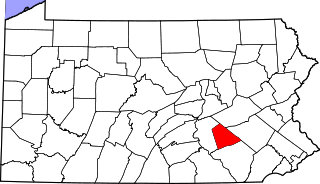
This is a list of the National Register of Historic Places listings in Dauphin County, Pennsylvania.

<span class="mw-page-title-main">National Register of Historic Places listings in Pittsburgh, Pennsylvania</span>

The following properties are listed on the National Register of Historic Places in Pittsburgh, Pennsylvania.

<span class="mw-page-title-main">National Register of Historic Places listings in Lancaster, Pennsylvania</span>

This is a list of the National Register of Historic Places listings in Lancaster, Pennsylvania.

<span class="mw-page-title-main">National Register of Historic Places listings in Cumberland County, Pennsylvania</span>

This is a list of the National Register of Historic Places listings in Cumberland County, Pennsylvania.

<span class="mw-page-title-main">National Register of Historic Places listings in Lebanon County, Pennsylvania</span>

This is a list of the National Register of Historic Places listings in Lebanon County, Pennsylvania.

<span class="mw-page-title-main">National Register of Historic Places listings in Snyder County, Pennsylvania</span>

This is a list of the National Register of Historic Places listings in Snyder County, Pennsylvania.

<span class="mw-page-title-main">National Register of Historic Places listings in Venango County, Pennsylvania</span>

This is a list of the National Register of Historic Places listings in Venango County, Pennsylvania.

<span class="mw-page-title-main">National Register of Historic Places listings in Center City, Philadelphia</span>

This is a list of the National Register of Historic Places listings in Center City, Philadelphia.

<span class="mw-page-title-main">National Register of Historic Places listings in North Philadelphia</span>

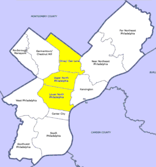
The following properties are listed on the National Register of Historic Places in North Philadelphia.

<span class="mw-page-title-main">National Register of Historic Places listings in Northeast Philadelphia</span>

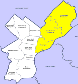
This is a list of the National Register of Historic Places listings in Northeast Philadelphia.

<span class="mw-page-title-main">National Register of Historic Places listings in Northwest Philadelphia</span>

This is a list of the National Register of Historic Places listings in Northwest Philadelphia.

<span class="mw-page-title-main">National Register of Historic Places listings in Southwest Philadelphia</span>

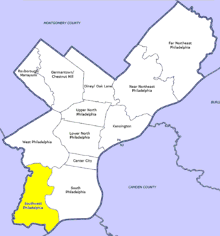
This is a list of the National Register of Historic Places listings in Southwest Philadelphia.

<span class="mw-page-title-main">National Register of Historic Places listings in West Philadelphia</span>

This is a list of the National Register of Historic Places listings in West Philadelphia.

<span class="mw-page-title-main">National Register of Historic Places listings in northern Chester County, Pennsylvania</span>

This is a list of the National Register of Historic Places listings in northern Chester County, Pennsylvania.

<span class="mw-page-title-main">National Register of Historic Places listings in southern Chester County, Pennsylvania</span>

This is a list of the National Register of Historic Places listings in southern Chester County, Pennsylvania.

<span class="mw-page-title-main">National Register of Historic Places listings in Charleston, South Carolina</span>

This is a list of the National Register of Historic Places listings in Charleston, South Carolina.

References

  1. The latitude and longitude information provided in this table was derived originally from the National Register Information System, which has been found to be fairly accurate for about 99% of listings. Some locations in this table may have been corrected to current GPS standards.
  2. Numbers represent an alphabetical ordering by significant words. Various colorings, defined here, differentiate National Historic Landmarks and historic districts from other NRHP buildings, structures, sites or objects.
  3. The eight-digit number below each date is the number assigned to each location in the National Register Information System database, which can be viewed by clicking the number.
  4. 1 2 3 4 Philadelphia Public Schools TR
  5. McMahon, Kevin. "National Register of Historic Places Nomination Form" (PDF). Retrieved December 26, 2017.