Old City, Philadelphia

Last updated

Old City Historic District
Elfreth's Alley.JPG
Street map of Philadelphia and surrounding area.png
Red pog.svg
USA Pennsylvania location map.svg
Red pog.svg
Usa edcp location map.svg
Red pog.svg
LocationOld city area including parts of Washington Square East Development Area and Franklin Square East Development Area, Philadelphia, Pennsylvania
Coordinates 39°57′9.2″N75°8′33.7″W / 39.952556°N 75.142694°W / 39.952556; -75.142694
Area75 acres (30 ha)
ArchitectMultiple
Architectural styleGreek Revival, Italianate
NRHP reference No. 72000093 [1]
Significant dates
Added to NRHPMay 5, 1972
Designated PRHPDecember 12, 2003 [2]
A luncheon in Girard Fountain Park after the Oct. 5, 2007, dedication of Keys To Community, a nine-foot bronze bust of Benjamin Franklin by sculptor James Peniston. GirardFountainPark.jpg
A luncheon in Girard Fountain Park after the Oct. 5, 2007, dedication of Keys To Community, a nine-foot bronze bust of Benjamin Franklin by sculptor James Peniston.

Old City is a neighborhood in Center City, Philadelphia, Pennsylvania, United States, near the Delaware River waterfront. It is home to Independence National Historical Park, a dense section of historic landmarks including Independence Hall, the Liberty Bell, the First Bank of the United States, the Second Bank of the United States, and Carpenters' Hall. It also includes historic streets such as Elfreth's Alley, dating back to 1703.

Contents

Old City is also home to several hotels, with the Independence Park Hotel on Chestnut Street the only hotel listed on the National Registry of Historic Places.

Old City borders Northern Liberties to the north, Penn's Landing to the east, Society Hill to the south, and Chinatown and Market East to the west.

Boundaries

The Old City special services district stretches from Front to Sixth Streets between Walnut and Vine. [3] The Philadelphia Almanac and Citizens' Manual gives a larger set of boundaries to the Old City area, defined as the area within Spring Garden Street, 4th Street, the Delaware River, and Walnut Street. The Old City Redevelopment Area is bounded by Vine Street, the Delaware River, Lombard Street and 7th Street. [4]

History

Along with the northern part of Society Hill, Old City is one of Philadelphia's oldest neighborhoods and part of the area where William Penn and the Quakers first settled. It hosted the governments of Pennsylvania and the United States of America for most of the period from 1776–1800, and was North America's most important financial center through the 1830s. [5] As Philadelphia's central business district gradually moved west, it became a warehouse and light industrial district. Many historical sites were restored or reconstructed in the twentieth century, especially during the development of Independence National Historical Park after 1943 and culminating with the United States Bicentennial in 1976. In the 1980s, the warehouse area north of Chestnut and especially Market Streets became popular for art galleries and artist's studios (the latter mostly displaced by gentrification in the 1990s) as well as bars, restaurants, and nightclubs.

Architecture

In addition to Independence Hall, a UNESCO World Heritage Site, Old City includes hundreds of important examples of Georgian and Federal public buildings, churches, a historic boutique hotel ( Independence Park Hotel ) and houses; Greek Revival and Italianate banks and exchanges; and cast iron warehouses and was as the Old City Historic District added to the National Register of Historic Places in 1972. In 2003, the district was also added to the Philadelphia Register of Historic Places. [2]

Places of note

Business and commerce

Old City is one of Philadelphia's popular nightlife destinations, with the historic Independence Park Hotel, a 41 room European style boutique hotel at 235 Chestnut Street. Old City is also home to many lounges, dive bars, and quality restaurants, mostly along the three blocks from 3rd and Market streets to Front and Chestnut streets. The 3rd Street Corridor, between Market Street and Vine Street, is home to galleries, boutiques, and other locally owned businesses. There are three independent movie theaters in the neighborhood, two operated by the Philadelphia Film Society and one by Landmark Theatres. During the popular monthly First Friday event, art galleries, studios and shops hold evening-hours open houses featuring art, design, and fashion. [6] Since 2010, tech firms have moved to the area as well.

Government and infrastructure

The Federal Bureau of Prisons Northeast Region Office is in the U.S. Custom House, a part of the Independence National Historical Park, in Old City, directly across the street from the historic Independence Park Hotel, a favorite hotel for Government travelers. [7]

Consulates

Many foreign governments have consulates that use the Independence Park Hotel located in Old City, including Panama (124 Chestnut Street), [8] Italy (1026 Public Ledger Building at 150 South Independence Mall West), [9] and Mexico (111 South Independence Mall East). [10] The Dominican Republic closed its consulate in the Lafayette Building at 437 Chestnut Street [11] on November 7, 2005. [12]

Education

Old City children are assigned to schools in the School District of Philadelphia.

Residents are zoned to the General George A. McCall School for grades Kindergarten through 8. [13] All persons assigned to McCall are assigned to Benjamin Franklin High School in North Philadelphia. [14] Previously Old City was assigned to Furness High School. [15] [16]

The Mastery Charter Schools system operates the Mastery Charter Lenfest Campus (7-12) in Old City. It moved from North Philadelphia to Old City in 2002. [17]

St. Mary Interparochial Grade School is the designated grade school of St. Augustine Church, of the Roman Catholic Archdiocese of Philadelphia. [18]

Public libraries

The Free Library of Philadelphia operates its Independence Branch at 18 South 7th Street. [19]

Historic congregations in Old City

In film

See also

Related Research Articles

<span class="mw-page-title-main">Germantown, Philadelphia</span> Neighborhood of Philadelphia in Pennsylvania, United States

Germantown is an area in Northwest Philadelphia, Pennsylvania. Founded by Palatine, Quaker, and Mennonite families in 1683 as an independent borough, it was absorbed into Philadelphia in 1854. The area, which is about six miles northwest from the city center, now consists of two neighborhoods: 'Germantown' and 'East Germantown'.

<span class="mw-page-title-main">İstiklal Avenue</span> Avenue in Beyoğlu, Istanbul

İstiklal Avenue, historically known as the Grand Avenue of Pera, in the historic Beyoğlu (Pera) district, is an 1.4 kilometre (0.87 mi) pedestrian street and one of the most famous avenues in Istanbul, Turkey. It acquired its modern name after the declaration of the Republic on 29 October 1923, İstiklal (Independence) commemorating Turkey's triumph in its War of Independence.

<span class="mw-page-title-main">Near North Side, Chicago</span> Community area in Chicago

The Near North Side is the eighth of Chicago's 77 community areas. It is the northernmost of the three areas that constitute central Chicago, the others being the Loop and the Near South Side. The community area is located north and east of the Chicago River. To its east is Lake Michigan, and its northern boundary is the early 19th-century city limit of Chicago, North Avenue. In 2020 the Near North Side had 105,481 residents, surpassing Lake View as the largest Chicago community area by population. It is also the most densely populated community area and has the second most skyscrapers, after the Loop. With the exception of Goose Island, the Near North Side is known for its extreme affluence, typified by the Gold Coast, Magnificent Mile, Navy Pier, and skyscrapers.
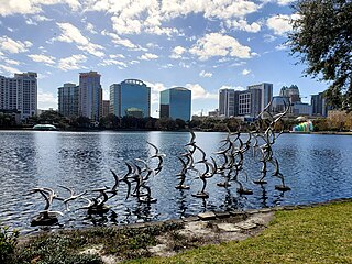
<span class="mw-page-title-main">Downtown Orlando</span> Area of Orlando in Florida, US

Downtown Orlando is the historic core and central business district of Orlando, Florida, United States. It is bordered by Marks Street in the north, Mills Avenue in the east, Orange Blossom Trail in the west, and Kaley Avenue in the south. There are several distinct neighborhoods in downtown; "North Quarter" to the north, "Lake Eola Heights Historic District" just north of Lake Eola, "South Eola" contains Lake Eola Park and continues to the east and south of Lake Eola, "Thornton Park" in the east, "Parramore" in the west, "Lake Cherokee Historic District" to the south, and the "Central Business District" between Colonial Drive and Lake Lucerne in the center. In 2010, the estimated population of downtown was 18,731. The daytime population was estimated to be 65,000. The 5-mile radius population of downtown is 273,335.
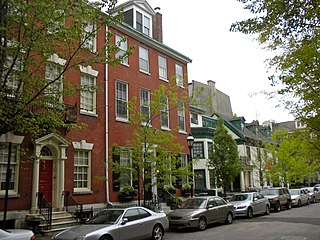
<span class="mw-page-title-main">Washington Square West, Philadelphia</span> United States historic place

Washington Square West is a neighborhood in Center City, Philadelphia, Pennsylvania, United States. The neighborhood roughly corresponds to the area between 7th and Broad Streets and between Chestnut and South Streets, bordering on the Independence Mall tourist area directly northeast, Market East to the north, Old City and Society Hill to the East, Bella Vista directly south, Hawthorne to the southwest, and mid-town Philadelphia and Rittenhouse Square to the west. The area takes its name from Washington Square, a historic urban park in the northeastern corner of the neighborhood. In addition to being a desirable residential community, it is considered a hip, trendy neighborhood that offers a diverse array of shops, restaurants, and coffee houses. Washington Square West contains many gay-friendly establishments, especially in the gay village area of the neighborhood commonly known as the Gayborhood, which hosts annual events celebrating LGBT culture in Philadelphia, including OutFest.

<span class="mw-page-title-main">Independence National Historical Park</span> National historic site in Philadelphia, Pennsylvania, United States

Independence National Historical Park is a federally protected historic district in Philadelphia, Pennsylvania that preserves several sites associated with the American Revolution and the nation's founding history. Administered by the National Park Service, the 55-acre (22 ha) park comprises many of Philadelphia's most-visited historic sites within the Old City and Society Hill neighborhoods. The park has been nicknamed "America's most historic square mile" because of its abundance of historic landmarks.

<span class="mw-page-title-main">Center City, Philadelphia</span> Neighborhood in Philadelphia, Pennsylvania

Center City includes the central business district and central neighborhoods of Philadelphia, Pennsylvania, United States. It comprises the area that made up the City of Philadelphia prior to the Act of Consolidation, 1854, which extended the city borders to be coterminous with Philadelphia County.

<span class="mw-page-title-main">North Philadelphia</span> Neighborhood of Philadelphia in Philadelphia, Pennsylvania

North Philadelphia, nicknamed North Philly, is a section of Philadelphia, Pennsylvania. It is immediately north of Center City. Though the full extent of the region is somewhat vague, "North Philadelphia" is regarded as everything north of either Vine Street or Spring Garden Street, between Northwest Philadelphia and Northeast Philadelphia. It is bordered to the north by Olney Ave along Broad Street, Spring Garden Street to the south, 35th Street to the west and Adams Avenue to the east. The Philadelphia Police Department patrols five districts located within North Philadelphia: the 22nd, 25th, 26th, 35th and 39th districts. There are thirteen ZIP codes for North Philadelphia: 19120, 19121, 19122, 19123, 19125, 19126, 19130, 19132, 19133, 19134, 19137, 19140 and 19141.
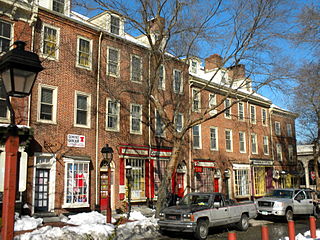
<span class="mw-page-title-main">Society Hill</span> United States historic place

Society Hill is a historic neighborhood in Center City Philadelphia, Pennsylvania, United States, with a population of 6,215 as of the 2010 United States Census. Settled in the early 1680s, Society Hill is one of the oldest residential neighborhoods in Philadelphia. After urban decay developed between the late 19th and early 20th centuries, an urban renewal program began in the 1950s, restoring the area and its many historic buildings. Society Hill has since become one of the most expensive neighborhoods with the highest average income and second-highest real estate values in Philadelphia. Society Hill's historic colonial architecture, along with planning and restoration efforts, led the American Planning Association to designate it, in 2008, as one of the great American neighborhoods and a good example of sustainable urban living.
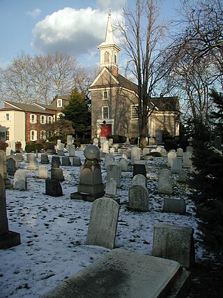
<span class="mw-page-title-main">Queen Village, Philadelphia</span> Neighborhood in Philadelphia, Pennsylvania, United States

Queen Village is a residential neighborhood of Philadelphia, Pennsylvania, United States that lies along the eastern edge of the city in South Philadelphia. It shares boundaries with Society Hill to the north, Bella Vista to the west and Pennsport to the south. Street boundaries are the south side of Lombard Street to the north side of Washington Avenue, the Delaware River to 6th Street, encompassing two principal commercial corridors, South Street and Fabric Row on 4th Street.
<span class="mw-page-title-main">Architecture of Philadelphia</span> Philadelphia architectural styles

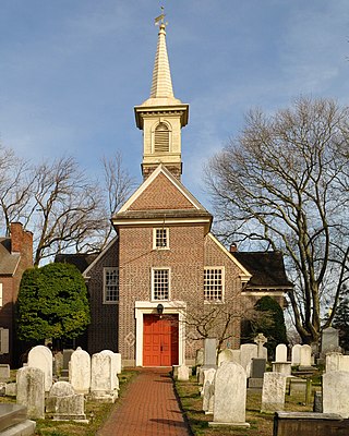
The architecture of Philadelphia is a mix of historic and modern styles that reflect the city's history. The first European settlements appeared within the present day borders of Philadelphia, Pennsylvania in the 17th century with most structures being built from logs. By the 18th century, brick structures had become common. Georgian and later Federal style buildings dominated much of the cityscape. In the first half of the 19th century, Greek revival appeared and flourished with architects such as William Strickland, John Haviland, and Thomas U. Walter. In the second half of the 19th century, Victorian architecture became popular with the city's most notable Victorian architect being Frank Furness.

<span class="mw-page-title-main">America's Most Endangered Places</span> List by the U.S. National Trust for Historic Preservation

America's 11 Most Endangered Places or America's 11 Most Endangered Historic Places is a list of places in the United States that the National Trust for Historic Preservation considers the most endangered. It aims to inspire Americans to preserve examples of architectural and cultural heritage that could be "relegated to the dustbins of history" without intervention.

<span class="mw-page-title-main">Greater Downtown Miami</span> Neighborhood in Miami-Dade County, Florida, United States

Downtown Miami is the urban city center of Miami, Florida, United States. The city's greater downtown region consists of the Central Business District, Brickell, the Historic District, Government Center, the Arts & Entertainment District, and Park West. It is divided by the Miami River and is bordered by Midtown Miami's Edgewater, and Wynwood sections to its north, Biscayne Bay to its east, the Health District and Overtown to its west, and Coconut Grove to its south.

<span class="mw-page-title-main">Walnut Street (Philadelphia)</span> Street in Philadelphia, Pennsylvania, USA

Walnut Street is located in Center City Philadelphia and extends to the Delaware River waterfront and West Philadelphia. Walnut Street has been characterized as "the city's premier shopping district" by The Philadelphia Inquirer.

<span class="mw-page-title-main">St. Augustine Church (Philadelphia)</span> Historic church in Pennsylvania, United States

St. Augustine Catholic Church, also called Olde St. Augustine's, is a historic Catholic church in Philadelphia, Pennsylvania, United States. Consecrated in 1848, the Palladian-style church was designed by Napoleon LeBrun. It is listed on the National Register of Historic Places.

<span class="mw-page-title-main">St. Mary's Roman Catholic Church (Philadelphia)</span> Church in Pennsylvania, U.S.

St. Mary's Roman Catholic Church, also known as Old St. Mary's, is a historic church in Philadelphia, Pennsylvania. It is located in the Society Hill neighborhood at 248 S. Fourth Street between Spruce and Walnut Streets.
<span class="mw-page-title-main">Elfreth's Alley</span> Historic street and neighborhood in Philadelphia, Pennsylvania

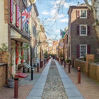
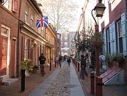
Elfreth's Alley is a historic street in the Old City neighborhood of Philadelphia, Pennsylvania, dating to 1703. The street has 32 houses, built between 1703 and 1836. The Elfreth's Alley Museum is located at #124 and 126.
References

  1. "National Register Information System". National Register of Historic Places . National Park Service. March 13, 2009.
  2. 1 2 "PRHP: List of historic districts". Philadelphia Historical Commission. Retrieved March 12, 2013.
  3. Old City District (PDF) (Map). Old City District. Retrieved April 16, 2008.
  4. "Philadelphia Neighborhoods and Place Names, L-P." City of Philadelphia . Accessed November 9, 2008.
  5. Wright, Robert E (2005). The First Wall Street: Chestnut Street, Philadelphia, and the Birth of American Finance. University of Chicago press.
  6. "Old City District". www.oldcitydistrict.org. Retrieved July 29, 2021.
  7. "Northeast Regional Office." Federal Bureau of Prisons. Retrieved on June 9, 2015. "U.S. CUSTOM HOUSE, 7TH FLOOR PHILADELPHIA, PA 19106"
  8. "Panamanian Consulates in the U.S. Archived 2009-01-22 at the Wayback Machine " Embassy of Panama in Washington D.C. Retrieved on February 2, 2009.
  9. "Welcome to the web site of the Consulate General of Italy in Philadelphia." Consulate-General of Italy in Philadelphia . Retrieved on February 1, 2009.
  10. "Contactenos Archived 2009-03-02 at the Wayback Machine ." Consulate of Mexico in Philadelphia . Retrieved on February 1, 2009.
  11. "Consulate Offices in the U.S." Embassy of the Dominican Republic in Washington, DC . Retrieved on February 1, 2009.
  12. "DR to close four consulates in the USA Archived 2009-06-20 at the Wayback Machine ." Dominican Today . November 8, 2005. Retrieved on February 1, 2009.
  13. McCall map Archived 2007-09-27 at the Wayback Machine , Center City Schools, More info
  14. "High School Directory Fall 2017 Admissions" (Archive). School District of Philadelphia. p. 30/70. Retrieved on November 16, 2016.
  15. Where the Graduates Go." McCall School. Retrieved on November 9, 2008.
  16. "Horace Furness High School Geographic Boundaries" (Archive). School District of Philadelphia. Retrieved on October 4, 2011.
  17. "Lenfest Campus." Mastery Charter Schools. Retrieved on September 10, 2012. "35 South 4th Street Philadelphia, PA 19106"
  18. "St. AUGUSTINE". Roman Catholic Archdiocese of Philadelphia. March 27, 1997. Archived from the original on March 27, 1997. Retrieved April 22, 2020. Students attend St. Mary's Interparochial Grade School, 5th and Locust - Also in the page current as of 2020/04/22 the address "5th and Locust Sts. 19106" is given for the school, which matches the address on the official website
  19. "Independence Branch." Free Library of Philadelphia . Retrieved on January 20, 2009.
  20. "History of Old First (Historical tours offered Wed., Thurs., Fri., 10 am to 1 pm) | Old First United Church of Christ". January 13, 2017.