
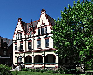
Oakland is the academic and healthcare center of Pittsburgh and one of the city's major cultural centers. Home to three universities, museums, hospitals, shopping venues, restaurants, and recreational activities, this section of the city also includes two city-designated historic districts: the mostly residential Schenley Farms Historic District and the predominantly institutional Oakland Civic Center Historic District, as well as the locally-designated Oakland Square Historic District.

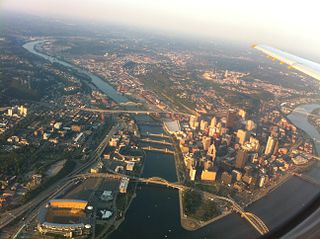
Downtown Pittsburgh, colloquially referred to as the Golden Triangle, and officially the Central Business District, is the urban downtown center of Pittsburgh. It is located at the confluence of the Allegheny River and the Monongahela River whose joining forms the Ohio River. The triangle is bounded by the two rivers.
Highland Park is a neighborhood in the northeastern part of Pittsburgh, Pennsylvania. Highland Park, the neighborhood, fully encompasses the park with the same name.
Lincoln–Lemington–Belmar is a neighborhood in Pittsburgh, Pennsylvania. It is located in the northeastern section of the city and spans the Allegheny River. Lincoln–Lemington–Belmar houses PBF 15 Engine, and is covered by PBP Zone 5 and the Bureau of EMS Medic 1.

East Liberty is a neighborhood in Pittsburgh, Pennsylvania's East End. It is bordered by Highland Park, Morningside, Stanton Heights, Garfield, Friendship, Shadyside and Larimer, and is represented on Pittsburgh City Council by Councilwoman Deborah Gross and Rev. Ricky Burgess. One of the most notable features in the East Liberty skyline is the East Liberty Presbyterian Church, which is an area landmark.

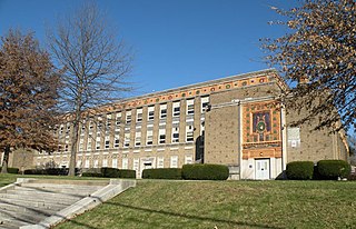
Uptown or The Bluff is a neighborhood in the city of Pittsburgh, Pennsylvania to the southeast of the city's Central Business District. It is bordered in the north by the Hill District and located across the Monongahela River from South Side. The predominant area zip code is 15219.
Spring Hill is a neighborhood on Pittsburgh, Pennsylvania's North Side. Spring Hill was named for the abundance of springs near the site. According to a 1977 Neighborhood Atlas, "Germans immigrated there from 1850 to 1920, giving the neighborhood a Bavarian atmosphere. Local street names include Rhine, Woessner, Haslage, Zoller and Goehring. In 1959 ACTION-Housing opened Spring Hill Gardens, a moderate rent, racially integrated, 209-unit apartment project at Buente and Rhine Streets. Spring Hill Gardens was Pittsburgh's first multi-family housing project backed by the Federal Housing Authority."

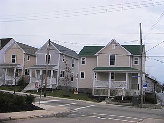
California-Kirkbride is a neighborhood on Pittsburgh, Pennsylvania's North Side.
Beltzhoover is a neighborhood in southern Pittsburgh, Pennsylvania, in an area known as the South Hills.
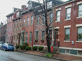
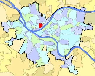
Central Northside is a neighborhood in the North Side of the city of Pittsburgh, Pennsylvania, USA. It has a zip code of 15212, and has representation on Pittsburgh City Council by the council member for District 6. Originally known as "The Buena Vista Tract", it is densely filled with restored row houses, community gardens and tree lined streets and alleyways.

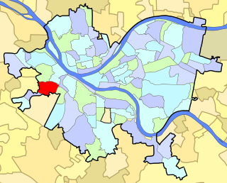
Chartiers is a neighborhood in Pittsburgh, Pennsylvania's West End. It has a zip code of 15204, and has representation on Pittsburgh City Council by the council member for District 2. The neighborhood was named after Peter Chartier, a trapper of French and Native American parentage who established a trading post at the mouth of Chartiers Creek in 1743.
East Allegheny, also known as Deutschtown, is a neighborhood on Pittsburgh's North Side. It has a ZIP Code of 15212, and has representation on Pittsburgh City Council by the council member for District 1. The Pittsburgh Bureau of Fire houses 32 Engine and 32 Truck in Deutschtown.

Marshall-Shadeland is a neighborhood on Pittsburgh, Pennsylvania's North Side. It has a zip codes of both 15212 and 15214, and has representation on Pittsburgh City Council by the council member for District 1.
North Shore is a neighborhood in Pittsburgh's North Side. Its zip code is 15212.

Summer Hill is a neighborhood on Pittsburgh, Pennsylvania's North Side. It has a zip code of 15214, and has representation on Pittsburgh City Council by the council member for District 1.

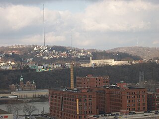
Troy Hill is a neighborhood on Pittsburgh, Pennsylvania's North Side. It has a zip code of 15212, and has representation on Pittsburgh City Council by the council member for District 1.
Westwood is a neighborhood in the West End Region of Pittsburgh, Pennsylvania. Beginning as a part of the now-defunct Township of Chartiers and existing for a short time as an independent borough, Westwood was annexed by the City of Pittsburgh in three pieces: the eastern third in 1872, and the remaining sectors progressing west in 1921 and 1927. Westwood is a quiet residential community inhabited by a large variety of residents, and exhibits an eclectic mix of architectural styles that span many periods. Among these is the John Frew House, one of the oldest surviving structures west of the Allegheny Mountains, which dates to 1790. Westwood also contains a public primary school bearing the community's name, as well as a public swimming pool, a playground, and ballfields. The neighborhood's main thoroughfare is Noblestown Road, and Noble Manor is its major commercial district. It has a zip codes of both 15205 and 15220, and has representation on Pittsburgh City Council by the council member for District 2. The Pittsburgh Bureau of Fire houses 29 Engine in Westwood.

West End Village is a neighborhood in Pittsburgh, Pennsylvania's west city area. It has a zip code of 15220, and has representation on Pittsburgh City Council by the council member for District 2.

Perry South — also known as Perry Hilltop — is a neighborhood on Pittsburgh, Pennsylvania's North Side. It developed as a streetcar suburb around the turn of the 20th century, so it consists almost exclusively of residential housing, with a small business district at the intersection of Perrysville Avenue and Charles Avenue. The hill on which the neighborhood is built provides natural borders to the west, to the east and to the south.

The South Shore is an American neighborhood that is located in Pittsburgh, Pennsylvania South Side. It encompasses the area surrounding Carson Street, from the West End Bridge to the Liberty Bridge.

