Uptown Pittsburgh

Last updated
Uptown
Bluff
Monongahela River - Southsidefromwash.jpg
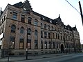
Uptown (visible on the left side of the image) overlooking the Monongahela River.
Pgh locator bluff.svg
Coordinates: 40°26′10″N79°59′20″W / 40.436°N 79.989°W / 40.436; -79.989
Country United States
State Pennsylvania
County Allegheny County
City Pittsburgh
Area
  Total0.327 sq mi (0.85 km2)
Population
 (2000) [1]
  Total6,600
  Density20,000/sq mi (7,800/km2)

Uptown or The Bluff (also known by its former name Soho and prior to the 20th century as Boyd's Hill [2] ) is a neighborhood in the city of Pittsburgh, Pennsylvania to the southeast of the city's Central Business District. It is bordered in the north by the Hill District and located across the Monongahela River from South Side. The predominant area zip code is 15219.

Contents

This area is home to Mercy Hospital as well as Duquesne University. It also includes a residential community that was once flourishing during the first half of the 20th century. Uptown is also the home of the Pittsburgh Fire Bureau 4 Engine and 4 Truck.

Historical population
YearPop.±%
1940 9,391    
1950 8,949−4.7%
1960 5,955−33.5%
1970 4,379−26.5%
1980 4,723+7.9%
1990 3,220−31.8%
2000 6,423+99.5%
2010 6,600+2.8%
[3] [4]
Source: University of Pittsburgh [5]

History

The area was known to American frontiersmen and colonists as Ayer's Hill in honor of a fortification built by the English commander Ayers in the mid-1700s. Sometime near the Revolutionary War and throughout the 19th century the area was referred to as Boyd's Hill in the expanding frontier and then industrial city. The name is said to have been given to the neighborhood after a newly arrived businessman swayed by Hugh Brackenridge, left his downtown office and hanged himself on the hill. [2] Boyd's Hill was the site of two judicial executions (those of Thomas Dunning on January 26, 1793 and John Tiernan on March 25, 1818). Tiernan's hanging was a grim spectacle that drew as many as 10,000 onlookers. He was buried beneath the gallows on Boyd's Hill. [6] [7]

Uptown was first developed by James Tustin, an eccentric English émigré who built an estate in the area in the late eighteenth or early nineteenth century. His home featured an English taste in architecture and a fruit orchard, and was acknowledged at the time to have been "the most beautiful place in Pittsburgh," according to a 1915 article in the Pittsburgh Gazette–Times . [8] Tustin named his estate "Soho" after his previous residence in Britain, and the name came to be generally applied to the neighborhood. [8]

The neighborhood was originally part of Pitt Township, but was annexed in 1846. The addition was precipitated by the city's efforts at regrowth following a cataclysmic fire in 1845, which destroyed 56 acres (230,000 m2) and 1,000 buildings. [9]

A 1922 guidebook, A History of Pittsburgh and Environs, noted that the area's houses were "old and not attractive, and are largely populated by foreign mill workers and their families", [8] and a 1977 guide remarked that it was once "a pleasant residential area for many wealthy Pittsburghers" but "as industry moved in, the wealthy moved out". [8] The neighborhood was adversely affected by Pittsburgh's urban renewal campaign in the 1960s, and in the estimation of some, "has never been reassembled". [10]

Construction projects in the area include expansion by Duquesne University, and development surrounding the newly completed arena for the Pittsburgh Penguins. [11]

Neighborhood character

Fifth Avenue is home to law offices and a few restaurants and bars, but vacant storefronts and small street parking lots for Downtown commuters are prevalent as well. [10] Brick rowhouses are common in the neighborhood.

There are significant efforts in the community to reassert a sense of identity, [10] and residents range from Downtown workers and long-time residents to university students and health professionals. [9]

City Steps

While the Bluff / Uptown neighborhood only has two distinct flights of city steps - it is home to one of the oldest and most striking. Connecting Bluff Street to Second Avenue is a 170 steps flight that also includes a walkway overpass above the Boulevard of the Allies. It is a very popular way to connect Duquesne University students, faculty, and staff to the 10th Street Bridge and the Southside. These City Steps of Pittsburgh quickly connect pedestrians to public transportation and provide an easy way to travel through this densely populated area. [12]

Surrounding and adjacent Pittsburgh neighborhoods

Uptown has four land borders with Downtown Pittsburgh to the west and northwest, the Crawford-Roberts section of the Hill District to the north, West Oakland to the northeast and South Oakland to the east.

The entire Bluff runs adjacent to the western section of the South Side Flats across the Monongahela River; the two neighborhoods are accessible to each other by the South Tenth Street and Birmingham Bridges.

Uptown 2 (1-14-08).jpg
A panoramic view of Pittsburgh's Bluff or Uptown neighborhood from the top of a parking garage at Duquesne University from January 2008

See also

Related Research Articles

<span class="mw-page-title-main">Squirrel Hill</span> Neighborhood of Pittsburgh in Allegheny County, Pennsylvania, United States

Squirrel Hill is a residential neighborhood in the East End of Pittsburgh, Pennsylvania, United States. The city officially divides it into two neighborhoods, Squirrel Hill North and Squirrel Hill South, but it is almost universally treated as a single neighborhood.

<span class="mw-page-title-main">Oakland (Pittsburgh)</span> Place in Pennsylvania, United States

Oakland is the academic and healthcare center of Pittsburgh and one of the city's major cultural centers. Home to three universities, museums, hospitals, shopping venues, restaurants, and recreational activities, this section of the city also includes two city-designated historic districts: the mostly residential Schenley Farms Historic District and the predominantly institutional Oakland Civic Center Historic District, as well as the locally-designated Oakland Square Historic District.

<span class="mw-page-title-main">Greenfield (Pittsburgh)</span> Neighborhood of Pittsburgh in Allegheny County, Pennsylvania, United States

Greenfield is a neighborhood in Pittsburgh, Pennsylvania, United States. It is represented on Pittsburgh City Council by Barb Warwick.

<span class="mw-page-title-main">Hazelwood (Pittsburgh)</span> Neighborhood of Pittsburgh in Allegheny County, Pennsylvania, United States

Hazelwood is a neighborhood of Pittsburgh, Pennsylvania in the United States. It is represented on Pittsburgh City Council by Barb Warwick. It is bordered by Greenfield and Oakland on the north, Squirrel Hill and Glen Hazel on the east, and the Monongahela River on the south and west. The Pittsburgh Bureau of Fire houses 13 Engine and 13 Truck in Hazelwood.

<span class="mw-page-title-main">Downtown Pittsburgh</span> Neighborhood in Allegheny County, Pennsylvania, United States

Downtown Pittsburgh, colloquially referred to as the Golden Triangle, and officially the Central Business District, is the urban downtown center of Pittsburgh, Pennsylvania, United States. It is located at the confluence of the Allegheny River and the Monongahela River whose joining forms the Ohio River. The triangle is bounded by the two rivers.

<span class="mw-page-title-main">Highland Park (Pittsburgh neighborhood)</span> Neighborhood of Pittsburgh in Allegheny County, Pennsylvania, United States

Highland Park is a neighborhood in the northeastern part of Pittsburgh, Pennsylvania. Highland Park, the neighborhood, fully encompasses the park with the same name.

<span class="mw-page-title-main">Swisshelm Park</span> Neighborhood of Pittsburgh in Allegheny County, Pennsylvania, United States

Swisshelm Park is a neighborhood located in the southeast corner of Pittsburgh, Pennsylvania. It is represented on the Pittsburgh City Council by Barbara Warwick. Swisshelm Park houses PBF 19 Engine, and is covered by PBP Zone 4 and the Bureau of EMS Medic 7.

<span class="mw-page-title-main">South Side Flats</span> Neighborhood in Pittsburgh, Pennsylvania, United States

The South Side Flats is a neighborhood in Pittsburgh, Pennsylvania's South Side area. It is located just south of the Monongahela River. The neighborhood has one of the City of Pittsburgh's largest concentrations of 19th-century homes, which has prompted outsiders to call the neighborhood the City's Georgetown. It includes many bars and restaurants as well as residences. The main throughway in the South Side Flats is East Carson Street. The street is home to a significant portion of Pittsburgh's nightlife.

<span class="mw-page-title-main">Central Northside</span> Neighborhood of Pittsburgh in Allegheny County, Pennsylvania, United States

Central Northside is a neighborhood in the North Side of the city of Pittsburgh, Pennsylvania, USA. It has a zip code of 15212, and has representation on Pittsburgh City Council by the council member for District 6. Originally known as "The Buena Vista Tract", it is densely filled with restored row houses, community gardens and tree lined streets and alleyways.

<span class="mw-page-title-main">East Allegheny</span> Neighborhood of Pittsburgh in Allegheny County, Pennsylvania, United States

East Allegheny, also known as Deutschtown, is a neighborhood on Pittsburgh's North Side. It has a ZIP code of 15212, and has representation on Pittsburgh City Council by the council member for District 1. The Pittsburgh Bureau of Fire houses 32 engines and 32 trucks in Deutschtown.

<span class="mw-page-title-main">North Shore (Pittsburgh)</span> Neighborhood of Pittsburgh in Allegheny County, Pennsylvania, United States

North Shore is a neighborhood in Pittsburgh's North Side. Its zip code is 15212.

<span class="mw-page-title-main">West End (Pittsburgh)</span> Neighborhood of Pittsburgh in Allegheny County, Pennsylvania, United States

West End Village is a neighborhood in Pittsburgh, Pennsylvania's west city area. It has a zip code of 15220, and has representation on Pittsburgh City Council by the council member for District 2.

<span class="mw-page-title-main">Transportation in Pittsburgh</span> Transportation in Pittsburgh, Pennsylvania, United States

Transportation in Pittsburgh, Pennsylvania is different than in many other major American cities. A large metropolitan area that is surrounded by rivers and hills, Pittsburgh has an infrastructure system that has been built out over the years to include roads, tunnels, bridges, railroads, inclines, bike paths, and stairways; however, the hills and rivers still form many barriers to transportation within the city.

<span class="mw-page-title-main">Boulevard of the Allies</span> Major road in Pittsburgh, US

The Boulevard of the Allies is a mostly four-lane road in the U.S. state of Pennsylvania, connecting Downtown Pittsburgh with the Oakland neighborhood of the city. Because of its lengthy name, locals sometimes refer to it as simply "The Boulevard".

<span class="mw-page-title-main">Pennsylvania Route 885</span> State highway in Allegheny County, Pennsylvania, US

Pennsylvania Route 885 is a 14.1 mi (22.69 km) long north–south state highway in the U.S. state of Pennsylvania. It runs from Pennsylvania Route 837 in Clairton north to Interstate 579 in Pittsburgh. The route is entirely within Allegheny County and serves as a connector between the city of Pittsburgh and its southern suburbs.

<span class="mw-page-title-main">South Side Slopes</span> Neighborhood of Pittsburgh in Allegheny County, Pennsylvania, United States

South Side Slopes is a neighborhood in Pittsburgh, Pennsylvania's South Side area. The neighborhood comprises the hills from the South Side Flats neighborhood along the Monongahela River from the Liberty Bridge (west) to beyond Josephine Street (east).

<span class="mw-page-title-main">South Shore (Pittsburgh)</span> Neighborhood of Pittsburgh in Allegheny County, Pennsylvania, United States

The South Shore is an American neighborhood that is located in the South Side of Pittsburgh, Pennsylvania, United States. It encompasses the area surrounding Carson Street, from the West End Bridge to the Liberty Bridge.

<span class="mw-page-title-main">Forbes Avenue</span>

Forbes Avenue is one of the longest streets in Pittsburgh, Pennsylvania, United States. It runs along an east–west route for a length of approximately 7 mi (11 km).

<span class="mw-page-title-main">Mount Washington, Pittsburgh (mountain)</span> Hill in Pittsburgh, Pennsylvania, USA

Mount Washington is a hill in Pittsburgh, on the southern banks of the Monongahela River and Ohio River.

References

  1. 1 2 "PGHSNAP 2010 Raw Census Data by Neighborhood". PGHSNAP Utility. Pittsburgh Department of City Planning. 2012. Retrieved 21 June 2013.
  2. 1 2 "'Boyd's Hill' depicts a world of work in 1892 Pittsburgh". Pittsburgh Post-Gazette. 2011-12-25. Archived from the original on 2012-02-02.
  3. "PGHSNAP - Neighborhoods: All Raw Data".
  4. "Census:Pittsburgh" (PDF). Archived from the original (PDF) on August 10, 2007. Retrieved 2 September 2012.[ better source needed ]
  5. "Pittsburgh Census Tracts". pitt.libguides.com. Retrieved January 2, 2018.
  6. "Executions". State Killings in the Steel City: The History of the Death Penalty in Pittsburgh. 2016-05-12. Retrieved 2023-04-21.
  7. "Notes and Queries". Western Pennsylvania Historical Magazine: 265–266.
  8. 1 2 3 4 Potter, Chris (2007-05-24). "Pittsburgh has a neighborhood named "Soho"..." You Had to Ask. Pittsburgh City Paper. Retrieved 2008-09-01.
  9. 1 2 "Uptown". Neighborhoods. Pittsburgh City Council District 6. Retrieved 2008-09-01.
  10. 1 2 3 Ackerman, Jan (2003-06-12). "Group taking steps to improve Uptown". Pittsburgh Post-Gazette. Retrieved 2008-09-01.
  11. Conte, Andrew (2007-11-14). "New Uptown arena to match neighborhood". Pittsburgh Tribune-Review. Retrieved 2008-09-01.
  12. Regan, Bob (2015). Pittsburgh Steps, The Story of the City's Public Stairways. Globe Pequot. ISBN   978-1-4930-1384-5.

Further reading