
The Ohio River is a 981-mile (1,579 km) long river in the United States. It is located at the boundary of the Midwestern and Southern United States, flowing in a southwesterly direction from western Pennsylvania to its mouth on the Mississippi River at the southern tip of Illinois. It is the third largest river by discharge volume in the United States and the largest tributary by volume of the north-south flowing Mississippi River, which divides the eastern from western United States. It is also the 6th oldest river on the North American continent. The river flows through or along the border of six states, and its drainage basin includes parts of 14 states. Through its largest tributary, the Tennessee River, the basin includes several states of the southeastern U.S. It is the source of drinking water for five million people.

The Allegheny River is a 325-mile-long (523 km) headwater stream of the Ohio River that is located in western Pennsylvania and New York in the United States. It runs from its headwaters just below the middle of Pennsylvania's northern border, northwesterly into New York, then in a zigzag southwesterly across the border and through Western Pennsylvania to join the Monongahela River at the Forks of the Ohio at Point State Park in Downtown Pittsburgh, Pennsylvania.

Allegheny County is a county in Pennsylvania, United States. It is located in Southwestern Pennsylvania. As of the 2020 census, the population was 1,250,578, making it the state's second-most populous county, after Philadelphia County. Its county seat and most populous city is Pittsburgh, Pennsylvania's second most populous city. Allegheny County is the center of the Pittsburgh, PA metropolitan statistical area and the Pittsburgh media market.

Baldwin is a borough in Allegheny County, Pennsylvania, United States. Part of the Pittsburgh metropolitan area, the borough's population was 21,510 as of the 2020 census.

Baldwin Township is a township in Allegheny County, Pennsylvania, United States. The population was 1,984 at the 2020 census, a decrease from the figure of 1,992 tabulated in 2010.
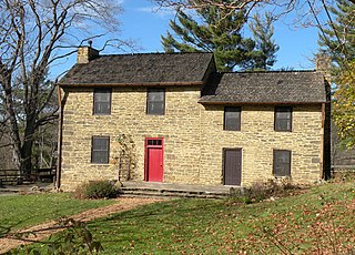
Upper St. Clair is a township with home rule status in southern Allegheny County, Pennsylvania, United States, located approximately 8 miles (13 km) south of Downtown Pittsburgh. It is known for being an affluent suburb with a nationally recognized school district. As of the 2010 census, the township population was 19,229.
South Park Township is a township in the southern part of Allegheny County, Pennsylvania, United States, near Pittsburgh. The population was 13,416 at the 2010 census.

Downtown Pittsburgh, colloquially referred to as the Golden Triangle, and officially the Central Business District, is the urban downtown center of Pittsburgh, Pennsylvania, United States. It is located at the confluence of the Allegheny River and the Monongahela River whose joining forms the Ohio River. The triangle is bounded by the two rivers.
Lincoln–Lemington–Belmar is a neighborhood in Pittsburgh, Pennsylvania. It is located in the northeastern section of the city and spans the Allegheny River. Lincoln–Lemington–Belmar houses PBF 15 Engine, and is covered by PBP Zone 5 and the Bureau of EMS Medic 1.

The Allegheny County Belt System color codes various county roads to form a unique system of routes in Allegheny County, Pennsylvania, and around the city of Pittsburgh.

Knoxville is a neighborhood in southern Pittsburgh, Pennsylvania, United States. It is part of zip code 15210, and has representation on Pittsburgh City Council by the council member for District 3.

Transportation in Pittsburgh, Pennsylvania is different than in many other major American cities. A large metropolitan area that is surrounded by rivers and hills, Pittsburgh has an infrastructure system that has been built out over the years to include roads, tunnels, bridges, railroads, inclines, bike paths, and stairways; however, the hills and rivers still form many barriers to transportation within the city.
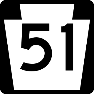
Pennsylvania Route 51 is a major state highway that is located in Western Pennsylvania in the United States. It runs for 89 miles (143 km) from Uniontown to the Ohio state line near Darlington, where it connects with Ohio State Route 14.
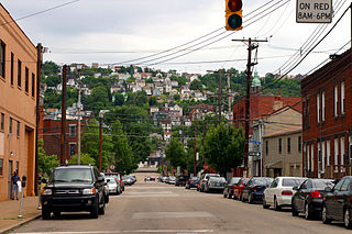
South Side Slopes is a neighborhood in Pittsburgh, Pennsylvania's South Side area. The neighborhood comprises the hills from the South Side Flats neighborhood along the Monongahela River from the Liberty Bridge (west) to beyond Josephine Street (east).
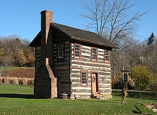
Lower St. Clair Township was a township in Allegheny County, Pennsylvania. The township was created by a division of St. Clair Township into Lower St. Clair and Upper St. Clair townships. St. Clair Township was named after Arthur St. Clair, an American Revolutionary War general and president of the Continental Congress.

The Three Rivers Heritage Trail is an urban rail trail paralleling the riverbanks in Pittsburgh, Pennsylvania and Allegheny County for about 33 miles (53 km), often on both sides of the rivers, and offering views of the city. The trail is promoted and maintained in part by the 'Friends of the Riverfront'.

Lake Monongahela was a proglacial lake in western Pennsylvania, West Virginia, and Ohio. It formed during the Pre-Illinoian ice epoch when the retreat of the ice sheet northwards blocked the drainage of these valleys to the north. The lake formed south of the ice front continued to rise until it was able to breach a low divide near New Martinsville, West Virginia. The overflow was the beginning of the process which created the modern Ohio River valley.
Pitt Township was one of the original townships created with the formation of Allegheny County, Pennsylvania in 1788. It repeatedly diminished in size until dissolving into the city of Pittsburgh in 1868.
