Libertyville, Iowa

Last updated

Libertyville, Iowa
Jefferson County Iowa Incorporated and Unincorporated areas Libertyville Highlighted.svg
Location of Libertyville, Iowa
Coordinates: 40°57′30″N92°02′59″W / 40.95833°N 92.04972°W / 40.95833; -92.04972
Country Flag of the United States.svg  United States
State Flag of Iowa.svg  Iowa
County Jefferson
Area
[1]
  Total0.51 sq mi (1.31 km2)
  Land0.51 sq mi (1.31 km2)
  Water0.00 sq mi (0.00 km2)
Elevation
[2]
761 ft (232 m)
Population
 (2020)
  Total274
  Density541.50/sq mi (209.05/km2)
Time zone UTC-6 (Central (CST))
  Summer (DST) UTC-5 (CDT)
ZIP code
52567
Area code 641
FIPS code 19-44985
GNIS feature ID2395702 [2]

Libertyville is a city in Jefferson County, Iowa, United States. The population was 274 at the time of the 2020 census. [3] It was platted in 1845. [4]

Contents

Geography

According to the United States Census Bureau, the city has a total area of 0.49 square miles (1.27 km2), all land. [5]

Demographics

Historical populations
YearPop.±%
1920 321    
1930 258−19.6%
1940 310+20.2%
1950 311+0.3%
1960 368+18.3%
1970 329−10.6%
1980 281−14.6%
1990 264−6.0%
2000 325+23.1%
2010 315−3.1%
1880 296−6.0%
2020 274−7.4%
Source: "U.S. Census website". United States Census Bureau . Retrieved March 29, 2020. and Iowa Data Center
Source:
U.S. Decennial Census [6] [3]

2010 census

As of the census [7] of 2010, there were 315 people, 132 households, and 86 families living in the city. The population density was 642.9 inhabitants per square mile (248.2/km2). There were 142 housing units at an average density of 289.8 per square mile (111.9/km2). The racial makeup of the city was 97.8% White, 0.3% Native American, 1.3% from other races, and 0.6% from two or more races. Hispanic or Latino of any race were 1.3% of the population.

There were 132 households, of which 33.3% had children under the age of 18 living with them, 54.5% were married couples living together, 8.3% had a female householder with no husband present, 2.3% had a male householder with no wife present, and 34.8% were non-families. Of all households 31.8% were made up of individuals, and 12.9% had someone living alone who was 65 years of age or older. The average household size was 2.39 and the average family size was 2.98.

The median age in the city was 38.2 years; 23.8% of residents were under the age of 18; 6.7% were between the ages of 18 and 24; 29.9% were from 25 to 44; 27.6% were from 45 to 64; and 12.1% were 65 years of age or older. The gender makeup of the city was 49.5% male and 50.5% female.

2000 census

As of the census [8] of 2000, there were 325 people, 138 households, and 85 families living in the city. The population density was 665.4 inhabitants per square mile (256.9/km2). There were 143 housing units at an average density of 292.8 per square mile (113.1/km2). The racial makeup of the city was 97.54% White, 0.31% African American, 0.31% Native American, 0.31% Asian, and 1.54% from two or more races. Hispanic or Latino of any race were 0.92% of the population.

There were 138 households, out of which 29.7% had children under the age of 18 living with them, 55.1% were married couples living together, 5.1% had a female householder with no husband present, and 37.7% were non-families. Of all households 32.6% were made up of individuals, and 15.2% had someone living alone who was 65 years of age or older. The average household size was 2.36 and the average family size was 3.05.

In the city, the population was spread out, with 26.8% under the age of 18, 6.8% from 18 to 24, 31.7% from 25 to 44, 21.8% from 45 to 64, and 12.9% who were 65 years of age or older. The median age was 37 years. For every 100 females, there were 91.2 males. For every 100 females age 18 and over, there were 84.5 males.

The median income for a household in the city was $31,071, and the median income for a family was $41,875. Males had a median income of $27,250 versus $17,656 for females. The per capita income for the city was $14,368. About 9.8% of families and 12.5% of the population were below the poverty line, including 16.1% of those under age 18 and none of those age 65 or over.

Notable person

Related Research Articles

<span class="mw-page-title-main">Libertyville, Alabama</span> Town in Alabama, United States

Libertyville is a town in Covington County, Alabama, United States. At the 2020 census, the population was 108.

<span class="mw-page-title-main">Harpers Ferry, Iowa</span> City in Iowa, United States

Harpers Ferry is a city in Taylor Township, Allamakee County, Iowa, United States. The population was 262 at the time of the 2020 census.

<span class="mw-page-title-main">Maynard, Iowa</span> City in Iowa, United States

Maynard is a city in Fayette County, Iowa, United States. The population was 476 at the time of the 2020 census.

<span class="mw-page-title-main">Hartwick, Iowa</span> City in Iowa, United States

Hartwick is a city in Poweshiek County, Iowa, United States. The population was 92 at the time of the 2020 census.

<span class="mw-page-title-main">Lilydale, Minnesota</span> City in Minnesota, United States

Lilydale is a city in Dakota County, Minnesota, United States. The population was 623 at the 2010 census.

<span class="mw-page-title-main">Wanamingo, Minnesota</span> City in Minnesota, United States

Wanamingo is a community in Goodhue County, Minnesota, United States, incorporated as a city. It lies along the North Fork of the Zumbro River. The population was 1,086 at the 2010 census.

<span class="mw-page-title-main">Erhard, Minnesota</span> City in Minnesota, United States

Erhard is a city in Otter Tail County, Minnesota, United States. The population was 132 at the 2020 census.

<span class="mw-page-title-main">Urbank, Minnesota</span> City in Minnesota, United States

Urbank is a city in Otter Tail County, Minnesota, United States. The population was 52 at the 2020 census.

<span class="mw-page-title-main">Orr, Minnesota</span> City in Minnesota, United States

Orr is a city in Saint Louis County, Minnesota, United States. The population was 211 at the 2020 census.

<span class="mw-page-title-main">Wheaton, Missouri</span> City in Missouri, United States

Wheaton is a city in Wheaton Township, Barry County, Missouri, United States. The population was 696 at the 2010 census.

<span class="mw-page-title-main">Lake Lafayette, Missouri</span> City in Missouri, United States

Lake Lafayette is a city in Lafayette County, Missouri, and is part of the Kansas City metropolitan area within the United States. The population was 327 at the 2010 census.

<span class="mw-page-title-main">Crystal Lakes, Missouri</span> City in Missouri, United States

Crystal Lakes is a city in western Ray County, Missouri, and part of the Kansas City metropolitan area within the United States. The population was 390 at the 2020 census.

<span class="mw-page-title-main">Breckenridge Hills, Missouri</span> City in Missouri, United States

Breckenridge Hills is a city in St. Louis County, Missouri, United States. As of the 2010 census, the city population was 4,746.
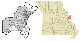
<span class="mw-page-title-main">Flordell Hills, Missouri</span> City in Missouri, United States

Flordell Hills is a city in St. Louis County, Missouri, United States. The population was 822 at the 2010 census.

<span class="mw-page-title-main">Clarkson Valley, Missouri</span> City in Missouri, United States

Clarkson Valley is a city in St. Louis County, Missouri, United States. The population was 2,609 at the 2020 census.
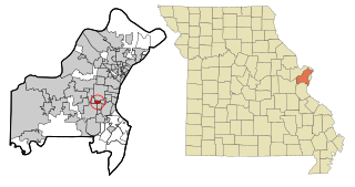
<span class="mw-page-title-main">Warson Woods, Missouri</span> City in Missouri, United States

Warson Woods is a city in St. Louis County, Missouri, United States. The population was 1,962 at the 2010 census.

<span class="mw-page-title-main">Willow City, North Dakota</span> City in North Dakota, United States

Willow City is a city in Bottineau County, North Dakota, United States. The population was 149 at the 2020 census. Willow City was founded in 1887.

<span class="mw-page-title-main">Milton, North Dakota</span> City in North Dakota, United States

Milton is a city in Cavalier County, North Dakota, United States. The population was 39 at the 2020 census. Milton was founded in 1887.
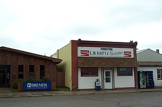
<span class="mw-page-title-main">Fordville, North Dakota</span> City in North Dakota, United States

Fordville is a city in Walsh County, North Dakota, United States. The population was 207 at the 2020 census. Fordville was founded in 1905.

<span class="mw-page-title-main">Stonewood, West Virginia</span> City in West Virginia, United States

Stonewood is a city in Harrison County, West Virginia, United States. The population was 1,810 at the 2020 census.

References

  1. "2020 U.S. Gazetteer Files". United States Census Bureau. Retrieved March 16, 2022.
  2. 1 2 U.S. Geological Survey Geographic Names Information System: Libertyville, Iowa
  3. 1 2 "2020 Census State Redistricting Data". census.gov. United states Census Bureau. Retrieved August 12, 2021.
  4. History of Libertyville
  5. "US Gazetteer files 2010". United States Census Bureau. Archived from the original on January 12, 2012. Retrieved May 11, 2012.
  6. "Census of Population and Housing". Census.gov. Retrieved June 4, 2015.
  7. "U.S. Census website". United States Census Bureau . Retrieved May 11, 2012.
  8. "U.S. Census website". United States Census Bureau . Retrieved January 31, 2008.