Liebenfels

Last updated
Liebenfels
Liebenfels Burgruine 14032007 02.jpg
Liebenfels Castle
Wappen at liebenfels.png
Coat of arms
Austria adm location map.svg
Red pog.svg
Liebenfels
Location within Austria
Coordinates: 46°44′N14°17′E / 46.733°N 14.283°E / 46.733; 14.283 Coordinates: 46°44′N14°17′E / 46.733°N 14.283°E / 46.733; 14.283
Country Austria
State Carinthia
District Sankt Veit an der Glan
Government
   Mayor Klaus Köchl (SPÖ)
Area
[1]
  Total58.85 km2 (22.72 sq mi)
Elevation
491 m (1,611 ft)
Population
 (2018-01-01) [2]
  Total3,329
  Density57/km2 (150/sq mi)
Time zone UTC+1 (CET)
  Summer (DST) UTC+2 (CEST)
Postal code
9356
Area code 04215
Website liebenfels.at

Liebenfels (Slovene : Lepo Polje) is a market town in the district of Sankt Veit an der Glan in the Austrian state of Carinthia.

Contents

Geography

View from Schneebauerberg over Sorg and Liebenfels Castle Liebenfels Blick auf Soerg vom Schneebauer 06012008 01.jpg
View from Schneebauerberg over Sörg and Liebenfels Castle

The municipal area is situated on the southern slopes of the Gurktal Alps. It lies about 6 km (3.7 mi) west of the district capital Sankt Veit an der Glan and directly north of the state capital Klagenfurt. The highest point in the municipality is the Schneebauerberg with an elevation of 1,338 m (4,390 ft), and the lowest is in the valley of the Glan river at 477 m (1,565 ft).

The municiplatiy comprises the cadastral communities of Freundsam, Glantschach, Gradenegg, Hardegg, Liebenfels proper, Liemberg, Pflausach, Rosenbichl, Rottschaft Feistritz, Sörg, and Sörgerberg.

History

While the oldest archaeological findings in the area date back to the Neolithic, the foundation of an ancient temple were discovered on a hill near the village of Hohenstein. The building was erected in the 2nd century AD, when the area was part of the Roman Noricum province, and dedicated to the local Celtic goddess Noreia.

The building of church in the village of Glantschach was documented between 958 and 991. Located near the central Zollfeld area in the Duchy of Carinthia, Liebenfels is the site of numerous medieval castles and residences, most notably Liebenfels Castle which was first mentioned as Liewenvelse in a 1312 deed.

Related Research Articles

Straßburg, Austria Place in Carinthia, Austria

Straßburg is a town in the district of Sankt Veit an der Glan in Carinthia, Austria.

Feldkirchen in Kärnten Place in Carinthia, Austria

Feldkirchen in Kärnten is a town in the Austrian state of Carinthia and the capital of the district of the same name. It consists of the Katastralgemeinden Fasching, Feldkirchen, Glanhofen, Gradisch, Hoefling, Klein Sankt Veit, Pernegg, Rabensdorf, Sankt Ulrich, Sittich, Tschwarzen and Waiern.

Sankt Veit an der Glan Place in Carinthia, Austria

Sankt Veit an der Glan is a town in the Austrian state of Carinthia, the administrative centre of the Sankt Veit an der Glan District. It was the historic Carinthian capital until 1518.

Glanegg Place in Carinthia, Austria

Glanegg is a town in the district of Feldkirchen in Carinthia in Austria.

Althofen Place in Carinthia, Austria

Althofen is a town in the district of Sankt Veit an der Glan in the Austrian state of Carinthia.

Brückl Place in Carinthia, Austria

Brückl is a town in the district of Sankt Veit an der Glan in the Austrian state of Carinthia.

Deutsch-Griffen Place in Carinthia, Austria

Deutsch-Griffen is a municipality in the district of Sankt Veit an der Glan in Austrian state of Carinthia.

Eberstein, Austria Place in Carinthia, Austria

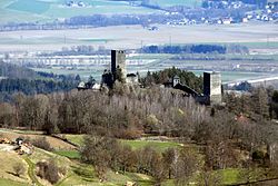
Eberstein is a town in the district of Sankt Veit an der Glan in the Austrian state of Carinthia.

Frauenstein, Austria Place in Carinthia, Austria

Frauenstein is a town in the district of Sankt Veit an der Glan in the Austrian state of Carinthia.

Glödnitz Place in Carinthia, Austria

Glödnitz is a municipality in the district of Sankt Veit an der Glan in the Austrian state of Carinthia.

Guttaring Place in Carinthia, Austria

Guttaring is a town in the district of Sankt Veit an der Glan in the Austrian state of Carinthia.

Hüttenberg, Austria Place in Carinthia, Austria

Hüttenberg is a market town in the district of Sankt Veit an der Glan in the Austrian state of Carinthia.

Kappel am Krappfeld Place in Carinthia, Austria

Kappel am Krappfeld is a town in the district of Sankt Veit an der Glan in the Austrian state of Carinthia. It is the birthplace of Maria Lassnig.

Klein Sankt Paul Place in Carinthia, Austria

Klein Sankt Paul is a town in the district of Sankt Veit an der Glan in the Austrian state of Carinthia.

Metnitz Place in Carinthia, Austria

Metnitz is a town in the district of Sankt Veit an der Glan in the Austrian state of Carinthia.

Micheldorf Place in Carinthia, Austria

Micheldorf is a municipality in the district of Sankt Veit an der Glan in the Austrian state of Carinthia.

Mölbling Place in Carinthia, Austria

Mölbling is a municipality on the Gurk River in the district of Sankt Veit an der Glan in the Austrian state of Carinthia.

Sankt Georgen am Längsee Place in Carinthia, Austria

Sankt Georgen am Längsee is a municipality in the district of Sankt Veit an der Glan in Carinthia, Austria.

Weitensfeld im Gurktal Place in Carinthia, Austria

Weitensfeld im Gurktal is a market town in the district of Sankt Veit an der Glan in the Austrian state of Carinthia.

Schwarzach im Pongau Place in Salzburg, Austria

Schwarzach im Pongau is a market town in the St. Johann im Pongau District in the Austrian state of Salzburg.

References

  1. "Dauersiedlungsraum der Gemeinden Politischen Bezirke und Bundesländer - Gebietsstand 1.1.2018". Statistics Austria. Retrieved 10 March 2019.
  2. "Einwohnerzahl 1.1.2018 nach Gemeinden mit Status, Gebietsstand 1.1.2018". Statistics Austria. Retrieved 9 March 2019.