Lincoln Highway in Greene County, Iowa

Last updated

The Lincoln Highway in
Greene County, Iowa
JeffersonIA LincolnStatue.jpg
The Lincoln statue in Jefferson.
USA Iowa location map.svg
Red pog.svg
Usa edcp location map.svg
Red pog.svg
Location Greene County, Iowa
Coordinates 42°0′55″N94°22′29″W / 42.01528°N 94.37472°W / 42.01528; -94.37472
MPS The Lincoln Highway in Greene County, Iowa MPS
NRHP reference No. 64500168 [1]
Added to NRHPMarch 29, 1993

The Lincoln Highway in Greene County, Iowa is a multiple property submission to the National Register of Historic Places, which was approved on March 29, 1993. It includes five individual listings and five historic districts located in Greene County, Iowa, United States. They encompass abandoned sections of dirt roads, paved sections that are now part of other highways, and various sites, objects, structures and pieces of infrastructure that were a part of the Lincoln Highway. The years of historical significance are 1912 to 1928.

Contents

The Lincoln Highway in Iowa

The Lincoln Highway route marker. LincolnHighwayMarker.svg
The Lincoln Highway route marker.

Carl Fisher was an American automotive and real estate entrepreneur who conceived the Lincoln Highway in 1912, and helped to develop it. Connecting New York City to San Francisco, it was the first highway to cross the United States. The intention to develop the highway was announced in 1913, and Iowans raised over $5 million for the construction of the road. [2] There were no particularly good options to cross Iowa, but the Lincoln Highway Association wanted a direct route between Chicago and Omaha. [3] The route through Iowa was announced on September 14, 1913. They chose what was known as the "Iowa Official Trans-Continental Route," which was already being used by transcontinental motorists through the state. It covered 358 miles (576 km) of dirt and gravel roads that began in Clinton and traveled west to Council Bluffs. [4] Rural roads in Iowa were notorious for their poor condition, and when it rained the mud made them even worse. The chosen route paralleled the Chicago Northwestern Railroad tracks as they followed the driest and least hilly terrain in the state. [5]

In Iowa the Lincoln Highway was also known as State Primary Road No. 6 from 1920 to 1926. Its designation changed when the federal highway system was created and it became known as U.S. 30 in 1926. The Lincoln Highway Association operated until 1927, however, the following year it put up memorial markers along the route. The old Lincoln Highway remained a major transportation artery in Iowa into the 1950s when the state constructed a new US Highway 30.

Lincoln Highway in Green County

Greene County had a history of providing good roads early in the 20th century, so much so that it was the first Iowa county to receive Rural Free Delivery (RFD) mail service. [5] There were 20 reinforced bridges in the county in 1907, and by 1909 it had 175 miles (282 km) of gravel roads. The year the Lincoln Highway route was announced, the Greene County Board of Supervisors established an official county road system that connected all the towns in the county. The citizens of the county worked to raise funds to promote and improve the Lincoln Highway through their territory. The Board of Supervisors spent $15,000 to improve the roadway in 1914, and the citizens raised another $5,000. A statue of Abraham Lincoln, a gift from E.B. and Minnie Wilson, was placed on the courthouse square in 1918 to commemorate the highway. The county was the first to accept Federal funds for paving roads in 1919. While the “seedling mile” outside of Marion was the first section of the Lincoln Highway that was paved in the state, Greene County was the first county to pave their portion of the highway. The first paved portion was a 6.5-mile (10.5 km) section equidistant from the center of Jefferson. All 30 miles (48 km) in the county were paved by 1924. The route through Green County was changed several times between 1913 and 1924. This was done as highway design and engineering standards evolved so that curves were straightened, hills were graded, and rail crossings were avoided.

Individual listings

Lincoln Highway Markers

The Lincoln Highway Markers are 48.5-inch (1.23 m) high concrete structures. They are composed of a 28-inch (71 cm) octagon shaped post and a rectangular top that are cast in one piece. [6] A nearly 4-inch (10 cm) medallion of Abraham Lincoln is embedded in the front side of the rectangular top. It is inscribed with: "This highway dedicated to Abraham Lincoln." Below the medallion an "L" and a direction arrow are stamped into the concrete. The markers were the last official signs used to designate the highway right of way. About 3,000 of them were cast. They were placed in designated spots about 1 mile (1.6 km) apart by local Boy Scout troops in 1928.

Six markers are known to exist in Green County. Five are located along the highway and one is broken and is located in the Greene County Museum. Two of the markers are individually listed on the National Register of Historic Places. Lincoln Highway Marker (2) is located near the Lincoln Statue on the grounds of the Greene County Courthouse in Jefferson. Given its location along the highway and next to the Lincoln statue it is possible that this marker was installed here in 1928, but that cannot be determined definitively. [6] In 2011 this marker was included as a contributing property in the Jefferson Square Commercial Historic District. [7] Lincoln Highway Marker (1) is also in Jefferson in an address restricted location.

Buttrick's Creek Abandoned Segment

Abandoned section of the highway. GreeneCountyIA LincolnHighway ButtricksCreekAbandonedSegment.jpg
Abandoned section of the highway.

This 600-by-66-foot (183 by 20 m) section of abandoned roadway was part of the original Lincoln Highway route. [8] It was abandoned when a curve was straightened in 1920. This section was a part of the roadway that went past the farmstead of Capt. Albert Head, an early promoter of the highway who made significant monetary contributions to its development. Head also contributed toward the construction of a nearby bridge, no longer extant. While the bridge's construction in 1914 straightened part of the roadway, motorists still had to negotiate a tight curve immediately south of the bridge. The realignment removed this curve, but kept the roadway close to the farmsteads.

The abandoned section lays perpendicular to the west from County Road E53. It is located on a grass incline, and the old grade and cut banks are clearly visible. [8] The old roadway is no longer used for any purpose, and the grade and cut banks are covered with mowed grass. A partially buried concrete headwall of a driveway culvert is located at the top of the incline. Its design and materials are consistent with other culverts along the old highway.

Little Beaver Creek Bridge

Little Beaver Creek Bridge GreeneCountyIA LincolnHighway LittleBeaverCreekBridge.jpg
Little Beaver Creek Bridge

The bridge over Little Beaver Creek is a reinforced concrete deck structure with concrete baluster guardrails built in 1915. [9] It carries the traffic of a gravel rural road over the creek. The road served as part of the Lincoln Highway between 1914 and 1922. Originally, the highway was designated to be a mile south along the Chicago Northwestern tracks, but the Greene and Boone County segments would not align. Greene County moved its route to the north so the two segments would meet at the county line. In 1920 a sizable contingent of residents from Grand Junction petitioned to have the route shifted back to the south. Both county Boards of Supervisors agreed to route the highway south of the railroad tracks, which necessitated a new stretch of highway to be built. It was completed in 1922, and the Greene County Board of Supervisors returned this bridge and the road it serves to the township road system on October 23.

Lincoln Statue

This statue of Abraham Lincoln is a replica of W. Granville Hastings’ statue in Cincinnati, Ohio. [10] It was a gift of E.B. and Minnie Wilson. Dedicated on September 22, 1918, it was the first statue of Lincoln built beside, and dedicated to, the Lincoln Highway. [11]

Historic districts

Buttrick's Creek to Grand Junction Segment

County Road E53, formerly part of the Lincoln Highway GreeneCountyIA LincolnHighway ButtricksCreekToGrandJunctionSegment.jpg
County Road E53, formerly part of the Lincoln Highway

This is an original section of the old Lincoln Highway from 1913, and it is now part of County Road E53. It runs across 2.4 miles (3.9 km) of relatively level farm land from a curve east of Buttrick's Creek to Iowa Highway 144 just south of Grand Junction. [12] At one time the junction with Iowa 144 was a Y-intersection that has subsequently been converted into a T intersection. The Lincoln Highway through Iowa had many Y-intersections, and they have likewise been converted. [12] A jog in the road was straightened in 1920, and this whole stretch of highway was paved with concrete in 1924 by Empire Construction Company of Des Moines. There are six contributing resources to this historic district, all structures: the roadway itself, the road drainage system, and four culverts. Construction plans from 1923 show that the culverts and half of the drainage system were in place when the highway was paved. The roadway is 18 feet (5.5 m) across, and within a 66-foot (20 m) right-of-way. The drainage system includes two lines of 6-inch (150 mm) drainage tiles and 12 intakes. Each intake is a conical-shaped cast iron grate that covers a subsurface concrete cylinder. The four culverts include one concrete driveway culvert and three concrete box culverts, all of different sizes.

Grand Junction Segment

Former gas station in Grand Junction along the old Lincoln Highway route. GrandJunctionIA LincolnHighwaySegment GasStation.jpg
Former gas station in Grand Junction along the old Lincoln Highway route.

Most of this 1.75-mile (2.82 km) section of the Lincoln Highway was not on the original route from 1913, but was part of the negotiations with Boone County to re-route the highway south of the Chicago Northwestern tracks in 1920. [13] The new alignment required a new roadway to be built, and it eliminated all railroad crossings on this part of the highway. It was completed in 1922. The western section of the roadway is in the town of Grand Junction, and it was paved in 1923. The rural section on the east side was paved the following year. Empire Construction completed both projects. Like the segment in the historic district above, it is now a part of County Road E53. The town section passes through the central business district on the west and a residential area on the east. The rural section passes along the railroad tracks and under the US 30 overpass before it connects with the newer highway. There are six contributing resources to this historic district, five structures and one object. The structures are the 0.75-mile (1.21 km) section of urban roadway, the 1 mile (1.6 km) section of rural roadway, the West Beaver Creek Bridge, one culvert and the road drainage system. The object is a Lincoln Highway Marker that stands in front of the Grand Junction city hall. The West Beaver Creek Bridge is a 24-by-24-foot (7.3 by 7.3 m) concrete slab bridge with closed guardrails. It is located outside of town on the rural section of roadway. Christenson Construction Company built the structure for $3,440. [13]

Raccoon River Rural Segment

Eureka Bridge GreeneCountyIA LincolnHighway RaccoonRiverRuralSegmentBridge.jpg
Eureka Bridge

This is another original section of the old Lincoln Highway from 1913 that is now part of County Road E53. [14] It runs through 3.6 miles (5.8 km) of rolling farmland, and through the Raccoon River Valley. There are 11 contributing resources to this historic district, 10 structures and one site. The roadway is one structure broken into three segments. The first segment is a 1.4-mile (2.3 km) section on the west side of the district. It was paved in 1924 by Empire Construction. The second segment is a 1.3-mile (2.1 km) section on the east and west sides of the Eureka Bridge. It includes Danger Hill where the grade was reduced considerably in 1920 and a jog in the highway was replaced with a curve. The C.C. Barnes Company completed the work. Empire Construction also paved this section in 1924. The third segment is a 0.9-mile (1.4 km) section on the east side of the district. It was one of the first sections of the Lincoln Highway paved in Greene County in 1920. The work was completed by F.E. Marsh Company of Jefferson, Iowa. The Eureka Bridge is a five-span reinforced concrete arch bridge. Each span is 77 feet (23 m) wide with an overall length of 422 feet (129 m). It replaced an earlier span that was partially washed out by a flood in 1912. Marsh Engineering Company of Des Moines constructed the bridge that was designed by the Iowa Highway Commission. It is one of the earliest arch bridges still standing in Iowa, and one of the first designed by the state highway commission. [14] Because of increased traffic on the span it had to be widened in 1924. Other historic structures include the road drainage system, six culverts, and one cattle pass. The site is 600 feet (180 m) of abandoned roadway at the top of Danger Hill. This section of roadway appears not to have been paved, and it includes one of the culverts.

West Beaver Creek Abandoned Segment

Bridge on the West Beaver Creek Abandoned Segment Lincoln Highway-West Beaver Creek Abandoned Segment - Greene County- Iowa-NRHP 93000169-10-8-2016-5022.jpg
Bridge on the West Beaver Creek Abandoned Segment

This abandoned section of roadway was part of the original Lincoln Highway from 1913. [15] It lies to the north of the Chicago Northwestern tracks which are immediately to the north of the Grand Junction Segment (see above). The Lincoln Highway route was moved north in eastern Greene County in 1914 so the Greene and Boone County segments of the highway would connect. The realignment also removed a couple of dangerous railroad crossings at the same time. This section of roadway survived that realignment, and remained part of the highway until 1922 when the right-of-way was shifted south of the railroad tracks and a new roadway was built. This realignment removed another railroad crossing at Grand Junction. There are three contributing resources to this historic district, two structures and one site. One of the structures is a 18-by-24-foot (5.5 by 7.3 m) concrete bridge that features concrete balustered guardrails. It was built by the Iowa Bridge Company in 1915 for $1,339. It replaced an older wooden span. A partially buried concrete driveway culvert is the other structure, and a 0.1-mile (0.16 km) section of the abandoned dirt roadway is the site. The roadway was never paved. The historic district is located on a farm and the former roadway and bridge are still used to move farm machinery.

West Greene County Rural Segment

One of the property markers on the West Greene County Rural Segment. GreeneCountyIA LincolnHighway WestGreeneCountyRuralSegment MossMarker.jpg
One of the property markers on the West Greene County Rural Segment.

This is yet another original section of the old Lincoln Highway from 1913. The east–west section of roadway is now part of County Road E39, and the north–south section of the roadway is part of Iowa Highway 25. The highways are located on relatively level farmland. There are 13 contributing resources to this historic district, 11 structures and two objects. [16] The structures include the 4.35 miles (7.00 km) of roadway, the road drainage system, eight culverts, and a skew I-beam bridge. Empire Construction paved this section of the Lincoln Highway in 1924. Part of the paving project included the construction of a new bridge. The I-beam structure was completed by C.J. Kramme of Fort Dodge, Iowa for $5,413. It replaced an earlier wooden span. The objects are two property markers located on private property where the road turns south from County Road E39 onto Iowa 25. They were placed here by James E. Moss, who farmed the land and was an ardent supporter of the Lincoln Highway. Moss was a Civil War veteran who lost a foot at Missionary Ridge. He had these identical markers erected in 1926 as memorials to Abraham Lincoln, whom he considered "one of our greatest citizens." [16] They are concrete structures created by Harold Carlisle of Jefferson, and are capped by a concrete bust of Abraham Lincoln. The original busts were broken off and have been replaced. An "L" is stamped on the shoulder of the base, and "J.E. Moss" stamped on front. Similar markers were to be erected at several other points in Greene County, but there is no evidence that they ever were. [16]

Related Research Articles

<span class="mw-page-title-main">California State Route 1</span> State highway in California, United States

State Route 1 (SR 1) is a major north–south state highway that runs along most of the Pacific coastline of the U.S. state of California. At 656 miles (1,056 km), it is the longest state route in California, and the second-longest in the US after Montana Highway 200. SR 1 has several portions designated as either Pacific Coast Highway (PCH), Cabrillo Highway, Shoreline Highway, or Coast Highway. Its southern terminus is at Interstate 5 (I-5) near Dana Point in Orange County and its northern terminus is at U.S. Route 101 (US 101) near Leggett in Mendocino County. SR 1 also at times runs concurrently with US 101, most notably through a 54-mile (87 km) stretch in Ventura and Santa Barbara counties, and across the Golden Gate Bridge.

The Alaska Highway was constructed during World War II to connect the contiguous United States to Alaska across Canada. It begins at the junction with several Canadian highways in Dawson Creek, British Columbia, and runs to Delta Junction, Alaska, via Whitehorse, Yukon. When it was completed in 1942, it was about 2,700 kilometres (1,700 mi) long, but in 2012, it was only 2,232 km (1,387 mi). This is due to the continuing reconstruction of the highway, which has rerouted and straightened many sections. The highway opened to the public in 1948. Once legendary for being a rough, challenging drive, the highway is now paved over its entire length. Its component highways are British Columbia Highway 97, Yukon Highway 1, and Alaska Route 2.

<span class="mw-page-title-main">U.S. Route 18</span> Highway in the United States

U.S. Highway 18 (US 18) is an east–west United States Numbered Highway in the Midwestern United States. The western terminus is in Orin, Wyoming, at an interchange with Interstate 25 (I-25). Its eastern terminus is in downtown Milwaukee, Wisconsin. However, US 18 runs concurrent with other U.S. Highways from its western terminus to Mule Creek Junction, Wyoming. US 18 is one of the original U.S. Highways of 1926. The US 18 designation was originally proposed for a road in Michigan from Grand Haven east to Detroit. This roadway was eventually designated as US 16.

<span class="mw-page-title-main">New York State Route 42</span> State highway in New York, US

New York State Route 42 (NY 42) is a north–south, discontinuous state highway in the Catskill Mountains region of New York in the United States. The southernmost of the highway's two segments begins at an intersection with U.S. Route 6 (US 6) and US 209 in Port Jervis and ends at a junction with NY 55 near the Rondout Reservoir in Neversink. NY 42's northern segment runs from NY 28 in Shandaken to NY 23A in Lexington. The 41-mile (66 km) southern segment is located in Orange County and Sullivan County, while the 11-mile (18 km) northern segment is in Ulster County and Greene County.

<span class="mw-page-title-main">U.S. Route 66 in Kansas</span> Historic highway in Kansas

U.S. Route 66, the historic east–west US highway between Chicago, Illinois and Santa Monica, California, passed through one brief segment in the southeastern corner of Kansas. It entered the state south of Baxter Springs and continued north until it crossed Brush Creek, from where it turned east and left the state in Galena. After the decertification of the highway in 1985, this road segment was numbered as US-69 (alternate) from Quapaw, Oklahoma north to Riverton, Kansas and as K-66 from Riverton east to Route 66 in Missouri.

<span class="mw-page-title-main">U.S. Route 66 in Illinois</span> Historic highway in Illinois

U.S. Route 66 was a United States Numbered Highway in Illinois that connected St. Louis, Missouri, and Chicago, Illinois. The historic Route 66, the Mother Road or Main Street of America, took long distance automobile travelers from Chicago to Southern California. The highway had previously been Illinois Route 4 and the road has now been largely replaced with Interstate 55 (I-55). Parts of the road still carry traffic and six separate portions of the roadbed have been listed on the National Register of Historic Places.

<span class="mw-page-title-main">Minnesota State Highway 91</span>

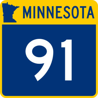
Minnesota State Highway 91 (MN 91) is a 61.456-mile-long (98.904 km) highway in southwest Minnesota. It runs from Lyon County Road L14 at the Iowa state line near Ellsworth northward to State Highway 23 at Russell.

<span class="mw-page-title-main">U.S. Route 30 in Iowa</span> U.S. Highway in Iowa

U.S. Highway 30 (US 30) is a major east–west U.S. Highway which spans 330 miles (530 km) across the state of Iowa. It is the longest primary highway in the state and is maintained by the Iowa Department of Transportation. The route in Iowa begins at the Missouri River crossing at Blair, Nebraska, and ends at the Mississippi River crossing at Clinton, Iowa. Along the way, it serves Denison and Carroll in western Iowa, Boone, Ames, and Marshalltown in central Iowa, and Tama, Cedar Rapids, and DeWitt in eastern Iowa. Cutting across the central portion of the state, US 30 runs within close proximity of the Union Pacific Railroad's Overland Route for its entire length.

<span class="mw-page-title-main">Maryland Route 26</span> State highway in Maryland, US

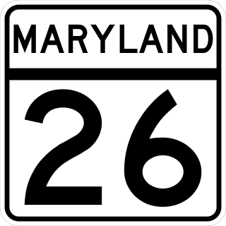
Maryland Route 26 is a state highway in the U.S. state of Maryland. Known for most of its length as Liberty Road, the state highway runs 44.10 miles (70.97 km) from U.S. Route 15 in Frederick east to MD 140 in Baltimore. MD 26 connects Frederick and Baltimore with the highway's namesake of Libertytown in eastern Frederick County, the suburban area of Eldersburg in southern Carroll County, and the western Baltimore County suburbs of Randallstown, Milford Mill, and Lochearn. The highway also serves as a major thoroughfare in the western part of Baltimore, where the street is named Liberty Heights Avenue. MD 26 is maintained by the Maryland State Highway Administration outside of Baltimore and by the Baltimore City Department of Transportation within the city.

<span class="mw-page-title-main">U.S. Route 15 in Maryland</span> Part of the U.S. Highway System in Maryland

U.S. Route 15 (US 15) is a part of the United States Numbered Highway System that runs from Walterboro, South Carolina, north to Painted Post, New York. In Maryland, the highway runs 37.85 miles (60.91 km) from the Virginia state line at the Potomac River in Point of Rocks north to the Pennsylvania state line near Emmitsburg. Known for most of its length as Catoctin Mountain Highway, US 15 is the primary north–south highway of Frederick County. The highway connects the county seat of Frederick with Point of Rocks, Leesburg, Virginia, and Charles Town, West Virginia, to the south and with Thurmont, Emmitsburg, and Gettysburg, Pennsylvania, to the north. US 15 is a four-lane divided highway throughout the state except for the portion between the Point of Rocks Bridge and the highway's junction with US 340 near Jefferson. The highway is a freeway along its concurrency with US 340 and through Frederick, where the highway meets US 40 and Interstate 70 (I-70). US 15 has a business route through Emmitsburg.

<span class="mw-page-title-main">Interstate 80 in Nebraska</span> Highway in Nebraska

Interstate 80 (I-80) in the US state of Nebraska runs east from the Wyoming state border across the state to Omaha. Construction of the stretch of I-80 spanning the state was completed on October 19, 1974. Nebraska was the first state in the nation to complete its mainline Interstate Highway System.

<span class="mw-page-title-main">Lincoln Highway (Omaha)</span>

The Lincoln Highway in Omaha, Nebraska, runs east–west from near North 183rd Street and West Dodge Road in Omaha, Nebraska, towards North 192nd Street outside of Elkhorn. This section of the Lincoln Highway, one of only 20 miles (32 km) that were paved with brick in Nebraska, is one of the most well-preserved in the country. The roadway was listed on the National Register of Historic Places in 1984. The Lincoln Highway was the first road across the United States, traversing coast-to-coast from Times Square in New York City to Lincoln Park in San Francisco, California.

Federal Highway 5 is a tollfree part of the federal highways corridors, and follows the northeast length of the state of Baja California from the US-Mexico border in Mexicali at the northern point at San Felipe in the south. The highway is entirely inside the Mexicali Municipality. However, a state highway from San Felipe to Puertecitos is usually considered part of Fed. 5. From San Felipe to the south, the road follows the seacoast of the Gulf of California.

<span class="mw-page-title-main">U.S. Route 64 in Arkansas</span>

U.S. Route 64 is a U.S. highway running from Teec Nos Pos, Arizona east to Nags Head, North Carolina. In the U.S. state of Arkansas, the route runs 246.35 miles (396.46 km) from the Oklahoma border in Fort Smith east to the Tennessee border in Memphis. The route passes through several cities and towns, including Fort Smith, Clarksville, Russellville, Conway, Searcy, and West Memphis. US 64 runs parallel to Interstate 40 until Conway, when I-40 takes a more southerly route.

<span class="mw-page-title-main">Arkansas Highway 365</span> State highway in Arkansas, U.S.

Arkansas Highway 365 is a north–south state highway in Central Arkansas. The route of 69.31 miles (111.54 km) runs from US 65B/US 79B in Pine Bluff north through Little Rock to US 65B/AR 60 in Conway. The route is a redesignation of former U.S. Route 65, which has since been rerouted onto various Interstate highways through the area. Portions of Highway 365 in Jefferson County are former alignments of the Dollarway Road, which was the longest paved concrete road upon completion in 1913.

<span class="mw-page-title-main">Zion – Mount Carmel Highway</span> United States historic place

The Zion – Mount Carmel Highway is a 25-mile (40 km) long road in Washington and Kane counties in southern Utah, United States, that is listed on the National Register of Historic Places and is a National Historic Civil Engineering Landmark.

<span class="mw-page-title-main">Iowa Primary Highway System</span>

The primary highway system makes up over 9,000 miles (14,000 km), approximately 8 percent of the U.S. state of Iowa's public road system. The Iowa Department of Transportation is responsible for the day-to-day maintenance of the primary highway system, which consists of Interstate Highways, United States Highways, and Iowa state highways. Currently, the longest primary highway is U.S. Highway 30 at 332 miles (534 km). The shortest highway is Interstate 129 at 0.27 miles (430 m).

<span class="mw-page-title-main">Statue of Abraham Lincoln (Jefferson, Iowa)</span> United States historic place

The Lincoln Statue is an historic structure located on the grounds of the Greene County Courthouse in Jefferson, Iowa, United States. It was erected in 1918, and individually listed on the National Register of Historic Places in 1993. In 2011 it was included as a contributing property in the Jefferson Square Commercial Historic District.

<span class="mw-page-title-main">Old US 41–Backwater Creek Bridge</span> United States historic place

The Old US 41–Backwater Creek Bridge is a bridge located on an abandoned section of US Highway 41 (US 41) over Backwater Creek in Baraga Township, Michigan. It was listed on the National Register of Historic Places in 1999.

<span class="mw-page-title-main">U.S. Route 71 in Arkansas</span>

U.S. Highway 71 is a U.S. highway that runs from Krotz Springs, LA to the Fort Frances–International Falls International Bridge at the Canadian border. In Arkansas, the highway runs from the Louisiana state line near Doddridge to the Missouri state line near Bella Vista. In Texarkana, the highway runs along State Line Avenue with US 59 and partially runs in Texas. Other areas served by the highway include Fort Smith and Northwest Arkansas.

References

  1. "National Register Information System". National Register of Historic Places . National Park Service. March 13, 2009.
  2. "Says Iowa Will Get Lincoln Highway". Des Moines Tribune. September 3, 1913. p. 3.
  3. Rebecca Conard. "The Lincoln Highway in Greene County, Iowa" (PDF). National Park Service . Retrieved February 23, 2016.
  4. Thompson, William H. (1989). Transportation in Iowa: A Historical Summary. Iowa Department of Transportation. pp. 100–101. ISBN   0-9623167-0-9.
  5. 1 2 "Greene". Iowa Lincoln Highway Association. Retrieved February 23, 2016.
  6. 1 2 Rebecca Conard. "Lincoln Highway Marker (2)" (PDF). National Park Service . Retrieved February 23, 2016.
  7. James E. Jacobsen. "Jefferson Square Commercial Historic District" (PDF). National Park Service. Archived from the original (PDF) on August 23, 2016. Retrieved August 16, 2016.
  8. 1 2 Rebecca Conard. "The Lincoln Highway: Buttrick's Creek Abandoned Segment" (PDF). National Park Service . Retrieved February 23, 2016.
  9. Rebecca Conard. "The Lincoln Highway: Little Beaver Creek Bridge" (PDF). National Park Service . Retrieved February 23, 2016.
  10. "Hastings Statue in Jefferson, Iowa". Abraham Lincoln Online. Retrieved February 23, 2016.
  11. Rebecca Conard. "Lincoln Statue" (PDF). National Park Service . Retrieved February 24, 2016.
  12. 1 2 Rebecca Conard. "The Lincoln Highway: Buttrick's Creek to Grand Junction Segment" (PDF). National Park Service . Retrieved February 24, 2016.
  13. 1 2 Rebecca Conard. "The Lincoln Highway: Grand Junction Segment" (PDF). National Park Service . Retrieved February 24, 2016.
  14. 1 2 Rebecca Conard. "The Lincoln Highway: Raccoon River Rural Segment" (PDF). National Park Service . Retrieved February 24, 2016.
  15. Rebecca Conard. "The Lincoln Highway: West Beaver Creek Abandoned Segment" (PDF). National Park Service . Retrieved February 24, 2016.
  16. 1 2 3 Rebecca Conard. "The Lincoln Highway: West Greene County Rural Segment" (PDF). National Park Service . Retrieved February 24, 2016.