This is a list of the National Register of Historic Places listings in Greene County, Iowa.
This is intended to be a complete list of the properties and districts on the National Register of Historic Places in Greene County, Iowa, United States. Latitude and longitude coordinates are provided for many National Register properties and districts; these locations may be seen together in a map. [1]
There are 17 properties and districts listed on the National Register in the county.
- This National Park Service list is complete through NPS recent listings posted May 14, 2021. [2]
| [3] | Name on the Register [4] | Image | Date listed [5] | Location | City or town | Description |
|---|---|---|---|---|---|---|
| 1 | Chicago, Milwaukee & St. Paul Depot-Jefferson |  | September 30, 1994 (#93000326) | 507 E. Lincoln Way 42°00′54″N94°22′05″W / 42.015000°N 94.368056°W | Jefferson | |
| 2 | Frantz Round Barn | June 30, 1986 (#86001432) | Off U.S. Route 30 42°02′19″N94°12′04″W / 42.038611°N 94.201111°W | Grand Junction | Demolished. | |
| 3 | George H. Gallup House |  | July 18, 1985 (#85001581) | 703 S. Chestnut St. 42°00′27″N94°22′23″W / 42.007518°N 94.373050°W | Jefferson | |
| 4 | Greene County Courthouse |  | December 14, 1978 (#78001222) | E. Lincoln Way and Chestnut St. 42°00′57″N94°22′26″W / 42.015833°N 94.373889°W | Jefferson | |
| 5 | Jefferson Square Commercial Historic District |  | November 22, 2011 (#11000503) | Courthouse Sq. and fronting blocks of N. Wilson, N. Chestnut, E. Lincoln, E. State & 115 S. Wilson Sts. 42°00′57″N94°22′27″W / 42.015791°N 94.374136°W | Jefferson | |
| 6 | Lincoln Highway Marker (1) | March 29, 1993 (#93000163) | Address Restricted | Jefferson | ||
| 7 | Lincoln Highway Marker (2) | March 29, 1993 (#93000164) | Junction of Lincoln Way and Chestnut St. 42°00′54″N94°22′05″W / 42.015000°N 94.368056°W | Jefferson | Has been moved or lost. | |
| 8 | Lincoln Highway-Buttrick's Creek Abandoned Segment |  | March 29, 1993 (#93000166) | Approximately 3.5 miles east of Jefferson on the southern side of the Buttrick's Creek bridge 42°01′02″N94°17′43″W / 42.017186°N 94.295379°W | Jefferson | |
| 9 | Lincoln Highway-Buttrick's Creek to Grand Junction Segment |  | March 29, 1993 (#93000167) | From Buttrick's Creek east to Iowa Highway 144 42°01′21″N94°15′52″W / 42.0225°N 94.264444°W | Grand Junction | |
| 10 | Lincoln Highway-Grand Junction Segment | 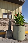 | March 29, 1993 (#93000168) | Through and 1 mile east of Grand Junction, south of the Chicago & Northwestern railroad line 42°01′54″N94°13′32″W / 42.031752°N 94.225531°W | Grand Junction | |
| 11 | Lincoln Highway-Little Beaver Creek Bridge |  | March 29, 1993 (#93000170) | 2.5 miles east and 1 mile north of Grand Junction across Little Beaver Creek 42°02′57″N94°10′38″W / 42.049093°N 94.177279°W | Grand Junction | |
| 12 | Lincoln Highway-Raccoon River Rural Segment |  | March 29, 1993 (#93000162) | County Road E53 approximately 0.1 miles west of Jefferson city limits, going west across the Raccoon River 42°00′38″N94°26′02″W / 42.010574°N 94.433846°W | Jefferson | |
| 13 | Lincoln Highway-West Beaver Creek Abandoned Segment |  | March 29, 1993 (#93000169) | Approximately 1 mile east of Grand Junction between the Chicago & Northwestern railroad line and U.S. Route 30 42°02′01″N94°12′39″W / 42.033652°N 94.210732°W | Grand Junction | |
| 14 | Lincoln Highway-West Greene County Rural Segment |  | March 29, 1993 (#93000161) | North from the junction of U.S. Route 30 and Iowa Highway 25, approximately 0.5 miles north of Scranton, then west to its junction with U.S. Route 30 42°02′56″N94°33′09″W / 42.048807°N 94.552392°W | Scranton | |
| 15 | Lincoln Statue |  | March 29, 1993 (#93000165) | Junction of Lincoln Way and Chestnut St. 42°00′56″N94°22′27″W / 42.015426°N 94.374089°W | Jefferson | |
| 16 | St. Patrick's Catholic Church, Cedar |  | July 10, 1992 (#92000840) | 4 miles west of Churdan on E. 19, 0.5 miles north on a gravel road 42°09′34″N94°33′05″W / 42.159444°N 94.551389°W | Churdan | |
| 17 | Squirrel Hollow County Park Historic District | December 23, 1991 (#91001835) | Eastern bank of the North Raccoon River southeast of Jefferson 41°57′07″N94°17′16″W / 41.951944°N 94.287778°W | Jefferson |