
Auraria was a small mining settlement in the Kansas Territory in the United States. Today it survives in its original location as a neighborhood of Denver, Colorado, south of the confluence of Cherry Creek and the South Platte River.

North University Park is a neighborhood in Los Angeles, California. Located just north of the University of Southern California, North University Park contains two historic districts that are both on the National Register of Historic Places: The North University Park Historic District and the Menlo Avenue–West Twenty-ninth Street Historic District.

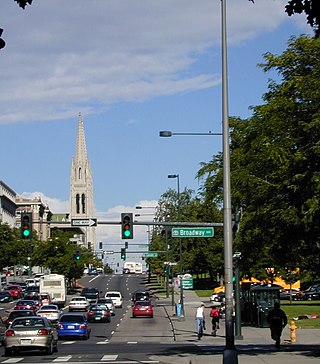
Located in the city and county of Denver, Colorado, the Capitol Hill neighborhood is bordered by Broadway, Downing Street, Colfax Avenue, and Seventh Avenue, which carry large volumes of traffic around the neighborhood. It is technically located in East Denver which begins immediately east of Broadway, the neighborhood's western boundary. Many consider the Cheesman Park neighborhood to be a part of the Capitol Hill neighborhood, but as defined by the city, Cheesman Park is a separate neighborhood. Denver also recognizes a statistical neighborhood called North Capitol Hill, also known as Uptown by some residents. Colfax Avenue is the border between these two neighborhoods.

The Denver Civic Center is a civic center area that includes two parks surrounded by government and cultural buildings and spaces. Civic Center is located in central Denver, Colorado, on the south side of Downtown Denver. Much of the area is a historic district which was listed on the National Register of Historic Places in 1974. A somewhat smaller area was designated a U.S. National Historic Landmark in 2012 as one of the nation's finest examples of the City Beautiful movement of civic design. Denver Civic Center lies partially within the north end of an official Denver neighborhood also named Civic Center. It includes the Colorado State Capitol building, in the west end of Denver's official Capitol Hill neighborhood, and it includes a few buildings in the south end of Denver's Central Business District.

Civic Center, Denver is a neighborhood in Denver, Colorado, United States. The northern part of the neighborhood overlaps partially with the Denver Civic Center, an area of parks and civic buildings.

Park Hill is a neighborhood in Denver, Colorado, U.S. Located in the northeastern quadrant of the city, it is bordered by Colorado Boulevard on the west, East Colfax Avenue on the south, Quebec Street on the east, and East 52nd Avenue on the north. The entire Park Hill neighborhood is located in the area known as East Denver. It is further divided by the City and County of Denver into three administrative neighborhoods, South Park Hill, North Park Hill, and Northeast Park Hill.

Cherry Creek is a neighborhood in Denver, Colorado, in the United States. It has many newer residences mixed in with some of Denver's older homes.
Saco Rienk DeBoer was a Dutch landscape architect and city planner. He was born on September 7, 1883, in Ureterp, Opsterland, Friesland, Netherlands to architect Rienk Kornelius De Boer and avid gardener Antje Dictus Benedictus. He studied engineering and passed the Junior Engineer (surveyor) exam. He went on to study landscape architecture at The Royal Imperial School of Horticulture in Germany. He was diagnosed with tuberculosis, on the advice of doctors him to return home to Ureterp where he opened an office. His symptoms worsened in the summer of 1908, on doctor and family advice he emigrated to the United States in October 1908 be cured at the Dutch operated Bethesda Sanatarium in Maxwell, NM. In 1909 when Bethesda Sanitarium moved to Denver, he moved with it, planning the landscaping for the new building. He became the official Landscape Architect of Denver from 1910 to 1931. He also designed the planned community of Boulder City, Nevada. In 1919, he joined with another Dutchman, M. Walter Pesman, to form a partnership. Together their projects were many, among them the landscaping of both sides of Speer Boulevard in Denver, and two early and innovative Colorado subdivisions, Bonnie Brae in Denver and The Glens in Lakewood, both of which feature winding streets and multiple small "pocket parks."

The City and County of Denver, Colorado, is located at 39°43'35" North, 104°57'56" West in the Colorado Front Range region. The Southern Rocky Mountains lie to the west of Denver and the High Plains lie to the east.

Jefferson Park is a neighborhood and public park that overlooks Downtown Denver, Colorado from its perch across Interstate 25 (I-25). It is located in the area that is called North Denver. Views east from Jefferson Park take in Elitch Gardens Theme Park, The Children's Museum, Denver's Downtown Aquarium, Pepsi Center, the REI flagship store and other attractions in Downtown's Central Platte Valley. Downtown Denver and the Central Platte Valley are quickly accessed from Jefferson Park, using the 23rd Avenue overpass on I-25 and Water Street. In addition, the Light Rail C-Line is located by Empower Field at Mile High in the southern part of the neighborhood.

Highland is a distinct city-center neighborhood in Denver, Colorado, United States, bounded by West 38th Avenue to the north, a Union Pacific Railroad line on the east, the South Platte River to the southeast, Speer Boulevard on the south, and Federal Boulevard on the west. The Highlands is sometimes used to refer to two separate city-center neighborhoods in Denver; Highland and West Highland, although the two neighborhoods are distinct. Highland and West Highland are both in the area that is referred to as the Northside. Highland is located immediately northwest of downtown. Note that the Highland neighborhood association has a slightly different definition with the easternmost boundary stopping at I-25. And the West Highland neighborhood to the immediate west of Highland, with the borders of 38th and 29th Avenues on the north and south and Federal and Sheridan Boulevards on the east and west. To distinguish between its immediately adjacent neighbor, West Highland, Highland is sometimes referred to as East Highland, Lower Highland or LoHi. The two together are casually called "the Highlands," a term which often falsely encompasses other Northwest Denver neighborhoods such as Jefferson Park, Sunnyside and Berkeley. Realtors have particularly pushed the inclusion of the recently gentrified Berkeley, located directly north of West Highland, as part of the Highlands, sometimes going so far as to refer to Berkeley and parts of Sunnyside as the "Upper Highlands". To add further confusion, within the Highlands neighborhoods there are several historic designations of various degrees, including Potter Highlands, Scottish Highlands and Highlands Park.

City Park is an urban park and neighborhood in Denver, Colorado. The park is 330 acres (1.3 km2) and is located in east-central Denver. The park contains the Denver Zoo, the Denver Museum of Nature and Science, Ferril and Duck Lakes, and a boathouse. City Park is also the name of the neighborhood that contains the park, though the park is the vast majority of the neighborhood. To the immediate north of the park is the City Park Golf Course. City Park is the largest park in Denver.
The oldest part of Denver, Colorado, now the neighborhoods of Auraria Campus, LoDo, much of downtown, and Five Points, is laid out on a grid plan that is oriented diagonal to the four cardinal directions. The rest of the city, including the eastern part of downtown, is laid out primarily on a grid oriented to the cardinal directions. In this larger grid, from east to west, there are generally 16 city blocks per mile, except between Zuni Street and Lowell Boulevard in west Denver. From north to south, there are typically eight blocks per mile, although there are many areas with more blocks per mile. Addresses follow a decimal system, with addresses advancing by one hundred at each cross street.
Speer is the official name for the Denver neighborhood bounded by 7th Avenue (north), Broadway (West), Alameda Avenue (South) and Downing Street (East). The northeast portion northeast of Speer Boulevard is generally referred to as Alamo Placita due to a local park and historic district of this name.

West Colfax is a neighborhood of Denver, Colorado. The neighborhood is located in the West Denver area. In 2015 the population of the neighborhood was 9,120, and there were 4,055 housing units.

State Highway 88 (SH 88) is a state highway located within the Denver Metropolitan Area in the U.S. state of Colorado. Spanning 19.171 miles (30.853 km), the highway travels through the City and County of Denver and Arapahoe County. SH 88 begins at Colfax Avenue in Denver and heads south along Federal Boulevard until it reaches Belleview Avenue, where it continues east until it reaches Interstate 25 in the Denver Tech Center. It then continues along Arapahoe Road until it reaches eastern terminus at SH 83 in Aurora.
The Hale neighborhood is a designated statistical neighborhood in the City and County of Denver, Colorado. Its boundaries are Colfax Avenue to the north, 6th Avenue to the south, Colorado Boulevard to the west, and Holly Street to the east. Most of the neighborhood is represented by the Bellevue-Hale Neighborhood Association, a registered neighborhood organization.

Denver's Art District on Santa Fe (ADSF) is an Arts and Cultural district, encompassing hundreds of artists, galleries, studios, theaters, and creative businesses along Santa Fe Drive in Denver, Colorado. ADSF is a 501(c)(3), nonprofit membership organization.

