
Epping Forest District is a local government district in Essex, England. It is named after the ancient woodland of Epping Forest, a large part of which lies within the district. The district covers northeastern parts of the urban area of London, including the suburban towns of Epping, Loughton, Waltham Abbey, Chigwell, and Buckhurst Hill, as well as rural areas beyond it. The district is situated in the west of the county, bordering north-eastern Greater London.

Norsey Wood is a 67.2-hectare (166-acre) biological Site of Special Scientific Interest in Billericay, Essex. It is also a Local Nature Reserve and a Scheduled Monument.

Queen's Wood is a 52-acre area of ancient woodland in the London Borough of Haringey, abutting Highgate Wood and lying between East Finchley, Highgate, Muswell Hill and Crouch End. It was originally part of the ancient Forest of Middlesex which covered much of London, Hertfordshire and Essex and was mentioned in the Domesday Book. It is now one of three Local Nature Reserves in the London Borough of Haringey. It is situated a few minutes' walk from Highgate tube station.

Stanmore Common is a 49.2-hectare public park, Local Nature Reserve and Site of Metropolitan Importance for Nature Conservation in Stanmore in the London Borough of Harrow in England. It is owned by Harrow Council and managed by the council with a local group. It was a biological Site of Special Scientific Interest, but was de-notified in the early 1990s.

Scratchwood is an extensive, mainly wooded, country park in Mill Hill in the London Borough of Barnet. The 57-hectare site is a Site of Metropolitan Importance for Nature Conservation and together with the neighbouring Moat Mount Open Space. It is a Local Nature Reserve.
Big Wood and Little Wood are two patches of woodland in Hampstead Garden Suburb in the London Borough of Barnet. They are a Site of Borough Importance for Nature Conservation, Grade 1, and a Local Nature Reserve. Big Wood is 7.3 hectares and Little Wood is 1.2 hectares.

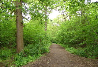
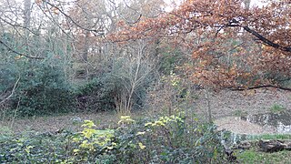
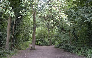
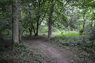
Chigwell Row Wood is a 14.1 hectare Local Nature Reserve in Chigwell in Epping Forest district, Essex. It is owned by The Chigwell Row Recreation Ground Charity, of which the district council are the trustees, and managed by council staff and volunteers.

St John's Wood Church Grounds is a disused graveyard which is now a public park in St. John's Wood in London. It is a Site of Borough Importance for Nature Conservation, Grade 1, and the only Local Nature Reserve in the City of Westminster. Since 2004 it has received the Green Flag Award for excellent green spaces. It is owned and managed by Westminster Council.
Dacres Wood is a small local nature reserve in Forest Hill in the London Borough of Lewisham. It is owned and managed by Lewisham Council.
The Wick is a 3.4 hectare Local Nature Reserve in St Albans in Hertfordshire. It is owned and managed by St Albans City Council. It is also designated a County Wildlife Site.

Cuckoo Wood is a 2.5 hectare Local Nature Reserve in Braintree in Essex. It is owned by Braintree District Council and managed by Essex County Council as an educational resource.

Nazeing Triangle is a 0.5 hectare Local Nature Reserve in Nazeing, between Harlow and Cheshunt in Essex. It is owned by Nazeing Parish Council and managed by the council together with Epping Forest District Council.
Roughtalley's Wood is a 3.4 hectare Local Nature Reserve in Theydon Garnon parish in Essex, England. It is owned and managed by Epping Forest District Council.
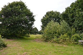
Church Lane Flood Meadow is a 3.3 hectare Local Nature Reserve in North Weald Bassett in Essex. It is owned and managed by Epping Forest District Council.

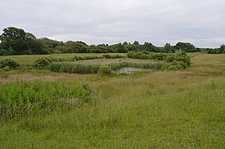
Weald Common Flood Meadows is a 1.9 hectare Local Nature Reserve in North Weald Bassett in Essex. It is owned and managed by Epping Forest District Council.
Tiptree Parish Field is a 2.2 hectare Local Nature Reserve in Tiptree in Essex, England. It is owned and managed by Tiptree Parish Council.

Harlow Woods is a 47.1-hectare (116-acre) biological Site of Special Scientific Interest in Harlow in Essex. It is composed of three woods, Hospital Wood Risden's Wood and Parndon Wood. They are owned and maintained by Harlow District Council, and they are part of the slightly larger Parndon Woods and Common Local Nature Reserve.

Gernon Bushes is a 32 hectare nature reserve north-east of Epping in Essex. It is managed by the Essex Wildlife Trust. It is part of the Epping Forest Site of Special Scientific Interest and Nature Conservation Review site.

Farningham Wood is a 74.2-hectare (183-acre) biological Site of Special Scientific Interest east of Swanley in Kent. It is also a Local Nature Reserve. It is owned and managed by Sevenoaks District Council and Farningham Parish Council.

