Buckhurst Hill

Last updated

Buckhurst Hill
Buckhurst Hill - Church of St John the Baptist - geograph.org.uk - 648995.jpg
The parish church of St John the Baptist, built in 1838
Essex UK location map.svg
Red pog.svg
Buckhurst Hill
Location within Essex
Population11,380 (2011) [1]
OS grid reference TQ415935
  London 10 mi (16 km)  SW
Civil parish
  • Buckhurst Hill
District
Shire county
Region
Country England
Sovereign state United Kingdom
Post town BUCKHURST HILL
Postcode district IG9
Dialling code 020
Police Essex
Fire Essex
Ambulance East of England
UK Parliament
Website Buckhurst Hill Parish Council
List of places
UK
England
Essex

51°37′55″N0°02′10″E / 51.632°N 0.036°E / 51.632; 0.036

Contents

Buckhurst Hill

Buckhurst Hill is a suburban town in Epping Forest, Essex, within the Greater London Urban Area and adjacent to the northern boundary of the London Borough of Redbridge. The area developed following the opening of a railway line in 1856, originally part of the Eastern Counties Railway and now on the Central line of the London Underground.

History

The first mention of Buckhurst Hill is in 1135, when reference was made to "La Bocherste", becoming in later years "Bucket Hill", originally meaning a hill covered with beech trees. [2] It lay in Epping Forest and consisted of only a few scattered houses along the ancient road from Woodford to Loughton. Before the building of the railways, Buckhurst Hill was on the stagecoach route between London and Cambridge, Norwich, Bury St Edmunds and Great Dunmow. Originally it was a part of the parish of Chigwell; there was no road connecting the two communities and in order to get to church, parishioners had to ford the River Roding at Woodford. [3] The Parish Church of St John was built in 1838 as a chapel of ease but Buckhurst Hill did not become a separate ecclesiastical parish until 1867. [4] St John's National School was also built in 1838. The lord of the manor gave a site next to the church; the building cost £209, most of which was donated by the church congregation. [5] The opening of Buckhurst Hill station in 1856 saw a rapid expansion in the population of the area; nearly six hundred new houses had been built near the station by 1871, leading to the opening of the Prince's Road school in 1872. Some of the land for this expansion was enclosed from Epping Forest, before this practice was halted by the Epping Forest Act 1878.

The civil parish of Buckhurst Hill became Buckhurst Hill Urban District in 1894. In 1933, it was merged with the parish of Chigwell and Loughton Urban District to form the Chigwell Urban District. [6] A further merger with Epping Urban District, Waltham Holy Cross Urban District and most of Epping and Ongar Rural District in 1974 brought Buckhurst Hill into Epping Forest District, [7] and in 1996, Buckhurst Hill Parish Council was established as a first tier of local government. [8]

Geography

The town is located at the western edge of Essex, 10.7 miles (17.2 km) north-east of Charing Cross and bordering the London Borough of Redbridge. Parts of Epping Forest in Buckhurst Hill are intermingled with residential areas.

Transport

Buckhurst Hill station Buckhurst Hill stn building.JPG
Buckhurst Hill station

Buckhurst Hill is served by two London Underground stations: Buckhurst Hill (in London fare zone 5) and Roding Valley (in zone 4), which are on the Central line. The line directly links the area to central London, as well as local areas including Woodford, South Woodford, Leytonstone, Epping and Loughton. [9]

London Overground railway services from nearby Chingford station can be used to reach London Liverpool Street, via Walthamstow and Hackney. [10]

Most bus routes serving Buckhurst Hill are London Buses services, operated by Stagecoach London. Services link the town with Chingford, Debden, Ilford, Loughton, Walthamstow and Woodford. Bus service 397 can be used to reach Chingford station. [11]

Sport

Buckhurst Hill Cricket Club Buckhurst Hill Cricket Club pavilion, Essex, England 2.jpg
Buckhurst Hill Cricket Club

Loughton Rugby Union Football Club has its clubhouse and pitches on Hornbeam Road at the south of the town. Buckhurst Hill F.C. is on Roding Lane at the east of the town.

Buckhurst Hill Cricket Club plays in the Shepherd Neame Essex League, and fields four Saturday XIs, two Sunday XIs, and teams in a junior section. The club plays at two cricket fields: one off Roding Lane at the east of the town; and one at the edge of Powell's Forest (part of Epping Forest), off High Road at the north of the town.

Education

Primary schools include Buckhurst Hill Community (BHCPS), St John's (Church of England) and Whitebridge.

Roding Valley High School in Loughton provides secondary level education for the area. It was formed by the merger of three schools: Loughton County High School for Girls, Buckhurst Hill County High School (for boys) and Epping Forest High School.

Braeside and Daiglen are independent schools.

Notable people

Related Research Articles

<span class="mw-page-title-main">Chingford</span> Town in east London, England

Chingford is a town in east London, England, within the London Borough of Waltham Forest. The centre of Chingford is 9.2 miles (14.8 km) north-east of Charing Cross, with Waltham Abbey to the north, Woodford Green and Buckhurst Hill to the east, Walthamstow to the south, and Edmonton and Enfield to the west.

<span class="mw-page-title-main">Loughton</span> Town in southwest Essex, England

Loughton is a town and civil parish in the Epping Forest District of Essex, within the metropolitan and urban area of London, England. Situated 12 miles (19 km) north-east of Charing Cross, the town borders Waltham Abbey, Theydon Bois, Chigwell, Chingford, and Buckhurst Hill.

<span class="mw-page-title-main">Woodford Green</span> Human settlement in England

Woodford Green is an area of Woodford in East London, England, within the London Borough of Redbridge. It adjoins Buckhurst Hill to the north, Woodford Bridge to the east, South Woodford to the south, and Chingford to the west. Epping Forest runs through Woodford Green in the west of the area, 9.4 miles (15.1 km) north-east of Charing Cross.

<span class="mw-page-title-main">Chigwell</span> Human settlement in England

Chigwell is a town and civil parish in the Epping Forest District of Essex, England. It is part of the urban and metropolitan area of London, and is adjacent to the northern boundary of Greater London. It is on the Central line of the London Underground.

<span class="mw-page-title-main">Epping Forest District</span> Non-metropolitan district in England

Epping Forest District is a local government district in Essex, England. It is named after the ancient woodland of Epping Forest, a large part of which lies within the district. The district covers northeastern parts of the urban area of London, including the suburban towns of Epping, Loughton, Waltham Abbey, Chigwell, and Buckhurst Hill, as well as rural areas beyond it. The district is situated in the west of the county, bordering north-eastern Greater London.

<span class="mw-page-title-main">Chigwell Urban District</span>

Chigwell was a local government district in south west Essex, England. It contained the settlements of Chigwell, Loughton and Buckhurst Hill; and formed part of the Metropolitan Police District.

<span class="mw-page-title-main">River Roding</span> River in Essex and Greater London, England

The River Roding rises at Molehill Green, Essex, England, then flows south through Essex and London and forms Barking Creek as it reaches the River Thames.

<span class="mw-page-title-main">Sewardstone</span> Human settlement in England

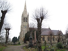
Sewardstone is a hamlet in the parish of Waltham Abbey, in the Epping Forest District of Essex, England. It is located south of the main built-up area of Waltham Abbey, lying between Epping Forest, Chingford and Enfield. It is 11.6 miles north-northeast of Central London and is in the London commuter belt.

<span class="mw-page-title-main">Waltham Abbey</span> Human settlement in England

Waltham Abbey is a town and civil parish in the Epping Forest District of Essex, within the metropolitan and urban area of London, England, 13.5 miles (21.7 km) north-east of Charing Cross. It lies on the Greenwich Meridian, between the River Lea in the west and Epping Forest in the east, with large sections forming part of the Metropolitan Green Belt.

<span class="mw-page-title-main">History of Essex</span>

Essex is a county in the East of England which originated as the ancient Kingdom of Essex and one of the seven kingdoms, or heptarchy, that went on to form the Kingdom of England.

<span class="mw-page-title-main">Epping Forest (UK Parliament constituency)</span> Parliamentary constituency in the United Kingdom since 1974

Epping Forest is a constituency in Essex represented in the House of Commons of the UK Parliament since 1997 by Eleanor Laing, a Conservative.

<span class="mw-page-title-main">Abridge</span> Human settlement in England

Abridge is a village in Essex, England. It is on the River Roding, 16 miles (26 km) southwest of the county town of Chelmsford. The village is in the district of Epping Forest and in the parliamentary constituency of Brentwood and Ongar. It is part of the civil parish of Lambourne and is served by Lambourne Parish Council.

Epping was a parliamentary constituency represented in the House of Commons of the UK Parliament from 1885 to 1974. It elected one Member of Parliament (MP) by the first past the post system of election.

<span class="mw-page-title-main">Woodford Bridge</span> Human settlement in England

Woodford Bridge is part of the East London suburb of Woodford, in the London Borough of Redbridge. It is located on an old road between Chigwell and Leytonstone.

<span class="mw-page-title-main">A104 road (England)</span> Trunk road in London

The A104 is an A road which runs from Islington Green in London to Epping in Essex, England.

<span class="mw-page-title-main">Woodford, London</span> Human settlement in England

Woodford is a town in North-East, London, within the London Borough of Redbridge. It is located 9.5 miles (15.3 km) north-east of Charing Cross. Woodford historically formed an ancient parish in the county of Essex. It contained a string of agrarian villages and was part of Epping Forest. From about 1700 onwards, it became a place of residence for affluent people who had business in London; this wealth, together with its elevated position, has led to it being called the Geographical and social high point of East London. Woodford was suburban to London and after being combined with Wanstead in 1934 it was incorporated as a municipal borough in 1937. It has formed part of Greater London since 1965 and comprises the neighbourhoods of Woodford Green, Woodford Bridge, Woodford Wells and South Woodford. The area is served by two stations on the Central line of the London Underground: Woodford and South Woodford.

Loughton is a town in the county of Essex in England. The first settlement can be traced back to 2,500 years ago, but the earliest records of the modern-day site of Loughton are from the Anglo-Saxon era of English history, when it was known as Lukintone. After the Norman conquest it became part of the estate of Waltham Abbey and is mentioned in the Domesday Book as Lochintuna. It was during the 17th century, however, when Loughton began to grow significantly as a coaching stop on the newly created main route to Cambridge and East Anglia. With good transport links and proximity to both London and also Epping Forest and the countryside, it became a popular location for aristocratic and wealthy Londoners to have a home.

Debden is a suburb in the civil parish of Loughton, in the Epping Forest district of Essex, England. It takes its name from the ancient manor of Debden, which lay at its northern end. The area is predominantly residential, but is also the location of Epping Forest College, East 15 Acting School and the De La Rue printing works. It is one of a limited number of places outside Greater London to be served by the London Underground.

<span class="mw-page-title-main">Epping, Essex</span> Town and parish in Essex, England

Epping is a market town and civil parish in the Epping Forest District of Essex, England. Part of the metropolitan and urban area of London, it is 17 miles (30 km) north-east of Charing Cross. It is surrounded by the northern end of Epping Forest, and on a ridge of land between the River Roding and River Lea valleys.

<span class="mw-page-title-main">2011 Epping Forest District Council election</span> 2011 UK local government election

The 2011 Epping Forest District Council election was held on 5 May 2011 to elect members of Epping Forest Council in England as part of the wider local elections in England and Northern Ireland.

References

  1. "Town population 2011". Neighbourhood Statistics. Office for National Statistics. Archived from the original on 18 October 2016. Retrieved 1 September 2016.
  2. Reaney, Percy Hide (10 June 2017). The Place-Names of Essex. The University Press. ISBN   9780521075053 via Google Books.
  3. [A History of the County of Essex: Volume 4: Ongar Hundred. W R Powell (Editor), 1956 (pp 18–22) http://www.british-history.ac.uk/report.aspx?compid=15534]
  4. "Chigwell: Churches - British History Online". www.british-history.ac.uk.
  5. "Chigwell: Schools - British History Online". www.british-history.ac.uk.
  6. "Chigwell: Introduction - British History Online". www.british-history.ac.uk.
  7. "Epping Forest District Council: History of the District". Archived from the original on 6 June 2010. Retrieved 14 June 2010.
  8. "BUCKHURST HILL PARISH COUNCIL - About Buckhurst Hill". www.essexinfo.net.
  9. "Central Line timetable". May 2023. Retrieved 3 June 2023.
  10. "London Overground Timetables". May 2023. Retrieved 3 June 2023.
  11. "Stops in Buckhurst Hill". Bus Times. 2023. Retrieved 3 June 2023.
  12. Kneale, Kenneth (1992); Essex Heritage, Leopards Head Press, pp.3-14. ISBN   0904920232
  13. Morris, Richard; "Sir William Addison (1905-1992) – a retrospective" in Loughton and District Historical Society: Newsletter 165 , March/April 2005, pp.3-5
  14. Winchester College, A Register, 1974, page 108
  15. Kilburn, Terry. "Mark Knopfler Biography". Archived from the original on 29 September 2011. Retrieved 12 October 2011.
  16. Paddock, Terri (11 February 2008). ""20 Questions With… Daniel Mays"". whatsonstage.com. Archived from the original on 16 June 2011.
  17. "Student & graduate profiles: Daniel Mays". RADA. Retrieved 19 October 2020.
  18. Who's Who 2008, A & C Black, 2008; online edn, Oxford University Press, December 2007
  19. Last Man Standing: Memoirs of a Political Survivor , Jack Straw, 2012
  20. General Register Office Birth Index 1946 Q3 Epping 5a 178
  21. "Dick Turpin, Boudica, Hangman's Hill and the Suicide Pool: Tales from Epping Forest". 20 April 2013.