Chingford is a district of northeast London, England, within the London Borough of Waltham Forest. The centre of Chingford is 9.2 miles (14.8 km) north-east of Charing Cross, with Waltham Abbey to the north, Woodford Green and Buckhurst Hill to the east, Walthamstow to the south, and Edmonton and Enfield to the west. It had a population of 70,583 at the 2021 census.
Walthamstow is a town within the London Borough of Waltham Forest in East London. The town borders Chingford to the north, Snaresbrook and South Woodford to the east, Leyton and Leytonstone to the south, and Tottenham to the west. At the 2011 census, Walthamstow had a population of approximately 109,424 and is around 7.5 miles (12 km) north-east of Central London.

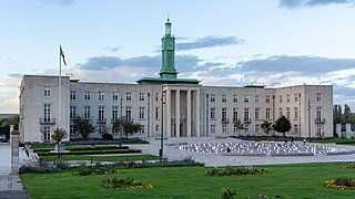
The London Borough of Waltham Forest is an outer London borough formed in 1965 from the merger of the municipal boroughs of Leyton, Walthamstow and Chingford.
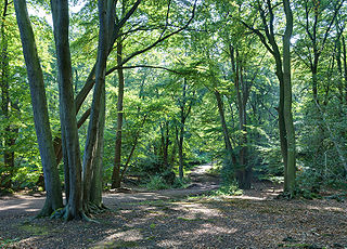
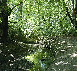
Epping Forest is a 2,400-hectare (5,900-acre) area of ancient woodland, and other established habitats, which straddles the border between Greater London and Essex. The main body of the forest stretches from Epping in the north, to Chingford on the edge of the London built-up area. South of Chingford the forest narrows, and forms a green corridor that extends deep into east London, as far as Forest Gate; the forest's position gives rise to its nickname, the Cockney Paradise. It is the largest forest in London.

Lea Bridge is a district in the London Borough of Hackney and the London Borough of Waltham Forest in London, England. It lies 7 miles (11.3 km) northeast of Charing Cross.

Waltham Abbey is a town and civil parish in the Epping Forest District of Essex, within the metropolitan and urban area of London, England, 13.5 miles (21.7 km) north-east of Charing Cross. It lies on the Greenwich Meridian, between the River Lea in the west and Epping Forest in the east, with large sections forming part of the Metropolitan Green Belt.

East London is the northeastern part of London, England, east of the ancient City of London and north of the River Thames as it begins to widen. Containing areas in the historic counties of Middlesex and Essex, East London developed as London's docklands and the primary industrial centre. The expansion of railways in the 19th century encouraged the eastward expansion of the East End of London and a proliferation of new suburbs. The industrial lands of East London are today an area of regeneration, which are well advanced in places such as Canary Wharf and ongoing elsewhere.
Highams Park is a district in the London Borough of Waltham Forest, England, near Epping Forest and 8.1 miles (13 km) north-east of Charing Cross.
Chingford was a local government district in south west Essex, England from 1894 to 1965, around the town of Chingford. It was within the London suburbs, forming part of the London postal district and Metropolitan Police District. Its former area now corresponds to the northern part of the London Borough of Waltham Forest in Greater London.
The Lea Valley, the valley of the River Lea, has been used as a transport corridor, a source of sand and gravel, an industrial area, a water supply for London, and a recreational area. The London 2012 Summer Olympics were based in Stratford, in the Lower Lea Valley. It is important for London's water supply, as the source of the water transported by the New River aqueduct, but also as the location for the Lee Valley Reservoir Chain, stretching from Enfield through Tottenham and Walthamstow.
Chingford was a parliamentary constituency centred on the town of Chingford in the London Borough of Waltham Forest. It returned one Member of Parliament (MP) to the House of Commons of the Parliament of the United Kingdom by the first past the post system.
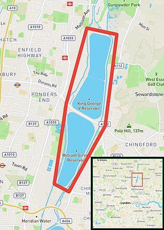
The Chingford Reservoirs are the King George V Reservoir and the William Girling Reservoir, which form part of the Lee Valley Reservoir Chain in the London Boroughs of Enfield and Waltham Forest and Epping Forest in Essex. Construction of the King George V Reservoir was started in 1908 and completed in 1912. Work on the William Girling Reservoir was started in 1938, with John Mowlem & Co being the contractor, but owing to technical problems, and the intervention of World War II, the reservoir was not finished until 1951.

Pymmes Brook is located in North London and named after William Pymme, a local land owner. It is a minor tributary of the River Lea. The brook mostly flows through urban areas and is particularly prone to flooding in its lower reaches. To alleviate the problem the brook has been culverted in many areas. Part of it is a Site of Borough Importance for Nature Conservation, Grade II.

Salmons Brook is a minor tributary of the River Lea, located in the London Borough of Enfield.

The Small River Lea is a minor tributary of the River Lea, which flows through the Lee Valley Park between Cheshunt and Enfield Lock. It forms part of the Turnford and Cheshunt Pits Site of Special Scientific Interest (SSSI) as it flows through the River Lee Country Park.
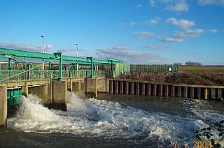
The Lee Flood Relief Channel (FRC) is located in the Lea Valley and flows between Ware, Hertfordshire, and Stratford, east London. Work started on the channel in 1947 following major flooding and it was fully operational by 1976. The channel incorporates existing watercourses, lakes, and new channels. Water from the channel feeds the Lee Valley Reservoir Chain.

Cuffley Brook is a tributary of Turkey Brook. It runs through parts of Hertfordshire and the London Borough of Enfield, England. After the confluence of the two streams in Whitewebbs Park, the watercourse continues eastwards as Turkey Brook to join the River Lea near Enfield Lock.

The Lee Valley Reservoir Chain is located in the Lee Valley, and comprises 13 reservoirs that supply drinking water to London.

Deephams Sewage Treatment Works is a sewage treatment facility close to Picketts Lock, Edmonton, England. The outflow discharges via Pymmes Brook into the River Lee Navigation at Tottenham Lock. The treatment works was upgraded in 2012/13.
Hawkwood is a 25-acre estate in North Chingford, London Borough of Waltham Forest, North East London, England. It is about nine miles from central London, in the fertile Lea Valley on the western edge of Epping Forest. In the 19th century it formed the grounds of a large Elizabethan-style Victorian mansion, seat of Richard Hodgson, lord of Chingford St. Pauls. The mansion became derelict after bomb damage in 1944 and was demolished in 1951. Part of the site is now a nature reserve, a special school has been built on another part, and a large part of the site is being used by OrganicLea, a workers' cooperative growing and selling food and providing horticultural training.