
Cheshunt is a town in the Borough of Broxbourne in Hertfordshire, England, 13 miles (21 km) north of Central London on the River Lea and Lee Navigation and directly south of Broxbourne. It contains a section of the Lee Valley Park, including much of the River Lee Country Park. To the north lies Broxbourne and Wormley, Waltham Abbey to the east, Waltham Cross and Enfield to the south, and Cuffley to the west.
The River Rib is a tributary of the River Lea, which runs from Buckland in Hertfordshire, England. It flows into the River Lea to the east of Hertford.

The Prittle Brook is a 7.2 mile (11.59 km) watercourse in south Essex, England. A tributary of the River Roach, the brook rises in Thundersley and passes through Hadleigh, Leigh-on-Sea, Westcliff, Prittlewell, Rochford and discharges into the Roach and then into the North Sea via the Roach and Crouch estuaries.
The Hackney Brook is one of the subterranean rivers of London. Rising in Holloway, it crossed the northern parts of the current London boroughs of Islington and Hackney, before emptying into the River Lea at Old Ford.

The Emm Brook, sometimes known as the Embrook or Emmbrook, is a small river in the English county of Berkshire. It is a tributary of the River Loddon which it meets at the village of Hurst.
The Lea Valley, the valley of the River Lea, has been used as a transport corridor, a source of sand and gravel, an industrial area, a water supply for London, and a recreational area. The London 2012 Summer Olympics were based in Stratford, in the Lower Lea Valley. It is important for London's water supply, as the source of the water transported by the New River aqueduct, but also as the location for the Lee Valley Reservoir Chain, stretching from Enfield through Tottenham and Walthamstow.

Forty Hill is a largely residential suburb in the north of the London Borough of Enfield, England. To the north is Bulls Cross, to the south Enfield Town, to the west Clay Hill, and to the east Enfield Highway. Prior to 1965 it was in the historic county of Middlesex.

Turkey Brook is a river in the northern outskirts of London. It rises in Potters Bar, Hertfordshire, and flows broadly eastwards to merge with the River Lea Navigation near Enfield Lock.

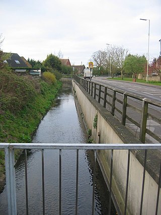
Pymmes Brook is located in North London and named after William Pymme, a local land owner. It is a minor tributary of the River Lea. The brook mostly flows through urban areas and is particularly prone to flooding in its lower reaches. To alleviate the problem the brook has been culverted in many areas. Part of it is a Site of Borough Importance for Nature Conservation, Grade II.

Salmons Brook is a minor tributary of the River Lea, located in the London Borough of Enfield.

Cobbins Brook is a minor tributary of the River Lea. It forms to the north of Epping, Essex and flows past Epping Upland, Waltham Abbey until it joins the River Lee Flood Relief Channel below the M25 near Rammey Marsh.

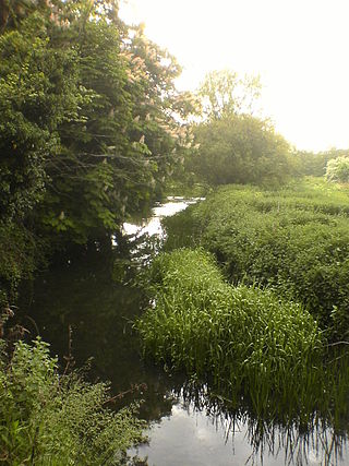
The Small River Lea is a minor tributary of the River Lea, which flows through the Lee Valley Park between Cheshunt and Enfield Lock. It forms part of the Turnford and Cheshunt Pits Site of Special Scientific Interest (SSSI) as it flows through the River Lee Country Park.
Turnford Brook is a minor tributary of the River Lea. The brook flows through the Borough of Broxbourne for approximately 3 miles (5 km).

Bayford Brook is a minor tributary of the River Lea. It forms in the hills near Bayford, Hertfordshire and joins the River Lea at Horns Mill Weir.

The Spital Brook is a minor tributary of the River Lea in Hertfordshire, England.

Cuffley Brook is a tributary of Turkey Brook. It runs through parts of Hertfordshire and the London Borough of Enfield, England. After the confluence of the two streams in Whitewebbs Park, the watercourse continues eastwards as Turkey Brook to join the River Lea near Enfield Lock.
The Woollens Brook is a minor tributary of the River Lea which flows through Hoddesdon in Hertfordshire, England.

Turnford is a village in the Borough of Broxbourne, in Hertfordshire, England, in an area generally known as the Lee Valley. It is bounded by Wormley to the north, Cheshunt to the south and west, and its eastern boundary is formed largely by the Lee Navigation. Central London at Charing Cross is approximately 18 miles (29 km) south. At the 2001 census, together with Wormley, the village had a population of 8,146 in 3,399 households.

Lewsey Brook is a minor tributary of the River Lea which flows through Luton.

Houghton Brook, the lower section sometimes known as Knapps Brook, is a minor tributary of the River Lea which flows through the northwest suburbs of Luton.
