Epping Forest District

Last updated

Epping Forest
Epping Forest District
Civic Offices, Epping.jpg
Epping Forest District Council headquarters on Epping High Street
Epping Forest UK locator map.svg
Epping Forest District shown within Essex
Sovereign state United Kingdom
Constituent country England
Region East of England
Non-metropolitan county Essex
Status Non-metropolitan district
Admin HQ Epping
Incorporated1 April 1974
Government
  TypeNon-metropolitan district council
  BodyEpping Forest District Council
  LeadershipLeader & Cabinet (Conservative)
   MPs Eleanor Laing
Alex Burghart
Robert Halfon
Area
  Total130.88 sq mi (338.99 km2)
  Rank106th (of 296)
Population
 (2022)
  Total134,989
  Rank174th (of 296)
  Density1,000/sq mi (400/km2)
Ethnicity (2021)
[1]
   Ethnic groups
List
Religion (2021)
[1]
   Religion
List
Time zone UTC0 (GMT)
  Summer (DST) UTC+1 (BST)
ONS code 22UH (ONS)
E07000072 (GSS)
OS grid reference TL455025

Epping Forest District is a local government district in Essex, England. It is named after the ancient woodland of Epping Forest, a large part of which lies within the district. The district covers northeastern parts of the urban area of London, including the suburban towns of Epping, Loughton, Waltham Abbey, Chigwell, and Buckhurst Hill, as well as rural areas beyond it. The district is situated in the west of the county, bordering north-eastern Greater London.

Contents

The administrative headquarters of Epping Forest District Council are in the town of Epping. Neighbouring districts are Brentwood, Broxbourne, Chelmsford, East Hertfordshire, Enfield, Harlow, Havering, Redbridge, Uttlesford and Waltham Forest. In 2021 it had a population of 134,909.

History

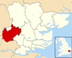
The district was formed on 1 April 1974 under the Local Government Act 1972, covering the whole area of three former districts and most of a fourth, all of which were abolished at the same time: [2]

The new district was named Epping Forest after the ancient woodland of that name, much of which falls within the district. The woodland is in turn named after the town of Epping. [3]

Since 1974 there have been some changes to the district's boundary with Greater London:

Governance

Epping Forest District Council
Epping Forest District Council logo.svg
Type
Type
Leadership
Darshan Sunger,
Conservative
since 25 May 2023
Chris Whitbread,
Conservative
since 22 May 2012
Georgina Blakemore
since 1 April 2019 [6]
Structure
Seats58
Political groups
Administration (34)
  Conservatives (34)

Opposition (24)

  Loughton RA (13)
  Liberal Democrats (6)
  Independent (3)
  Green (2)
Elections
Last election
4 May 2023
Next election
2024
Meeting place
Civic Offices, Epping.jpg
Civic Offices, 323 High Street, Epping, CM16 4BZ
Website
www.eppingforestdc.gov.uk

Epping Forest District Council provides district-level services. County-level services are provided by Essex County Council. The district is also entirely covered by civil parishes, which form a third tier of local government. [7] [8]

Political control

The council has been under Conservative control since 2006.

The first election to the council was held in 1973, initially operating as a shadow authority alongside the outgoing authorities until the new arrangements came into effect on 1 April 1974. Political control of the council since 1974 has been as follows: [9] [10]

Party in controlYears
Conservative 1974–1994
No overall control 1994–2006
Conservative 2006–present

Leadership

The leaders of the council since 2001 have been: [11]

CouncillorPartyFromTo
Andrew Thompson Liberal Democrats 15 May 20015 May 2002
Maggie McEwen Conservative 14 May 200218 Feb 2003
Michael Heavens Liberal Democrats 24 Feb 200324 Jun 2004
John KnapmanChigwell Residents' Association24 Jun 200418 May 2006
Diana Collins Conservative 18 May 200618 May 2011
Lesley Wagland Conservative 18 May 201122 May 2012
Chris Whitbread Conservative 22 May 2012

Composition

Following the 2023 election, the composition of the council was: [12]

PartyCouncillors
Conservative 34
Loughton Residents Association 13
Liberal Democrats 6
Independent 3
Green 2
Total58

Two of the three independent councillors sit together as the "Grange Hill Independent Community Group". [13] The next election is due in 2024.

Premises

Epping Forest District Council is based at the Civic Offices at 323 High Street, Epping. [14]

When the council was first created it inherited four sets of offices from its predecessors and functions were initially divided between them: [15]

The council subsequently built a large new building, Epping Civic Offices, adjoining the original converted house at 323 High Street in Epping. The new building was designed by Richard Reid and built between 1987 and 1992. It was designated a Grade II listed building in 2017. [16]

Geography

The north-east of the district is rural and sparsely populated for an area so close to London; this area includes Chipping Ongar and surrounding villages. The south-west of the district closer to the boundary with Greater London is more suburban and is dominated by Loughton, the largest town in the district. Most of the district has a wide range of architectural styles and periods. [17] Loughton adjoins the woodland of Epping Forest to the west and is separated by farms, rivers and golf courses from other settlements in other directions. As an example of conserved physical geographic landscapes, the Roding Valley and Three Forests Way (one end of the Stort Valley Way and the other end connecting to the Harcamlow Way in Hatfield Forest and National Nature Reserve, Essex which is north of Epping Forest District.

The River Roding runs through the eastern portion of the district, with the Lea Valley in the west. [18] [19] [20]

Buckhurst Hill, Chigwell, Waltham Abbey and Loughton, although they are not within Greater London, are included in the Office for National Statistics definition of the Greater London Built-up Area. [21] [22]

Epping Forest district is bounded by the Harlow, Uttlesford, Chelmsford and Brentwood districts of Essex, the East Hertfordshire and Broxbourne districts of Hertfordshire, and the London boroughs of Havering, Redbridge, Waltham Forest and Enfield. [18]

Transport

Rail

Roydon railway station on the West Anglia Main Line is the only National Rail station within the district, which lies on the district boundary with East Hertfordshire. Sawbridgeworth railway station on the same line lies directly west of the district, within Hertfordshire, as does Waltham Cross railway station, which serves the district's town of Waltham Abbey. These stations are served by Greater Anglia trains either between London Liverpool Street and Ely, and London Stratford and Bishop's Stortford, with direct connections to destinations such as Broxbourne, Tottenham Hale, Audley End and Cambridge. [18] [23]

The London Underground Central line passes through the southern portion of Epping Forest. Epping, Theydon Bois, Debden and Loughton stations in the borough fall in London fare zone 6, with Buckhurst Hill in zone 5 and Roding Valley, Chigwell and Grange Hill in zone 4. [24]

The Central line provides the district with direct connections with East London, The City, the West End, and West London. Transport for London manages the London Underground network. [24]

A former portion of the Central line between Epping and Chipping Ongar, via North Weald and Blake Hall, is part of the Epping Ongar Railway. [25]

Road

Two motorways meet in the district - the M25 London Orbital motorway and the M11 motorway.

The M25 motorway runs eastbound (clockwise) towards Brentwood and the Dartford Crossing. The motorway runs westbound (anticlockwise) towards Enfield, Watford and Heathrow Airport. The M11 motorway runs northbound towards Stansted Airport and Cambridge, and southbound towards East London. Junctions 5 (A1168, Loughton and Chigwell), 6 (M25), 7 (A414, Harlow) and 7A (A1025, Harlow) fall within Epping Forest. [18]

Other main routes in the district include:

Most public highways in the district are managed by Essex County Council. [26] The M11 and M25 motorways are managed by National Highways. [27]

Cycling

National Cycle Network Route 1 passes along the eastern boundary of the district near Broxbourne, through Harlow, and east-west through the district via High Laver, Moreton and Fyfield. [28] [29]

A shared-use path runs alongside the Rivers Lee and Stort, which connect the district with other cycle routes in Hertfordshire and London. [30]

Epping Forest features a network of shared-use forest trails, managed by the City of London Corporation. [31]

Aviation

North Weald Airfield is owned by Epping Forest District Council and is open to general aviation. Flying out of North Weald began in 1916, during the First World War. [32]

Stapleford Aerodrome is home to a flight training centre within the district. [33]

Stansted Airport, an international passenger and freight airport, lies in the neighbouring district of Uttlesford, north of the district. [18]

Rivers

The Lee Navigation and River Stort are navigable rivers which form the district's eastern boundary. They are managed by the Canal and River Trust, and connect with the Regent's Canal in London via Hertford Union Canal. [30]

Nature reserves

The Lower Forest, Epping Forest Path in Lower Forest - geograph.org.uk - 2596241.jpg
The Lower Forest, Epping Forest

Epping Forest District Council has nine nature local nature reserves (LNRs):

Roding Valley Meadows Local Nature Reserve (LNR) is the district's oldest nature reserve, designated in 1986, and the largest at 56 hectares. [34]

Seven Sites of Special Scientific Interest on the Natural England register fall within Epping Forest. These are:

Essex Wildlife Trust manages sites at:

Epping Forest partially falls within the Epping Forest district. It has been owned and conserved by the City of London Corporation - the local authority which governs the Square Mile - since the Epping Forest Act 1878. [38] [39]

Elections

Since the last full review of boundaries in 2002 the council has comprised 58 councillors representing 32 wards, with each ward electing one, two or three councillors. Elections are held three years out of every four, with roughly a third of the council being elected each time for a four-year term. In the fourth year of the cycle when there are no district council elections, there are elections for Essex County Council instead. [40]

The wards are:

  1. Broadley Common, Epping Upland and Nazeing
  2. Buckhurst Hill East
  3. Buckhurst Hill West
  4. Chigwell Row
  5. Chigwell Village
  6. Chipping Ongar, Greensted and Marden Ash
  7. Epping Hemnall
  8. Epping Lindsey and Thornwood Common
  9. Grange Hill
  10. Hastingwood, Matching and Sheering Village
  11. High Ongar, Willingale and the Rodings
  12. Lambourne
  13. Loughton Alderton
  14. Loughton Broadway
  15. Loughton Fairmead
  16. Loughton Forest
  17. Loughton Roding
  18. Loughton St John's
  19. Loughton St Mary's
  20. Lower Nazeing
  21. Lower Sheering
  22. Moreton and Fyfield
  23. North Weald Bassett
  24. Passingford
  25. Roydon
  26. Shelley
  27. Theydon Bois
  28. Waltham Abbey High Beach
  29. Waltham Abbey Honey Lane
  30. Waltham Abbey North East
  31. Waltham Abbey Paternoster
  32. Waltham Abbey South West

New ward boundaries are being prepared to take effect from the 2024 elections. [41]

County Council

Of the seven Essex County Councillors elected for Epping Forest divisions in the most recent county council elections in 2021, six are from the Conservative Party, and one is from Loughton Residents Association.

Constituencies

The district straddles three constituencies: [42]

Parishes

Civil parishes in Epping Forest District. The forest itself today spans from Epping Upland to the Greater London border Civil Parishes in Epping Forest District.png
Civil parishes in Epping Forest District. The forest itself today spans from Epping Upland to the Greater London border

The district is divided into 28 civil parishes. The parish councils of Epping, Loughton, Ongar and Waltham Abbey take the style "town council". The five parishes of Bobbingworth, High Laver, Little Laver, Magdalen Laver and Moreton share a grouped parish council called Moreton, Bobbingworth and the Lavers Parish Council. [43]

Arms

Coat of arms of Epping Forest District
Notes
Granted 31 December 1975.
Crest
On a wreath Argent and Gules upon a mount Vert in front of a castle of three towers each domed and ensigned with a cross crosslet all Gules a stag courant Proper.
Escutcheon
Argent a cross engrailed Sable over all a bugle horn ensigned with an ancient crown Or on a chief Vert four axeheads bendwise Argent.
Supporters
On either side a stag guardant Proper holding in the mouth a seaxe Argent the hilt and pommel inwards Or.
Motto
Per Crucem Per Coronam (Through The Cross Through The Crown). [44]
Badge
A stag's head caboshed Proper holding in the mouth a seaxe Argent the hilt and pommel to the dexter Or.

Related Research Articles

<span class="mw-page-title-main">Loughton</span> Town in southwest Essex, England

Loughton is a town and civil parish in the Epping Forest District of Essex, within the metropolitan and urban area of London, England. Situated 12 miles (19 km) north-east of Charing Cross, the town borders Waltham Abbey, Theydon Bois, Chigwell, Chingford, and Buckhurst Hill.

<span class="mw-page-title-main">Chigwell</span> Human settlement in England

Chigwell is a town and civil parish in the Epping Forest District of Essex, England. It is part of the urban and metropolitan area of London, and is adjacent to the northern boundary of Greater London. It is on the Central line of the London Underground.

<span class="mw-page-title-main">Chigwell Urban District</span>

Chigwell was a local government district in south west Essex, England. It contained the settlements of Chigwell, Loughton and Buckhurst Hill; and formed part of the Metropolitan Police District.

<span class="mw-page-title-main">Buckhurst Hill</span> Human settlement in England

Buckhurst Hill is a suburban town in Epping Forest, Essex, within the Greater London Urban Area and adjacent to the northern boundary of the London Borough of Redbridge. The area developed following the opening of a railway line in 1856, originally part of the Eastern Counties Railway and now on the Central line of the London Underground.

<span class="mw-page-title-main">Epping tube station</span> London Underground station

Epping is a London Underground station in the market town of Epping in Essex, England. The station serves as the north-eastern terminus of the Central line. Located in Travelcard Zone 6, it is one of eight London Underground stations in the Epping Forest District. The station before Epping is Theydon Bois, which is about three minutes' travelling time away.

<span class="mw-page-title-main">Harlow (UK Parliament constituency)</span> Parliamentary constituency in the United Kingdom, 1974 onwards

Harlow is a constituency represented in the House of Commons of the UK Parliament since 2010 by Robert Halfon, a Conservative.

<span class="mw-page-title-main">Epping Forest (UK Parliament constituency)</span> Parliamentary constituency in the United Kingdom since 1974

Epping Forest is a constituency in Essex represented in the House of Commons of the UK Parliament since 1997 by Eleanor Laing, a Conservative.

<span class="mw-page-title-main">Abridge</span> Human settlement in England

Abridge is a village in Essex, England. It is on the River Roding, 16 miles (26 km) southwest of the county town of Chelmsford. The village is in the district of Epping Forest and in the parliamentary constituency of Brentwood and Ongar. It is part of the civil parish of Lambourne and is served by Lambourne Parish Council.

The district of Epping Forest is in the county of Essex in England. It was created on 1 April 1974, following the merger of Epping Urban District, Chigwell Urban District, Waltham Holy Cross Urban District, and part of Epping and Ongar Rural District.

Epping was a parliamentary constituency represented in the House of Commons of the UK Parliament from 1885 to 1974. It elected one Member of Parliament (MP) by the first past the post system of election.

Loughton is a town in the county of Essex in England. The first settlement can be traced back to 2,500 years ago, but the earliest records of the modern-day site of Loughton are from the Anglo-Saxon era of English history, when it was known as Lukintone. After the Norman conquest it became part of the estate of Waltham Abbey and is mentioned in the Domesday Book as Lochintuna. It was during the 17th century, however, when Loughton began to grow significantly as a coaching stop on the newly created main route to Cambridge and East Anglia. With good transport links and proximity to both London and also Epping Forest and the countryside, it became a popular location for aristocratic and wealthy Londoners to have a home.

Debden is a suburb in the civil parish of Loughton, in the Epping Forest district of Essex, England. It takes its name from the ancient manor of Debden, which lay at its northern end. The area is predominantly residential, but is also the location of Epping Forest College, East 15 Acting School and the De La Rue printing works. It is one of a limited number of places outside Greater London to be served by the London Underground.

<span class="mw-page-title-main">Epping, Essex</span> Town and parish in Essex, England

Epping is a market town and civil parish in the Epping Forest District of Essex, England. Part of the metropolitan and urban area of London, it is 17 miles (30 km) north-east of Charing Cross. It is surrounded by the northern end of Epping Forest, and on a ridge of land between the River Roding and River Lea valleys.

<span class="mw-page-title-main">2012 Epping Forest District Council election</span> 2012 UK local government election

The 2012 Epping Forest Council election took place on 3 May 2012 to elect members of Epping Forest Council in England. This was on same day as other 2012 United Kingdom local elections.

<span class="mw-page-title-main">2011 Epping Forest District Council election</span> 2011 UK local government election

The 2011 Epping Forest District Council election was held on 5 May 2011 to elect members of Epping Forest Council in England as part of the wider local elections in England and Northern Ireland.

<span class="mw-page-title-main">2008 Epping Forest District Council election</span> UK local election

Elections to Epping Forest Council were held on 1 May 2008. One third of the council was up for election and the council remained in Conservative control.

<span class="mw-page-title-main">Three Forests Way</span> Footpath in Essex and Hertfordshire, England

The Three Forests Way is a long-distance footpath in Essex and Hertfordshire, England. The 59-mile (95 km) circular path passes through three forests in west Essex. It is waymarked, and named on Ordnance Survey mapping.

References

  1. 1 2 UK Census (2021). "2021 Census Area Profile – Epping Forest Local Authority (E07000072)". Nomis. Office for National Statistics . Retrieved 5 January 2024.
  2. "The English Non-metropolitan Districts (Definition) Order 1972", legislation.gov.uk , The National Archives, SI 1972/2039, retrieved 31 May 2023
  3. "The English Non-metropolitan Districts (Names) Order 1973", legislation.gov.uk , The National Archives, SI 1973/551, retrieved 31 May 2023
  4. Office of Public Sector Information - The Essex, Greater London and Hertfordshire (County and London Borough Boundaries) Order 1993. Retrieved on 23 February 2008.
  5. Office of Public Sector Information - The Essex and Greater London (County Boundaries) Order 1993. Retrieved on 23 February 2008.
  6. "Council minutes, 5 March 2019". Epping Forest District Council. Retrieved 6 June 2023.
  7. "Local Government Act 1972", legislation.gov.uk , The National Archives, 1972 c. 70, retrieved 31 May 2023
  8. "County council and local councils". Essex County Council . Archived from the original on 7 October 2022. Retrieved 28 February 2023.
  9. "Compositions calculator". The Elections Centre. Retrieved 1 June 2023.
  10. "Epping Forest". BBC News Online . 19 April 2008. Retrieved 4 October 2009.
  11. "Council minutes". Epping Forest District Council. Retrieved 26 May 2022.
  12. "Local elections 2023: live council results for England". The Guardian.
  13. "Council meeting, 25 May 2023". Epping Forest District Council. Retrieved 6 June 2023.
  14. "Contact Us". Epping Forest District Council. Archived from the original on 5 December 2022. Retrieved 28 February 2023.
  15. South West Essex Telephone Directory, 1978, page 149: Chief Executive etc. 323 High Street, Epping / Recreation department Hemnall Street, Epping / Area offices Old Station Road, Loughton and Town Hall, Waltham Abbey
  16. Historic England. "Epping Civic Offices (Grade II) (1451630)". National Heritage List for England . Retrieved 6 June 2023.
  17. Loughton has 19 listed buildings Ordnance Survey map, courtesy of English Heritage Archived 24 April 2012 at the Wayback Machine
  18. 1 2 3 4 5 "Election Maps". Ordnance Survey . Retrieved 28 February 2022.
  19. "Essex Rivers Hub". Essex Rivers Hub. Archived from the original on 4 December 2022. Retrieved 28 February 2022.
  20. "Lee Valley Walking and Cycling Trails". Visit Epping Forest. Archived from the original on 3 October 2022. Retrieved 28 February 2023.
  21. "2011 Census". nomis, Office for National Statistics . Archived from the original on 21 November 2022. Retrieved 28 February 2023.
  22. "Economic Evidence Base for London 2016: The Spatial Characteristics of London" (PDF). Greater London Authority . 2016. Archived (PDF) from the original on 24 November 2020. Retrieved 28 February 2023.
  23. "National Rail Train Operators Map" (PDF). National Rail . Archived (PDF) from the original on 23 February 2023. Retrieved 28 February 2023.
  24. 1 2 "Tube Map" (PDF). Transport for London . November 2022. Archived (PDF) from the original on 23 February 2023. Retrieved 28 February 2023.
  25. "A Brief History of the Epping Ongar Railway". Epping Ongar Railway . Archived from the original on 22 December 2022. Retrieved 28 February 2023.
  26. "Essex Highways Information Map". Essex County Council . Retrieved 28 February 2023.
  27. "National Highways Strategic Road Network" (PDF). National Highways . Archived (PDF) from the original on 20 January 2023. Retrieved 28 February 2023.
  28. "National Cycle Network". Ordnance Survey . Archived from the original on 28 January 2023. Retrieved 28 February 2023.
  29. "National Cycle Network". Sustrans . Archived from the original on 16 February 2023. Retrieved 28 February 2023.
  30. 1 2 "Explorers Map". Canal & River Trust . Archived from the original on 18 February 2023. Retrieved 28 February 2023.
  31. "Cycling in Epping Forest". City of London Corporation . Archived from the original on 1 December 2022. Retrieved 28 February 2023.
  32. "North Weald Airfield: History". Epping Forest District Council. Archived from the original on 4 December 2022. Retrieved 28 February 2023.
  33. "Stapleford flight centre". Stapleford flight centre. Archived from the original on 9 February 2023. Retrieved 28 February 2023.
  34. "Epping Forest Countrycare: Our Places". Epping Forest District Council. Archived from the original on 4 October 2022. Retrieved 28 February 2023.
  35. "Sites of Special Scientific Interest (England)". Natural England/ArcGIS. Retrieved 28 February 2023.
  36. "Natural England Designated Sites". Natural England . Archived from the original on 28 February 2023. Retrieved 28 February 2023.
  37. "Essex Wildlife Trust Nature Discovery Centres and Nature Reserves". Essex Wildlife Trust . Archived from the original on 14 August 2022. Retrieved 28 February 2023.
  38. "Epping Forest". City of London Corporation . Archived from the original on 12 December 2022. Retrieved 28 February 2023.
  39. "Epping Forest Act 1878". legislation.gov.uk. 1878. Retrieved 28 February 2023.
  40. "The District of Epping Forest (Electoral Changes) Order 2001", legislation.gov.uk , The National Archives, SI 2001/2444, retrieved 6 June 2023
  41. "Epping Forest". Local Government Boundary Commission for England. Retrieved 6 June 2023.
  42. "Election maps". Ordnance Survey. Retrieved 6 June 2023.
  43. "Parish and Town Councils". Epping Forest District Council. Retrieved 6 June 2023.
  44. "East of England Region". Civic Heraldry of England. Retrieved 8 March 2021.