List of World Heritage Sites in Cameroon

Last updated

Flag of Cameroon.svg
Welterbe.svg UNESCO logo.svg

The United Nations Educational, Scientific and Cultural Organization (UNESCO) World Heritage Sites are places of importance to cultural or natural heritage as described in the UNESCO World Heritage Convention, established in 1972. [1] Cameroon accepted the convention, making its historical sites eligible for inclusion on the list. As of 2023, Cameroon has two World Heritage Sites, one of them Sangha Trinational it's shared with the countries of Central African Republic and Republic of the Congo. [2]

Contents

Location of sites

Cameroon adm location map.svg
Location of World Heritage Sites in Flag of Cameroon.svg  Cameroon

List of sites

  * Transnational site
NameImageLocationCriteriaYearDescription
Dja Faunal Reserve Dja River and pirogue.JPG East Region, South Region

3°N13°E / 3°N 13°E / 3; 13 (Dja Faunal Reserve)

Natural (ix) (x)1987This is one of the largest and best-protected rainforests in Africa, with 90% of its area left undisturbed. Almost completely surrounded by the Dja River, which forms a natural boundary, the reserve is especially noted for its biodiversity and a wide variety of primates. It contains 107 mammal species, five of which are threatened. [3]
Sangha Trinational Clairiere dans le Parc National de Lobeke.JPG East Region

2°15′N15°45′E / 2.25°N 15.75°E / 2.25; 15.75 (Sangha Trinational)

Natural (ix) (x)2012Situated in the north-western Congo Basin, where Cameroon, Central African Republic and Congo meet, the site encompasses three contiguous national parks totalling around 750,000 ha. Much of the site is unaffected by human activity and features a wide range of humid tropical forest ecosystems with rich flora and fauna, including Nile crocodiles and goliath tigerfish, a large predator. Forest clearings support herbaceous species and Sangha is home to considerable populations of forest elephants, critically endangered western lowland gorilla, and endangered chimpanzee. The site’s environment has preserved the continuation of ecological and evolutionary processes on a huge scale and great biodiversity, including many endangered animal species. [4]

Tentative List

SiteImageLocation Criteria Area
ha (acre)
Year of submissionDescription
Boumba Bek and Nki National Parks Complex East Region 2°25′00″N14°25′00″E / 2.416667°N 14.416667°E / 2.416667; 14.416667 (Boumba Bek and Nki National Parks Complex) Natural (vii) (ix) (x)2018 [5]
Bouba Njida National Park Specimens of roan antelope - Photographer Angelo Casto.jpg North Region 8°37′25″N14°39′24″E / 8.623611°N 14.656667°E / 8.623611; 14.656667 (Bouba Njida National Park) Natural (ix) (x)2018 [6]
Campo Ma'an National Park Musee de l'arbre.jpg South Region 2°21′00″N9°59′00″E / 2.35°N 9.983333°E / 2.35; 9.983333 (Campo Ma'an National Park) Natural (vii) (viii) (ix) (x)2018 [7]
Waza National Park Elephants around tree in Waza, Cameroon.jpg Farth North Region 6°40′00″N2°15′00″E / 6.666667°N 2.25°E / 6.666667; 2.25 (Waza National Park) Natural (ix) (x)2018 [8]
The Bahut chiefdom Bafut Quartier des femmes.jpg Northwest Region 6°05′00″N10°06′00″E / 6.083333°N 10.1°E / 6.083333; 10.1 (The Bahut chiefdom) Cultural (i) (iii) (v) (vi)2018 [9]
Tower of Goto Goulfey Farth North Region 12°23′00″N14°56′00″E / 12.383333°N 14.933333°E / 12.383333; 14.933333 (Tower of Goto Goulfey) Cultural (i) (iii)2018 [10]
Bidzar petroglyphs Site archeologique de Bidzar4.jpg North Region 9°51′08″N14°06′49″E / 9.852222°N 14.113611°E / 9.852222; 14.113611 (Bidzar petroglyphs) Cultural (i)2018 [11]
Megaliths of Djohong Centre Region 6°50′00″N14°42′00″E / 6.833333°N 14.7°E / 6.833333; 14.7 (Megaliths of Djohong) Cultural (i) (iv) (v)2018 [12]
Megaliths of Saa Centre Region 4°21′54″N11°26′24″E / 4.365°N 11.44°E / 4.365; 11.44 (Megaliths of Saa) Cultural (iii) (iv) (v)2018 [13]
Njock Rail Tunnels Centre Region 4°45′03″N13°02′00″E / 4.75083°N 13.03333°E / 4.75083; 13.03333 (Njock Rail Tunnels) Cultural (iv) (vi)2018 [14]
Palace of Rey Bouba Lamidat de Rey-Bouba en janvier 1974.jpg North Region 8°40′19″N14°10′44″E / 8.672°N 14.179°E / 8.672; 14.179 (Palace of Rey Bouba) Cultural (i) (ii) (iii)2018 [15]
Lobé Falls Cultural Landscape Chutes de la Lobe.jpg South Region 5°N12°E / 5°N 12°E / 5; 12 (Lobé Falls Cultural Landscape) Mixed (v) (vi) (vii)2018 [16]
Shum Laka Archaeological Site Northwest Region 5°51′31″N10°04′40″E / 5.858611°N 10.077778°E / 5.858611; 10.077778 (Shum Laka Archaeological Site) Cultural (iii) (iv) (v)2018 [17]
“Grandes Cases” of the traditional chiefdoms of the Grassfields region Mankon Palace (3).JPG North Region, Northwest Region 5°57′41″N10°09′06″E / 5.961389°N 10.151667°E / 5.961389; 10.151667 (“Grandes Cases” of the traditional chiefdoms of the Grassfields region) Cultural (ii)2018 [18]
Lake Chad cultural landscape LakeChadCameroonTown.jpg Far North Region 13°N14°E / 13°N 14°E / 13; 14 (Lake Chad cultural landscape) Mixed (ii) (iii) (vii) (ix)2018 [19]
Cross River-Korup-Takamanda Mbe mountains community forest.jpg Southwest Region 6°10′00″N9°20′00″E / 6.166667°N 9.333333°E / 6.166667; 9.333333 (Cross River-Korup-Takamanda) Natural (ix) (x)2020 [20]
Bimbia and associated sites Bimbia Slave Port.jpg Southwest Region 3°57′14″N9°14′42″E / 3.953889°N 9.245°E / 3.953889; 9.245 (Bimbia and associated sites) Cultural (iii) (vi)2020 [21]
Diy Gid Biy cultural landscape at Mandara Mountains Mora Massif.jpg Far North Region 10°55′00″N13°50′00″E / 10.916667°N 13.833333°E / 10.916667; 13.833333 (Diy Gid Biy cultural landscape at Mandara Mountains) Cultural (iii) (v) (vi)2020 [22]

Related Research Articles

<span class="mw-page-title-main">Dja Faunal Reserve</span> Reserve in southeastern Cameroon

Dja Faunal Reserve, located in southeastern Cameroon, is a UNESCO World Heritage Site inscribed in 1987. Causes of inscription include diversity of species present in the park, the presence of five threatened species of mammal, and lack of disturbance within the park. It is managed by Dja Conservation Services (DCS), which is led by a conservator. The Reserve receives significant support for its management from many projects funded by international partners and supporters of conservation in Cameroon.
<span class="mw-page-title-main">World Heritage Sites by country</span>

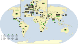
As of September 2023, there are a total of 1,199 World Heritage Sites located across 168 countries, of which 933 are cultural, 227 are natural, and 39 are mixed properties. The countries have been divided by the World Heritage Committee into five geographic zones: Africa, Arab States, Asia and the Pacific, Europe and North America, and Latin America and the Caribbean. With 59 selected areas, Italy is the country with the most sites; followed by China with 57, then France and Germany with 52 each.

<span class="mw-page-title-main">Dja River</span>

The Dja River is a stream in west-central Africa. It forms part of Cameroon–Republic of Congo border and has a course of roughly 720 kilometres (450 mi).

<span class="mw-page-title-main">Lobéké National Park</span> National park in Cameroon

Lobéké National Park is a national park of southeastern Cameroon within the Moloundou Arrondissement of East Province. Located in the Congo Basin, it is bounded on the east by the Sangha River which serves as Cameroon's international border with Central African Republic and the Republic of the Congo. It is adjacent to two other reserves in the CAR and Congo. To the northwest is Boumba Bek National Park, another national park in Cameroon's East Province.

The Dzanga-Ndoki National Park is located in the southwestern extremity of the Central African Republic. Established in 1990, the national park is 1,143.26 square kilometres (441.42 sq mi). The national park is split into two non-continuous sectors, the northern Dzanga sector 49,500 ha and the southern Ndoki sector 72,500 ha. Notable in the Dzanga sector is a gorilla density of 1.6/km2 (4.1/sq mi), one of the highest densities ever reported for the western lowland gorilla.

<span class="mw-page-title-main">Sangha Trinational</span> UNESCO World Heritage Site

Sangha Trinational is a forest divided between the nations of Central African Republic, Cameroon and Congo-Brazzaville. It was added as a UNESCO World Heritage Site in 2012 because of its outstanding biodiversity and unique biological communities. The site includes 3 contiguous national parks within the humid tropical forests of Central Africa: Nouabalé-Ndoki National Park in Congo, Lobéké National Park in Cameroon, and Dzanga-Ndoki National Park in Central African Republic. The large size of the site and the relatively limited amount of deforestation within the three parks has allowed populations of vulnerable species such as African forest elephants, gorillas, sitatunga, and chimpanzees to thrive. In addition, populations of critically endangered plant species such as Mukulungu are protected within the site's borders.
References

  1. "The World Heritage Convention". UNESCO. Retrieved December 11, 2023.
  2. "Cameroon". UNESCO. Retrieved November 20, 2023.
  3. "Dja Faunal Reserve". UNESCO World Heritage Centre. Retrieved 2023-11-20. CC-BY icon.svg Text was copied from this source, which is available under a Creative Commons Attribution 3.0 IGO (CC BY 3.0 IGO) license.
  4. "Sangha Trinational". UNESCO World Heritage Centre. Retrieved 2023-11-20. CC-BY icon.svg Text was copied from this source, which is available under a Creative Commons Attribution 3.0 IGO (CC BY 3.0 IGO) license.
  5. "Boumba Bek and Nki National Parks Complex". UNESCO World Heritage Centre (in French). Retrieved 2023-11-20.
  6. "Bouba Njida National Park". UNESCO World Heritage Centre (in French). Retrieved 2023-11-20.
  7. "Campo Ma'an National Park". UNESCO World Heritage Centre (in French). Retrieved 2023-11-20.
  8. "Waza National Park". UNESCO World Heritage Centre (in French). Retrieved 2023-11-20.
  9. "The Bahut chiefdom". UNESCO World Heritage Centre (in French). Retrieved 2023-11-20.
  10. "Tower of Goto Goulfey". UNESCO World Heritage Centre (in French). Retrieved 2023-11-20.
  11. "Bidzar petroglyphs". UNESCO World Heritage Centre (in French). Retrieved 2023-11-20.
  12. "Megaliths of Djohong". UNESCO World Heritage Centre (in French). Retrieved 2023-11-20.
  13. "Megaliths of Saa". UNESCO World Heritage Centre (in French). Retrieved 2023-11-20.
  14. "Njock Rail Tunnels". UNESCO World Heritage Centre (in French). Retrieved 2023-11-20.
  15. "Palace of Rey Bouba". UNESCO World Heritage Centre (in French). Retrieved 2023-11-20.
  16. "Lobé Falls Cultural Landscape". UNESCO World Heritage Centre (in French). Retrieved 2023-11-20.
  17. "Shum Laka Archaeological Site". UNESCO World Heritage Centre (in French). Retrieved 2023-11-20.
  18. ""Grandes Cases" of the traditional chiefdoms of the Grassfields region". UNESCO World Heritage Centre (in French). Retrieved 2023-11-20.
  19. "Lake Chad cultural landscape". UNESCO World Heritage Centre (in French). Retrieved 2023-11-20.
  20. "Cross River-Korup-Takamanda". UNESCO World Heritage Centre (in French). Retrieved 2023-11-20.
  21. "Bimbia and associated sites". UNESCO World Heritage Centre (in French). Retrieved 2023-11-20.
  22. "Diy Gid Biy cultural landscape at Mandara Mountains". UNESCO World Heritage Centre (in French). Retrieved 2023-11-20.