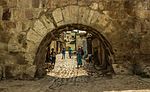
List of cultural assets of Algeria includes monuments, natural sites and parks, and other cultural assets as classed by the AlgerianMinistry of Culture. The Ministry's list was updated in September 2019 with 1,030 cultural assets across the country. Skikda Province has the highest number of assets at 131.[1]
Aflou is a town and commune in Laghouat Province, Algeria. It is located in the Amour Range of the Saharan Atlas, at an elevation of 1,426 m (4,678 ft), which makes it one of the highest towns in Algeria. Aflou is the capital of Aflou District. Its population in 1998 was 48,000.
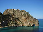
Béni Abbès, also known as the Pearl of the Saoura, and also as the White Oasis, is a town and commune located in western Algeria in Béchar Province, 241 km (150 mi) far from the provincial capital Béchar, and 1,200 km (746 mi) from Algiers.
Fenoughil District is a district of Adrar Province, Algeria. According to the 2008 census it has a population of 29,540.
Zaouiet Kounta District is a district of Adrar Province, Algeria.
Laghouat District is a district of Laghouat Province, Algeria. Laghouat (Laghwat) is an Algerian town, About 400 km from Algiers.
The Institut Français is a French public industrial and commercial organization (EPIC). Started in 1907 by the Ministry of Foreign Affairs for promoting French, francophone as well as local cultures around the world, in 2011 it replaced the CulturesFrance project as the umbrella for all French cultural outreach projects, with an expanded scope of work and increased resources.
Mohamed Seghir Boushaki, was an Algerian Kabyle politician after the French conquest of Algeria.
Claude Sintes is a French archaeologist and curator.
The 4th constituency of Indre-et-Loire is one of five French legislative constituencies in the Indre-et-Loire département.
The 5th constituency of Indre-et-Loire is one of five French legislative constituencies in the Indre-et-Loire département.
The 4th constituency of Isère is one of ten French legislative constituencies in the Isère département.
The 9th constituency of Isère is one of ten French legislative constituencies in the Isère département.
The 2nd constituency of Loir-et-Cher is one of three French legislative constituencies in the Loir-et-Cher department, in the Centre-Val de Loire region.
Nacéra Benseddik is an Algerian historian, archaeologist and epigrapher. She was born in Bordj Bou Arreridj on 4 December 1949.
Angèle Aguigah is a Togolese archaeologist and politician. She was the first female archaeologist from Togo, and in 2017 she was given the honor of “Human Living Treasure of Togo“.
The Bash Hezzab is the senior Hezzab supervising the Hizb Rateb and Salka in mosques and zawiyas in Algeria according to the Algerian Islamic reference under the supervision of the Ministry of Religious Affairs and Endowments.
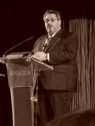
Olivier Bianchi is a French politician. A member of the Socialist Party, he has been mayor of Clermont-Ferrand since April 4, 2014 and president of Clermont Auvergne Métropole since April 22, 2014.
↑ Arrêté du 01 février 1982 MINISTERE DE LA CULTURE JO N° 18 du 04 mai 1982, Page 634, Portant classement du site de Honaine parmi les sites historiques.
↑ Société de Saint-Jean (1879). Revue de l'art chrétien[Review of Christian Art]. Vol.28. St. Augustin, Desclée, De Brouwer et Cie. p.25 – via Google Books.
↑ Unesco. International Scientific Committee for the Drafting of a General History of Africa (1981). G. Mokhtar; Mohamed Gamal el-Din; Muḥammad Jamāl al-Dīn Mukhtār; Joseph Ki-Zerbo; A. Adu Boahen; J. F. Ade Ajayi; Djibril Tamsir Niane; Bethwell A. Ogot (eds.). Ancient Civilizations of Africa. Vol.2. University of California Press. p.523. ISBN9789231017087.{{cite book}}: |work= ignored (help)
This page is based on this Wikipedia article Text is available under the CC BY-SA 4.0 license; additional terms may apply. Images, videos and audio are available under their respective licenses.


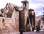
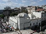
![Casbah de Bejaia [fr] brj lrwmn.jpg](http://upload.wikimedia.org/wikipedia/commons/thumb/b/b2/%D8%A8%D8%B1%D8%AC_%D8%A7%D9%84%D8%B1%D9%88%D9%85%D8%A7%D9%86.jpg/150px-%D8%A8%D8%B1%D8%AC_%D8%A7%D9%84%D8%B1%D9%88%D9%85%D8%A7%D9%86.jpg)


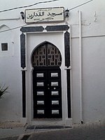


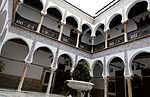


![Mosque of the Bey Mohamed el-Kebir [fr] Oran vieille mosquee Karguentah.JPG](http://upload.wikimedia.org/wikipedia/commons/thumb/6/6c/Oran_vieille_mosqu%C3%A9e_Karguentah.JPG/150px-Oran_vieille_mosqu%C3%A9e_Karguentah.JPG)


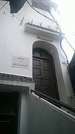
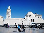
![Mohamed El Houari Mosque [fr] Sidi houari.jpg](http://upload.wikimedia.org/wikipedia/commons/thumb/3/30/Sidi_houari.jpg/150px-Sidi_houari.jpg)